| Home | City Bus | Maps | Villages | Cities | Rail | Tourist Places | School | College | Pin Codes | Corona Cases Count |
| Distance Calculator Bus Services IFSC Codes Trace Mobile Number Weather Search Place Trace IP Available Cash ATM/Banks Locate Polling Booth Report an Error contact People |
Dhasaradhapuram
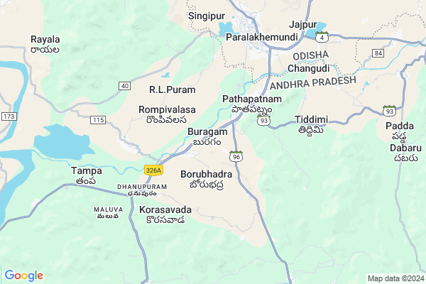
Dhasaradhapuram Map
EDIT Map
Add Your House
 ..
..
Current Corona Virus Infected Patients Count in Srikakulam District
| City Name | District Name | Total Covid cases |
|---|---|---|
| Srikakulam District | Srikakulam | 3 |
Locality Name :
Dhasaradhapuram
( దశరధపురం )
Mandal Name : Pathapatnam
District : Srikakulam
State : Andhra Pradesh
Region : Andhra
Language : Telugu
Current Time 12:13 PM
Date: Wednesday , Feb 05,2025 (IST)
Time zone: IST (UTC+5:30)
Elevation / Altitude: 68 meters. Above Seal level
Telephone Code / Std Code: 08946
Assembly constituency : Udayagiri assembly constituency
Assembly MLA : REDDY SHANTHI
Lok Sabha constituency : Anantapur parliamentary constituency
Parliament MP : KINJARAPU RAM MOHAN NAIDU
Serpanch Name :
Alternate Village Name : Dasaradhapuram , Dasaradhipuram
Commodities Prices : Parlakhemundi Market / Mandi
Edit below overview about Dhasaradhapuram
Edit below overview about Dhasaradhapuram
OverView of Dhasaradhapuram
The name of the village is Dasarathpur.It is one of the Sasans out of sixteen Sasans donated to the Brahmins by the ruler of paralakhemundi Zamindari.It was in the Madras Presidency.When a new State Odisha was.created in 1936 there arose a problem of demarcation.To resolve the problem River Mahendra Tanya was accepted as the border.As a result many Odia speaking areas remained in AP.These odia speaking areas got a special status as Outlying Oriya Tract.Now people of Odia and Telugu are living there.The name of the village is gradually mispronounced to the present name Dasaradhapuram or Dasaradhipuram.I would like to request the Authority to go through the RoR and restore the actual name Dasarathpur.Edit below overview about Dhasaradhapuram
Rivers Near Dhasaradhapuram
Bendi Gedda
Vamsadhara
Bendi Gedda
Vamsadhara
About Dhasaradhapuram
Dhasaradhapuram is a Village in Pathapatnam Mandal in Srikakulam District of Andhra Pradesh State, India. It belongs to Andhra region . It is located 60 KM towards North from District head quarters Srikakulam. 712 KM from State capital Hyderabad
Dhasaradhapuram is surrounded by Hiramandalam Mandal towards west , Meliaputti Mandal towards East , Saravakota Mandal towards South , Kotturu Mandal towards west .
Parlakhemundi , Palasa Kasibugga , Amadalavalasa , Gunupur are the near by Cities to Dhasaradhapuram.
This Place is in the border of the Srikakulam District and Gajapati District. Gajapati District Gosani is East towards this place . It is near to the Odisha State Border.
Dasaradhipuram 2011 Census Details
Dhasaradhapuram Local Language is Telugu. Dasaradhipuram Village Total population is 426 and number of houses are 101. Female Population is 53.3%. Village literacy rate is 44.1% and the Female Literacy rate is 19.0%.
Population
| Census Parameter | Census Data |
| Total Population | 426 |
| Total No of Houses | 101 |
| Female Population % | 53.3 % ( 227) |
| Total Literacy rate % | 44.1 % ( 188) |
| Female Literacy rate | 19.0 % ( 81) |
| Scheduled Tribes Population % | 0.0 % ( 0) |
| Scheduled Caste Population % | 50.2 % ( 214) |
| Working Population % | 61.3 % |
| Child(0 -6) Population by 2011 | 55 |
| Girl Child(0 -6) Population % by 2011 | 52.7 % ( 29) |
Dasaradhipuram Census More Deatils.
Politics in Dhasaradhapuram
TD , TDP , YSRC , Yuvajana Sramika Rythu Congress Party , YSRCP , INC are the major political parties in this area.Polling Stations /Booths near Dhasaradhapuram
1)Jaladanki2)Jammalapalem
3)Kummara Kondur
4)L.r.agraharam
5)Veligandla
HOW TO REACH Dhasaradhapuram
By Road
Parlakhemundi is the Nearest Town to Dhasaradhapuram. Road connectivity is there from Parlakhemundi to Dhasaradhapuram.By Rail
Pathapatnam Rail Way Station , Paralakhemundi Rail Way Station are the very nearby railway stations to Dhasaradhapuram.By Bus
Patapatnam(Boarder) APSRTC Bus Station , Parlakimidi APSRTC Bus Station , Kotturu APSRTC Bus Station are the nearby by Bus Stations to Dhasaradhapuram .APSRTC runs Number of busses from major cities to here.Pincodes near Dhasaradhapuram
532213 ( Pathapatnam ) , 532214 ( Korasavada ) , 532457 ( Nivagam )Colleges near Dhasaradhapuram
Sri Vidyaniketan Jr College, Pathapatnam
Address : Pathapatnam
A P S W R Jr. College, Pathapatnam
Address : Pathapatnam
Kiranmayi Jr College, Pathapatnam
Address : Pathapatnam
Mahendra Jr College, Pathapatnam
Address : Pathapatnam
Govt Junior College Pathapatnam
Address : Govt Junior College Pathapatnam
Schools near Dhasaradhapuram
Apswrs Pathapatnam
Address : pathapatnam , pathapatnam , srikakulam , Andhra Pradesh . PIN- 532213 , Post - Pathapatnam
Kmps Pathapatnam
Address : pathapatnam , pathapatnam , srikakulam , Andhra Pradesh . PIN- 532213 , Post - Pathapatnam
Vignan High Scholl
Address : pathapatnam , pathapatnam , srikakulam , Andhra Pradesh . PIN- 532213 , Post - Pathapatnam
K.g.b.v School
Address : pathapatnam , pathapatnam , srikakulam , Andhra Pradesh . PIN- 532213 , Post - Pathapatnam
Govt Health Centers near Dhasaradhapuram
1) Booragam , 1-120 , MAIN STRET , MAIN STRET2) Meliaputti , Main Road, , Opp. MRO Office , MELIAPUTTI
3) Labara , , Kapu street , Near Rama Mandir
Hospitals in Dhasaradhapuram,Pathapatnam
sumani medical
పర్లాకిమిడి నరస్సన్నపేట రహదారి; Korasawada; Andhra Pradesh 532214; India
1.6 KM distance Detail
Vijayadurga Dental Care
Kotaguddi Colony; Pathapatnam; Andhra Pradesh 532213; India
3.0 KM distance Detail
more ..
Petrol Bunks in Dhasaradhapuram,Pathapatnam
Hindustan Petroleum
Srikakulam; SH-4; Kotabommali Road; Patha Patnam; Patha Patnam; Andhra Pradesh 532213; India
1.3 KM distance Detail
SRI NEELAMANI DURGA F/S - HPCL
Parlakhemundi - Narasannapeta Rd; Pathapatnam; Andhra Pradesh 532213; India
1.3 KM distance Detail
HP PETROL PUMP - HP AUTO CARE CENTRE PATHAPATNAM
Hpcl Dealers S.NO.99/19; Praharajapalem Village Pathapatnam Mandal; Visakhapatnam; Andhra Pradesh 532213; India
1.4 KM distance Detail
Subakari Enterprises Indian Oil Petrol Pump
Korasavada; Srikakulam; SH-4; Kotabommali Road; Patha Patnam; Patha Patnam; Andhra Pradesh 532213; India
3.0 KM distance Detail
more ..
Colleges in Dhasaradhapuram,Pathapatnam
Womens College
Jawahar Navodaya School Road; Friends Colony; Paralakhemundi; Odisha 761201; India
6.1 KM distance Detail
Centurion University Of Technology And Management;M S Swaminathan School Of Agricultural
paralakhemudi; Odisha 761200; India
6.9 KM distance Detail
Sri Krushna Chandra Gajapati College
Paralakhemundi; Gajapati; Odisha 761200; India
6.9 KM distance Detail
more ..
Schools in Dhasaradhapuram,Pathapatnam
APSWREIS JUNIOR COLLEGE PATHAPATNAM
Atisurikaviti; Andhra Pradesh 532213; India
1.7 KM distance Detail
Sri Sai Gayatri School
Srikakulam; SH-4; Kotabommali Road; Patha Patnam; Patha Patnam; Andhra Pradesh 532213; India
1.8 KM distance Detail
Electronic Shops in Dhasaradhapuram,Pathapatnam
Home needs enterprises
Kotaguddi Colony; Pathapatnam; Andhra Pradesh 532213; India
3.1 KM distance Detail
Sri Madhu Enterprises
Main Road; Pathapatnam; Srikakulam; Andhra Pradesh 532213; India
3.3 KM distance Detail
SSS(Sri Surya Solutions)
All Andhra Road; Pathapatnam; Andhra Pradesh 532213; India
3.3 KM distance Detail
Super Markets in Dhasaradhapuram,Pathapatnam
Prasoona Super Market
Shivashankar Colony; Changudi; Andhra Pradesh 532213; India
2.9 KM distance Detail
General Store
Treasury to Hospital Connecting Rd; Paralakhemundi; Odisha 761200; India
6.5 KM distance Detail
Police Stations near Dhasaradhapuram,Pathapatnam
Police Vigilance Unit
Brindavan Palace Road; Paralakhemundi; Andhra Pradesh 761200; India
6.7 KM distance Detail
Governement Offices near Dhasaradhapuram,Pathapatnam
District Agriculture Office
Srikakulam; SH-4; Kotabommali Road; Patha Patnam; Patha Patnam; Andhra Pradesh 532213; India
2.5 KM distance Detail
Sub Treasury Office
Srikakulam; SH-4; Kotabommali Road; Patha Patnam; Patha Patnam; Andhra Pradesh 532213; India
2.6 KM distance Detail
MRO Office
Srikakulam; SH-4; Kotabommali Road; Patha Patnam; Patha Patnam; Andhra Pradesh 532213; India
2.6 KM distance Detail
About Dhasaradhapuram &
History
How to reach Dhasaradhapuram
Tourist Places Near By Dhasaradhapuram
Schools in Dhasaradhapuram
Colleges in Dhasaradhapuram
Temperature & weather of Dhasaradhapuram
places in Dhasaradhapuram
Dhasaradhapuram photos
More Information
How to reach Dhasaradhapuram
Tourist Places Near By Dhasaradhapuram
Schools in Dhasaradhapuram
Colleges in Dhasaradhapuram
Temperature & weather of Dhasaradhapuram
places in Dhasaradhapuram
Dhasaradhapuram photos
More Information
Village Talk
Post News or Events about this Village
Near Cities
Parlakhemundi 17 KM near
Palasa Kasibugga 39 KM near
Amadalavalasa 45 KM near
Gunupur 53 KM near
Parlakhemundi 17 KM near
Palasa Kasibugga 39 KM near
Amadalavalasa 45 KM near
Gunupur 53 KM near
Near By Taluks
Pathapatnam 0 KM near
Hiramandalam 14 KM near
Meliaputti 17 KM near
Kotturu 18 KM near
Pathapatnam 0 KM near
Hiramandalam 14 KM near
Meliaputti 17 KM near
Kotturu 18 KM near
Near By Air Ports
Vishakhapatnam Airport 159 KM near
Bhubaneswar Airport 279 KM near
Rajahmundry Airport 334 KM near
Raipur Airport 409 KM near
Vishakhapatnam Airport 159 KM near
Bhubaneswar Airport 279 KM near
Rajahmundry Airport 334 KM near
Raipur Airport 409 KM near
Near By Tourist Places
Vizayanagaram 111 KM near
Berhampur 112 KM near
Gopalpur 118 KM near
Araku Valley 150 KM near
Ananthagiri 150 KM near
Vizayanagaram 111 KM near
Berhampur 112 KM near
Gopalpur 118 KM near
Araku Valley 150 KM near
Ananthagiri 150 KM near
Near By Districts
Srikakulam 57 KM near
Gajapati 59 KM near
Rayagada 94 KM near
Vizianagaram 108 KM near
Srikakulam 57 KM near
Gajapati 59 KM near
Rayagada 94 KM near
Vizianagaram 108 KM near
Near By RailWay Station
Pathapatnam Rail Way Station 1.8 KM near
Paralakhemundi Rail Way Station 7.5 KM near
Ganguwada Rail Way Station 9.3 KM near
Naupada Junction Rail Way Station 31 KM near
Palasa Rail Way Station 41 KM near
Pathapatnam Rail Way Station 1.8 KM near
Paralakhemundi Rail Way Station 7.5 KM near
Ganguwada Rail Way Station 9.3 KM near
Naupada Junction Rail Way Station 31 KM near
Palasa Rail Way Station 41 KM near