| Home | City Bus | Maps | Villages | Cities | Rail | Tourist Places | School | College | Pin Codes | Corona Cases Count |
| Distance Calculator Bus Services IFSC Codes Trace Mobile Number Weather Search Place Trace IP Available Cash ATM/Banks Locate Polling Booth Report an Error contact People |
Savara
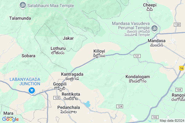
Savara Map
EDIT Map
Add Your House
 ..
..
Current Corona Virus Infected Patients Count in Srikakulam District
| City Name | District Name | Total Covid cases |
|---|---|---|
| Srikakulam District | Srikakulam | 3 |
Locality Name :
Savara
( సవర )
Mandal Name : Mandasa
District : Srikakulam
State : Andhra Pradesh
Region : Andhra
Language : Telugu
Current Time 10:07 AM
Date: Thursday , Apr 24,2025 (IST)
Time zone: IST (UTC+5:30)
Elevation / Altitude: 38 meters. Above Seal level
Telephone Code / Std Code: 08947
Assembly constituency : Sullurpeta assembly constituency
Assembly MLA : APPALARAJU SEEDIRI
Lok Sabha constituency : Anantapur parliamentary constituency
Parliament MP : KINJARAPU RAM MOHAN NAIDU
Serpanch Name :
Pin Code : 532242
Post Office Name : Mandasa
Main Village Name : Konkadaputti
Commodities Prices : Parlakhemundi Market / Mandi
Rivers Near Savara
Bendi Gedda
Mahendratanaya
Bendi Gedda
Mahendratanaya
About Savara
Correct below Info and add more info about SavaraSavara is a small Village/hamlet in Mandasa Mandal in Srikakulam District of Andhra Pradesh State, India. It comes under Konkadaputti Panchayath. It belongs to Andhra region . It is located 94 KM towards North from District head quarters Srikakulam. 12 KM from Mandasa. 753 KM from State capital Hyderabad
Savara Pin code is 532242 and postal head office is Mandasa .
Savara is surrounded by Mandasa Mandal towards East , Vajrapukotturu Mandal towards South , Rayagada Mandal towards west , Paralakhemundi Mandal towards west .
Parlakhemundi , Ichchapuram , Palasa Kasibugga , Gunupur are the near by Cities to Savara.
It is near to bay of bengal. There is a chance of humidity in the weather.
Demographics of Savara
Telugu is the Local Language here. Total population of Savara is 429 .Males are 213 and Females are 216 living in 98 Houses. Total area of Savara is 135 hectares.Politics in Savara
TDP , YSRC , Yuvajana Sramika Rythu Congress Party , YSRCP , INC are the major political parties in this area.Polling Stations /Booths near Savara
1)Zphs Gottiprolu2)Zphs Kurugonda
3)Mpps Hw Naidupet
4)Mpps Kurugonda
5)Mpups Karaballavolu
HOW TO REACH Savara
By Road
Palasa Kasibugga is the Nearest Town to Savara. Road connectivity is there from Palasa Kasibugga to Savara.By Rail
Summadevi Rail Way Station is the very nearby railway stations to Savara. Also you can consider railway Stations from Near By town Palasa Kasibugga. Kotabommali Rail Way Station , Dindu Gopala Puram Halt Rail Way Station are the railway Stations near to Palasa Kasibugga. You can reach from Palasa Kasibugga to Savara by road after .By Bus
Palasa APSRTC Bus Station , Haripuram APSRTC Bus Station , Baruva APSRTC Bus Station are the nearby by Bus Stations to Savara .APSRTC runs Number of busses from major cities to here.Colleges near Savara
Siddhartha Juniour College
Address :
Sathavahana Jr College, Haripuram
Address : Haripuram
Schools in Savara
M.p.primary School
Address : konkadaputti , mandasa , srikakulam , Andhra Pradesh . PIN- 532242 , Post - Mandasa
Govt Health Centers near Savara
1) Killoi , , ST KILLOYI , GOVT ST KILLOYI2) Lotturu , Jan-59 , School Street , Near Water Tank
3) Budubocolony , 10-Jan , Main Street , Near GOVT SCHOOL
Hospitals in Savara,Mandasa
Ramakrishna Duppala; Uma Maheswara Medical Shop
Goppili; Andhra Pradesh 761215; India
5.8 KM distance Detail
more ..
Petrol Bunks in Savara,Mandasa
JAYALAKSHMI FILLING STATION
Goppili Road; Mogilipadu; Palasa; Andhra Pradesh 532221; India
9.4 KM distance Detail
HP PETROL PUMP - JAYALAKSHMI FILLING STATION
Survey NO. 220/4;5;6 Palasa-kasibugga Muncipality Palasa; Visakhapatnam; Andhra Pradesh 532221; India
9.4 KM distance Detail
KALUVAMMA FILLING STATION
MANDASA; SRIKAKULAM; Srikakulam; Andhra Pradesh 532342; India
9.9 KM distance Detail
ESSAR RETAIL OUTLET. Krishnaprasad filling Station
Mogilipadu; Palasa; Andhra Pradesh 532221; India
10.1 KM distance Detail
more ..
Colleges in Savara,Mandasa
Government Junior College
KT Rd (Kasibugga-Tharlakota Road); Mogilipadu; Palasa; Andhra Pradesh 532221; India
10.0 KM distance Detail
more ..
Super Markets in Savara,Mandasa
Tirumula Pan Shop
Goppili Road; Rentikota new colony; Rentikota; Andhra Pradesh 761215; India
5.3 KM distance Detail
Sri Sai Chandrasekhar Mini Super Market
Mandasa Paralakhemundi Road Meliaputti Mandal; Goppili; Andhra Pradesh 532221; India
5.5 KM distance Detail
Local Parks in Savara,Mandasa
Pedd thota
tharlakota; Goppili Road; Kedaripuram; Andhra Pradesh 532221; India
7.2 KM distance Detail
Police Stations near Savara,Mandasa
POLICE SUB CONTROL PALASA INDHIRA CHOWK
KT Rd (Kasibugga-Tharlakota Road); Mogilipadu; Palasa; Andhra Pradesh 532221; India
10.5 KM distance Detail
About Savara &
History
How to reach Savara
Tourist Places Near By Savara
Schools in Savara
Colleges in Savara
Temperature & weather of Savara
places in Savara
Savara photos
More Information
How to reach Savara
Tourist Places Near By Savara
Schools in Savara
Colleges in Savara
Temperature & weather of Savara
places in Savara
Savara photos
More Information
Village Talk
Post News or Events about this Village
Near Cities
Parlakhemundi 23 KM near
Ichchapuram 49 KM near
Palasa Kasibugga 51 KM near
Gunupur 73 KM near
Parlakhemundi 23 KM near
Ichchapuram 49 KM near
Palasa Kasibugga 51 KM near
Gunupur 73 KM near
Near By Taluks
Palasa 8 KM near
Mandasa 11 KM near
Vajrapukotturu 18 KM near
Rayagada 19 KM near
Palasa 8 KM near
Mandasa 11 KM near
Vajrapukotturu 18 KM near
Rayagada 19 KM near
Near By Air Ports
Vishakhapatnam Airport 196 KM near
Bhubaneswar Airport 242 KM near
Rajahmundry Airport 373 KM near
Raipur Airport 425 KM near
Vishakhapatnam Airport 196 KM near
Bhubaneswar Airport 242 KM near
Rajahmundry Airport 373 KM near
Raipur Airport 425 KM near
Near By Tourist Places
Berhampur 74 KM near
Gopalpur 79 KM near
Vizayanagaram 149 KM near
Chilika 156 KM near
Araku Valley 190 KM near
Berhampur 74 KM near
Gopalpur 79 KM near
Vizayanagaram 149 KM near
Chilika 156 KM near
Araku Valley 190 KM near
Near By Districts
Gajapati 53 KM near
Srikakulam 90 KM near
Ganjam 93 KM near
Rayagada 121 KM near
Gajapati 53 KM near
Srikakulam 90 KM near
Ganjam 93 KM near
Rayagada 121 KM near
Near By RailWay Station
Palasa Rail Way Station 12 KM near
Sompeta Rail Way Station 27 KM near
Palasa Rail Way Station 12 KM near
Sompeta Rail Way Station 27 KM near