| Home | City Bus | Maps | Villages | Cities | Rail | Tourist Places | School | College | Pin Codes | Corona Cases Count |
| Distance Calculator Bus Services IFSC Codes Trace Mobile Number Weather Search Place Trace IP Available Cash ATM/Banks Locate Polling Booth Report an Error contact People |
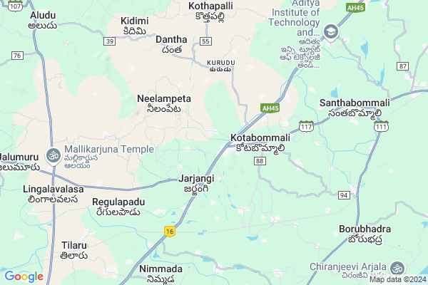
Kothapeta
Kothapeta Map
EDIT Map
Add Your House
 ..
..
Current Corona Virus Infected Patients Count in Srikakulam District
| City Name | District Name | Total Covid cases |
|---|---|---|
| Srikakulam District | Srikakulam | 3 |
Locality Name :
Kothapeta
( కొత్తపేట )
Mandal Name : Kotabommili
District : Srikakulam
State : Andhra Pradesh
Region : Andhra
Language : Telugu
Current Time 06:02 AM
Date: Saturday , Apr 26,2025 (IST)
Time zone: IST (UTC+5:30)
Elevation / Altitude: 28 meters. Above Seal level
Telephone Code / Std Code: 08945
Assembly constituency : Venkatagiri assembly constituency
Assembly MLA : ATCHANNAIDU KINJARAPU
Lok Sabha constituency : Anantapur parliamentary constituency
Parliament MP : KINJARAPU RAM MOHAN NAIDU
Serpanch Name :
Pin Code : 532005
Post Office Name : Gujarathipeta
Commodities Prices : Parlakhemundi Market / Mandi
Kothapeta Live Weather
Temperature: 27.0 °C
scattered clouds
Humidity: 89%
Wind : 3.66 mt/sec towards SW
StationName : "Narasannapeta"
observed on 1 Hours Back
Temperature: 27.0 °C
scattered clouds
Humidity: 89%
Wind : 3.66 mt/sec towards SW
StationName : "Narasannapeta"
observed on 1 Hours Back
Kothapeta Weather Forecast for Next 5 days
27-04-2025
26.7°C to 37.6°C
few clouds, clear sky, broken clouds
26.7°C to 37.6°C
few clouds, clear sky, broken clouds
28-04-2025
26.6°C to 39.1°C
broken clouds, scattered clouds, few clouds
26.6°C to 39.1°C
broken clouds, scattered clouds, few clouds
29-04-2025
26.6°C to 36.7°C
broken clouds, clear sky, scattered clouds
26.6°C to 36.7°C
broken clouds, clear sky, scattered clouds
30-04-2025
25.4°C to 36.6°C
scattered clouds, clear sky, light rain
25.4°C to 36.6°C
scattered clouds, clear sky, light rain
Rivers Near Kothapeta
Garibula Gedda
Vamsadhara
Garibula Gedda
Vamsadhara
About Kothapeta
Correct below Info and add more info about KothapetaKothapeta is a Village in Kotabommili Mandal in Srikakulam District of Andhra Pradesh State, India. It belongs to Andhra region . It is located 41 KM towards East from District head quarters Srikakulam. 1 KM from Kotabommali. 714 KM from State capital Hyderabad
Kothapeta Pin code is 532005 and postal head office is Gujarathipeta .
Jarjangi ( 1 KM ) , Kotabommali ( 2 KM ) , Kasturipadu ( 2 KM ) , Sariyaboddapadu ( 2 KM ) , Pattupuram ( 3 KM ) are the nearby Villages to Kothapeta. Kothapeta is surrounded by Santhabommali Mandal towards East , Saravakota Mandal towards west , Jalumuru Mandal towards west , Tekkali Mandal towards North .
Palasa Kasibugga , Amadalavalasa , Parlakhemundi , Srikakulam are the near by Cities to Kothapeta.
It is near to bay of bengal. There is a chance of humidity in the weather.
Kothapeta 2011 Census Details
Kothapeta Local Language is Telugu. Kothapeta Village Total population is 1779 and number of houses are 480. Female Population is 49.6%. Village literacy rate is 64.4% and the Female Literacy rate is 27.7%.
Population
| Census Parameter | Census Data |
| Total Population | 1779 |
| Total No of Houses | 480 |
| Female Population % | 49.6 % ( 883) |
| Total Literacy rate % | 64.4 % ( 1145) |
| Female Literacy rate | 27.7 % ( 492) |
| Scheduled Tribes Population % | 1.9 % ( 33) |
| Scheduled Caste Population % | 1.9 % ( 33) |
| Working Population % | 39.6 % |
| Child(0 -6) Population by 2011 | 173 |
| Girl Child(0 -6) Population % by 2011 | 46.8 % ( 81) |
Kothapeta Census More Deatils.
Politics in Kothapeta
TDP , YSRC , Yuvajana Sramika Rythu Congress Party , YSRCP , INC are the major political parties in this area.Polling Stations /Booths near Kothapeta
1)Kasipeta Venkatagiri Town2)Panjam
3)Madhavayapalem
4)Gottikadu
5)Griddaluru
HOW TO REACH Kothapeta
By Road
Amadalavalasa is the Nearest Town to Kothapeta. Amadalavalasa is 56 km from Kothapeta. Road connectivity is there from Amadalavalasa to Kothapeta.By Rail
Harishchandrapuram Rail Way Station , Kotabommali Rail Way Station are the very nearby railway stations to Kothapeta. Also you can consider railway Stations from Near By town Amadalavalasa. Srikakulam Road Rail Way Station , Dusi Rail Way Station are the railway Stations near to Amadalavalasa. You can reach from Amadalavalasa to Kothapeta by road after .By Bus
Tekkali APSRTC Bus Station , Narasannapeta APSRTC Bus Station , Patapatnam(Boarder) APSRTC Bus Station are the nearby by Bus Stations to Kothapeta .APSRTC runs Number of busses from major cities to here.Colleges near Kothapeta
Govt Junior College? Kotabommali
Address : Govt Junior College? Kotabommali
Victory Jr College, Kotabommali
Address : Kotabommali
Vamsadhara Jr College, Kotabommali
Address : Kotabommali
Vamsadhara Degree College
Address : Kotabommali, Srikakulam Dist.
Schools in Kothapeta
M P Primary Kothapeta
Address : kothapeta , kotabommali , srikakulam , Andhra Pradesh . PIN- 532195 , Post - Kotabommali
Govt Health Centers near Kothapeta
1) Jarjangi , , Main Street , Jarjangi2) Kasturipadu , , Main Street , Kasturipadu
3) Podugupadu , , Main Street , Podugupadu
Hospitals in Kothapeta,Kotabommili
Gandhi Hospital
NH 5; Main Road; Kotabommali; Kothapeta; Andhra Pradesh 532195; India
2.3 KM distance Detail
more ..
Petrol Bunks in Kothapeta,Kotabommili
BNM Filling Station
NH16; Near Kothapeta; Kotabommali; Andhra Pradesh 532195; India
1.3 KM distance Detail
BP PETROL PUMP - BP AUTO CARE CENTRE KOTABOMMALI
Tarlipeta Village; NH- 5; Kotabommali Mandal; Srikakulam DT.; Visakhapatnam; Andhra Pradesh 532001; India
2.9 KM distance Detail
Bharat Petroleum
Kannevalasa; Srikakulam; NH-5; Ichapuram Road; Kotabommali; Andhra Pradesh 532195; India
3.8 KM distance Detail
more ..
Colleges in Kothapeta,Kotabommili
Vamsadhara Teacher Training College
Kotabommali Village; Srikakulam; Andhra Pradesh 532195; India
1.4 KM distance Detail
Swamy Tamanuja Institute for Management of thyology Indology (Vedic University )
Tarlipeta; Kotabommali; Andhra Pradesh 532201; India
7.2 KM distance Detail
more ..
Schools in Kothapeta,Kotabommili
Navnirman college of arts commerce and science
Tahsildar office; Kotabommali; Andhra Pradesh 532195; India
1.2 KM distance Detail
Electronic Shops in Kothapeta,Kotabommili
Lotha Mechanic All Two Weller Bike Repair Shop
Kotabommali Main Rd; Kotabommali; Andhra Pradesh 532195; India
1.1 KM distance Detail
Sri Sampath Electronics
Kotabommali Main Road; Kotabommali; Andhra Pradesh 532195; India
1.4 KM distance Detail
Super Markets in Kothapeta,Kotabommili
Guptha Super Market
Mutyalamma Centre; Opp. C.B.M Primary School; Main Road; Kotabommali; Srikakulam; Andhra Pradesh 532195; India
2.7 KM distance Detail
DSK Net Cafe;Kirana;Educational Tutorial
Harichandrapuram; Main street; Vinjampadu Rd; Harichandrapuram; Andhra Pradesh 532430; India
6.8 KM distance Detail
Local Parks in Kothapeta,Kotabommili
Yerranaidu Park
Kacheri St; Rotari Nagar; Tekkali; Andhra Pradesh 532201; India
15.9 KM distance Detail
Police Stations near Kothapeta,Kotabommili
Tekkali Police Station
Rotari Nagar;Tekkali Main Road; Tekkali; Andhra Pradesh 532201; India
15.3 KM distance Detail
Governement Offices near Kothapeta,Kotabommili
Sri Rama Prasad Mee Seva
Kotabommali Main Rd; Kotabommali; Andhra Pradesh 532195; India
1.5 KM distance Detail
Allu Communications
Kotabommali Main Rd; Kotabommali; Andhra Pradesh 532195; India
1.5 KM distance Detail
Sub Treasury Office
Srikakulam; NH-5; Kotabommali Road; Kotabommali; Kotabommali; Andhra Pradesh 532195; India
1.6 KM distance Detail
About Kothapeta &
History
How to reach Kothapeta
Tourist Places Near By Kothapeta
Schools in Kothapeta
Colleges in Kothapeta
Temperature & weather of Kothapeta
places in Kothapeta
Kothapeta photos
More Information
How to reach Kothapeta
Tourist Places Near By Kothapeta
Schools in Kothapeta
Colleges in Kothapeta
Temperature & weather of Kothapeta
places in Kothapeta
Kothapeta photos
More Information
Village Talk
Post News or Events about this Village
Near Cities
Palasa Kasibugga 14 KM near
Amadalavalasa 32 KM near
Parlakhemundi 35 KM near
Srikakulam 38 KM near
Palasa Kasibugga 14 KM near
Amadalavalasa 32 KM near
Parlakhemundi 35 KM near
Srikakulam 38 KM near
Near By Taluks
Kotabommili 2 KM near
Santhabommali 10 KM near
Saravakota 13 KM near
Tekkali 14 KM near
Kotabommili 2 KM near
Santhabommali 10 KM near
Saravakota 13 KM near
Tekkali 14 KM near
Near By Air Ports
Vishakhapatnam Airport 146 KM near
Bhubaneswar Airport 292 KM near
Rajahmundry Airport 326 KM near
Raipur Airport 434 KM near
Vishakhapatnam Airport 146 KM near
Bhubaneswar Airport 292 KM near
Rajahmundry Airport 326 KM near
Raipur Airport 434 KM near
Near By Tourist Places
Vizayanagaram 101 KM near
Berhampur 125 KM near
Gopalpur 128 KM near
Simhachalam 143 KM near
Visakhapatnam 150 KM near
Vizayanagaram 101 KM near
Berhampur 125 KM near
Gopalpur 128 KM near
Simhachalam 143 KM near
Visakhapatnam 150 KM near
Near By Districts
Srikakulam 40 KM near
Gajapati 84 KM near
Vizianagaram 99 KM near
Rayagada 117 KM near
Srikakulam 40 KM near
Gajapati 84 KM near
Vizianagaram 99 KM near
Rayagada 117 KM near
Near By RailWay Station
Harishchandrapuram Rail Way Station 5.8 KM near
Kotabommali Rail Way Station 8.5 KM near
Naupada Junction Rail Way Station 18 KM near
Srikakulam Road Rail Way Station 31 KM near
Harishchandrapuram Rail Way Station 5.8 KM near
Kotabommali Rail Way Station 8.5 KM near
Naupada Junction Rail Way Station 18 KM near
Srikakulam Road Rail Way Station 31 KM near