| Home | City Bus | Maps | Villages | Cities | Rail | Tourist Places | School | College | Pin Codes | Corona Cases Count |
| Distance Calculator Bus Services IFSC Codes Trace Mobile Number Weather Search Place Trace IP Available Cash ATM/Banks Locate Polling Booth Report an Error contact People |
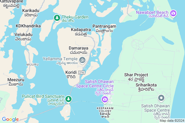
Koridi
Koridi Map
EDIT Map
Add Your House
 ..
..
Current Corona Virus Infected Patients Count in Spsr Nellore District
| City Name | District Name | Total Covid cases |
|---|---|---|
| S.P.S. Nellore District | S.P.S. Nellore | 49 |
| Nellore | S.P.S. Nellore | 5 |
| Naidupeta | S.P.S. Nellore | 3 |
| Tada | S.P.S. Nellore | 2 |
| Kotamitta | S.P.S. Nellore | 2 |
| Vakadu | S.P.S. Nellore | 2 |
| Gudur | S.P.S. Nellore | 1 |
| Thirumuru | S.P.S. Nellore | 1 |
| Magunta Layout | S.P.S. Nellore | 1 |
| Turimella | S.P.S. Nellore | 1 |
| Nelamalipudi,Ozhili | S.P.S. Nellore | 1 |
| Chandrababu Nagar | S.P.S. Nellore | 1 |
| Tada Mandal | S.P.S. Nellore | 1 |
| Mallam | S.P.S. Nellore | 1 |
| Ranganayakakulapeta | S.P.S. Nellore | 1 |
| Haripriya Garden | S.P.S. Nellore | 1 |
| Pedda Bazar | S.P.S. Nellore | 1 |
Locality Name :
Koridi
( కోరింది )
Mandal Name : Sullurpeta
District : Spsr Nellore
State : Andhra Pradesh
Region : Andhra
Language : Telugu and Urdu
Current Time 05:25 PM
Date: Monday , Apr 28,2025 (IST)
Time zone: IST (UTC+5:30)
Elevation / Altitude: 9 meters. Above Seal level
Telephone Code / Std Code: 08623
Assembly constituency : assembly constituency
Assembly MLA :
Lok Sabha constituency : parliamentary constituency
Parliament MP :
Serpanch Name :
Pin Code : 524124
Post Office Name : Sriharikota Range
Commodities Prices : Puttur Market / Mandi
National Highways Reachable To Koridi
Nationa High Way :NH45
Nationa High Way :NH45
About Koridi
Correct below Info and add more info about KoridiKoridi is a Village in Sullurpeta Mandal in Spsr Nellore District of Andhra Pradesh State, India. It belongs to Andhra region . It is located 89 KM towards South from District head quarters Nellore. 16 KM from Sullurpet. 513 KM from State capital Hyderabad
Koridi Pin code is 524124 and postal head office is Sriharikota Range .
Kotapoluru ( 7 KM ) , Reddipalem Bit-ii ( 11 KM ) , Mannemutheri ( 11 KM ) , Venadu ( 14 KM ) , Buradagalikothapalem ( 15 KM ) are the nearby Villages to Koridi. Koridi is surrounded by Tada Mandal towards South , Doravarisatram Mandal towards west , Chittamur Mandal towards North , Vakadu Mandal towards North .
Srikalahasti , Ponneri , Gudur , Venkatagiri are the near by Cities to Koridi.
This Place is in the border of the Spsr Nellore District and Chittoor District. Chittoor District Buchinadidu Khandriga is west towards this place . It is near to bay of bengal. There is a chance of humidity in the weather.
Koridi 2011 Census Details
Koridi Local Language is Telugu. Koridi Village Total population is 1063 and number of houses are 300. Female Population is 48.4%. Village literacy rate is 46.5% and the Female Literacy rate is 18.7%.
Population
| Census Parameter | Census Data |
| Total Population | 1063 |
| Total No of Houses | 300 |
| Female Population % | 48.4 % ( 515) |
| Total Literacy rate % | 46.5 % ( 494) |
| Female Literacy rate | 18.7 % ( 199) |
| Scheduled Tribes Population % | 8.5 % ( 90) |
| Scheduled Caste Population % | 39.1 % ( 416) |
| Working Population % | 45.6 % |
| Child(0 -6) Population by 2011 | 116 |
| Girl Child(0 -6) Population % by 2011 | 48.3 % ( 56) |
Koridi Census More Deatils.
HOW TO REACH Koridi
By Road
Gudur is the Nearest Town to Koridi. Gudur is 76 km from Koridi. Road connectivity is there from Gudur to Koridi.By Rail
There is no railway station near to Koridi in less than 10 km. How ever there are railway Stations from Near By town Gudur. are the railway Stations near to Gudur. You can reach from Gudur to Koridi by road after .By Bus
Srihari Kota APSRTC Bus Station , Sullurupet APSRTC Bus Station , Sullurupet Bypass APSRTC Bus Station are the nearby by Bus Stations to Koridi .APSRTC runs Number of busses from major cities to here.Colleges near Koridi
Sri Rangareddy Jr Coll, Sullurpet
Address : Sullurpet
Bishop Balaswamy Jr College, Sullurpet
Address : Sullurpet
Sri Prathibha Jr College, Sullurpet
Address : Sullurpet
Apswr Jr College (girls), Sullurpet, Nellore
Address : Sullurpet, Nellore
Sri Prathiba Degree College
Address : Arva Bhoomi Rama Chandra Reddy (street), D.no.11-
Schools in Koridi
Mpups Koradi Hw
Address : koridi , sullurpet , nellore , Andhra Pradesh . PIN- 524124 , Post - Sriharikota Range
Govt Health Centers near Koridi
1) KAREPAKAM , , Karipakam , Karipakam2) SANTHAVELLORE , , Santhavellore , Santhavellore
3) BATHALAVALLAM , , BATHALAVALLAM , Near AW Centre
Sub Villages in Koridi
Hospitals in Koridi,Sullurpeta
Government Hospital
Nidigurthi; Reddipalem Bit - I; Andhra Pradesh 524403; India
15.1 KM distance Detail
Olive Dental
kasareddy palem; Y-Junction; SHAR Bypass Road; Sullurpet; Andhra Pradesh; India
18.4 KM distance Detail
more ..
Petrol Bunks in Koridi,Sullurpeta
Indian Oil Petrol Bunk
Venkateshpuram; Sullurupeta; Andhra Pradesh 524121; India
18.5 KM distance Detail
more ..
Colleges in Koridi,Sullurpeta
Sivalingam Chettiar Govt. Degree College
Sullurupeta; Andhra Pradesh 524121; India
18.1 KM distance Detail
APSWR Girls SCHOOL & JR COLLEGE;SULLURUPETA
Shar Rd; Venkateshpuram; Sullurupeta; Andhra Pradesh 524121; India
18.3 KM distance Detail
Sri A.R.K.R.Memorial B.Ed College
Sai Nagar; Sullurupet; Andhra Pradesh 524121; India
19.1 KM distance Detail
RR medicals
Bapuji street sullurpet; Sullurpet; Andhra Pradesh 524121; India
19.2 KM distance Detail
more ..
Schools in Koridi,Sullurpeta
Zp high school; ragannapatteda
Pernadu Road; Damaraya; Andhra Pradesh 524123; India
2.9 KM distance Detail
Govt Elementary School Chinnathota
Pudilayadoruvu; Andhra Pradesh 524403; India
12.9 KM distance Detail
Electronic Shops in Koridi,Sullurpeta
ESA Janatha Garage
Venkateshpuram; Sullurupeta; Andhra Pradesh 524121; India
18.4 KM distance Detail
Gokul Home Needs
Shar Y Circle; Shar Road; Sullurupeta; Andhra Pradesh 524121; India
18.5 KM distance Detail
Srinivasa Digitals
Shar Bus Stand; Shar Road; Sullurupeta; Andhra Pradesh 524121; India
18.6 KM distance Detail
Super Markets in Koridi,Sullurpeta
Sri Lakshimi Store
125;; 2/3/125; Sriharikota Rd; Sullurupeta; Andhra Pradesh 524121; India
17.7 KM distance Detail
Ashtalakshmi Super Market
Balaji Nagar; Sullurupeta; Andhra Pradesh 524121; India
18.7 KM distance Detail
Local Parks in Koridi,Sullurpeta
Rocket Park;KRP
C2/350'-355; C2/350'-355; Sullurupeta; Pulicat Nagar; Krishnareddi Thagelu; Andhra Pradesh 524121; India
17.3 KM distance Detail
Police Stations near Koridi,Sullurpeta
Sullurpet Police Station
Sainagar; Nellore District; Sullurupeta; Andhra Pradesh 524121; India
19.3 KM distance Detail
Prohibition and Excise Police Department
Katcheri St; Sullurupeta; Andhra Pradesh 524121; India
19.4 KM distance Detail
Governement Offices near Koridi,Sullurpeta
Divisional Forest Office Sullurupet
Sriharikota Rd; Sullurupeta; Andhra Pradesh 524121; India
17.1 KM distance Detail
vijaya earth movers and system engineers office
2/3/125; Sriharikota Rd; Sullurupeta; Andhra Pradesh 524121; India
17.7 KM distance Detail
Alavalavari Kalyana Mandapam Sulluru Peta
Sullurupeta; Andhra Pradesh 524121; India
18.9 KM distance Detail
About Koridi &
History
How to reach Koridi
Tourist Places Near By Koridi
Schools in Koridi
Colleges in Koridi
Temperature & weather of Koridi
places in Koridi
Koridi photos
More Information
How to reach Koridi
Tourist Places Near By Koridi
Schools in Koridi
Colleges in Koridi
Temperature & weather of Koridi
places in Koridi
Koridi photos
More Information
Village Talk
Post News or Events about this Village
Near Cities
Srikalahasti 53 KM near
Ponneri 56 KM near
Gudur 65 KM near
Venkatagiri 72 KM near
Srikalahasti 53 KM near
Ponneri 56 KM near
Gudur 65 KM near
Venkatagiri 72 KM near
Near By Taluks
Sullurpeta 16 KM near
Tada 20 KM near
Doravarisatram 25 KM near
Chittamur 27 KM near
Sullurpeta 16 KM near
Tada 20 KM near
Doravarisatram 25 KM near
Chittamur 27 KM near
Near By Air Ports
Tirupati Airport 75 KM near
Chennai Airport 98 KM near
Bengaluru International Airport 304 KM near
Vijayawada Airport 352 KM near
Tirupati Airport 75 KM near
Chennai Airport 98 KM near
Bengaluru International Airport 304 KM near
Vijayawada Airport 352 KM near
Near By Tourist Places
Pulicat 48 KM near
Srikalahasti 54 KM near
Nellore 85 KM near
Chennai 89 KM near
Tirupati 90 KM near
Pulicat 48 KM near
Srikalahasti 54 KM near
Nellore 85 KM near
Chennai 89 KM near
Tirupati 90 KM near
Near By Districts
Thiruvallur 83 KM near
Spsr Nellore 85 KM near
Chennai 88 KM near
Kanchipuram 127 KM near
Thiruvallur 83 KM near
Spsr Nellore 85 KM near
Chennai 88 KM near
Kanchipuram 127 KM near
Near By RailWay Station
Sullurupeta Rail Way Station 18 KM near
Nayadupeta Rail Way Station 34 KM near
Sullurupeta Rail Way Station 18 KM near
Nayadupeta Rail Way Station 34 KM near