| Home | City Bus | Maps | Villages | Cities | Rail | Tourist Places | School | College | Pin Codes | Corona Cases Count |
| Distance Calculator Bus Services IFSC Codes Trace Mobile Number Weather Search Place Trace IP Available Cash ATM/Banks Locate Polling Booth Report an Error contact People |
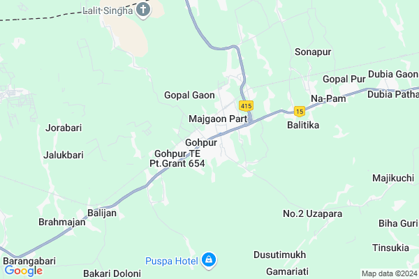
Gohpur
Gohpur Map
EDIT Map
Add Your House
 ..
..
Current Corona Virus Infected Patients Count in Sonitpur District
| City Name | District Name | Total Covid cases |
|---|
Locality Name :
Gohpur
( गोहपुर )
Tehsil Name : Pub Chaiduar
District : Sonitpur
State : Assam
Language : Assamese and Bengali,
Current Time 11:01 AM
Date: Friday , Apr 25,2025 (IST)
Time zone: IST (UTC+5:30)
Elevation / Altitude: 79 meters. Above Seal level
Telephone Code / Std Code: 03715
Assembly constituency : Gohpur assembly constituency
Assembly MLA : Sri Utpal Borah
Lok Sabha constituency : Tezpur parliamentary constituency
Parliament MP : PALLAB LOCHAN DAS
Serpanch Name :
Pin Code : 784168
Post Office Name : Gohpur
Commodities Prices : Mangkolemba Market / Mandi
Gohpur Live Weather
Temperature: 32.3 °C
clear sky
Humidity: 38%
Wind : 2.36 mt/sec towards E
StationName : "Gohpur"
observed on Now
Temperature: 32.3 °C
clear sky
Humidity: 38%
Wind : 2.36 mt/sec towards E
StationName : "Gohpur"
observed on Now
Gohpur Weather Forecast for Next 5 days
26-04-2025
20.8°C to 34.3°C
clear sky, light rain
20.8°C to 34.3°C
clear sky, light rain
27-04-2025
20.8°C to 34.4°C
few clouds, clear sky, light rain
20.8°C to 34.4°C
few clouds, clear sky, light rain
28-04-2025
21.9°C to 34.9°C
scattered clouds, light rain, few clouds, moderate rain
21.9°C to 34.9°C
scattered clouds, light rain, few clouds, moderate rain
29-04-2025
21.6°C to 27.6°C
light rain, overcast clouds
21.6°C to 27.6°C
light rain, overcast clouds
30-04-2025
22.8°C to 32.3°C
overcast clouds, broken clouds, clear sky
22.8°C to 32.3°C
overcast clouds, broken clouds, clear sky
National Highways Reachable To Gohpur
Nationa High Way :NH715K
Nationa High Way :NH715K
Rivers Near Gohpur
Jhanji-Melak
Jhanji-Melak
Jhanji-Melak
Jhanji-Melak
About Gohpur
Correct below Info and add more info about GohpurGohpur is a Village in Pub Chaiduar Tehsil in Sonitpur District of Assam State, India. It is located 66 KM towards East from District head quarters Tezpur. 9 KM from . 237 KM from State capital Dispur
Gohpur Pin code is 784168 and postal head office is Gohpur .
Gopalpur ( 6 KM ) , Satrang ( 6 KM ) , Balijan ( 6 KM ) , Jalukbari ( 7 KM ) , Rangalial ( 9 KM ) are the nearby Villages to Gohpur. Gohpur is surrounded by Chaiduar Tehsil towards west , Narayanpur Tehsil towards East , Golaghat West Tehsil towards South , Behali Tehsil towards west .
Itanagar , Naharlagun , Golaghat , Jorhat are the near by Cities to Gohpur.
Demographics of Gohpur
Assamese is the Local Language here.Politics in Gohpur
Bharatiya Janata Party , 72069 , BJP , AGP , 85.3% , INC are the major political parties in this area.Polling Stations /Booths near Gohpur
1)Chagaigaon L.p. School2)M.c D Higher Secondary School (west)
3)Madhya Chatrang L.p.school (east)
4)Gohpur Girls High School (west)
5)Gohpur High School (middle)
HOW TO REACH Gohpur
By Rail
Gohpur Rail Way Station is the very nearby railway stations to Gohpur.Colleges near Gohpur
Missamari Jnr And Degree College
Address : Vill-gorubandha, Po-gorubandha, Ps-missamari, Pin-784506, Dist-sonitpur, State-assam
Tezpur College, Tezpur
Address :
Behali Higher Secondery School
Address :
Behali Junior College
Address : Po. Borgang Vill Borkotiabari Sonitpur. 784167
Chariduar College
Address : (gahpur) Sonitpur,assam
Schools near Gohpur
Shakura Indira Me School
Address : Kalabari village
Govt Health Centers near Gohpur
1) Madhya Chatrong SC , , Gohpur ,2) Dalanigaon SC , , Raunamukh , Near Dalanigaon L. P. School
3) Rahdhala Danigaon SC , Rahdhala Danigaon SC , Gohpur , Near Balijan Danigaon L. P. School
Petrol Bunks in Gohpur,Pub Chaiduar
Sundaram Mahadeo (Gohpur) Indian Oil Petrol Pump
Gohpur T.E. Grant 655 Pt.; Assam 784168; India
0.1 KM distance Detail
more ..
Colleges in Gohpur,Pub Chaiduar
PARA MEDICAL COLLEGE
National Highway 52; Gohpur T.E. Grant 655 Pt.; Assam 784168; India
0.1 KM distance Detail
Chaiduar College;Gohpur
Opp State Bank of India; NH15; Gohpur; Assam 784168; India
0.4 KM distance Detail
more ..
Schools in Gohpur,Pub Chaiduar
Gohpur Collegiate High School
National Highway 52; Gohpur T.E. Grant 655 Pt.; Assam 784168; India
0.5 KM distance Detail
Electronic Shops in Gohpur,Pub Chaiduar
Raju Bike Scooty Repairing Service
Gohpur T.E. Grant 655 Pt.; Assam 784168; India
0.1 KM distance Detail
diganta mobile repairing center
Gohpur T.E. Grant 655 Pt.; Assam 784168; India
0.2 KM distance Detail
About Gohpur &
History
How to reach Gohpur
Tourist Places Near By Gohpur
Schools in Gohpur
Colleges in Gohpur
Temperature & weather of Gohpur
places in Gohpur
Gohpur photos
More Information
How to reach Gohpur
Tourist Places Near By Gohpur
Schools in Gohpur
Colleges in Gohpur
Temperature & weather of Gohpur
places in Gohpur
Gohpur photos
More Information
Village Talk
Post News or Events about this Village
Near Cities
Itanagar 25 KM near
Naharlagun 31 KM near
Golaghat 61 KM near
Jorhat 66 KM near
Itanagar 25 KM near
Naharlagun 31 KM near
Golaghat 61 KM near
Jorhat 66 KM near
Near By Taluks
Pub Chaiduar 8 KM near
Chaiduar 10 KM near
Narayanpur 24 KM near
Golaghat West 29 KM near
Pub Chaiduar 8 KM near
Chaiduar 10 KM near
Narayanpur 24 KM near
Golaghat West 29 KM near
Near By Air Ports
Rowriah Airport 66 KM near
Lilabari Airport 73 KM near
Salonibari Airport 92 KM near
Dimapur Airport 125 KM near
Rowriah Airport 66 KM near
Lilabari Airport 73 KM near
Salonibari Airport 92 KM near
Dimapur Airport 125 KM near
Near By Tourist Places
Itanagar 25 KM near
Kaziranga National Park 38 KM near
Yupia 38 KM near
Majuli 63 KM near
Jorhat 68 KM near
Itanagar 25 KM near
Kaziranga National Park 38 KM near
Yupia 38 KM near
Majuli 63 KM near
Jorhat 68 KM near
Near By Districts
Papum Pare 53 KM near
Golaghat 61 KM near
Sonitpur 64 KM near
Jorhat 66 KM near
Papum Pare 53 KM near
Golaghat 61 KM near
Sonitpur 64 KM near
Jorhat 66 KM near
Near By RailWay Station
Gohpur Rail Way Station 2.1 KM near
Furkating Junction Rail Way Station 67 KM near
Mariani Junction Rail Way Station 82 KM near
Gohpur Rail Way Station 2.1 KM near
Furkating Junction Rail Way Station 67 KM near
Mariani Junction Rail Way Station 82 KM near