| Home | City Bus | Maps | Villages | Cities | Rail | Tourist Places | School | College | Pin Codes | Corona Cases Count |
| Distance Calculator Bus Services IFSC Codes Trace Mobile Number Weather Search Place Trace IP Available Cash ATM/Banks Locate Polling Booth Report an Error contact People |
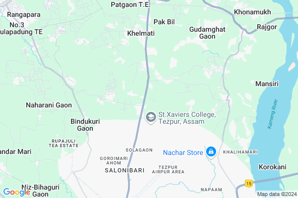
Napam Map
EDIT Map
Add Your House
 ..
..
Current Corona Virus Infected Patients Count in Sonitpur District
| City Name | District Name | Total Covid cases |
|---|
Locality Name :
Napam
( नपं )
Tehsil Name : Balipara
District : Sonitpur
State : Assam
Language : Assamese and Bengali,
Current Time 04:14 PM
Date: Thursday , Apr 24,2025 (IST)
Time zone: IST (UTC+5:30)
Elevation / Altitude: 83 meters. Above Seal level
Telephone Code / Std Code: 03712
Assembly constituency : Rangapara assembly constituency
Assembly MLA : Krishna Kamal Tanti
Lok Sabha constituency : Tezpur parliamentary constituency
Parliament MP : PALLAB LOCHAN DAS
Serpanch Name :
Pin Code : 784028
Post Office Name : Napaam
Napam Live Weather
Temperature: 34.5 °C
scattered clouds
Humidity: 32%
Wind : 5.53 mt/sec towards SW
StationName : "RangÄ\u0081pÄ\u0081ra"
observed on 3 Mins Back
Temperature: 34.5 °C
scattered clouds
Humidity: 32%
Wind : 5.53 mt/sec towards SW
StationName : "RangÄ\u0081pÄ\u0081ra"
observed on 3 Mins Back
Napam Weather Forecast for Next 5 days
25-04-2025
22.1°C to 31.4°C
light rain, few clouds, clear sky
22.1°C to 31.4°C
light rain, few clouds, clear sky
26-04-2025
21.4°C to 34.2°C
clear sky, few clouds, light rain, moderate rain
21.4°C to 34.2°C
clear sky, few clouds, light rain, moderate rain
27-04-2025
21.4°C to 33.6°C
light rain, scattered clouds, few clouds
21.4°C to 33.6°C
light rain, scattered clouds, few clouds
28-04-2025
21.7°C to 32.0°C
light rain, broken clouds, moderate rain
21.7°C to 32.0°C
light rain, broken clouds, moderate rain
29-04-2025
21.3°C to 25.8°C
moderate rain, light rain, overcast clouds
21.3°C to 25.8°C
moderate rain, light rain, overcast clouds
National Highways Reachable To Napam
Nationa High Way :NH13
Nationa High Way :NH13
Rivers Near Napam
Pasa
Bargang
Pasa
Bargang
About Napam
Correct below Info and add more info about NapamNapam is a Village in Balipara Tehsil in Sonitpur District of Assam State, India. It is located 31 KM towards west from District head quarters Tezpur. 145 KM from State capital Dispur
Napam Pin code is 784028 and postal head office is Napaam .
Napam is surrounded by Murkongselek Tehsil towards North , Naduar Tehsil towards East , Bihaguri Tehsil towards South , Tezpur Tehsil towards South .
Tezpur , Dhekiajuli , Nagaon , Marigaon are the near by Cities to Napam.
This Place is in the border of the Sonitpur District and Nagaon District. Nagaon District Tezpur is South towards this place .
Na-Pam Gaon 2011 Census Details
Napam Local Language is Assamese. Na-Pam Gaon Village Total population is 4105 and number of houses are 904. Female Population is 48.7%. Village literacy rate is 63.9% and the Female Literacy rate is 29.0%.
Population
| Census Parameter | Census Data |
| Total Population | 4105 |
| Total No of Houses | 904 |
| Female Population % | 48.7 % ( 1998) |
| Total Literacy rate % | 63.9 % ( 2625) |
| Female Literacy rate | 29.0 % ( 1192) |
| Scheduled Tribes Population % | 0.7 % ( 29) |
| Scheduled Caste Population % | 1.5 % ( 60) |
| Working Population % | 40.8 % |
| Child(0 -6) Population by 2011 | 612 |
| Girl Child(0 -6) Population % by 2011 | 48.4 % ( 296) |
Na-Pam Gaon Census More Deatils.
Politics in Napam
Bharatiya Janata Party , BJP , 58134 , AGP , 86.05% , INC are the major political parties in this area.Polling Stations /Booths near Napam
1)Hatibari T.e. L.p. School (west)2)Hem Baruah High School (east)
3)Hem Baruah High School (north)
4)Gudamghat Miri L.p. School (west)
5)Gudamghat No.1 L.p. School (east)
HOW TO REACH Napam
By Rail
Balipara Rail Way Station is the very nearby railway stations to Napam.Colleges near Napam
Missamari Jnr And Degree College
Address : Vill-gorubandha, Po-gorubandha, Ps-missamari, Pin-784506, Dist-sonitpur, State-assam
Tezpur College, Tezpur
Address :
Behali Higher Secondery School
Address :
Behali Junior College
Address : Po. Borgang Vill Borkotiabari Sonitpur. 784167
Chariduar College
Address : (gahpur) Sonitpur,assam
Schools in Napam
Napam Mvs
Address : napam , balipara , sonitpur , Assam . PIN- 784028 , Post - Napaam
Govt Health Centers near Napam
1) Naharani SC , , Ghansyam Center to Naharani Sub Way , Near Naharani L. P. School2) Panchmile NPHC , , Panchmile , Near Borghat Out-Post
3) Kalitagaon SC , , , Near Bharoti Libaray
Hospitals in Napam,Balipara
COMPOSIT HOSPITAL; SSB; SALONIBARI
Solagaon; Goroi Mari Borpukhuri; Assam 784105; India
5.2 KM distance Detail
Dr T Kutum; MBBS; MD(Biochemestry)
Goroimari Ahom; Goroi Mari Borpukhuri; Assam 784105; India
5.3 KM distance Detail
more ..
Petrol Bunks in Napam,Balipara
Indian Oil Petrol Deput
Thelamara - Bandarmari- Bindukuri - Khanamukh Rd; Dipoota; Tezpur; Assam 784501; India
11.8 KM distance Detail
Durrang Industrial Corporation
Balipara-Old Missamari Rd; Rangapara; Assam 784505; India
13.6 KM distance Detail
more ..
Colleges in Napam,Balipara
Girijananda Chowdhury Institute Of Management & Technology
Kunderbari Road; Dekargaon; Dipoota; Tezpur; Assam 784501; India
10.7 KM distance Detail
Global Education & Technoworld
Ward No.4; B.R Dutta Road; Near Kirtan Sangha; Rangapara; Assam; India
13.5 KM distance Detail
more ..
Schools in Napam,Balipara
Drishtee Computer Education Center
Solagaon; Niz-Haleswar; Assam 784105; India
5.4 KM distance Detail
Binapani School And Home Of Mr Chandra Bir Tamang
sundarban; Mansiri; Assam; India
5.4 KM distance Detail
No. 36 Goroimari J. B. School
784105; Tenali; Salonibari; Tezpur; Assam 784105; India
5.6 KM distance Detail
Local Parks in Napam,Balipara
Police Stations near Napam,Balipara
Salonibari Police Station
National Highway-52; Borpukharipar Gaon; Tezpur; Assam 784105; India
7.1 KM distance Detail
About Napam &
History
How to reach Napam
Tourist Places Near By Napam
Schools in Napam
Colleges in Napam
Temperature & weather of Napam
places in Napam
Napam photos
More Information
How to reach Napam
Tourist Places Near By Napam
Schools in Napam
Colleges in Napam
Temperature & weather of Napam
places in Napam
Napam photos
More Information
Village Talk
Post News or Events about this Village
Near Cities
Tezpur 16 KM near
Dhekiajuli 32 KM near
Nagaon 51 KM near
Marigaon 80 KM near
Tezpur 16 KM near
Dhekiajuli 32 KM near
Nagaon 51 KM near
Marigaon 80 KM near
Near By Taluks
Balipara 0 KM near
Murkongselek 8 KM near
Naduar 12 KM near
Tezpur 13 KM near
Balipara 0 KM near
Murkongselek 8 KM near
Naduar 12 KM near
Tezpur 13 KM near
Near By Air Ports
Salonibari Airport 6 KM near
Borjhar Airport 155 KM near
Dimapur Airport 155 KM near
Rowriah Airport 156 KM near
Salonibari Airport 6 KM near
Borjhar Airport 155 KM near
Dimapur Airport 155 KM near
Rowriah Airport 156 KM near
Near By Tourist Places
Tezpur 13 KM near
Nameri National Park 21 KM near
Bhalukpong 34 KM near
Orang National Park 35 KM near
Nagaon 52 KM near
Tezpur 13 KM near
Nameri National Park 21 KM near
Bhalukpong 34 KM near
Orang National Park 35 KM near
Nagaon 52 KM near
Near By Districts
Sonitpur 29 KM near
Nagaon 51 KM near
Udalguri 74 KM near
Marigaon 80 KM near
Sonitpur 29 KM near
Nagaon 51 KM near
Udalguri 74 KM near
Marigaon 80 KM near
Near By RailWay Station
Balipara Rail Way Station 7.8 KM near
Rangapara North Junction Rail Way Station 13 KM near
Chaparmukh Junction Rail Way Station 75 KM near
Balipara Rail Way Station 7.8 KM near
Rangapara North Junction Rail Way Station 13 KM near
Chaparmukh Junction Rail Way Station 75 KM near