| Home | City Bus | Maps | Villages | Cities | Rail | Tourist Places | School | College | Pin Codes | Corona Cases Count |
| Distance Calculator Bus Services IFSC Codes Trace Mobile Number Weather Search Place Trace IP Available Cash ATM/Banks Locate Polling Booth Report an Error contact People |
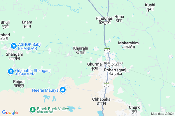
Jait
Jait Map
EDIT Map
Add Your House
 ..
..
Current Corona Virus Infected Patients Count in Sonbhadra District
| City Name | District Name | Total Covid cases |
|---|
Locality Name :
Jait
( जाइत )
Block Name : Robertsganj
District : Sonbhadra
State : Uttar Pradesh
Division : Mirzapur
Language : Hindi and Urdu
Current Time 07:22 PM
Date: Tuesday , Apr 29,2025 (IST)
Time zone: IST (UTC+5:30)
Elevation / Altitude: 318 meters. Above Seal level
Telephone Code / Std Code: 05444
Assembly constituency : Ghorawal assembly constituency
Assembly MLA : Dr. Anil Kumar Maurya
Lok Sabha constituency : Robertsganj parliamentary constituency
Parliament MP : PAKAURI LAL KOL
Serpanch Name :
Pin Code : 231216
Post Office Name : Robertsganj
Commodities Prices : Robertsganj Market / Mandi
Jait Live Weather
Temperature: 36.1 °C
few clouds
Humidity: 18%
Wind : 3.49 mt/sec towards NE
StationName : "Robertsganj"
observed on 2 Hours Back
Temperature: 36.1 °C
few clouds
Humidity: 18%
Wind : 3.49 mt/sec towards NE
StationName : "Robertsganj"
observed on 2 Hours Back
Jait Weather Forecast for Next 5 days
30-04-2025
25.6°C to 36.1°C
few clouds, scattered clouds, clear sky
25.6°C to 36.1°C
few clouds, scattered clouds, clear sky
01-05-2025
24.5°C to 39.6°C
clear sky
24.5°C to 39.6°C
clear sky
02-05-2025
26.1°C to 39.7°C
clear sky, broken clouds, scattered clouds
26.1°C to 39.7°C
clear sky, broken clouds, scattered clouds
03-05-2025
24.7°C to 40.5°C
clear sky, few clouds, scattered clouds
24.7°C to 40.5°C
clear sky, few clouds, scattered clouds
04-05-2025
25.8°C to 41.7°C
clear sky, few clouds, light rain, overcast clouds
25.8°C to 41.7°C
clear sky, few clouds, light rain, overcast clouds
National Highways Reachable To Jait
Nationa High Way :NH35
Nationa High Way :NH119
Nationa High Way :NH35
Nationa High Way :NH119
Rivers Near Jait
Durbul Nala
Son
Durbul Nala
Son
About Jait
Correct below Info and add more info about JaitJait is a Village in Robertsganj Block in Sonbhadra District of Uttar Pradesh State, India. It belongs to Mirzapur Division . It is located 3 KM towards west from District head quarters Robertsganj. 1 KM from Robertsganj. 371 KM from State capital Lucknow
Jait Pin code is 231216 and postal head office is Robertsganj .
Kaithi ( 1 KM ) , Babanauli ( 2 KM ) , Parashipandy ( 2 KM ) , Kamhari ( 2 KM ) , Burhr Khurd ( 2 KM ) are the nearby Villages to Jait. Jait is surrounded by Ghorawal Block towards west , Chatra Block towards East , Naugarh Block towards East , Chopan Block towards South .
Robertsganj , Shahganj , Kota , Obra are the near by Cities to Jait.
This Place is in the border of the Sonbhadra District and Chandauli District. Chandauli District Naugarh is East towards this place .
Jait 2011 Census Details
Jait Local Language is Hindi. Jait Village Total population is 808 and number of houses are 132. Female Population is 47.6%. Village literacy rate is 62.5% and the Female Literacy rate is 23.9%.
Population
| Census Parameter | Census Data |
| Total Population | 808 |
| Total No of Houses | 132 |
| Female Population % | 47.6 % ( 385) |
| Total Literacy rate % | 62.5 % ( 505) |
| Female Literacy rate | 23.9 % ( 193) |
| Scheduled Tribes Population % | 0.0 % ( 0) |
| Scheduled Caste Population % | 43.9 % ( 355) |
| Working Population % | 43.6 % |
| Child(0 -6) Population by 2011 | 136 |
| Girl Child(0 -6) Population % by 2011 | 49.3 % ( 67) |
Jait Census More Deatils.
Politics in Jait
SP , BSP are the major political parties in this area.Polling Stations /Booths near Jait
1)Prathamik Vidyalay Mamua2)Prathamik Vidyalay Badhauna
3)Prathamik Vidyalay Judi
4)Prathmik Vidhayalay Dabha
5)Prathmik Vidhayalay Kapura
HOW TO REACH Jait
By Rail
Roberts Ganj Rail Way Station , Churk Rail Way Station are the very nearby railway stations to Jait.Colleges near Jait
Jan Sewa Inter College Phulawari Sonebhadra
Address :
Awadhut Bhagwan Ram Mahavidyalaya
Address :
Sonebarsha Intermediet College
Address :
Schools in Jait
P.s.jait Robertsganj
Address : jait , robertsganj , sonbhadra , Uttar Pradesh . PIN- 231216 , Post - Robertsganj
Govt Health Centers near Jait
1) Robertsganj , , ,2) Nipraj , , ,
3) Pakari , , ,
Hospitals in Jait,Robertsganj
Upkar Hospital & Surgical Centre
Kamarhi; Robertsganj; Uttar Pradesh 231216; India
1.7 KM distance Detail
more ..
Petrol Bunks in Jait,Robertsganj
Reliance Petrol Pump Station
Bichchi; SH 5A; Robertsganj; Uttar Pradesh 231216; India
3.0 KM distance Detail
Sonbhadra Service Station Hindustan Petroleum
Ganguar; Sonbhadra; SH-5; Robertsganj Varansi Road; Robertsganj; Robertsganj; Uttar Pradesh 231216; India
3.1 KM distance Detail
HP PETROL PUMP - MUNNILAL & CO ROBERTSGANJ
Badhaulay Chauraha Robertsganj; Varanasi; Uttar Pradesh 231001; India
3.5 KM distance Detail
more ..
Colleges in Jait,Robertsganj
School of Management and Information Technology
Ward Number 7; Kamarhi; Robertsganj; Uttar Pradesh 231216; India
3.0 KM distance Detail
Rajkiya Mahila Mahavidyalaya
Civil Line Road; Tagore Nagar; Robertsganj; Uttar Pradesh 231216; India
3.6 KM distance Detail
more ..
Schools in Jait,Robertsganj
SHREE GANGA RAM BAUDH SIKSHAN SANSTHA MANPUR NAVTALLI
Manpur; Uttar Pradesh 231216; India
0.5 KM distance Detail
MAA VAISHNO MODERN PUBLIC SCHOOL
Ghorawal To Robertsganj Rd; Jamgane; Uttar Pradesh 231216; India
1.6 KM distance Detail
Electronic Shops in Jait,Robertsganj
STF Enterprises
Ghorawal road; Kamarhi; Robertsganj; Uttar Pradesh 231216; India
2.4 KM distance Detail
Ashishmobilecare
Uttar Mohal; kmaharirobertsganj; Uttar Pradesh 231216; India
2.6 KM distance Detail
Super Markets in Jait,Robertsganj
Kesharwani Bartan Bhandar
MDR 160E; Tagore Nagar; Robertsganj; Uttar Pradesh 231216; India
4.1 KM distance Detail
Local Parks in Jait,Robertsganj
Pratap Park
Hameed Nagar; Tagore Nagar; Robertsganj; Uttar Pradesh 231216; India
3.5 KM distance Detail
Kaimoor Wildlife Sanctuary
from 3 kilometer of Robertsganj Shahganj village Mahuvaria; Uttar Pradesh; India
3.9 KM distance Detail
Police Stations near Jait,Robertsganj
Robertsganj Police Station
Hameed Nagar; Tagore Nagar; Robertsganj; Uttar Pradesh 231216; India
3.6 KM distance Detail
Governement Offices near Jait,Robertsganj
Pradeep Kumar ( Office Online Works )
Ambedkar Nagar; Robertsganj; Uttar Pradesh 231216; India
3.5 KM distance Detail
Mansa Transport Co.
19/51; Shankat Mochan; Badhauli Chauraha; Robertsganj;Sonbhadra; Uttar Pradesh; 231216; India
3.8 KM distance Detail
About Jait &
History
How to reach Jait
Tourist Places Near By Jait
Schools in Jait
Colleges in Jait
Temperature & weather of Jait
places in Jait
Jait photos
More Information
How to reach Jait
Tourist Places Near By Jait
Schools in Jait
Colleges in Jait
Temperature & weather of Jait
places in Jait
Jait photos
More Information
Village Talk
Post News or Events about this Village
Near Cities
Robertsganj 3 KM near
Shahganj 10 KM near
Kota 32 KM near
Obra 35 KM near
Robertsganj 3 KM near
Shahganj 10 KM near
Kota 32 KM near
Obra 35 KM near
Near By Taluks
Robertsganj 1 KM near
Ghorawal 20 KM near
Chatra 23 KM near
Naugarh 23 KM near
Robertsganj 1 KM near
Ghorawal 20 KM near
Chatra 23 KM near
Naugarh 23 KM near
Near By Air Ports
Varanasi Airport 95 KM near
Bamrauli Airport 173 KM near
Gaya Airport 215 KM near
Patna Airport 256 KM near
Varanasi Airport 95 KM near
Bamrauli Airport 173 KM near
Gaya Airport 215 KM near
Patna Airport 256 KM near
Near By Tourist Places
Varanasi 77 KM near
Vindhyachal 83 KM near
Sarnath 84 KM near
Rohtasgarh Fort 99 KM near
Sasaram 114 KM near
Varanasi 77 KM near
Vindhyachal 83 KM near
Sarnath 84 KM near
Rohtasgarh Fort 99 KM near
Sasaram 114 KM near
Near By Districts
Sonbhadra 3 KM near
Kaimur (Bhabua) 73 KM near
Chandauli 74 KM near
Mirzapur 75 KM near
Sonbhadra 3 KM near
Kaimur (Bhabua) 73 KM near
Chandauli 74 KM near
Mirzapur 75 KM near
Near By RailWay Station
Roberts Ganj Rail Way Station 5.0 KM near
Churk Rail Way Station 9 KM near
Roberts Ganj Rail Way Station 5.0 KM near
Churk Rail Way Station 9 KM near