| Home | City Bus | Maps | Villages | Cities | Rail | Tourist Places | School | College | Pin Codes | Corona Cases Count |
| Distance Calculator Bus Services IFSC Codes Trace Mobile Number Weather Search Place Trace IP Available Cash ATM/Banks Locate Polling Booth Report an Error contact People |
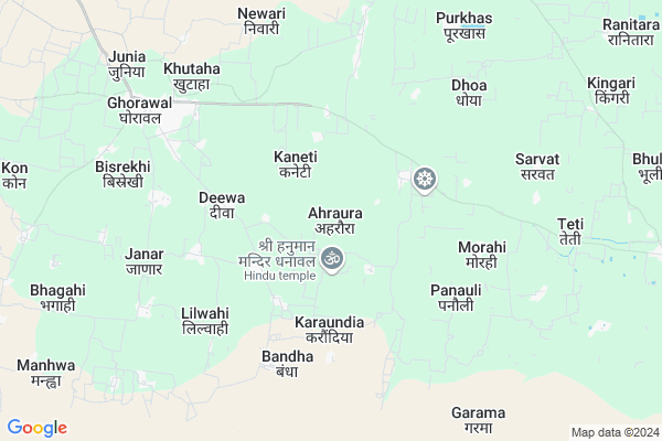
Ahraura
Ahraura Map
EDIT Map
Add Your House
 ..
..
Current Corona Virus Infected Patients Count in Sonbhadra District
| City Name | District Name | Total Covid cases |
|---|
Locality Name :
Ahraura
( अहरौरा )
Block Name : Ghorawal
District : Sonbhadra
State : Uttar Pradesh
Division : Mirzapur
Language : Hindi and Urdu
Current Time 07:42 AM
Date: Saturday , Apr 26,2025 (IST)
Time zone: IST (UTC+5:30)
Elevation / Altitude: 287 meters. Above Seal level
Telephone Code / Std Code: 05444
Assembly constituency : Ghorawal assembly constituency
Assembly MLA : Dr. Anil Kumar Maurya
Lok Sabha constituency : Robertsganj parliamentary constituency
Parliament MP : PAKAURI LAL KOL
Serpanch Name :
Pin Code : 231215
Post Office Name : Rajpur (Sonbhadra)
Alternate Village Name : Aharaura
Commodities Prices : Robertsganj Market / Mandi
Rivers Near Ahraura
Son
Belan
Son
Belan
About Ahraura
Correct below Info and add more info about AhrauraAhraura is a Village in Ghorawal Block in Sonbhadra District of Uttar Pradesh State, India. It belongs to Mirzapur Division . It is located 27 KM towards west from District head quarters Robertsganj. 3 KM from Ghorawal. 354 KM from State capital Lucknow
Ahraura Pin code is 231215 and postal head office is Rajpur (Sonbhadra).
Barsot ( 1 KM ) , Bakuli ( 2 KM ) , Kharuaun ( 2 KM ) , Sotil ( 2 KM ) , Lohandi ( 3 KM ) are the nearby Villages to Ahraura. Ahraura is surrounded by Rajgarh Block towards North , Robertsganj Block towards East , Chopan Block towards South , Obra Block towards South .
Shahganj , Robertsganj , Obra , Kota are the near by Cities to Ahraura.
This Place is in the border of the Sonbhadra District and Mirzapur District. Mirzapur District Rajgarh is North towards this place .
Ahraura 2011 Census Details
Ahraura Local Language is Hindi. Ahraura Village Total population is 950 and number of houses are 157. Female Population is 48.9%. Village literacy rate is 53.5% and the Female Literacy rate is 21.5%.
Population
| Census Parameter | Census Data |
| Total Population | 950 |
| Total No of Houses | 157 |
| Female Population % | 48.9 % ( 465) |
| Total Literacy rate % | 53.5 % ( 508) |
| Female Literacy rate | 21.5 % ( 204) |
| Scheduled Tribes Population % | 0.0 % ( 0) |
| Scheduled Caste Population % | 59.3 % ( 563) |
| Working Population % | 46.6 % |
| Child(0 -6) Population by 2011 | 169 |
| Girl Child(0 -6) Population % by 2011 | 50.9 % ( 86) |
Ahraura Census More Deatils.
Politics in Ahraura
SP , BSP are the major political parties in this area.Polling Stations /Booths near Ahraura
1)Prathmik Vidyalay Baradiyan Pa. Pa.2)Prathmik Vidyalay Belahee
3)Prathmik Vidyalay Devari Kath
4)Prathmik Vidyalay Dhurakari
5)Prathmik Vidyalay Ghorawal U. Pa.
HOW TO REACH Ahraura
By Rail
There is no railway station near to Ahraura in less than 10 km.Colleges near Ahraura
Jan Sewa Inter College Phulawari Sonebhadra
Address :
Schools near Ahraura
S.b.b. Patel Inter C. Bhagwas
Address : masi adinath , ghorawal , sonbhadra , Uttar Pradesh . PIN- 231216 , Post - Robertsganj
Rajkiy Asharam P. I.c. Ghorawal
Address : ghorawal , ghorawal , sonbhadra , Uttar Pradesh . PIN- 231216 , Post - Robertsganj
G I C Ghorawal
Address : ghorawal , ghorawal , sonbhadra , Uttar Pradesh . PIN- 231210 , Post - Ghorawal
Bhartiya Inter College Ghorawa
Address : ghorawal , ghorawal , sonbhadra , Uttar Pradesh . PIN- 231210 , Post - Ghorawal
Govt Health Centers near Ahraura
1) Kusrat , , ,2) Nipraj , , ,
3) Burharkala , , ,
Hospitals in Ahraura,Ghorawal
Yuvraj Singh (Bombay Hospital)
Shivdwa Rd; Ghorawal; Uttar Pradesh 231210; India
7.9 KM distance Detail
more ..
Petrol Bunks in Ahraura,Ghorawal
HP PETROL PUMP - H P BAJRANG
Hpcl Petrol Pump 4 KM From Shivdwar MOR TO Shahganj Road Ghorawal; Varanasi; Uttar Pradesh 231210; India
7.6 KM distance Detail
HP PETROL PUMP - VIKASH FILLING STATION
Village Orahtha Shahganj Orahtha Road Tehsil Ghorawal; Orahtha; Varanasi; Uttar Pradesh 231210; India
11.7 KM distance Detail
more ..
Schools in Ahraura,Ghorawal
Swami Vivekananda Uchattar Madyamic Vidyalay Udar Mudiladih
Ghorawal To Robertsganj Rd; Odar; Uttar Pradesh 231215; India
4.1 KM distance Detail
कस्तूरबा गांधी बालिका विद्यालय घोरावल सोनभद्रा
Munghri; Uttar Pradesh 231215; India
4.4 KM distance Detail
Electronic Shops in Ahraura,Ghorawal
Vimal Motar Wainding
Ghorawal To Robertsganj Rd; Munghri; Uttar Pradesh 231215; India
4.5 KM distance Detail
Governement Offices near Ahraura,Ghorawal
About Ahraura &
History
How to reach Ahraura
Tourist Places Near By Ahraura
Schools in Ahraura
Colleges in Ahraura
Temperature & weather of Ahraura
places in Ahraura
Ahraura photos
More Information
How to reach Ahraura
Tourist Places Near By Ahraura
Schools in Ahraura
Colleges in Ahraura
Temperature & weather of Ahraura
places in Ahraura
Ahraura photos
More Information
Village Talk
Post News or Events about this Village
Near Cities
Shahganj 12 KM near
Robertsganj 25 KM near
Obra 40 KM near
Kota 47 KM near
Shahganj 12 KM near
Robertsganj 25 KM near
Obra 40 KM near
Kota 47 KM near
Near By Taluks
Ghorawal 3 KM near
Rajgarh 21 KM near
Robertsganj 23 KM near
Chopan 31 KM near
Ghorawal 3 KM near
Rajgarh 21 KM near
Robertsganj 23 KM near
Chopan 31 KM near
Near By Air Ports
Varanasi Airport 90 KM near
Bamrauli Airport 153 KM near
Gaya Airport 238 KM near
Gorakhpur Airport 261 KM near
Varanasi Airport 90 KM near
Bamrauli Airport 153 KM near
Gaya Airport 238 KM near
Gorakhpur Airport 261 KM near
Near By Tourist Places
Vindhyachal 66 KM near
Varanasi 75 KM near
Sarnath 84 KM near
Rohtasgarh Fort 122 KM near
Jaunpur 127 KM near
Vindhyachal 66 KM near
Varanasi 75 KM near
Sarnath 84 KM near
Rohtasgarh Fort 122 KM near
Jaunpur 127 KM near
Near By Districts
Sonbhadra 26 KM near
Mirzapur 60 KM near
Singrauli 69 KM near
Varanasi 76 KM near
Sonbhadra 26 KM near
Mirzapur 60 KM near
Singrauli 69 KM near
Varanasi 76 KM near
Near By RailWay Station
Lusa Rail Way Station 19 KM near
Roberts Ganj Rail Way Station 27 KM near
Lusa Rail Way Station 19 KM near
Roberts Ganj Rail Way Station 27 KM near