| Home | City Bus | Maps | Villages | Cities | Rail | Tourist Places | School | College | Pin Codes | Corona Cases Count |
| Distance Calculator Bus Services IFSC Codes Trace Mobile Number Weather Search Place Trace IP Available Cash ATM/Banks Locate Polling Booth Report an Error contact People |
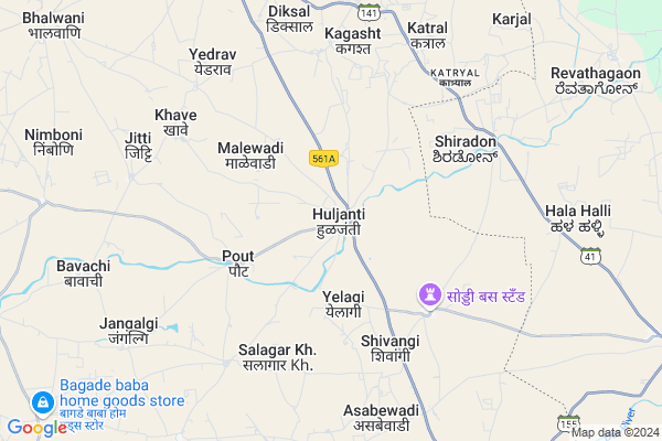
Huljanti
Huljanti Map
EDIT Map
Add Your House
 ..
..
Current Corona Virus Infected Patients Count in Solapur District
| City Name | District Name | Total Covid cases |
|---|---|---|
| Solapur District | Solapur | 26 |
Locality Name :
Huljanti
( हुलजंती )
Taluka Name : Mangalvedhe
District : Solapur
State : Maharashtra
Region : Desh or Paschim Maharashtra
Division : Pune
Language : Marathi and Kannada, Telugu, Urdu
Current Time 06:17 AM
Date: Saturday , Apr 26,2025 (IST)
Time zone: IST (UTC+5:30)
Elevation / Altitude: 499 meters. Above Seal level
Telephone Code / Std Code: 02188
Assembly constituency : Pandharpur assembly constituency
Assembly MLA : Bhalake Bharat Tukaram
Lok Sabha constituency : Solapur parliamentary constituency
Parliament MP : SHRI. SHA. BRA. DR. JAI SIDHESHWAR SHIVACHARY MAHA
Serpanch Name :
Pin Code : 413319
Post Office Name : Marwade
Alternate Village Name : Huljanit
Commodities Prices : Mangal Wedha Market / Mandi
Edit below overview about Huljanti
Edit below overview about Huljanti
OverView of Huljanti
Huljanti : One of famous place in three states viz Karnataka, Maharashtra and Andhra Pradesh. A place is famous for a big fair of Lord Mahalingaraya (Lord Shiva). The fair is the main attraction which is on the occasion of Divali and millions of people worship Lord Mahalingaraya's "Mundas Darshan" on that day.. Its a small village located on a sub river of Bhima named Dodda Nala. It is on Pandharpur-Vijapur Highway and 21 km from Mangalwedha...
Edit below overview about Huljanti
Rivers Near Huljanti
Bhima :भीमा :ಭೀಮಾ :भीमा
Bhima :भीमा :ಭೀಮಾ :भीमा
Bhima :भीमा :ಭೀಮಾ :भीमा
Bhima :भीमा :ಭೀಮಾ :भीमा
About Huljanti
Huljanti is a Village in Mangalvedhe Taluka in Solapur District of Maharashtra State, India. It belongs to Desh or Paschim Maharashtra region . It belongs to Pune Division . It is located 60 KM towards west from District head quarters Solapur. 13 KM from Mangalvedhe. 397 KM from State capital Mumbai
Huljanti Pin code is 413319 and postal head office is Marwade .
Pout ( 4 KM ) , Soddi ( 4 KM ) , Shivangi ( 5 KM ) , Kagasht ( 7 KM ) , Salagar Kh ( 7 KM ) are the nearby Villages to Huljanti. Huljanti is surrounded by Indi Taluka towards East , Sangola Taluka towards west , Jath Taluka towards west , Pandharpur Taluka towards North .
Mangalvedhe , Pandharpur , Sangole , Solapur are the near by Cities to Huljanti.
Huljanti 2011 Census Details
Huljanti Local Language is Marathi. Huljanti Village Total population is 5323 and number of houses are 1036. Female Population is 47.7%. Village literacy rate is 58.4% and the Female Literacy rate is 23.6%.
Population
| Census Parameter | Census Data |
| Total Population | 5323 |
| Total No of Houses | 1036 |
| Female Population % | 47.7 % ( 2540) |
| Total Literacy rate % | 58.4 % ( 3106) |
| Female Literacy rate | 23.6 % ( 1255) |
| Scheduled Tribes Population % | 1.3 % ( 68) |
| Scheduled Caste Population % | 19.1 % ( 1017) |
| Working Population % | 50.3 % |
| Child(0 -6) Population by 2011 | 812 |
| Girl Child(0 -6) Population % by 2011 | 45.1 % ( 366) |
Huljanti Census More Deatils.
Politics in Huljanti
Bharatiya Janata Party , BJP , NCP , SWP , INC are the major political parties in this area.Polling Stations /Booths near Huljanti
1)Zilla Parishad Primary School Room No.1 Katral2)Zilla Parishad Primary School Room No.1 Malewadi
3)Zilla Parishad Primary School West Side Room No .1huljati
4)Zilla Parishad Primary School Room No.1 Diksal
5)Zilla Parishad Primary School Primary Weastern Side Room No.1 Kasegaon.
HOW TO REACH Huljanti
By Rail
There is no railway station near to Huljanti in less than 10 km. are the Rail way stations reachable from near by towns.By Road
Mangalvedhe are the nearby by towns to Huljanti having road connectivity to HuljantiColleges near Huljanti
Mp Mansinsing Highschool And Jr College Sodi
Address :
Schools in Huljanti
S.mahalingraya Highschool Huln
Address : huljanti , mangalwedha , solapur , Maharashtra . PIN- 413319 , Post - Marwade
Zpps Huljanti
Address : huljanti , mangalwedha , solapur , Maharashtra . PIN- 413319 , Post - Marwade
Govt Health Centers near Huljanti
1) Huljanti , SubCentre Huljanti , ,2) Kagast , SubCentre Kagast , ,
3) Salagar Bk. , Primary Health Centre Salagar Bk. , ,
Sub Villages in Huljanti
Petrol Bunks in Huljanti,Mangalvedhe
HP PETROL PUMP - SHREE MALKARSIDH PETROLEUM
Hpcl Dealers; A/P.- Umdi; SH-141; Taluka Jath;; Vasco; Maharashtra 416413; India
13.0 KM distance Detail
Hindustan Petroleum
Umadi - Salgar - Nandeshwar Rd; Umadi; Maharashtra 416413; India
13.0 KM distance Detail
Hindustan Petroleum
Umadi - Salgar - Nandeshwar Rd; Umadi; Maharashtra 416413; India
13.1 KM distance Detail
more ..
Colleges in Huljanti,Mangalvedhe
Shri Samarth Krupa
At Post Radde; Radde Road; Radde; Maharashtra 413322; India
14.7 KM distance Detail
more ..
Schools in Huljanti,Mangalvedhe
Shri Mahalingraya Highschool
Bijapur-Umadi-Pandharpur Rd; Maharashtra 413319; India
1.0 KM distance Detail
Bharat English School
Balaji Nagar; Solapur; SH-141; Mangalwedha Road; Solapur; Solapur; Maharashtra 413323; India
7.9 KM distance Detail
Shri Sadguru Bagade Maharaj Vidhyalay Bavachi
Lavangi- Mangalwedha Rd; Bavachi; Maharashtra 413322; India
8.5 KM distance Detail
Electronic Shops in Huljanti,Mangalvedhe
निंबोणी विनायक मशनरी
Pandharpur - Sankh - Vijaypura Rd; Nimboni; Maharashtra 413322; India
11.0 KM distance Detail
Super Markets in Huljanti,Mangalvedhe
Vaibhav Bricks Factory; Kumbhar Wasti
bijapur-umadi rd; Bijapur-Umadi-Pandharpur Rd; Maravde; Maharashtra 413319; India
10.8 KM distance Detail
Local Parks in Huljanti,Mangalvedhe
Police Stations near Huljanti,Mangalvedhe
Bharat(nana) Bhalake; Career Academy; BALAJINAGAR
Kagasht; Maharashtra 413319; India
8.5 KM distance Detail
Nandeshwar Police Station
Nandeshwar - Shirashi Rd; Hanumangalli; Nandeshwar; Maharashtra 413322; India
21.9 KM distance Detail
Governement Offices near Huljanti,Mangalvedhe
Gram Sachivalaya
bijapur-umadi rd; Bijapur-Umadi-Pandharpur Rd; Marawde; Maharashtra 413325; India
11.1 KM distance Detail
About Huljanti &
History
How to reach Huljanti
Tourist Places Near By Huljanti
Schools in Huljanti
Colleges in Huljanti
Temperature & weather of Huljanti
places in Huljanti
Huljanti photos
More Information
How to reach Huljanti
Tourist Places Near By Huljanti
Schools in Huljanti
Colleges in Huljanti
Temperature & weather of Huljanti
places in Huljanti
Huljanti photos
More Information
Village Talk
Post News or Events about this Village
Near Cities
Mangalvedhe 23 KM near
Pandharpur 48 KM near
Sangole 52 KM near
Solapur 56 KM near
Mangalvedhe 23 KM near
Pandharpur 48 KM near
Sangole 52 KM near
Solapur 56 KM near
Near By Taluks
Mangalvedhe 12 KM near
Indi 45 KM near
Sangola 48 KM near
Jath 49 KM near
Mangalvedhe 12 KM near
Indi 45 KM near
Sangola 48 KM near
Jath 49 KM near
Near By Air Ports
Sholapur Airport 57 KM near
Kolhapur Airport 168 KM near
Latur Airport 170 KM near
Sambre Airport 216 KM near
Sholapur Airport 57 KM near
Kolhapur Airport 168 KM near
Latur Airport 170 KM near
Sambre Airport 216 KM near
Near By Tourist Places
Pandharpur 48 KM near
Solapur 60 KM near
Bijapur 68 KM near
Tuljapur 102 KM near
Gulbarga 152 KM near
Pandharpur 48 KM near
Solapur 60 KM near
Bijapur 68 KM near
Tuljapur 102 KM near
Gulbarga 152 KM near
Near By Districts
Solapur 57 KM near
Bijapur District 68 KM near
Osmanabad 121 KM near
Sangli 131 KM near
Solapur 57 KM near
Bijapur District 68 KM near
Osmanabad 121 KM near
Sangli 131 KM near
Near By RailWay Station
Sangola Rail Way Station 44 KM near
Pandharpur Rail Way Station 48 KM near
Sangola Rail Way Station 44 KM near
Pandharpur Rail Way Station 48 KM near