| Home | City Bus | Maps | Villages | Cities | Rail | Tourist Places | School | College | Pin Codes | Corona Cases Count |
| Distance Calculator Bus Services IFSC Codes Trace Mobile Number Weather Search Place Trace IP Available Cash ATM/Banks Locate Polling Booth Report an Error contact People |
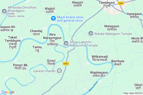
Sangam
Sangam Map
EDIT Map
Add Your House
 ..
..
Current Corona Virus Infected Patients Count in Solapur District
| City Name | District Name | Total Covid cases |
|---|---|---|
| Solapur District | Solapur | 26 |
Locality Name :
Sangam
( संगम )
Taluka Name : Malshiras
District : Solapur
State : Maharashtra
Region : Desh or Paschim Maharashtra
Division : Pune
Language : Marathi and Kannada, Telugu, Urdu
Current Time 06:04 AM
Date: Saturday , Apr 26,2025 (IST)
Time zone: IST (UTC+5:30)
Elevation / Altitude: 493 meters. Above Seal level
Telephone Code / Std Code: 02185
Assembly constituency : Malshiras assembly constituency
Assembly MLA : Ram Vitthal Satpute
Lok Sabha constituency : Madha parliamentary constituency
Parliament MP : Ranjeetsinha Hindurao Naik- Nimbalkar
Serpanch Name :
Pin Code : 413112
Post Office Name : Shreepur
Commodities Prices : Akluj Market / Mandi
Sangam Live Weather
Temperature: 30.7 °C
broken clouds
Humidity: 33%
Wind : 4.57 mt/sec towards NW
StationName : "KurduvÄ\u0081di"
observed on 2 Hours Back
Temperature: 30.7 °C
broken clouds
Humidity: 33%
Wind : 4.57 mt/sec towards NW
StationName : "KurduvÄ\u0081di"
observed on 2 Hours Back
Sangam Weather Forecast for Next 5 days
27-04-2025
30.0°C to 40.3°C
broken clouds, overcast clouds
30.0°C to 40.3°C
broken clouds, overcast clouds
28-04-2025
28.8°C to 40.9°C
scattered clouds, few clouds, clear sky
28.8°C to 40.9°C
scattered clouds, few clouds, clear sky
29-04-2025
27.1°C to 40.5°C
clear sky, scattered clouds
27.1°C to 40.5°C
clear sky, scattered clouds
30-04-2025
27.9°C to 40.7°C
clear sky, few clouds
27.9°C to 40.7°C
clear sky, few clouds
National Highways Reachable To Sangam
Nationa High Way :NH965G
Nationa High Way :NH160
Nationa High Way :NH965G
Nationa High Way :NH160
Rivers Near Sangam
Manganga :माणगंगा
Manganga :माणगंगा
Manganga :माणगंगा
Manganga :माणगंगा
About Sangam
Correct below Info and add more info about SangamSangam is a Village in Malshiras Taluka in Solapur District of Maharashtra State, India. It belongs to Desh or Paschim Maharashtra region . It belongs to Pune Division . It is located 104 KM towards west from District head quarters Solapur. 27 KM from Malshiras. 312 KM from State capital Mumbai
Sangam Pin code is 413112 and postal head office is Shreepur .
Giravi ( 3 KM ) , Mitkalwadi ( 4 KM ) , Ganeshgaon ( 4 KM ) , Chandaj ( 5 KM ) , Wadoli ( 5 KM ) are the nearby Villages to Sangam. Sangam is surrounded by Indapur Taluka towards west , Madha Taluka towards East , Pandharpur Taluka towards South , Karmala Taluka towards North .
Pandharpur , Mhaswad , Mangalvedhe , Baramati are the near by Cities to Sangam.
Sangam 2011 Census Details
Sangam Local Language is Marathi. Sangam Village Total population is 2466 and number of houses are 519. Female Population is 47.4%. Village literacy rate is 67.1% and the Female Literacy rate is 28.4%.
Population
| Census Parameter | Census Data |
| Total Population | 2466 |
| Total No of Houses | 519 |
| Female Population % | 47.4 % ( 1169) |
| Total Literacy rate % | 67.1 % ( 1654) |
| Female Literacy rate | 28.4 % ( 700) |
| Scheduled Tribes Population % | 2.1 % ( 53) |
| Scheduled Caste Population % | 10.8 % ( 267) |
| Working Population % | 37.7 % |
| Child(0 -6) Population by 2011 | 286 |
| Girl Child(0 -6) Population % by 2011 | 48.3 % ( 138) |
Sangam Census More Deatils.
Politics in Sangam
Bharatiya Janata Party , BJP , NCP , SWP , are the major political parties in this area.Polling Stations /Booths near Sangam
1)Zilla Parishad Primary School Northern Side Room No. 1 Sangam2)Zilla Parishad Primary School Northern Side Room No. 1 Medad
3)Zilla Parishad Primary School Southern Side Room No. 1 Babhulgaon Slab Building Fourt Door Easting
4)Zilla Parishad Primary School Southern Side New Bulding Room No.1 Girazani
5)Zilla Parishad Primary School Southern Side Room No. 1 Babhulgaon
HOW TO REACH Sangam
By Rail
There is no railway station near to Sangam in less than 10 km. Baramati Rail Way Station (near to Baramati) , Katphal Rail Way Station (near to Baramati) , Pandharpur Rail Way Station (near to Pandharpur) are the Rail way stations reachable from near by towns.By Road
Indapur , Pandharpur , Baramati , Phaltan are the nearby by towns to Sangam having road connectivity to SangamColleges near Sangam
Greenfingers College Of Computer And Technology,akluj
Address :
Ardhanari Nateshwer Mahavidyalaya Velapur
Address :
Gopalrao Dev Prashala,malshiras
Address : 58-phata,malshiras
National Backward Agriculture Education Of Information Technology Malshiras
Address : At Post Malshiras Urban Tal Malshiras Dist Solapur
Schools in Sangam
Zpps Adarsh Kendra Shala
Address : sangam , malshirus , solapur , Maharashtra . PIN- 413211 , Post - Tembhurni (Solapur)
Govt Health Centers near Sangam
1) Sangam , SubCentre Sangam , ,2) Shevre , SubCentre Shevre , ,
3) Chandaj , SubCentre Chandaj , ,
Sub Villages in Sangam
Petrol Bunks in Sangam,Malshiras
DHANU SMRUTI
Sharda Sangam Complex; Rohini Nagar; Jule; Solapur; Maharashtra 413240; India
1.3 KM distance Detail
more ..
Colleges in Sangam,Malshiras
Janata Vidyalaya & Junior College
Akluj - Tembhurni Rd; Tembhurni; Maharashtra 413211; India
9.6 KM distance Detail
KOHINOOR TECHCNICAL INSITUTE & VAIBHAV AUTOMOBILE
Pune-Solapur Highway; Tembhurni; Maharashtra 413211; India
10.2 KM distance Detail
Easy Spoken English
Tembhurni - Kurduwadi Rd; Tembhurni; Maharashtra 413211; India
10.6 KM distance Detail
more ..
Schools in Sangam,Malshiras
Chaitanya Vidyalay Old School Campus; Nira-Narsinhpur
Nira Narasingpur; Maharashtra 413103; India
1.1 KM distance Detail
Shevare Primary School
Akluj - Tembhurni Rd; Shevare; Maharashtra 413212; India
1.2 KM distance Detail
Super Markets in Sangam,Malshiras
Ganesh Hitech Nursery Tembhurni
Akluj - Phule Nagar Rd; Maharashtra 413211; India
7.9 KM distance Detail
sahil kirana stores
Tilak Rd; Shukrawar Peth; Tembhurni; Maharashtra 413211; India
9.9 KM distance Detail
Rajendra sarode (R.R.S) Genral store
Shukrawar Peth; Tembhurni; Maharashtra 413211; India
10.0 KM distance Detail
About Sangam &
History
How to reach Sangam
Tourist Places Near By Sangam
Schools in Sangam
Colleges in Sangam
Temperature & weather of Sangam
places in Sangam
Sangam photos
More Information
How to reach Sangam
Tourist Places Near By Sangam
Schools in Sangam
Colleges in Sangam
Temperature & weather of Sangam
places in Sangam
Sangam photos
More Information
Village Talk
Post News or Events about this Village
Near Cities
Pandharpur 42 KM near
Mhaswad 59 KM near
Mangalvedhe 68 KM near
Baramati 69 KM near
Pandharpur 42 KM near
Mhaswad 59 KM near
Mangalvedhe 68 KM near
Baramati 69 KM near
Near By Taluks
Malshiras 27 KM near
Indapur 29 KM near
Madha 30 KM near
Pandharpur 40 KM near
Malshiras 27 KM near
Indapur 29 KM near
Madha 30 KM near
Pandharpur 40 KM near
Near By Air Ports
Sholapur Airport 102 KM near
Lohegaon Airport 163 KM near
Latur Airport 166 KM near
Kolhapur Airport 188 KM near
Sholapur Airport 102 KM near
Lohegaon Airport 163 KM near
Latur Airport 166 KM near
Kolhapur Airport 188 KM near
Near By Tourist Places
Pandharpur 42 KM near
Solapur 99 KM near
Tuljapur 109 KM near
Satara 136 KM near
Ahmednagar 146 KM near
Pandharpur 42 KM near
Solapur 99 KM near
Tuljapur 109 KM near
Satara 136 KM near
Ahmednagar 146 KM near
Near By Districts
Solapur 99 KM near
Osmanabad 112 KM near
Satara 139 KM near
Beed 146 KM near
Solapur 99 KM near
Osmanabad 112 KM near
Satara 139 KM near
Beed 146 KM near
Near By RailWay Station
Kurduvadi Junction Rail Way Station 36 KM near
Jeur Rail Way Station 36 KM near
Kurduvadi Junction Rail Way Station 36 KM near
Jeur Rail Way Station 36 KM near