| Home | City Bus | Maps | Villages | Cities | Rail | Tourist Places | School | College | Pin Codes | Corona Cases Count |
| Distance Calculator Bus Services IFSC Codes Trace Mobile Number Weather Search Place Trace IP Available Cash ATM/Banks Locate Polling Booth Report an Error contact People |
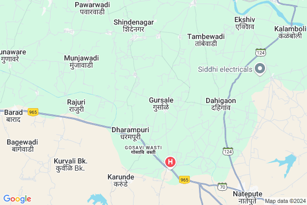
Gursale
Gursale Map
EDIT Map
Add Your House
 ..
..
Current Corona Virus Infected Patients Count in Solapur District
| City Name | District Name | Total Covid cases |
|---|---|---|
| Solapur District | Solapur | 26 |
Locality Name :
Gursale
( गुरसाळे )
Taluka Name : Malshiras
District : Solapur
State : Maharashtra
Region : Desh or Paschim Maharashtra
Division : Pune
Language : Marathi and Kannada, Telugu, Urdu
Current Time 07:30 AM
Date: Saturday , Apr 26,2025 (IST)
Time zone: IST (UTC+5:30)
Elevation / Altitude: 493 meters. Above Seal level
Telephone Code / Std Code: 02185
Assembly constituency : Malshiras assembly constituency
Assembly MLA : Ram Vitthal Satpute
Lok Sabha constituency : Madha parliamentary constituency
Parliament MP : Ranjeetsinha Hindurao Naik- Nimbalkar
Serpanch Name :
Pin Code : 413109
Post Office Name : Natepute
Commodities Prices : Jawali Market / Mandi
Edit below overview about Gursale
Edit below overview about Gursale
OverView of Gursale
shivaginagar is heart of gursale . one of most popular tempal situtated in gursale that SHREE KALBHAIRAVNATH MANDIR. now the beautiful tempal are at gursale .the unit of persan to persan is uniceEdit below overview about Gursale
National Highways Reachable To Gursale
Nationa High Way :NH965G
Nationa High Way :NH160
Nationa High Way :NH965G
Nationa High Way :NH160
Rivers Near Gursale
Manganga :माणगंगा
Manganga :माणगंगा
Manganga :माणगंगा
Manganga :माणगंगा
About Gursale
Gursale is a Village in Malshiras Taluka in Solapur District of Maharashtra State, India. It belongs to Desh or Paschim Maharashtra region . It belongs to Pune Division . It is located 155 KM towards west from District head quarters Solapur. 34 KM from Malshiras. 265 KM from State capital Mumbai
Gursale Pin code is 413109 and postal head office is Natepute .
Dahigaon ( 4 KM ) , Morochi ( 5 KM ) , Dombalwadi ( 5 KM ) , Shindewadi ( 5 KM ) , Karunde ( 7 KM ) are the nearby Villages to Gursale. Gursale is surrounded by Indapur Taluka towards East , Malshiras Taluka towards East , Baramati Taluka towards North , Phaltan Taluka towards west .
Baramati , Phaltan , Mhaswad , Daund are the near by Cities to Gursale.
Gursale 2011 Census Details
Gursale Local Language is Marathi. Gursale Village Total population is 4659 and number of houses are 976. Female Population is 48.5%. Village literacy rate is 69.1% and the Female Literacy rate is 29.4%.
Population
| Census Parameter | Census Data |
| Total Population | 4659 |
| Total No of Houses | 976 |
| Female Population % | 48.5 % ( 2258) |
| Total Literacy rate % | 69.1 % ( 3220) |
| Female Literacy rate | 29.4 % ( 1369) |
| Scheduled Tribes Population % | 0.3 % ( 16) |
| Scheduled Caste Population % | 20.0 % ( 931) |
| Working Population % | 46.1 % |
| Child(0 -6) Population by 2011 | 493 |
| Girl Child(0 -6) Population % by 2011 | 49.3 % ( 243) |
Gursale Census More Deatils.
Politics in Gursale
Bharatiya Janata Party , BJP , NCP , SWP , are the major political parties in this area.Polling Stations /Booths near Gursale
1)Zilla Parishad Primary School (gaothan) Room No. 1 Yeliv2)Zilla Parishad Primary School Room No. 1 Dongarwadi Lonand
3)Zilla Parishad Primary School Westren Side North Side Door Room No.1 Kanher
4)Zilla Parishad Primary School Room No. 1 Vatpali
5)Zilla Parishad Primary School(gaothan) Near Road South Side Door Room No. 4 Ughadewadi
HOW TO REACH Gursale
By Rail
There is no railway station near to Gursale in less than 10 km. Baramati Rail Way Station (near to Baramati) , Katphal Rail Way Station (near to Baramati) , Pandharpur Rail Way Station (near to Pandharpur) are the Rail way stations reachable from near by towns.By Road
Indapur , Pandharpur , Baramati , Phaltan are the nearby by towns to Gursale having road connectivity to GursaleColleges near Gursale
Greenfingers College Of Computer And Technology,akluj
Address :
Ardhanari Nateshwer Mahavidyalaya Velapur
Address :
Gopalrao Dev Prashala,malshiras
Address : 58-phata,malshiras
National Backward Agriculture Education Of Information Technology Malshiras
Address : At Post Malshiras Urban Tal Malshiras Dist Solapur
Schools in Gursale
Madyamik Vidyalay Gursale
Address : gursale , malshirus , solapur , Maharashtra . PIN- 413109 , Post - Natepute
Jinpuri Pathashala
Address : gursale , malshirus , solapur , Maharashtra . PIN- 413109 , Post - Natepute
Zpps Gursale
Address : gursale , malshirus , solapur , Maharashtra . PIN- 413109 , Post - Natepute
Govt Health Centers near Gursale
1) Gursale , SubCentre Gursale , ,2) dharmapuri , SubCentre dharmapuri , ,
3) Morochi , Primary Health Centre Morochi , ,
Sub Villages in Gursale
Hospitals in Gursale,Malshiras
Dhanashree Hospital
Morochi; Solapur; SH-70; Mahad Pandharpur Road; Pandharpur Road; Natepute; Natepute; Maharashtra 413109; India
5.4 KM distance Detail
more ..
Colleges in Gursale,Malshiras
College of Engineering
Akluj-Tirwandi-Malshiras Rd; Natepute; Maharashtra 413109; India
10.1 KM distance Detail
Sahakar Maharshi Shankarrao Mohite-Patil Mahavidyalaya; Natspute.
Natepute; Maharashtra 413109; India
10.2 KM distance Detail
Vijay Singh Mohite Patil Mahavidyalaya
Sathe Nagar; Solapur; SH-70; Mahad Pandharpur Road; Pandharpur Road; Natepute; Natepute; Maharashtra 413109; India
10.2 KM distance Detail
VMP Mahavidyalayaa
Dombalwadi - Dahigaon Rd; Natepute; Maharashtra 413109; India
10.6 KM distance Detail
more ..
Schools in Gursale,Malshiras
new english school; dharampuri
Shindewadi - Dharampuri Rd; Dharampuri; Maharashtra 413109; India
3.2 KM distance Detail
Zila Parishad Prathmik Shala
Jadhav Wasti; Dharampuri; Solapur; SH-70; Mahad Pandharpur Road; Pandharpur Road; Natepute; Natepute; Maharashtra 413109; India
4.0 KM distance Detail
Electronic Shops in Gursale,Malshiras
Ramdev machinery &electicals
Pune - Pandharpur Road; Natepute; Maharashtra 413109; India
10.3 KM distance Detail
About Gursale &
History
How to reach Gursale
Tourist Places Near By Gursale
Schools in Gursale
Colleges in Gursale
Temperature & weather of Gursale
places in Gursale
Gursale photos
More Information
How to reach Gursale
Tourist Places Near By Gursale
Schools in Gursale
Colleges in Gursale
Temperature & weather of Gursale
places in Gursale
Gursale photos
More Information
Village Talk
Post News or Events about this Village
Near Cities
Baramati 27 KM near
Phaltan 31 KM near
Mhaswad 42 KM near
Daund 64 KM near
Baramati 27 KM near
Phaltan 31 KM near
Mhaswad 42 KM near
Daund 64 KM near
Near By Taluks
Man 31 KM near
Baramati 32 KM near
Indapur 32 KM near
Malshiras 33 KM near
Man 31 KM near
Baramati 32 KM near
Indapur 32 KM near
Malshiras 33 KM near
Near By Air Ports
Lohegaon Airport 119 KM near
Sholapur Airport 152 KM near
Kolhapur Airport 166 KM near
Latur Airport 217 KM near
Lohegaon Airport 119 KM near
Sholapur Airport 152 KM near
Kolhapur Airport 166 KM near
Latur Airport 217 KM near
Near By Tourist Places
Pandharpur 83 KM near
Satara 85 KM near
Mandwa 98 KM near
Panchgani 106 KM near
Vadhu Tulapur 116 KM near
Pandharpur 83 KM near
Satara 85 KM near
Mandwa 98 KM near
Panchgani 106 KM near
Vadhu Tulapur 116 KM near
Near By Districts
Satara 88 KM near
Pune 120 KM near
Sangli 138 KM near
Ahmednagar 143 KM near
Satara 88 KM near
Pune 120 KM near
Sangli 138 KM near
Ahmednagar 143 KM near
Near By RailWay Station
Bhigwan Rail Way Station 45 KM near
Daund Junction Rail Way Station 64 KM near
Bhigwan Rail Way Station 45 KM near
Daund Junction Rail Way Station 64 KM near