| Home | City Bus | Maps | Villages | Cities | Rail | Tourist Places | School | College | Pin Codes | Corona Cases Count |
| Distance Calculator Bus Services IFSC Codes Trace Mobile Number Weather Search Place Trace IP Available Cash ATM/Banks Locate Polling Booth Report an Error contact People |
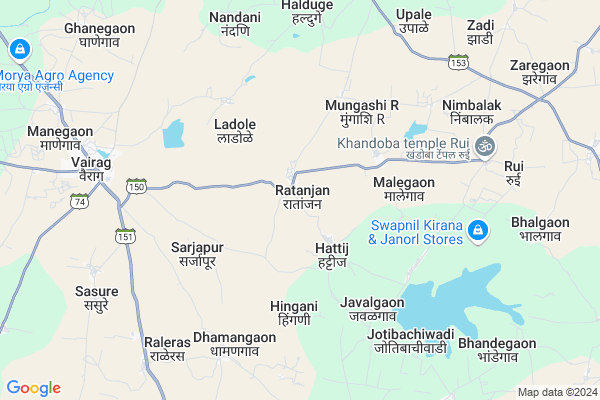
Ratanjan
Ratanjan Map
EDIT Map
Add Your House
 ..
..
Current Corona Virus Infected Patients Count in Solapur District
| City Name | District Name | Total Covid cases |
|---|---|---|
| Solapur District | Solapur | 26 |
Locality Name :
Ratanjan
( रातांजन )
Taluka Name : Barshi
District : Solapur
State : Maharashtra
Region : Desh or Paschim Maharashtra
Division : Pune
Language : Marathi and Kannada, Telugu, Urdu
Current Time 11:06 AM
Date: Friday , Apr 25,2025 (IST)
Time zone: IST (UTC+5:30)
Elevation / Altitude: 528 meters. Above Seal level
Telephone Code / Std Code: 02184
Assembly constituency : Barshi assembly constituency
Assembly MLA : Rajendra Vitthal Raut
Lok Sabha constituency : Osmanabad parliamentary constituency
Parliament MP : Omprakash Bhupalsinh Alias Pawan Rajenimbalkar
Serpanch Name :
Pin Code : 413406
Post Office Name : Gaudgaon
Commodities Prices : Barshi(Vairag) Market / Mandi
Ratanjan Live Weather
Temperature: 34.1 °C
clear sky
Humidity: 20%
Wind : 3.87 mt/sec towards N
StationName : "KÄ\u0081ti"
observed on 2 Hours Back
Temperature: 34.1 °C
clear sky
Humidity: 20%
Wind : 3.87 mt/sec towards N
StationName : "KÄ\u0081ti"
observed on 2 Hours Back
Ratanjan Weather Forecast for Next 5 days
26-04-2025
33.0°C to 40.9°C
clear sky, scattered clouds, overcast clouds, broken clouds
33.0°C to 40.9°C
clear sky, scattered clouds, overcast clouds, broken clouds
27-04-2025
32.6°C to 39.4°C
light rain, overcast clouds, broken clouds
32.6°C to 39.4°C
light rain, overcast clouds, broken clouds
28-04-2025
31.8°C to 39.9°C
overcast clouds, broken clouds, scattered clouds, few clouds
31.8°C to 39.9°C
overcast clouds, broken clouds, scattered clouds, few clouds
29-04-2025
29.2°C to 40.4°C
few clouds, clear sky, broken clouds
29.2°C to 40.4°C
few clouds, clear sky, broken clouds
30-04-2025
30.2°C to 41.3°C
scattered clouds, clear sky, broken clouds
30.2°C to 41.3°C
scattered clouds, clear sky, broken clouds
Edit below overview about Ratanjan
Edit below overview about Ratanjan
OverView of Ratanjan
Ratanjan has very old temple of Lord Venkatesh. Lot of Devotees come to temple. Badave families are priest of temple and also taking care of management.Ratanjan was a tehsil place. Lord Bhairavnath is Gram Daivat(Village Deity). There is Sarakar Vada(Fort), Gav Tat(Security Wall),Ves(Entrance), Gadi (Observation Post), Barav(Pond),which depicts the rich artitecture.There is temple of Lord Bhairavnath, Balaji, Dattatraya, Maruti,Ambabai, Kaknai,Mareai, Biroba, Mahadev, Santoshi Mata etc. There is a Mosque. The villagers take part in other communities's festivals. People are religious minded. There is Aradhi Mandal, Bhajani Mandal, Kirtankar, Pothi Vachan, Lezim Pathak, Jhanj Pathak, Ganesh Mandals, Drama Mandals etc.This helps in social & cultural devolopment. Village is highly qualified. There are Three Commissioned Officers in Indian Army, one IAS officer, Police Officers, Engineers, Doctors, Proffessors, Teachers, Soldiers, Drivers, One NCC Officer & at various posts in more or less all the Deptts. There are maximum Drivers, Soldiers & Teachers. Village is located between two mountain ridges ,which run North-South direction. There is a stream passing nearby, which flows through fields of Khandala & meets in river Nagazari.There is a percolation dam on a stream,which is situated North-West of the village.There are three forests looked after by the ForestDepartment.This has been reviewd by Colonel (Retd) Annasaheb Vasantrao Deshmukh.Edit below overview about Ratanjan
National Highways Reachable To Ratanjan
Nationa High Way :NH548C
Nationa High Way :NH548C
Rivers Near Ratanjan
Bhima :Bhima River :ಭಿಮಾ :भीमा
Bhogavati River
Bhima :Bhima River :ಭಿಮಾ :भीमा
Bhogavati River
About Ratanjan
Ratanjan is a Village in Barshi Taluka in Solapur District of Maharashtra State, India. It belongs to Desh or Paschim Maharashtra region . It belongs to Pune Division . It is located 51 KM towards North from District head quarters Solapur. 22 KM from Barshi. 392 KM from State capital Mumbai
Ratanjan Pin code is 413406 and postal head office is Gaudgaon .
Sarjapur ( 5 KM ) , Jotibachiwadi ( 5 KM ) , Ambabaiwadi ( 6 KM ) , Halduge ( 8 KM ) , Nandani ( 8 KM ) are the nearby Villages to Ratanjan. Ratanjan is surrounded by Tuljapur Taluka towards East , Osmanabad Taluka towards East , Mohol Taluka towards South , Solapur North Taluka towards South .
Tuljapur , Osmanabad , Solapur , Pandharpur are the near by Cities to Ratanjan.
Ratanjan 2011 Census Details
Ratanjan Local Language is Marathi. Ratanjan Village Total population is 2285 and number of houses are 492. Female Population is 46.8%. Village literacy rate is 65.5% and the Female Literacy rate is 27.0%.
Population
| Census Parameter | Census Data |
| Total Population | 2285 |
| Total No of Houses | 492 |
| Female Population % | 46.8 % ( 1070) |
| Total Literacy rate % | 65.5 % ( 1496) |
| Female Literacy rate | 27.0 % ( 618) |
| Scheduled Tribes Population % | 0.0 % ( 0) |
| Scheduled Caste Population % | 12.2 % ( 278) |
| Working Population % | 55.2 % |
| Child(0 -6) Population by 2011 | 247 |
| Girl Child(0 -6) Population % by 2011 | 43.7 % ( 108) |
Ratanjan Census More Deatils.
Politics in Ratanjan
NCP , Shivsena , SHS , INC are the major political parties in this area.Polling Stations /Booths near Ratanjan
1)Jilha Parishad Primary School Nimblak East West Building Western Side Facing To North Room No.12)Jilha Parishad Primary School Ratanjan East West Building Northern Room No.1
3)Jilha Parishad Primary School Halduge Girls East West Building Facing To North Room No.3
4)Jilha Parishad Primary School Malegaon East West Building Western Side Facing To East Room No.2
5)Jilha Parishad Primary School Malwandi South Side Building Western Side Room No.1
HOW TO REACH Ratanjan
By Rail
There is no railway station near to Ratanjan in less than 10 km. Solapur Rail Way Station (near to Solapur) , Barsi Town Rail Way Station (near to Barshi) , Bale Rail Way Station (near to Solapur) , Osmanabad Rail Way Station (near to Osmanabad) , Uplai Rail Way Station (near to Barshi) are the Rail way stations reachable from near by towns.By Road
Barshi , Osmanabad , Bhum , Tuljapur , Solapur are the nearby by towns to Ratanjan having road connectivity to RatanjanColleges near Ratanjan
Shri Shivaji Mahavidyalaya Barshi
Address :
National Backward Agriculture Education Of Information Technology
Address : At Post Sasure Tal Barshi Dist Solapur
Schools in Ratanjan
High School Ratanjan
Address : ratanjan , barshi , solapur , Maharashtra . PIN- 413411 , Post - K.V.Nagar Barshi
Govt Health Centers near Ratanjan
1) Ratanjan , SubCentre Ratanjan , ,2) Malegaon , Sub centre Malegaon , ,
3) Malegaon , SubCentre Malegaon , ,
Hospitals in Ratanjan,Barshi
Aappaai Baalrugnalaya & General Health Clinic
Dr. Rohan Khupsare (M.B.B.S.;D.C.H.); MH SH 150; Vairag; Maharashtra 413402; India
8.5 KM distance Detail
more ..
Schools in Ratanjan,Barshi
ZP Primary School; Jotibawadi (Jawalgaon No. 2)
Javalgaon; Maharashtra 413406; India
5.6 KM distance Detail
Electronic Shops in Ratanjan,Barshi
ALANKAR SALES ; ELECTRONICS SHOP
435; Main Rd; Vairag; Maharashtra 413402; India
8.5 KM distance Detail
Governement Offices near Ratanjan,Barshi
Grampanchyat Office
Sarjapur - Vairag Rd; Sarjapur; Maharashtra 413402; India
5.0 KM distance Detail
About Ratanjan &
History
How to reach Ratanjan
Tourist Places Near By Ratanjan
Schools in Ratanjan
Colleges in Ratanjan
Temperature & weather of Ratanjan
places in Ratanjan
Ratanjan photos
More Information
How to reach Ratanjan
Tourist Places Near By Ratanjan
Schools in Ratanjan
Colleges in Ratanjan
Temperature & weather of Ratanjan
places in Ratanjan
Ratanjan photos
More Information
Village Talk
Post News or Events about this Village
Near Cities
Tuljapur 25 KM near
Osmanabad 26 KM near
Solapur 48 KM near
Pandharpur 79 KM near
Tuljapur 25 KM near
Osmanabad 26 KM near
Solapur 48 KM near
Pandharpur 79 KM near
Near By Taluks
Barshi 21 KM near
Tuljapur 36 KM near
Osmanabad 37 KM near
Mohol 44 KM near
Barshi 21 KM near
Tuljapur 36 KM near
Osmanabad 37 KM near
Mohol 44 KM near
Near By Air Ports
Sholapur Airport 52 KM near
Latur Airport 83 KM near
Nanded Airport 221 KM near
Chikkalthana Airport 232 KM near
Sholapur Airport 52 KM near
Latur Airport 83 KM near
Nanded Airport 221 KM near
Chikkalthana Airport 232 KM near
Near By Tourist Places
Tuljapur 23 KM near
Solapur 46 KM near
Pandharpur 79 KM near
Gulbarga 145 KM near
Bijapur 153 KM near
Tuljapur 23 KM near
Solapur 46 KM near
Pandharpur 79 KM near
Gulbarga 145 KM near
Bijapur 153 KM near
Near By Districts
Osmanabad 28 KM near
Solapur 49 KM near
Latur 94 KM near
Beed 117 KM near
Osmanabad 28 KM near
Solapur 49 KM near
Latur 94 KM near
Beed 117 KM near
Near By RailWay Station
Barsi Town Rail Way Station 29 KM near
Osmanabad Rail Way Station 30 KM near
Barsi Town Rail Way Station 29 KM near
Osmanabad Rail Way Station 30 KM near