| Home | City Bus | Maps | Villages | Cities | Rail | Tourist Places | School | College | Pin Codes | Corona Cases Count |
| Distance Calculator Bus Services IFSC Codes Trace Mobile Number Weather Search Place Trace IP Available Cash ATM/Banks Locate Polling Booth Report an Error contact People |
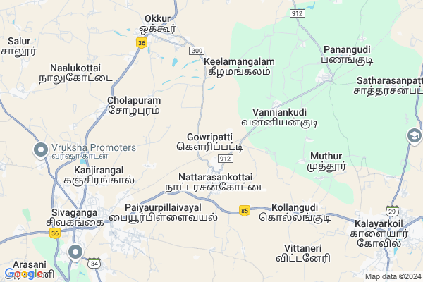
Gowripatti
Gowripatti Map
EDIT Map
Add Your House
 ..
..
Current Corona Virus Infected Patients Count in Sivaganga District
| City Name | District Name | Total Covid cases |
|---|---|---|
| Sivaganga District | Sivaganga | 7 |
| Thirupathur | Sivaganga | 3 |
| Ilayankudi | Sivaganga | 1 |
| Devakottai | Sivaganga | 1 |
Locality Name :
Gowripatti
( கௌரிபட்டி )
Block Name : Kalaiyarkoil
District : Sivaganga
State : Tamil Nadu
Language : Tamil
Current Time 06:09 PM
Date: Monday , Apr 28,2025 (IST)
Time zone: IST (UTC+5:30)
Elevation / Altitude: 95 meters. Above Seal level
Telephone Code / Std Code: 04575
Assembly constituency : Sivaganga assembly constituency
Assembly MLA : Pr. Senthilnathan
Lok Sabha constituency : Sivaganga parliamentary constituency
Parliament MP : KARTI P CHIDAMBARAM
Serpanch Name :
Commodities Prices : Sivagangai Market / Mandi
Gowripatti Live Weather
Temperature: 33.8 °C
overcast clouds
Humidity: 47%
Wind : 5.76 mt/sec towards SE
StationName : "Sivaganga"
observed on 27 Mins Back
Temperature: 33.8 °C
overcast clouds
Humidity: 47%
Wind : 5.76 mt/sec towards SE
StationName : "Sivaganga"
observed on 27 Mins Back
Gowripatti Weather Forecast for Next 5 days
29-04-2025
28.2°C to 32.7°C
light rain, broken clouds, overcast clouds
28.2°C to 32.7°C
light rain, broken clouds, overcast clouds
30-04-2025
27.8°C to 37.9°C
light rain, broken clouds, clear sky, scattered clouds, overcast clouds
27.8°C to 37.9°C
light rain, broken clouds, clear sky, scattered clouds, overcast clouds
01-05-2025
28.2°C to 37.3°C
overcast clouds
28.2°C to 37.3°C
overcast clouds
02-05-2025
28.5°C to 37.1°C
overcast clouds
28.5°C to 37.1°C
overcast clouds
03-05-2025
28.6°C to 39.4°C
overcast clouds, broken clouds, few clouds
28.6°C to 39.4°C
overcast clouds, broken clouds, few clouds
National Highways Reachable To Gowripatti
Nationa High Way :NH536
Nationa High Way :NH38
Nationa High Way :NH536
Nationa High Way :NH38
Rivers Near Gowripatti
Kiruthumal :Kiruthumal :கிருதுமால் நதி
Sathaiyar :Sathaiyar :சாத்தையாறு
Kiruthumal :Kiruthumal :கிருதுமால் நதி
Sathaiyar :Sathaiyar :சாத்தையாறு
About Gowripatti
Correct below Info and add more info about GowripattiGowripatti is a Village in Kalaiyarkoil Block in Sivaganga District of Tamil Nadu State, India. It is located 9 KM towards East from District head quarters Sivaganga. 13 KM from Kalaiyarkoil. 465 KM from State capital Chennai
Soorakulam Pudukkottai ( 4 KM ) , Soorakulam Pudukottai ( 5 KM ) , Cholapuram ( 5 KM ) , Melamangalam ( 6 KM ) , Kollangudi ( 6 KM ) are the nearby Villages to Gowripatti. Gowripatti is surrounded by Kalaiyarkoil Block towards East , Kallal Block towards North , Melur Block towards west , Manamadurai Block towards South .
Sivaganga , Thirupuvanam , Karaikudi , Paramakudi are the near by Cities to Gowripatti.
Gowripatti 2011 Census Details
Gowripatti Local Language is Tamil. Gowripatti Village Total population is 1014 and number of houses are 269. Female Population is 52.3%. Village literacy rate is 53.2% and the Female Literacy rate is 24.3%.
Population
| Census Parameter | Census Data |
| Total Population | 1014 |
| Total No of Houses | 269 |
| Female Population % | 52.3 % ( 530) |
| Total Literacy rate % | 53.2 % ( 539) |
| Female Literacy rate | 24.3 % ( 246) |
| Scheduled Tribes Population % | 0.0 % ( 0) |
| Scheduled Caste Population % | 16.0 % ( 162) |
| Working Population % | 54.6 % |
| Child(0 -6) Population by 2011 | 120 |
| Girl Child(0 -6) Population % by 2011 | 44.2 % ( 53) |
Gowripatti Census More Deatils.
Politics in Gowripatti
MDMK , DMK , AIADMK , CPI , INC , ADMK are the major political parties in this area.Polling Stations /Booths near Gowripatti
1)Roselin College Of Education Meenakshi Nagar Sivaganga2)S.r. M.hsc School Nattarasankottai
3)Panchayat Union Middle School Gandhinagar Colony
4)Justin Metriculation Higher Secondary School Sivaganga West Building South Portion
5)K.m.s. C.girls High School Nattarasankottai
HOW TO REACH Gowripatti
By Rail
Nattrasankottai Rail Way Station , Panangudi Rail Way Station are the very nearby railway stations to Gowripatti.Pincodes near Gowripatti
630556 ( Nattarasankottai ) , 630558 ( Paganeri ) , 630557 ( Okkur )Colleges near Gowripatti
Idhaya Arts College
Address : Kalaiyarkoil
Schools near Gowripatti
Sambaviga Hr.ss, Rahinipatty
Address : soorakkulam , kalayarkoil , sivaganga , Tamil Nadu . PIN- 630561 , Post - Sivaganga
Ghs, Silukkapatty
Address : silukkapatty , kalayarkoil , sivaganga , Tamil Nadu . PIN- 630554 , Post - Mangalam (Sivaganga)
Holy Sprit Ms, Seegoorani
Address : seegoorani , kalayarkoil , sivaganga , Tamil Nadu . PIN- 630551 , Post - Kalayarkoil
Don Bosco Hr.ss, Pallithammam
Address : pallithammam , kalayarkoil , sivaganga , Tamil Nadu . PIN- 630551 , Post - Kalayarkoil
Govt Health Centers near Gowripatti
1) Central N/H , 127 , Justice Rajasekaran Street, , Oppsite To Theppakulam2) Sabari Maternity and Children Hospital , , 4 / 106 , Justice Rajasekaran Street , Aranmanaivasal
3) Sri Sakthi Clinic , 9 , Ilayangudi Road East, Indira Nagar , Near Main Road
Hospitals in Gowripatti,Kalaiyarkoil
Okkur Veterinary Hospital
National Highway 226; Okkurpudur; Tamil Nadu 630557; India
7.8 KM distance Detail
more ..
Petrol Bunks in Gowripatti,Kalaiyarkoil
Bharat Petroleum
Paiyaurpillaivayal; Sivaganga; NH-230; Kochi Madurai Tondi Point Highway; Madurai Thondi Road; Sivaganga; Sivaganga; 630561; India
3.7 KM distance Detail
Bharat Petroleum
Teacher Colony; Okkur Puthur; Sivaganga; NH-226; Pudukkottai Sivaganga Highway; Sivaganga; Sivaganga; 630557; India
7.5 KM distance Detail
more ..
Colleges in Gowripatti,Kalaiyarkoil
St Justin Arts and Science College For Women
Sholavaram; Sivaganga; NH-226; Pudukkottai Sivaganga Highway; Sivaganga; Sivaganga; 630557; India
7.7 KM distance Detail
Joseph Matriculation School
National Highway 226; Okkurpudur; Tamil Nadu 630557; India
7.7 KM distance Detail
more ..
Schools in Gowripatti,Kalaiyarkoil
Ilavarsi Nursery And Primary School
Periyar St; Nattarasankottai; Tamil Nadu 630556; India
1.8 KM distance Detail
Local Parks in Gowripatti,Kalaiyarkoil
Velu Nachiyar Memorial Hall (வேலுநாச்சியார் நினைவு மண்டபம் )
Paiyaurpillaivayal; Tamil Nadu 630561; India
7.0 KM distance Detail
Police Stations near Gowripatti,Kalaiyarkoil
Superintendent Of Police Camp Office
Town; Sivaganga; Tamil Nadu 630562; India
8.6 KM distance Detail
Governement Offices near Gowripatti,Kalaiyarkoil
Government Agricluture Office
Senthamil Nagar; Sivaganga; NH-230; Kochi Madurai Tondi Point Highway; Madurai Thondi Road; Sivaganga; Sivaganga; 630561; India
7.8 KM distance Detail
Kannaathaal Marriage Hall
Masathiyar Nagar 2nd St; Masathiyar Nagar; Okkur; Tamil Nadu 630557; India
8.1 KM distance Detail
About Gowripatti &
History
How to reach Gowripatti
Tourist Places Near By Gowripatti
Schools in Gowripatti
Colleges in Gowripatti
Temperature & weather of Gowripatti
places in Gowripatti
Gowripatti photos
More Information
How to reach Gowripatti
Tourist Places Near By Gowripatti
Schools in Gowripatti
Colleges in Gowripatti
Temperature & weather of Gowripatti
places in Gowripatti
Gowripatti photos
More Information
Village Talk
Post News or Events about this Village
Near Cities
Sivaganga 9 KM near
Thirupuvanam 34 KM near
Karaikudi 37 KM near
Paramakudi 43 KM near
Sivaganga 9 KM near
Thirupuvanam 34 KM near
Karaikudi 37 KM near
Paramakudi 43 KM near
Near By Taluks
Sivaganga 10 KM near
Kalaiyarkoil 12 KM near
Kallal 22 KM near
Melur 26 KM near
Sivaganga 10 KM near
Kalaiyarkoil 12 KM near
Kallal 22 KM near
Melur 26 KM near
Near By Air Ports
Madurai Airport 56 KM near
Civil Airport 110 KM near
Tuticorin Airport 159 KM near
Salem Airport 224 KM near
Madurai Airport 56 KM near
Civil Airport 110 KM near
Tuticorin Airport 159 KM near
Salem Airport 224 KM near
Near By Tourist Places
Karaikudi 37 KM near
Chettinad 44 KM near
Madurai 52 KM near
Dindigul 91 KM near
Sivakasi 107 KM near
Karaikudi 37 KM near
Chettinad 44 KM near
Madurai 52 KM near
Dindigul 91 KM near
Sivakasi 107 KM near
Near By Districts
Sivaganga 9 KM near
Madurai 53 KM near
Pudukkottai 69 KM near
Ramanathapuram 71 KM near
Sivaganga 9 KM near
Madurai 53 KM near
Pudukkottai 69 KM near
Ramanathapuram 71 KM near
Near By RailWay Station
Nattrasankottai Rail Way Station 1.5 KM near
Panangudi Rail Way Station 1.6 KM near
Sivaganga Rail Way Station 8.0 KM near
Manamadurai Junction Rail Way Station 28 KM near
Nattrasankottai Rail Way Station 1.5 KM near
Panangudi Rail Way Station 1.6 KM near
Sivaganga Rail Way Station 8.0 KM near
Manamadurai Junction Rail Way Station 28 KM near