| Home | City Bus | Maps | Villages | Cities | Rail | Tourist Places | School | College | Pin Codes | Corona Cases Count |
| Distance Calculator Bus Services IFSC Codes Trace Mobile Number Weather Search Place Trace IP Available Cash ATM/Banks Locate Polling Booth Report an Error contact People |
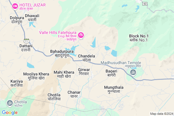
Chandela Map
EDIT Map
Add Your House
 ..
..
Current Corona Virus Infected Patients Count in Sirohi District
| City Name | District Name | Total Covid cases |
|---|
Locality Name :
Chandela
( चंदेला )
Tehsil Name : Abu Road
District : Sirohi
State : Rajasthan
Division : Jodhpur
Language : Hindi and Rajasthani
Current Time 10:34 AM
Date: Sunday , Apr 27,2025 (IST)
Time zone: IST (UTC+5:30)
Elevation / Altitude: 260 meters. Above Seal level
Telephone Code / Std Code: 02974
Assembly constituency : Reodar assembly constituency
Assembly MLA : Motiram
Lok Sabha constituency : Jalore parliamentary constituency
Parliament MP : Devaji Patel
Serpanch Name :
Pin Code : 307026
Post Office Name : Aburoad
Commodities Prices : Amirgadh Market / Mandi
Chandela Live Weather
Temperature: 36.4 °C
clear sky
Humidity: 20%
Wind : 3.51 mt/sec towards W
StationName : "Ä\u0080bu Road"
observed on Now
Temperature: 36.4 °C
clear sky
Humidity: 20%
Wind : 3.51 mt/sec towards W
StationName : "Ä\u0080bu Road"
observed on Now
Chandela Weather Forecast for Next 5 days
28-04-2025
27.1°C to 41.5°C
clear sky
27.1°C to 41.5°C
clear sky
29-04-2025
26.0°C to 42.7°C
clear sky
26.0°C to 42.7°C
clear sky
30-04-2025
25.5°C to 42.5°C
clear sky
25.5°C to 42.5°C
clear sky
01-05-2025
24.7°C to 42.3°C
clear sky, broken clouds
24.7°C to 42.3°C
clear sky, broken clouds
02-05-2025
24.4°C to 42.0°C
broken clouds, scattered clouds, clear sky
24.4°C to 42.0°C
broken clouds, scattered clouds, clear sky
National Highways Reachable To Chandela
Nationa High Way :NH27
Nationa High Way :NH27
Rivers Near Chandela
Sai
West Banas
Sai
West Banas
About Chandela
Correct below Info and add more info about ChandelaChandela is a Village in Abu Road Tehsil in Sirohi District of Rajasthan State, India. It belongs to Jodhpur Division . It is located 52 KM towards South from District head quarters Sirohi. 14 KM from Abu Road. 483 KM from State capital Jaipur
Chandela Pin code is 307026 and postal head office is Aburoad .
Chanar ( 5 KM ) , Bahadur Pura ( 5 KM ) , Dattani ( 8 KM ) , Dhawali ( 9 KM ) , Kyariya ( 9 KM ) are the nearby Villages to Chandela. Chandela is surrounded by Abu Road Tehsil towards East , Reodar Tehsil towards west , Amirgadh Tehsil towards South , Dantivada Tehsil towards west .
Mount Abu , Palanpur , Sirohi , Pindwara are the near by Cities to Chandela.
This Place is in the border of the Sirohi District and Banas Kantha District. Banas Kantha District Amirgadh is South towards this place . It is near to the Gujarat State Border.
Chandela 2011 Census Details
Chandela Local Language is Hindi. Chandela Village Total population is 3975 and number of houses are 724. Female Population is 48.8%. Village literacy rate is 22.5% and the Female Literacy rate is 5.7%.
Population
| Census Parameter | Census Data |
| Total Population | 3975 |
| Total No of Houses | 724 |
| Female Population % | 48.8 % ( 1941) |
| Total Literacy rate % | 22.5 % ( 895) |
| Female Literacy rate | 5.7 % ( 226) |
| Scheduled Tribes Population % | 87.6 % ( 3481) |
| Scheduled Caste Population % | 1.6 % ( 63) |
| Working Population % | 42.8 % |
| Child(0 -6) Population by 2011 | 978 |
| Girl Child(0 -6) Population % by 2011 | 49.9 % ( 488) |
Chandela Census More Deatils.
Politics in Chandela
Bharatiya Janata Party , BJP , INC are the major political parties in this area.Polling Stations /Booths near Chandela
1)Govt Secondary School (left Bhag) Chandela2)Govt Primary School Karjiya
3)Panchayat Bhawan Chanar
4)Govt Primary School Bhakyorji
5)Govt Higher Secondary School (purvi Bhag) Dattani
HOW TO REACH Chandela
By Rail
There is no railway station near to Chandela in less than 10 km.Colleges near Chandela
Seth Mangalchan Choudhary Govt.college Aburoad
Address :
Shri Usb College Of Pharmacy
Address : Shri Usb College Of Pharmacy G-192, Ambaji Industr
Srinath Ji College Of Physiotherapy
Address : Srinath Ji Collegeof Physiotherapy, Amthala, Abu R
Ummed Singh Bhati Shiksha Samiti Nurse / Compounder College
Address : Ummed Singh Bhati Shiksha Samiti Nurse / Compounde
Schools near Chandela
Saraswati Vidya Mandir Upper Primary School Oriya Abu
Address : oriya mount abu
Saraswati Vidya Mandir Upper Primary School Oriya Mount Abu
Address : village - oriya
Govt Health Centers near Chandela
1) Chandela , , ,2) Mahikheda , , Mahikheda ,
3) BAHADURPURA , BAHADURPURA , BAHADURPURA , BAHADURPURA
Hospitals in Chandela,Abu Road
Up Swasthya Kendra
Sirohi; SH-11; Sirohi Road; Abu Road; Abu Road; Rajasthan 307026; India
2.2 KM distance Detail
Doctor Chowhan's Clinic
MDR60; Sani Gaon; Mount Abu; Rajasthan 307501; India
11.1 KM distance Detail
Government Hospital; (CHC) Community Health Centre
Near Main Marker; Kalindi Kunj Rd; Rajasthan 307501; India
11.1 KM distance Detail
more ..
Petrol Bunks in Chandela,Abu Road
HP PETROL PUMP - GOYAL SERVICE STATION
HPC Dealers Mount ABU Rajasthan; Udaipur; Rajasthan 387501; India
11.0 KM distance Detail
more ..
Colleges in Chandela,Abu Road
Brahma kumari Vishwavidyalaya
Road; Sadar Bazar; Sani Gaon; Mount Abu; Rajasthan 307501; India
11.2 KM distance Detail
DR. RAJENDRA MUNI B.ED COLLEGE
house 7 d Kumar wada; Mount Abu; Rajasthan 307501; India
12.3 KM distance Detail
more ..
Schools in Chandela,Abu Road
Government Secondary School
Sirohi; SH-11; Sirohi Road; Abu Road; Abu Road; Rajasthan 307026; India
2.1 KM distance Detail
Government Secondary School
Sirohi; SH-11; Sirohi Road; Abu Road; Abu Road; Rajasthan 307026; India
3.5 KM distance Detail
Electronic Shops in Chandela,Abu Road
Krishna Electronics (Sales & Service)
Rajasthan; Akshya Bhawan Colony; Machgoan; Mount Abu; Rajasthan 307501; India
10.7 KM distance Detail
Super Markets in Chandela,Abu Road
Agrawal traders mount abu
Karawal Nagar Main Rd; Indra Vikas Colony; New Delhi; Delhi 110053; India
11.0 KM distance Detail
L. Ratiram Munshilal Store
MDR60; Sadar Bazar; Sani Gaon; Mount Abu; Rajasthan 307501; India
11.2 KM distance Detail
Local Parks in Chandela,Abu Road
Camp Climbing World
Gangaram's Farm; Gaumukh Road; Mount Abu; Rajasthan 307501; India
10.1 KM distance Detail
Lantern Campsite n Mount Abu Adventures
AbuTimes Office; Municipal Colony; Mount Abu; Rajasthan 307501; India
10.7 KM distance Detail
Mount Abu Trekking Camp
ramesh alika; near hotel couples paradise; akshay colony; Mount Abu; Rajasthan 307501; India
10.7 KM distance Detail
Police Stations near Chandela,Abu Road
Adhikshat Police Station; Abu Parbat
MDR60; Machgoan; Mount Abu; Rajasthan 307501; India
11.0 KM distance Detail
GRP Police Station
MDR49; Falna; Sadar Bazar; Abu Road; Rajasthan 307026; India
15.6 KM distance Detail
Governement Offices near Chandela,Abu Road
Atal Seva Center
Sirohi; SH-11; Sirohi Road; Abu Road; Abu Road; Rajasthan 307026; India
2.2 KM distance Detail
Karyalaya Gram Sachivalya
Sirohi; SH-11; Sirohi Road; Abu Road; Abu Road; Rajasthan 307026; India
2.3 KM distance Detail
Rajasthan State Bharat Scout and Guide; Mount Abu
Abu Road - Mount Abu Road; Kumarwada; Mount Abu; Rajasthan 307501; India
10.9 KM distance Detail
About Chandela &
History
How to reach Chandela
Tourist Places Near By Chandela
Schools in Chandela
Colleges in Chandela
Temperature & weather of Chandela
places in Chandela
Chandela photos
More Information
How to reach Chandela
Tourist Places Near By Chandela
Schools in Chandela
Colleges in Chandela
Temperature & weather of Chandela
places in Chandela
Chandela photos
More Information
Village Talk
Post News or Events about this Village
Near Cities
Mount Abu 10 KM near
Palanpur 48 KM near
Sirohi 51 KM near
Pindwara 56 KM near
Mount Abu 10 KM near
Palanpur 48 KM near
Sirohi 51 KM near
Pindwara 56 KM near
Near By Taluks
Mount Abu 10 KM near
Abu Road 13 KM near
Reodar 19 KM near
Amirgadh 22 KM near
Mount Abu 10 KM near
Abu Road 13 KM near
Reodar 19 KM near
Amirgadh 22 KM near
Near By Air Ports
Dabok Airport 139 KM near
Ahmedabad Airport 181 KM near
Jodhpur Airport 221 KM near
Vadodara Airport 280 KM near
Dabok Airport 139 KM near
Ahmedabad Airport 181 KM near
Jodhpur Airport 221 KM near
Vadodara Airport 280 KM near
Near By Tourist Places
Mount Abu 10 KM near
Ambaji 31 KM near
Danta Ambaji 43 KM near
Banaskantha 50 KM near
Sirohi 62 KM near
Mount Abu 10 KM near
Ambaji 31 KM near
Danta Ambaji 43 KM near
Banaskantha 50 KM near
Sirohi 62 KM near
Near By Districts
Banas Kantha 50 KM near
Sirohi 50 KM near
Jalore 103 KM near
Patan 103 KM near
Banas Kantha 50 KM near
Sirohi 50 KM near
Jalore 103 KM near
Patan 103 KM near
Near By RailWay Station
Abu Road Rail Way Station 15 KM near
Palanpur Junction Rail Way Station 50 KM near
Abu Road Rail Way Station 15 KM near
Palanpur Junction Rail Way Station 50 KM near