| Home | City Bus | Maps | Villages | Cities | Rail | Tourist Places | School | College | Pin Codes | Corona Cases Count |
| Distance Calculator Bus Services IFSC Codes Trace Mobile Number Weather Search Place Trace IP Available Cash ATM/Banks Locate Polling Booth Report an Error contact People |
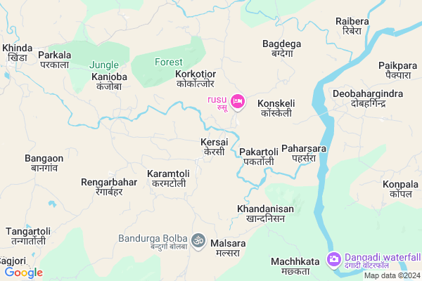
Kinkel Map
EDIT Map
Add Your House
 ..
..
Current Corona Virus Infected Patients Count in Simdega District
| City Name | District Name | Total Covid cases |
|---|---|---|
| Simdega District | Simdega | 2 |
Locality Name :
Kinkel
( किंकल )
Block Name : Kersai
District : Simdega
State : Jharkhand
Language : Hindi and Santali
Current Time 12:33 PM
Date: Friday , Apr 25,2025 (IST)
Time zone: IST (UTC+5:30)
Elevation / Altitude: 452 meters. Above Seal level
Telephone Code / Std Code: 06525
Assembly constituency : Simdega assembly constituency
Assembly MLA :
Lok Sabha constituency : Khunti parliamentary constituency
Parliament MP :
Serpanch Name :
Pin Code : 835223
Post Office Name : Simdega
Commodities Prices : Kunkuri Market / Mandi
Kinkel Live Weather
Temperature: 42.0 °C
clear sky
Humidity: 4%
Wind : 3.97 mt/sec towards W
StationName : "Simdega"
observed on Now
Temperature: 42.0 °C
clear sky
Humidity: 4%
Wind : 3.97 mt/sec towards W
StationName : "Simdega"
observed on Now
Kinkel Weather Forecast for Next 5 days
26-04-2025
27.5°C to 43.3°C
clear sky, few clouds
27.5°C to 43.3°C
clear sky, few clouds
27-04-2025
24.8°C to 43.6°C
clear sky, few clouds, overcast clouds
24.8°C to 43.6°C
clear sky, few clouds, overcast clouds
28-04-2025
26.7°C to 39.0°C
overcast clouds, broken clouds
26.7°C to 39.0°C
overcast clouds, broken clouds
29-04-2025
24.0°C to 39.0°C
overcast clouds, clear sky, light rain, scattered clouds
24.0°C to 39.0°C
overcast clouds, clear sky, light rain, scattered clouds
30-04-2025
22.5°C to 41.6°C
scattered clouds, few clouds, clear sky, light rain, overcast clouds, broken clouds
22.5°C to 41.6°C
scattered clouds, few clouds, clear sky, light rain, overcast clouds, broken clouds
Edit below overview about Kinkel
Edit below overview about Kinkel
OverView of Kinkel
kinkel is about 33km from simdega district. only road rutes are available to reach here. It is a nice place with wise peoples. This village is divided in many small kasba.Edit below overview about Kinkel
Rivers Near Kinkel
Bajdhoa
Lurgi
Bajdhoa
Lurgi
About Kinkel
Kinkel is a Village in Kersai Block in Simdega District of Jharkhand State, India. It is located 32 KM towards west from District head quarters Simdega. 167 KM from State capital Ranchi
Kinkel Pin code is 835223 and postal head office is Simdega .
Kinkel is surrounded by Kurdeg Block towards west , Bolba Block towards South , Duldula Block towards North , Thethaitanger Block towards East .
Simdega , Jashpurnagar , Sundargarh , Rajagangapur are the near by Cities to Kinkel.
Kinkel 2011 Census Details
Kinkel Local Language is Hindi. Kinkel Village Total population is 3833 and number of houses are 756. Female Population is 50.5%. Village literacy rate is 60.3% and the Female Literacy rate is 28.2%.
Population
| Census Parameter | Census Data |
| Total Population | 3833 |
| Total No of Houses | 756 |
| Female Population % | 50.5 % ( 1934) |
| Total Literacy rate % | 60.3 % ( 2312) |
| Female Literacy rate | 28.2 % ( 1080) |
| Scheduled Tribes Population % | 81.3 % ( 3118) |
| Scheduled Caste Population % | 9.7 % ( 371) |
| Working Population % | 49.4 % |
| Child(0 -6) Population by 2011 | 591 |
| Girl Child(0 -6) Population % by 2011 | 48.4 % ( 286) |
Kinkel Census More Deatils.
Politics in Kinkel
Jharkhand Party , Bharatiya Janata Party , BJP , JKP , INC are the major political parties in this area.Polling Stations /Booths near Kinkel
1)Govt.primary School Karamtoli2)Govt.primary School Kullukera
3)Govt.primary School Kullukera
4)Govt. Primary School Birkera
5)Govt.middle School Bilingbira
HOW TO REACH Kinkel
By Rail
There is no railway station near to Kinkel in less than 10 km.Colleges near Kinkel
Ss+2 High School Jaldega
Address :
Schools near Kinkel
High School Kersai
Address : Kersai Bhandar Toli
Poul Memorial English Medium School Kersai Rimjhimtoli
Address : Vill.Rimjhimtoli P/S kersai P/o kersai
Govt Health Centers near Kinkel
1) HSC Garorjor , HEALTH SUB CENTRE Garorjor , Garorjor , Garorjor2) HSC Koneskeli , HSC Koneskeli , Koneskeli , Koneskeli
3) HSC BAGDEGA , HEALTH SUB CENTRE BAGDEGA , BAGDEGA , Rural
Schools in Kinkel,Kersai
Rajkiya Madhyamik Vidyalaya
Barbera alias Chapamunda; Jharkhand 835235; India
16.9 KM distance Detail
URSULINE CONVENT GIRL’S HIGH SCHOOL;
Barbera alias Chapamunda; Jharkhand 835235; India
17.6 KM distance Detail
Super Markets in Kinkel,Kersai
Governement Offices near Kinkel,Kersai
About Kinkel &
History
How to reach Kinkel
Tourist Places Near By Kinkel
Schools in Kinkel
Colleges in Kinkel
Temperature & weather of Kinkel
places in Kinkel
Kinkel photos
More Information
How to reach Kinkel
Tourist Places Near By Kinkel
Schools in Kinkel
Colleges in Kinkel
Temperature & weather of Kinkel
places in Kinkel
Kinkel photos
More Information
Village Talk
Post News or Events about this Village
Near Cities
Simdega 32 KM near
Jashpurnagar 46 KM near
Sundargarh 56 KM near
Rajagangapur 57 KM near
Simdega 32 KM near
Jashpurnagar 46 KM near
Sundargarh 56 KM near
Rajagangapur 57 KM near
Near By Taluks
Kersai 0 KM near
Kurdeg 10 KM near
Bolba 16 KM near
Duldula 24 KM near
Kersai 0 KM near
Kurdeg 10 KM near
Bolba 16 KM near
Duldula 24 KM near
Near By Air Ports
Ranchi Airport 159 KM near
Gaya Airport 287 KM near
Raipur Airport 333 KM near
Bhubaneswar Airport 338 KM near
Ranchi Airport 159 KM near
Gaya Airport 287 KM near
Raipur Airport 333 KM near
Bhubaneswar Airport 338 KM near
Near By Tourist Places
Simdega 33 KM near
Jashpur 45 KM near
Gumla 73 KM near
Rourkela 82 KM near
Chotanagpur 107 KM near
Simdega 33 KM near
Jashpur 45 KM near
Gumla 73 KM near
Rourkela 82 KM near
Chotanagpur 107 KM near
Near By Districts
Simdega 31 KM near
Jashpur 44 KM near
Sundargarh 56 KM near
Gumla 73 KM near
Simdega 31 KM near
Jashpur 44 KM near
Sundargarh 56 KM near
Gumla 73 KM near
Near By RailWay Station
Rajgangpur Rail Way Station 59 KM near
Bamra Rail Way Station 60 KM near
Rajgangpur Rail Way Station 59 KM near
Bamra Rail Way Station 60 KM near