| Home | City Bus | Maps | Villages | Cities | Rail | Tourist Places | School | College | Pin Codes | Corona Cases Count |
| Distance Calculator Bus Services IFSC Codes Trace Mobile Number Weather Search Place Trace IP Available Cash ATM/Banks Locate Polling Booth Report an Error contact People |
 ..
..
Current Corona Virus Infected Patients Count in Sikar District
| City Name | District Name | Total Covid cases |
|---|---|---|
| Sikar District | Sikar | 5 |
Tehsil Name : Neem Ka Thana
District : Sikar
State : Rajasthan
Division : Jaipur
Language : Hindi and Rajasthani
Current Time 11:21 AM
Date: Sunday , Apr 27,2025 (IST)
Time zone: IST (UTC+5:30)
Elevation / Altitude: 446 meters. Above Seal level
Telephone Code / Std Code: 01574
Assembly constituency : Neem ka Thana assembly constituency
Assembly MLA : Suresh Modi
Lok Sabha constituency : Sikar parliamentary constituency
Parliament MP : Sumedhanand Saraswati
Serpanch Name :
Pin Code : 332706
Post Office Name : Guhala
Commodities Prices : Sri Madhopur Market / Mandi
OverView of Guhala
This village located on the state highway 37 B which connected with NH 8.The capital of India distance near about 200 Km.there is so many conveyance to Delhi ,Sikar and Others.The history of Guhala is ancient this was established 700 years ago.This was under the Jaipur dynasty and fact that no Rajput lived in main village they established on the chokies around the village to safe it thats were Narsinghpuri in the south west region, Bagh singh ki Dhani in the north east. there is a fort which is located behind the village on a small hill and There is a famous Pilgrim Of Kilania's " BABA RURDAS temple".The Samadhee's of BABA Rurdas located on the bank of river.The MELA of "BABA" were conducted on each NIRJALA EKADSHI of jyeshth month of Vikram samvat.In the village all communities lives with love each other. the village major population of HINDU's.Before the formation of new revenue village this was the biggest panchayat of Sikar District.This Village situated on the bank of famous River "KANTALI". Now this village connected with Neem Ka Thana assembly.
Edit below overview about Guhala
Nationa High Way :NH48
Nationa High Way :NH148B
Sahibi
Sota
About Guhala
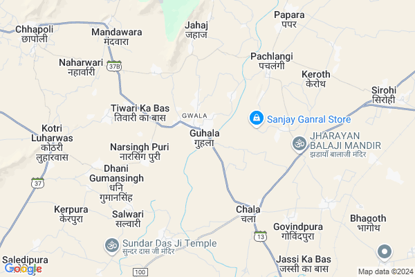
Guhala is a Village in Neem Ka Thana Tehsil in Sikar District of Rajasthan State, India. It belongs to Jaipur Division . It is located 56 KM towards East from District head quarters Sikar. 31 KM from Neem Ka Thana. 102 KM from State capital Jaipur
Guhala Pin code is 332706 and postal head office is Guhala .
Narsingh Puri ( 3 KM ) , Chala ( 5 KM ) , Dhani Gumansingh ( 5 KM ) , Kotri Luharwas ( 8 KM ) , Chaukri ( 8 KM ) are the nearby Villages to Guhala. Guhala is surrounded by Udaipurwati Tehsil towards North , Neem Ka Thana Tehsil towards East , Sri Madhopur Tehsil towards South , Khetri Tehsil towards North .
Udaipurwati , Sri Madhopur , Nawalgarh , Neem-Ka-Thana are the near by Cities to Guhala.
Demographics of Guhala
Hindi is the Local Language here.Politics in Guhala
RRP , BJP , INC are the major political parties in this area.Polling Stations /Booths near Guhala
1)Shaheed Ramniwas Nechu Govt. Primary School Preetampuri (left Side)2)Govt. Secondry School Mankri
3)Govt. Senior Sec. School Guhala (left Side)
4)Govt. Senior Sec. School Dareeba
5)Govt. Primary School Dhani Kerli Tan-sirohi (right Side)
HOW TO REACH Guhala
By Rail
Bhagega Rail Way Station is the very nearby railway stations to Guhala.Colleges near Guhala
Ekta CollegeSchools in Guhala
V.s.s.ups., GuhalaGovt Health Centers near Guhala
1) Mawata , , ,2) Jyotiba Nagar , SC Jyotiba Nagar , ,
3) Pachlangi , , ,
Colleges in Guhala,Neem Ka Thana
Shri Vinayak College ; chala; neem ka thana
chala-choukri road; chala; Neem Ka Thana; Rajasthan; India
5.1 KM distance Detail
National Institute Of Design And Technology
Kanwat Road Ralway; Station Kanwat; Tech.ShreeMadhpur; Kanwat; Rajasthan 332708; India
14.1 KM distance Detail
more ..
Schools in Guhala,Neem Ka Thana
Success International school
opp Power House sati mode; Guhala; Rajasthan; India
0.2 KM distance Detail
राजकीय प्राथमिक विद्यालय;गुहाला बाजार;गुहाला
गुहाला; Bajar; राजस्थान ३३२७०६; India
0.6 KM distance Detail
Electronic Shops in Guhala,Neem Ka Thana
Shree Shyam Repairing Senter Eko Milk& More
VPO-CHALA KUMAWAT colonie chokari road chala THE -NEEM KA THANA DIST; Rajasthan; India
5.1 KM distance Detail
Super Markets in Guhala,Neem Ka Thana
Dhani Bhatwali; Captain And Choudhary House ;Rajasthan
Dhani Gumansingh Th khendela Dis; Rajasthan 332709; India
7.0 KM distance Detail
Shri Shyam Departmental Stor
Kotri-Neem ka thana Road; Kotri Luharwas; Rajasthan 332706; India
8.9 KM distance Detail
Local Parks in Guhala,Neem Ka Thana
मामराज कालोनी
संतोषी माता का मन्दीर; Neem Ka Thana Rd; मोदी बाग; Makri Fatak; Rajasthan 332714; India
8.8 KM distance Detail
Police Stations near Guhala,Neem Ka Thana
Police Station Neem Ka Thana Sadar
Neem Ka Thana Rd; Neem Ka Thana; Rajasthan 332713; India
16.3 KM distance Detail
Governement Offices near Guhala,Neem Ka Thana
ग्राम पंचयात कार्यालय ढाणी गुमान सिंह
Dhani Gumansingh; Rajasthan 332706; India
6.8 KM distance Detail
STUDENTS
Love Kush Nagar 2; Barkat Nagar; Tonk Phatak; Jaipur; Rajasthan 302007; India
12.2 KM distance Detail
How to reach Guhala
Tourist Places Near By Guhala
Schools in Guhala
Colleges in Guhala
Temperature & weather of Guhala
places in Guhala
Guhala photos
More Information
Village Talk
Post News or Events about this Village
Udaipurwati 20 KM near
Sri Madhopur 31 KM near
Nawalgarh 38 KM near
Neem-Ka-Thana 39 KM near
Khandela 18 KM near
Udaipurwati 19 KM near
Neem Ka Thana 29 KM near
Sri Madhopur 33 KM near
Sanganeer Airport 109 KM near
Indira Gandhi International Airport 193 KM near
Kheria Airport 265 KM near
Surat Gujarat Airport 275 KM near
Shekhawati 44 KM near
Nawalgarh 45 KM near
Sikar 54 KM near
Jhunjhunu 60 KM near
Samode 63 KM near
Sikar 54 KM near
Jhunjhunu 60 KM near
Mahendragarh 67 KM near
Jaipur 100 KM near
Mahendragarh Rail Way Station 92 KM near
Loharu Junction Rail Way Station 93 KM near