| Home | City Bus | Maps | Villages | Cities | Rail | Tourist Places | School | College | Pin Codes | Corona Cases Count |
| Distance Calculator Bus Services IFSC Codes Trace Mobile Number Weather Search Place Trace IP Available Cash ATM/Banks Locate Polling Booth Report an Error contact People |
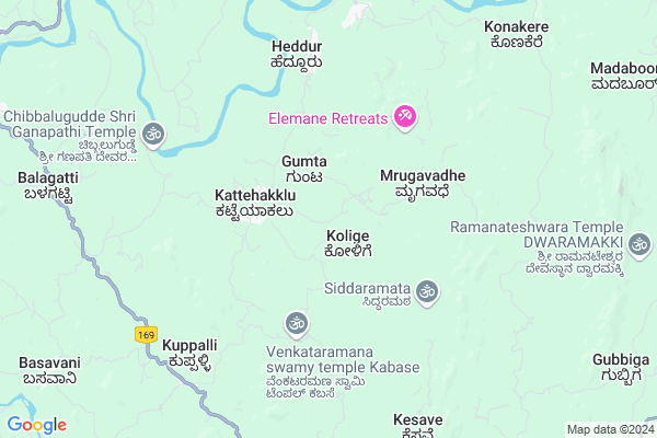
Gummata
Gummata Map
EDIT Map
Add Your House
 ..
..
Current Corona Virus Infected Patients Count in Shimoga District
| City Name | District Name | Total Covid cases |
|---|
Locality Name :
Gummata
( ಗುಮ್ಮಟ )
Taluk Name : Tirthahalli
District : Shimoga
State : Karnataka
Division : Bangalore
Language : Kannada and Urdu
Current Time 11:01 AM
Date: Sunday , Apr 27,2025 (IST)
Time zone: IST (UTC+5:30)
Elevation / Altitude: 667 meters. Above Seal level
Telephone Code / Std Code: 08181
Assembly constituency : Tirthahalli assembly constituency
Assembly MLA : Araga Jnanendra
Lok Sabha constituency : Shimoga parliamentary constituency
Parliament MP : B.Y.RAGHAVENDRA.
Serpanch Name :
Pin Code : 577415
Post Office Name : Devangi
Main Village Name : Angalagodige
Commodities Prices : Koppa Market / Mandi
Gummata Live Weather
Temperature: 27.7 °C
broken clouds
Humidity: 67%
Wind : 0.3 mt/sec towards E
StationName : "Koppa"
observed on 2 Hours Back
Temperature: 27.7 °C
broken clouds
Humidity: 67%
Wind : 0.3 mt/sec towards E
StationName : "Koppa"
observed on 2 Hours Back
Gummata Weather Forecast for Next 5 days
28-04-2025
21.0°C to 35.3°C
broken clouds, overcast clouds, light rain
21.0°C to 35.3°C
broken clouds, overcast clouds, light rain
29-04-2025
20.2°C to 35.0°C
scattered clouds, broken clouds, light rain, overcast clouds
20.2°C to 35.0°C
scattered clouds, broken clouds, light rain, overcast clouds
30-04-2025
20.4°C to 32.8°C
overcast clouds, scattered clouds, heavy intensity rain, light rain
20.4°C to 32.8°C
overcast clouds, scattered clouds, heavy intensity rain, light rain
01-05-2025
19.6°C to 33.6°C
overcast clouds, broken clouds, few clouds, scattered clouds
19.6°C to 33.6°C
overcast clouds, broken clouds, few clouds, scattered clouds
02-05-2025
18.9°C to 35.1°C
scattered clouds, few clouds, clear sky, broken clouds
18.9°C to 35.1°C
scattered clouds, few clouds, clear sky, broken clouds
National Highways Reachable To Gummata
Nationa High Way :NH169A
Nationa High Way :NH169
Nationa High Way :NH169A
Nationa High Way :NH169
Rivers Near Gummata
Jadkal Hole :ಜಡ್ಕಲ್ ಹೊಳೆ
Kubja :ಕುಬ್ಜಾ
Jadkal Hole :ಜಡ್ಕಲ್ ಹೊಳೆ
Kubja :ಕುಬ್ಜಾ
About Gummata
Correct below Info and add more info about GummataGummata is a small Village/hamlet in Tirthahalli Taluk in Shimoga District of Karnataka State, India. It comes under Angalagodige Panchayath. It belongs to Bangalore Division . It is located 46 KM towards South from District head quarters Shivamogga. 16 KM from Tirthahalli. 296 KM from State capital Bangalore
Gummata Pin code is 577415 and postal head office is Devangi .
Gummata is surrounded by Narasimharajapura Taluk towards East , Koppa Taluk towards South , Sringeri Taluk towards South , Shimoga Taluk towards North .
Shimoga , Tarikere , Chikmagalur , Karkala are the near by Cities to Gummata.
This Place is in the border of the Shimoga District and Chikmagalur District. Chikmagalur District Koppa is South towards this place .
Demographics of Gummata
Kannada is the Local Language here.Politics in Gummata
Bharatiya Janata Party , BJP , Bharatiya Janata Party (BJP) , SP , INC are the major political parties in this area.Polling Stations /Booths near Gummata
1)Govt Higher Primary School Naluru (h/o Kolige)2)Govt.modal Higher Primaryschool Seebinakere Thirthahalli(south Wing
3)Govt High School Araga
4)Govt Higher Primary School Hodla Guttiyadehalli
5)Govt Higher Primary School Yaduru Sulugodu
HOW TO REACH Gummata
By Rail
There is no railway station near to Gummata in less than 10 km. Shivamogga Rail Way Station (near to Shimoga) , Shivamogga Town Rail Way Station (near to Shimoga) are the Rail way stations reachable from near by towns.By Road
Tirthahalli , Sringeri , Shimoga are the nearby by towns to Gummata having road connectivity to GummataColleges near Gummata
Sharavathi First Grade College
Address :
Government Pre University College
Address : Megaravalli
Schools near Gummata
Murarji Desai Res. School
Address : thirthahalli town , thirthahalli , shimoga , Karnataka . PIN- 577432 , Post - Thirthahalli Town
National Residential School
Address : halesara , thirthahalli , shimoga , Karnataka . PIN- 577422 , Post - Konandur
Navajyothi Hps Konandur
Address : kolige , thirthahalli , shimoga , Karnataka . PIN- 577422 , Post - Konandur
Sayadri Higher Primary School
Address : thirthahalli 9 , thirthahalli , shimoga , Karnataka . PIN- 577432 , Post - Thirthahalli Town
Govt Health Centers near Gummata
1) Katagar , MEDICAL OFFICER , PRAIMARY HEALTH CENTER KATAGARU ,2) MALUR , MEDICAL OFFICER , PRAIMARY HEALTH CENTER MALUR ,
3) THIRTHAHALLI TH , ADMINISTRATIVE MEDICAL OFFICER , JAYA CHAMARAJENDRA TALUK GENERAL HOSPITAL , Near Bus stand
Hospitals in Gummata,Tirthahalli
ALN Rao Ayurvedic Hospital
Solapur - Mangalore Hwy; Thirthahalli; Karnataka 577432; India
15.3 KM distance Detail
more ..
Petrol Bunks in Gummata,Tirthahalli
Petrol Pump Bejjavalli
National Highway 13; Shivamogga; Karnataka 577232; India
13.1 KM distance Detail
Indian Oil;
oop; 577432; BMTC Bus Station; Outer Ring Rd; Kuvempu Nagar; Stage 2; Marathahalli; Bengaluru; Karnataka 560076; India
15.4 KM distance Detail
more ..
Colleges in Gummata,Tirthahalli
Tunga Mahavidyalaya
Anandagiri; Thirthahalli; Shimoga; Karnataka 577432; India
15.3 KM distance Detail
more ..
Schools in Gummata,Tirthahalli
Mudavalli GOVT Primary And Middle School
Munduvalli; Hosalli; Karnataka 577232; India
8.1 KM distance Detail
Melige Higher Primary School
Melige; Tirthahalli Taluk; Karnataka 577432; India
10.5 KM distance Detail
Super Markets in Gummata,Tirthahalli
HMP Hypermart
Agumbe - Thirthahalli Rd; Doddamane Keri; Thirthahalli; Karnataka 577432; India
16.4 KM distance Detail
Local Parks in Gummata,Tirthahalli
Jayachamarajendra Park
Solapur - Mangalore Hwy; Kushavati; Thirthahalli; Karnataka 577432; India
14.9 KM distance Detail
Police Stations near Gummata,Tirthahalli
Thirthahalli Police Station
Soppugudde; Thirthahalli; Karnataka 577432; India
16.3 KM distance Detail
Doddapete Ps
Sagar Rd; Doddamane Keri; Thirthahalli; Karnataka 577432; India
16.7 KM distance Detail
Governement Offices near Gummata,Tirthahalli
Mandal Panchayath Office
National Highway 13; KuDumallige; Karnataka 577432; India
14.0 KM distance Detail
About Gummata &
History
How to reach Gummata
Tourist Places Near By Gummata
Schools in Gummata
Colleges in Gummata
Temperature & weather of Gummata
places in Gummata
Gummata photos
More Information
How to reach Gummata
Tourist Places Near By Gummata
Schools in Gummata
Colleges in Gummata
Temperature & weather of Gummata
places in Gummata
Gummata photos
More Information
Village Talk
Post News or Events about this Village
Near Cities
Shimoga 43 KM near
Tarikere 56 KM near
Chikmagalur 63 KM near
Karkala 70 KM near
Shimoga 43 KM near
Tarikere 56 KM near
Chikmagalur 63 KM near
Karkala 70 KM near
Near By Taluks
Tirthahalli 16 KM near
Narasimharajapura 16 KM near
Koppa 19 KM near
Sringeri 31 KM near
Tirthahalli 16 KM near
Narasimharajapura 16 KM near
Koppa 19 KM near
Sringeri 31 KM near
Near By Air Ports
Bajpe Airport 101 KM near
Hubli Airport 216 KM near
Mysore Airport 228 KM near
Dabolim Airport 284 KM near
Bajpe Airport 101 KM near
Hubli Airport 216 KM near
Mysore Airport 228 KM near
Dabolim Airport 284 KM near
Near By Tourist Places
Sringeri 30 KM near
Agumbe 35 KM near
Kudremukh 39 KM near
Shimoga 42 KM near
Horanadu 46 KM near
Sringeri 30 KM near
Agumbe 35 KM near
Kudremukh 39 KM near
Shimoga 42 KM near
Horanadu 46 KM near
Near By Districts
Shimoga 44 KM near
Chikmagalur 63 KM near
Udupi 82 KM near
Dakshin Kannad 109 KM near
Shimoga 44 KM near
Chikmagalur 63 KM near
Udupi 82 KM near
Dakshin Kannad 109 KM near
Near By RailWay Station
Shivamogga Town Rail Way Station 46 KM near
Bhadravati Rail Way Station 48 KM near
Shivamogga Town Rail Way Station 46 KM near
Bhadravati Rail Way Station 48 KM near