| Home | City Bus | Maps | Villages | Cities | Rail | Tourist Places | School | College | Pin Codes | Corona Cases Count |
| Distance Calculator Bus Services IFSC Codes Trace Mobile Number Weather Search Place Trace IP Available Cash ATM/Banks Locate Polling Booth Report an Error contact People |
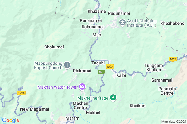
Tadubi Map
EDIT Map
Add Your House
 ..
..
Current Corona Virus Infected Patients Count in Senapati District
| City Name | District Name | Total Covid cases |
|---|
Locality Name :
Tadubi
( ताडी )
Tehsil Name : Tadubi
District : Senapati
State : Manipur
Language : Meiteilon (manipuri) and Aimol
Current Time 11:23 AM
Date: Wednesday , Feb 05,2025 (IST)
Time zone: IST (UTC+5:30)
Telephone Code / Std Code: 03871
Assembly constituency : Tadubi assembly constituency
Assembly MLA : N. Kayisii
Lok Sabha constituency : Outer Manipur parliamentary constituency
Parliament MP : Lorho S. Pfoze
Serpanch Name :
Pin Code : 795104
Post Office Name : Tadubi
Commodities Prices : Pfatsero Market / Mandi
Rivers Near Tadubi
Langdang
Sulen Nadi
Langdang
Sulen Nadi
About Tadubi
Correct below Info and add more info about TadubiTadubi is a Town in Tadubi Tehsil in Senapati District of Manipur State, India. It is located 30 KM towards North from District head quarters Senapati. It is a Tehsil head quarter.
Tadubi Pin code is 795104 and postal head office is Tadubi .
Phikomai ( 2 KM ) , Songsong ( 2 KM ) , Chakumai ( 2 KM ) , Kaibi ( 3 KM ) , Khridziiphi ( 3 KM ) are the nearby Villages to Tadubi. Tadubi is surrounded by Paomata Tehsil towards East , Jakhama Tehsil towards North , Kikruma Tehsil towards North , Purul Tehsil towards South .
Kohima , Dimapur , Zunheboto , Wokha are the nearby Cities to Tadubi.
This Place is in the border of the Senapati District and Kohima District. Kohima District Jakhama is North towards this place . Also it is in the Border of other district Phek . It is near to the Nagaland State Border.
Demographics of Tadubi
Meiteilon (manipuri) is the Local Language here.Politics in Tadubi
NPF , Naga Peoples Front , BJP , PDA , INC are the major political parties in this area.Polling Stations /Booths near Tadubi
1)Tadubi (a)2)T. Waichong
3)Yangkhullen (b)
4)Tadubi (a-i)
5)Chawainamei Khullen(b)
HOW TO REACH Tadubi
By Rail
There is no railway station near to Tadubi in less than 10 km.Govt Health Centers near Tadubi
1) PHSC Yumnam Khunou , PHSC Yumnam Khunou , Imphal Saikul Road , Near Puthiba Ground2) PHSC Seijang , , Sunurok Road , Near Yaingangpokpi Market
3) PHSC Chingkhu Sambei , PHSC Chingkhu Sambei , Imphal Saikul Road , Opposite Gulap English School
Petrol Bunks in Tadubi,Tadubi
HP PETROL PUMP - HP KOHIMA
Village: Phesama PO: Kohima; Gauhati; Nagaland 797001; India
17.7 KM distance Detail
New Reserve Phesema
New Reserve Colony Rd; New Reserve Colony; Nagaland 797005; India
21.1 KM distance Detail
more ..
Colleges in Tadubi,Tadubi
Japfü Christian College; Kigwema
National Highway number 29; Kigwema; Nagaland 797001; India
16.2 KM distance Detail
more ..
About Tadubi &
History
How to reach Tadubi
Tourist Places Near By Tadubi
Schools in Tadubi
Colleges in Tadubi
Temperature & weather of Tadubi
places in Tadubi
Tadubi photos
More Information
How to reach Tadubi
Tourist Places Near By Tadubi
Schools in Tadubi
Colleges in Tadubi
Temperature & weather of Tadubi
places in Tadubi
Tadubi photos
More Information
Town Talk
Post News or Events about this Town
Near Cities
Kohima 24 KM near
Dimapur 65 KM near
Zunheboto 75 KM near
Wokha 78 KM near
Kohima 24 KM near
Dimapur 65 KM near
Zunheboto 75 KM near
Wokha 78 KM near
Near By Taluks
Tadubi 8 KM near
Paomata 13 KM near
Jakhama 14 KM near
Kikruma 16 KM near
Tadubi 8 KM near
Paomata 13 KM near
Jakhama 14 KM near
Kikruma 16 KM near
Near By Air Ports
Dimapur Airport 63 KM near
Imphal Municipal Airport 92 KM near
Kumbhirgram Airport 147 KM near
Rowriah Airport 156 KM near
Dimapur Airport 63 KM near
Imphal Municipal Airport 92 KM near
Kumbhirgram Airport 147 KM near
Rowriah Airport 156 KM near
Near By Tourist Places
Kohima 23 KM near
Phek 47 KM near
Wokha 78 KM near
Imphal 86 KM near
Diphu 91 KM near
Kohima 23 KM near
Phek 47 KM near
Wokha 78 KM near
Imphal 86 KM near
Diphu 91 KM near
Near By Districts
Kohima 25 KM near
Senapati 28 KM near
Peren 44 KM near
Phek 46 KM near
Kohima 25 KM near
Senapati 28 KM near
Peren 44 KM near
Phek 46 KM near
Near By RailWay Station
Dimapur Rail Way Station 69 KM near
Bokajan Rail Way Station 77 KM near
Dimapur Rail Way Station 69 KM near
Bokajan Rail Way Station 77 KM near