| Home | City Bus | Maps | Villages | Cities | Rail | Tourist Places | School | College | Pin Codes | Corona Cases Count |
| Distance Calculator Bus Services IFSC Codes Trace Mobile Number Weather Search Place Trace IP Available Cash ATM/Banks Locate Polling Booth Report an Error contact People |
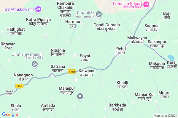
Soyat
Soyat Map
EDIT Map
Add Your House
 ..
..
Current Corona Virus Infected Patients Count in Sehore District
| City Name | District Name | Total Covid cases |
|---|
Locality Name :
Soyat
( सोयत )
Tehsil Name : Nasrullaganj
District : Sehore
State : Madhya Pradesh
Division : Bhopal
Language : Hindi
Current Time 07:57 PM
Date: Sunday , Apr 27,2025 (IST)
Time zone: IST (UTC+5:30)
Elevation / Altitude: 304 meters. Above Seal level
Telephone Code / Std Code: 07563
Assembly constituency : Budhni assembly constituency
Assembly MLA : Shivraj Singh Chouhan
Lok Sabha constituency : Vidisha parliamentary constituency
Parliament MP : Ramakant Bhargava
Serpanch Name :
Pin Code : 466446
Post Office Name : Rehti
Commodities Prices : Rehati Market / Mandi
Rivers Near Soyat
Kasarni Nadi
Parbati
Kasarni Nadi
Parbati
About Soyat
Correct below Info and add more info about SoyatSoyat is a Village in Nasrullaganj Tehsil in Sehore District of Madhya Pradesh State, India. It belongs to Bhopal Division . It is located 71 KM towards South from District head quarters Sehore. 16 KM from Nasrullaganj. 68 KM from State capital Bhopal
Soyat Pin code is 466446 and postal head office is Rehti .
Chichlaha Kalan ( 3 KM ) , Satrana ( 4 KM ) , Borghati ( 5 KM ) , Gondi Guradia ( 5 KM ) , Khanpura ( 6 KM ) are the nearby Villages to Soyat. Soyat is surrounded by Seoni Malwa Tehsil towards South , Hoshangabad Tehsil towards East , Budni Tehsil towards East , Itarsi Tehsil towards East .
Seoni-Malwa , Itarsi , Mandideep , Harda are the near by Cities to Soyat.
Soyat 2011 Census Details
Soyat Local Language is Hindi. Soyat Village Total population is 1760 and number of houses are 337. Female Population is 46.9%. Village literacy rate is 70.3% and the Female Literacy rate is 28.2%.
Population
| Census Parameter | Census Data |
| Total Population | 1760 |
| Total No of Houses | 337 |
| Female Population % | 46.9 % ( 826) |
| Total Literacy rate % | 70.3 % ( 1238) |
| Female Literacy rate | 28.2 % ( 497) |
| Scheduled Tribes Population % | 3.6 % ( 64) |
| Scheduled Caste Population % | 11.5 % ( 203) |
| Working Population % | 32.2 % |
| Child(0 -6) Population by 2011 | 222 |
| Girl Child(0 -6) Population % by 2011 | 42.3 % ( 94) |
Soyat Census More Deatils.
Politics in Soyat
Bharatiya Janata Party , BJP , SP , INC are the major political parties in this area.Polling Stations /Booths near Soyat
1)Rehti2)Rehti
3)Dabari
4)Maradanpur
5)Rehti
HOW TO REACH Soyat
By Rail
There is no railway station near to Soyat in less than 10 km.Colleges near Soyat
Sahid Bhagat Singh College Ashta
Address :
Bits Academy
Address :
Shri Satya Sai College Of Mca
Address : Shri Satya Sai College Of Mca, Nh -18, Bhopal-indo
Kalawati Smriti College
Address : Kalawati Smriti Collegeawadhpuri Colony, Sehore-46
Shri Satya Sai Institute Of Science & Technology
Address : Opp. Ollfed Plant, Bhopal Indore Highway, Nh-18, P
Schools in Soyat
Sunrise School Soyat
Address : soyat , nasrullaganj , sehore , Madhya Pradesh . PIN- 466446 , Post - Rehti
Gms Soyat
Address : soyat , nasrullaganj , sehore , Madhya Pradesh . PIN- 466446 , Post - Rehti
Govt Health Centers near Soyat
1) SHC Kalwana , SHC KALWANA , SHC KALWANA , MAIN ROAD2) SHC Satrana , SHC SATRANA , MAIN ROAD , SCHOOL KE PASS
3) CHC Rehti , CHC Rehti , Nasrullaganj Main Road Rehti ,
Petrol Bunks in Soyat,Nasrullaganj
Bharat Petroleum
Salkanpur; Sehore; SH-22; Bhopal Road; Sehore; Sehore; Madhya Pradesh 466446; India
7.0 KM distance Detail
Petrol Pump
Rala; Sehore; SH-22; Bhopal Road; Sehore; Sehore; Madhya Pradesh 466331; India
13.9 KM distance Detail
Indian Oil Petrol Pump
Baya; Sehore; SH-22; Bhopal Road; Sehore; Sehore; Madhya Pradesh 466445; India
14.1 KM distance Detail
more ..
Colleges in Soyat,Nasrullaganj
Govt Swami Vivekanand College Nasrullaganj
Neelkanth Rd; Nasrullaganj; Madhya Pradesh 466331; India
16.5 KM distance Detail
more ..
Schools in Soyat,Nasrullaganj
Government Middle School
Ramgarh; Sehore; SH-22; Bhopal Road; Sehore; Sehore; Madhya Pradesh 466331; India
6.2 KM distance Detail
Government Primary School
Satrao; Sehore; SH-22; Bhopal Road; Sehore; Sehore; Madhya Pradesh 466331; India
7.3 KM distance Detail
Super Markets in Soyat,Nasrullaganj
Ajay journal store Vindhyavasini market Salkanpur Paytm except shop Salkanpur
Salkanpur; Madhya Pradesh 466446; India
9.7 KM distance Detail
Governement Offices near Soyat,Nasrullaganj
TVS TWO WHEELER SHOWROOM NASRULLAGANJT
Bhopal Rd; Nasrullaganj; Madhya Pradesh 466331; India
15.8 KM distance Detail
Nagar Parishad Nasrullaganj
Bhopal Rd; Nasrullaganj; Madhya Pradesh 466331; India
16.1 KM distance Detail
About Soyat &
History
How to reach Soyat
Tourist Places Near By Soyat
Schools in Soyat
Colleges in Soyat
Temperature & weather of Soyat
places in Soyat
Soyat photos
More Information
How to reach Soyat
Tourist Places Near By Soyat
Schools in Soyat
Colleges in Soyat
Temperature & weather of Soyat
places in Soyat
Soyat photos
More Information
Village Talk
Post News or Events about this Village
Near Cities
Seoni-Malwa 35 KM near
Itarsi 42 KM near
Mandideep 47 KM near
Harda 57 KM near
Seoni-Malwa 35 KM near
Itarsi 42 KM near
Mandideep 47 KM near
Harda 57 KM near
Near By Taluks
Nasrullaganj 16 KM near
Seoni Malwa 33 KM near
Hoshangabad 36 KM near
Budni 40 KM near
Nasrullaganj 16 KM near
Seoni Malwa 33 KM near
Hoshangabad 36 KM near
Budni 40 KM near
Near By Air Ports
Bhopal Airport 69 KM near
Indore Airport 182 KM near
Sonegaon Airport 279 KM near
Jabalpur Airport 290 KM near
Bhopal Airport 69 KM near
Indore Airport 182 KM near
Sonegaon Airport 279 KM near
Jabalpur Airport 290 KM near
Near By Tourist Places
Bhimbetka 32 KM near
Itarsi 42 KM near
Bhopal 66 KM near
Raisen 86 KM near
Sanchi 101 KM near
Bhimbetka 32 KM near
Itarsi 42 KM near
Bhopal 66 KM near
Raisen 86 KM near
Sanchi 101 KM near
Near By Districts
Hoshangabad 36 KM near
Harda 59 KM near
Bhopal 64 KM near
Sehore 68 KM near
Hoshangabad 36 KM near
Harda 59 KM near
Bhopal 64 KM near
Sehore 68 KM near
Near By RailWay Station
Banapura Rail Way Station 32 KM near
Hoshangabad Rail Way Station 36 KM near
Banapura Rail Way Station 32 KM near
Hoshangabad Rail Way Station 36 KM near