| Home | City Bus | Maps | Villages | Cities | Rail | Tourist Places | School | College | Pin Codes | Corona Cases Count |
| Distance Calculator Bus Services IFSC Codes Trace Mobile Number Weather Search Place Trace IP Available Cash ATM/Banks Locate Polling Booth Report an Error contact People |
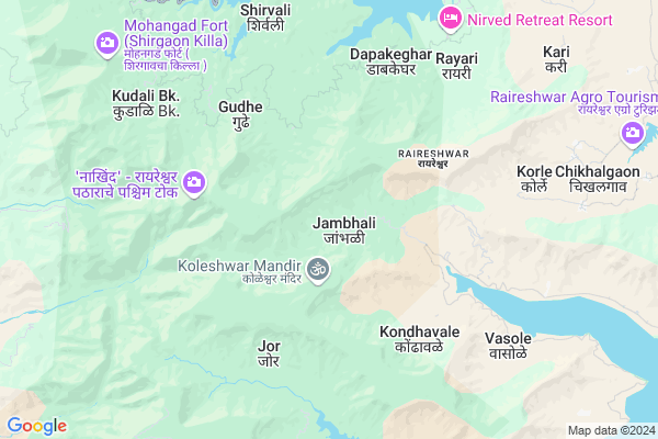
Jambhali
Jambhali Map
EDIT Map
Add Your House
 ..
..
Current Corona Virus Infected Patients Count in Satara District
| City Name | District Name | Total Covid cases |
|---|---|---|
| Satara District | Satara | 16 |
| Khandala | Satara | 1 |
Locality Name :
Jambhali
( जांभळी )
Taluka Name : Wai
District : Satara
State : Maharashtra
Region : Desh or Paschim Maharashtra
Division : Pune
Language : Marathi and Satara
Current Time 12:58 PM
Date: Tuesday , Apr 29,2025 (IST)
Time zone: IST (UTC+5:30)
Elevation / Altitude: 799 meters. Above Seal level
Telephone Code / Std Code: 02167
Assembly constituency : Wai assembly constituency
Assembly MLA : Makrand Laxmanrao Jadhav (Patil)
Lok Sabha constituency : Satara parliamentary constituency
Parliament MP : SHRIMANT CHH. UDAYANRAJE PRATAPSINHMAHARAJ BHONSLE
Serpanch Name :
Pin Code : 412803
Post Office Name : Wai
Commodities Prices : Vai Market / Mandi
Edit below overview about Jambhali
Edit below overview about Jambhali
OverView of Jambhali
In Jhambhali a small Dam In 1994.Also the A Animal and Birds sanctuary. One Tracking Place Koliwada there beautiful Nature.In Koliwada Reach you see at end point a kokan view also.Edit below overview about Jambhali
National Highways Reachable To Jambhali
Nationa High Way :NH65
Nationa High Way :NH60
Nationa High Way :NH65
Nationa High Way :NH60
Rivers Near Jambhali
Kaal River
Kaal River
Kaal River
Kaal River
About Jambhali
Jambhali is a Village in Wai Taluka in Satara District of Maharashtra State, India. It belongs to Desh or Paschim Maharashtra region . It belongs to Pune Division . It is located 58 KM towards North from District head quarters Satara. 26 KM from Wai. 165 KM from State capital Mumbai
Jambhali Pin code is 412803 and postal head office is Wai .
Vadoli ( 4 KM ) , Washivali ( 4 KM ) , Jor ( 5 KM ) , Oholi ( 6 KM ) , Vasole ( 7 KM ) are the nearby Villages to Jambhali. Jambhali is surrounded by Bhor Taluka towards North , Poladpur Taluka towards west , Wai Taluka towards East , Jawali Taluka towards South .
Mahabaleswar , Wai , Mahad , Sasvad are the near by Cities to Jambhali.
Jambhali 2011 Census Details
Jambhali Local Language is Marathi. Jambhali Village Total population is 859 and number of houses are 191. Female Population is 53.2%. Village literacy rate is 54.4% and the Female Literacy rate is 23.2%.
Population
| Census Parameter | Census Data |
| Total Population | 859 |
| Total No of Houses | 191 |
| Female Population % | 53.2 % ( 457) |
| Total Literacy rate % | 54.4 % ( 467) |
| Female Literacy rate | 23.2 % ( 199) |
| Scheduled Tribes Population % | 24.0 % ( 206) |
| Scheduled Caste Population % | 8.6 % ( 74) |
| Working Population % | 49.8 % |
| Child(0 -6) Population by 2011 | 131 |
| Girl Child(0 -6) Population % by 2011 | 48.1 % ( 63) |
Jambhali Census More Deatils.
Politics in Jambhali
Nationalist Congress Party , NCP , INC , SHS are the major political parties in this area.Polling Stations /Booths near Jambhali
1)Z.p.primary School Jamb Room No 32)Z.p.primary School Kikali West Side Room No 5
3)Z.p.primary School Ulumb Room No 1
4)Z.p.primary School Warkhadwadi Room No 2
5)Z.p.primary School Kondhavale Room No 1
HOW TO REACH Jambhali
By Rail
There is no railway station near to Jambhali in less than 10 km. Satara Rail Way Station (near to Satara) , Jarandeshwar Rail Way Station (near to Satara) are the Rail way stations reachable from near by towns.By Road
Satara are the nearby by towns to Jambhali having road connectivity to JambhaliColleges near Jambhali
Kisanveer Mahavidyalay
Address :
Schools in Jambhali
Z.p.ps.jambhali
Address : jambhali , wai , satara , Maharashtra . PIN- 412803 , Post - Wai
Govt Health Centers near Jambhali
1) Khavali , 226 , ,2) AAkoshi , 221 , ,
3) Hirdoshi , Hirdoshi , Hirdoshi , Bhor Mahad Road
Sub Villages in Jambhali
Hospitals in Jambhali,Wai
Shatayu Clinic
Jor- Balkawdi- asgaon- Vasole- Vadoli Rd; Vasole; Maharashtra 412803; India
8.4 KM distance Detail
more ..
Petrol Bunks in Jambhali,Wai
National Garage
Shri Salwekar Dutta Mandir; Panchgani Road; Wai-Panchgani-Mahableshwar Road; Dattanagar; Siddhanathwadi; Wai; Maharashtra 412803; India
14.1 KM distance Detail
HP PETROL PUMP
Pune Mahad Road Mahableshwar Dist; Pune; Maharashtra 412806; India
14.1 KM distance Detail
more ..
Colleges in Jambhali,Wai
Giristhan Arts and Commerce College
Near Post Office; Satara District; Mahabaleshwar; Maharashtra 412806; India
14.0 KM distance Detail
New Era Development Institute
Ganeshpeth; Panchgani; Maharashtra 412805; India
18.0 KM distance Detail
Sweet Memories High School and Junior College
Ruighar - Mahu Dam Road; Ganeshpeth; Panchgani; Maharashtra 412805; India
18.4 KM distance Detail
more ..
Schools in Jambhali,Wai
Shri. Mukai Devi Madhyamik Vidhayalaya Washivali.
Washivali; Maharashtra 412803; India
5.3 KM distance Detail
Electronic Shops in Jambhali,Wai
Akshay Electronics
Panchgani - Mahabaleswar Rd; Metgutad; Maharashtra 412806; India
14.0 KM distance Detail
Harish Electronics
Panchgani - Mahabaleswar Rd; Metgutad; Maharashtra 412806; India
14.0 KM distance Detail
videocon dish service
near 412806; S.T. Stand Rd; Siddhanathwadi; Wai; Maharashtra 412803; India
14.2 KM distance Detail
Super Markets in Jambhali,Wai
Parthe & Sons shoping complex
Ganeshpeth; Panchgani; Maharashtra 412805; India
18.2 KM distance Detail
Local Parks in Jambhali,Wai
Krushnai Valley Camp
Near Panchganga Mandir; Kshetra; Mahabaleshwar; Maharashtra 412806; India
8.8 KM distance Detail
Ulumb Dhom Dam; Wai
Jor- Balkawdi- asgaon- Vasole- Vadoli Rd; Ulumb; Maharashtra 412803; India
9.7 KM distance Detail
Police Stations near Jambhali,Wai
Mahableshwar Police Station
Satara; Mahabaleshwar; Maharashtra 412806; India
13.9 KM distance Detail
PANCHGANI POLICE STATION
Wai - Panchgani Road; Panchgani; Satara; Maharashtra 412805; India
19.2 KM distance Detail
About Jambhali &
History
How to reach Jambhali
Tourist Places Near By Jambhali
Schools in Jambhali
Colleges in Jambhali
Temperature & weather of Jambhali
places in Jambhali
Jambhali photos
More Information
How to reach Jambhali
Tourist Places Near By Jambhali
Schools in Jambhali
Colleges in Jambhali
Temperature & weather of Jambhali
places in Jambhali
Jambhali photos
More Information
Village Talk
Post News or Events about this Village
Near Cities
Mahabaleswar 14 KM near
Wai 25 KM near
Mahad 36 KM near
Sasvad 54 KM near
Mahabaleswar 14 KM near
Wai 25 KM near
Mahad 36 KM near
Sasvad 54 KM near
Near By Taluks
Mahabaleshwar 18 KM near
Bhor 22 KM near
Poladpur 22 KM near
Wai 25 KM near
Mahabaleshwar 18 KM near
Bhor 22 KM near
Poladpur 22 KM near
Wai 25 KM near
Near By Air Ports
Lohegaon Airport 73 KM near
Chhatrapati Shivaji International Airport 163 KM near
Kolhapur Airport 186 KM near
Gandhinagar Airport 241 KM near
Lohegaon Airport 73 KM near
Chhatrapati Shivaji International Airport 163 KM near
Kolhapur Airport 186 KM near
Gandhinagar Airport 241 KM near
Near By Tourist Places
Mahabaleshwar 14 KM near
Panchgani 18 KM near
Lavasa 51 KM near
Satara 57 KM near
Pune 64 KM near
Mahabaleshwar 14 KM near
Panchgani 18 KM near
Lavasa 51 KM near
Satara 57 KM near
Pune 64 KM near
Near By Districts
Satara 56 KM near
Pune 65 KM near
Raigad 124 KM near
Ratnagiri 137 KM near
Satara 56 KM near
Pune 65 KM near
Raigad 124 KM near
Ratnagiri 137 KM near
Near By RailWay Station
Veer Rail Way Station 43 KM near
Khed Rail Way Station 51 KM near
Veer Rail Way Station 43 KM near
Khed Rail Way Station 51 KM near