| Home | City Bus | Maps | Villages | Cities | Rail | Tourist Places | School | College | Pin Codes | Corona Cases Count |
| Distance Calculator Bus Services IFSC Codes Trace Mobile Number Weather Search Place Trace IP Available Cash ATM/Banks Locate Polling Booth Report an Error contact People |
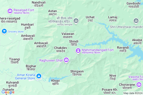
Shindi
Shindi Map
EDIT Map
Add Your House
 ..
..
Current Corona Virus Infected Patients Count in Satara District
| City Name | District Name | Total Covid cases |
|---|---|---|
| Satara District | Satara | 16 |
| Khandala | Satara | 1 |
Locality Name :
Shindi
( शिंदी )
Taluka Name : Mahabaleshwar
District : Satara
State : Maharashtra
Region : Desh or Paschim Maharashtra
Division : Pune
Language : Marathi and Satara
Current Time 07:25 AM
Date: Saturday , Apr 26,2025 (IST)
Time zone: IST (UTC+5:30)
Elevation / Altitude: 99 meters. Above Seal level
Telephone Code / Std Code: 02191
Assembly constituency : Satara assembly constituency
Assembly MLA : Bhonsle Shivendrasinh Abhaysinhraje
Lok Sabha constituency : Satara parliamentary constituency
Parliament MP : SHRIMANT CHH. UDAYANRAJE PRATAPSINHMAHARAJ BHONSLE
Serpanch Name :
Pin Code : 415715
Post Office Name : Khopi
Commodities Prices : Vai Market / Mandi
National Highways Reachable To Shindi
Nationa High Way :NH66
Nationa High Way :NH48
Nationa High Way :NH66
Nationa High Way :NH48
Rivers Near Shindi
Mutha
Koyna :कोयना
Mutha
Koyna :कोयना
About Shindi
Correct below Info and add more info about ShindiShindi is a Village in Mahabaleshwar Taluka in Satara District of Maharashtra State, India. It belongs to Desh or Paschim Maharashtra region . It belongs to Pune Division . It is located 49 KM towards west from District head quarters Satara. 23 KM from Mahabaleshwar. 192 KM from State capital Mumbai
Shindi Pin code is 415715 and postal head office is Khopi .
Araw ( 3 KM ) , Saloshi ( 7 KM ) , Akalpe ( 11 KM ) , Dabhe Dabhekar ( 12 KM ) , Renoshi ( 12 KM ) are the nearby Villages to Shindi. Shindi is surrounded by Mahabaleshwar Taluka towards North , Jawali Taluka towards East , Chipalun Taluka towards South , Poladpur Taluka towards North .
Chiplun , Mahabaleswar , Wai , Satara are the near by Cities to Shindi.
This Place is in the border of the Satara District and Raigad District. Raigad District Poladpur is North towards this place .
Shindi 2011 Census Details
Shindi Local Language is Marathi. Shindi Village Total population is 108 and number of houses are 37. Female Population is 54.6%. Village literacy rate is 75.9% and the Female Literacy rate is 37.0%.
Population
| Census Parameter | Census Data |
| Total Population | 108 |
| Total No of Houses | 37 |
| Female Population % | 54.6 % ( 59) |
| Total Literacy rate % | 75.9 % ( 82) |
| Female Literacy rate | 37.0 % ( 40) |
| Scheduled Tribes Population % | 1.9 % ( 2) |
| Scheduled Caste Population % | 17.6 % ( 19) |
| Working Population % | 44.4 % |
| Child(0 -6) Population by 2011 | 6 |
| Girl Child(0 -6) Population % by 2011 | 33.3 % ( 2) |
Shindi Census More Deatils.
Politics in Shindi
Nationalist Congress Party , BJP , NCP , SHS are the major political parties in this area.Polling Stations /Booths near Shindi
1)Z P Primary School Ranjani2)Z P Primary School Kharshi Tarf Kudal
3)Z P Primary School Karanje Tarf Medha
4)Z P Primary School Vahite
5)Z P Primary School Valuth
HOW TO REACH Shindi
By Rail
There is no railway station near to Shindi in less than 10 km. are the Rail way stations reachable from near by towns.By Road
Mahabaleswar , Panchgani are the nearby by towns to Shindi having road connectivity to ShindiColleges near Shindi
Raja Bhagwantrao Jr. College, Aundh
Address :
Mahatma Gandhi Vidyalaya And Junior College Dahiwadi
Address :
Wagdev College Art& Commerce Wathar Station
Address :
Yoshada Technical Campus Wadhe Satara.
Address :
Yeshwantrao Chavan College Karad
Address :
Schools in Shindi
Z.p.cps. Shindi
Address : shindi , mahabaleshwar , satara , Maharashtra . PIN- 412806 , Post - Mahabaleshwar
Govt Health Centers near Shindi
1) Waghawale , 19 , Mahabaleshwar- Tapola Road , Near Shivsagar Jalashay2) Pachgani , 158 , Near Z.P. School , Bus Stop
3) Shirgaon , At.Shirgaon , Post.Shirgaon , Shirgaon
Hospitals in Shindi,Mahabaleshwar
Primary Health Centre; Tapola
Satara District; Taluka Mahabaleshwar; Tapola Road; Tapola; Maharashtra 412806; India
18.5 KM distance Detail
more ..
Colleges in Shindi,Mahabaleshwar
ZP Kendra School; Andhari
Kaas Bamnoli Rd; Kasbe bamnoli; Maharashtra 415013; India
20.0 KM distance Detail
more ..
Police Stations near Shindi,Mahabaleshwar
About Shindi &
History
How to reach Shindi
Tourist Places Near By Shindi
Schools in Shindi
Colleges in Shindi
Temperature & weather of Shindi
places in Shindi
Shindi photos
More Information
How to reach Shindi
Tourist Places Near By Shindi
Schools in Shindi
Colleges in Shindi
Temperature & weather of Shindi
places in Shindi
Shindi photos
More Information
Village Talk
Post News or Events about this Village
Near Cities
Chiplun 25 KM near
Mahabaleswar 25 KM near
Wai 45 KM near
Satara 48 KM near
Chiplun 25 KM near
Mahabaleswar 25 KM near
Wai 45 KM near
Satara 48 KM near
Near By Taluks
Khed 20 KM near
Mahabaleshwar 22 KM near
Jawali 27 KM near
Chipalun 32 KM near
Khed 20 KM near
Mahabaleshwar 22 KM near
Jawali 27 KM near
Chipalun 32 KM near
Near By Air Ports
Lohegaon Airport 113 KM near
Kolhapur Airport 157 KM near
Chhatrapati Shivaji International Airport 191 KM near
Sambre Airport 261 KM near
Lohegaon Airport 113 KM near
Kolhapur Airport 157 KM near
Chhatrapati Shivaji International Airport 191 KM near
Sambre Airport 261 KM near
Near By Tourist Places
Mahabaleshwar 26 KM near
Panchgani 33 KM near
Mandwa 50 KM near
Satara 50 KM near
Anjanvel 50 KM near
Mahabaleshwar 26 KM near
Panchgani 33 KM near
Mandwa 50 KM near
Satara 50 KM near
Anjanvel 50 KM near
Near By Districts
Satara 47 KM near
Ratnagiri 97 KM near
Pune 105 KM near
Raigad 144 KM near
Satara 47 KM near
Ratnagiri 97 KM near
Pune 105 KM near
Raigad 144 KM near
Near By RailWay Station
Khed Rail Way Station 22 KM near
Chiplun Rail Way Station 23 KM near
Khed Rail Way Station 22 KM near
Chiplun Rail Way Station 23 KM near