| Home | City Bus | Maps | Villages | Cities | Rail | Tourist Places | School | College | Pin Codes | Corona Cases Count |
| Distance Calculator Bus Services IFSC Codes Trace Mobile Number Weather Search Place Trace IP Available Cash ATM/Banks Locate Polling Booth Report an Error contact People |
Rajpuri
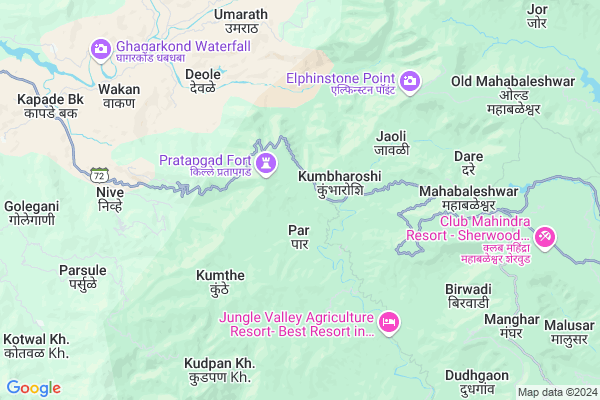
Rajpuri Map
EDIT Map
Add Your House
 ..
..
Current Corona Virus Infected Patients Count in Satara District
| City Name | District Name | Total Covid cases |
|---|---|---|
| Satara District | Satara | 16 |
| Khandala | Satara | 1 |
Locality Name :
Rajpuri
( राजपुरी )
Taluka Name : Mahabaleshwar
District : Satara
State : Maharashtra
Region : Desh or Paschim Maharashtra
Division : Pune
Language : Marathi and Satara
Current Time 09:48 AM
Date: Thursday , Apr 24,2025 (IST)
Time zone: IST (UTC+5:30)
Elevation / Altitude: 99 meters. Above Seal level
Telephone Code / Std Code: 02191
Assembly constituency : Wai assembly constituency
Assembly MLA : Makrand Laxmanrao Jadhav (Patil)
Lok Sabha constituency : Satara parliamentary constituency
Parliament MP : SHRIMANT CHH. UDAYANRAJE PRATAPSINHMAHARAJ BHONSLE
Serpanch Name :
Pin Code : 412806
Post Office Name : Mahabaleshwar
Alternate Village Name : Rajapuri
Commodities Prices : Mahad Market / Mandi
Edit below overview about Rajpuri
Edit below overview about Rajpuri
OverView of Rajpuri
Rajpuri is famous for marvelous caves. It is one of the best caves of Maharashtra. It called Kartikswami caves. It is said that Kartik lived in the caves for some days. Rajpuri village is on Hill ranges of Sahyadri. It's beutifull place n end village of East Mahabaleshwar tehsil.There is 3 caves. One is famous Kartikswami gufa (Lord Mahadevs Son). There is Hanuman Temple and Vakadeshwar temple.There is one table land called Shikhar where is a Lord Mahadevs (shankar) Temple n Below the temple there is cave inside. Rajpuri is also famous for strawberry & politically capital of Mahabaleshwar Tehsil.
Edit below overview about Rajpuri
National Highways Reachable To Rajpuri
Nationa High Way :NH66
Nationa High Way :NH48
Nationa High Way :NH66
Nationa High Way :NH48
Rivers Near Rajpuri
Mutha
Koyna :कोयना
Mutha
Koyna :कोयना
About Rajpuri
Rajpuri is a Village in Mahabaleshwar Taluka in Satara District of Maharashtra State, India. It belongs to Desh or Paschim Maharashtra region . It belongs to Pune Division . It is located 60 KM towards west from District head quarters Satara. 13 KM from Mahabaleshwar. 167 KM from State capital Mumbai
Rajpuri Pin code is 412806 and postal head office is Mahabaleshwar .
Birmani ( 4 KM ) , Mahabaleshwar ( 7 KM ) , Hatlot ( 8 KM ) , Goroshi ( 9 KM ) , Datta Krupa Housing Society ( 10 KM ) are the nearby Villages to Rajpuri. Rajpuri is surrounded by Mahabaleshwar Taluka towards East , Mahad Taluka towards North , Jawali Taluka towards East , Khed Taluka towards South .
Mahabaleswar , Mahad , Wai , Chiplun are the near by Cities to Rajpuri.
This Place is in the border of the Satara District and Raigad District. Raigad District Poladpur is west towards this place .
Rajpuri 2011 Census Details
Rajpuri Local Language is Marathi. Rajpuri Village Total population is 1097 and number of houses are 252. Female Population is 50.0%. Village literacy rate is 69.4% and the Female Literacy rate is 31.4%.
Population
| Census Parameter | Census Data |
| Total Population | 1097 |
| Total No of Houses | 252 |
| Female Population % | 50.0 % ( 549) |
| Total Literacy rate % | 69.4 % ( 761) |
| Female Literacy rate | 31.4 % ( 345) |
| Scheduled Tribes Population % | 2.0 % ( 22) |
| Scheduled Caste Population % | 10.1 % ( 111) |
| Working Population % | 55.9 % |
| Child(0 -6) Population by 2011 | 115 |
| Girl Child(0 -6) Population % by 2011 | 40.0 % ( 46) |
Rajpuri Census More Deatils.
Politics in Rajpuri
Nationalist Congress Party , NCP , INC , SHS are the major political parties in this area.Polling Stations /Booths near Rajpuri
1)Z.p Primary School Rameghar2)Z.p Primary School Kshetramahableshwar
3)Z.p Primary School Pangari
4)Z.p Primary School Kumbhroshi
5)Z.p Primary School Bhimnagar
HOW TO REACH Rajpuri
By Road
Panchgani is the Nearest Town to Rajpuri. Road connectivity is there from Panchgani to Rajpuri.By Rail
There is no railway station near to Rajpuri in less than 10 km.Colleges near Rajpuri
Raja Bhagwantrao Jr. College, Aundh
Address :
Mahatma Gandhi Vidyalaya And Junior College Dahiwadi
Address :
Wagdev College Art& Commerce Wathar Station
Address :
Yoshada Technical Campus Wadhe Satara.
Address :
Yeshwantrao Chavan College Karad
Address :
Schools in Rajpuri
K.m.r. Bhilore High School
Address : rajpuri , mahabaleshwar , satara , Maharashtra . PIN- 412806 , Post - Mahabaleshwar
Z.p.ps Rajpuri
Address : rajpuri , mahabaleshwar , satara , Maharashtra . PIN- 412806 , Post - Mahabaleshwar
Govt Health Centers near Rajpuri
1) Kumbharosi 2 , 15 , Mahabaleshwar- Pratapgad Road , pratapgad Road2) Kasarud , 25 , mahabaleshwar- pratapgad road , pratapgad Road
3) Rural Hospital Mahabaleshwar , , ,
Petrol Bunks in Rajpuri,Mahabaleshwar
HP PETROL PUMP
Pune Mahad Road Mahableshwar Dist; Pune; Maharashtra 412806; India
8.2 KM distance Detail
National Garage
Shri Salwekar Dutta Mandir; Panchgani Road; Wai-Panchgani-Mahableshwar Road; Dattanagar; Siddhanathwadi; Wai; Maharashtra 412803; India
8.3 KM distance Detail
more ..
Colleges in Rajpuri,Mahabaleshwar
Giristhan Arts and Commerce College
Near Post Office; Satara District; Mahabaleshwar; Maharashtra 412806; India
8.1 KM distance Detail
more ..
Schools in Rajpuri,Mahabaleshwar
Koyna Khore Vidya Vikas High School; Shiravali
Shiravali; Maharashtra 412806; India
5.8 KM distance Detail
Electronic Shops in Rajpuri,Mahabaleshwar
Tatasky service mahabaleshwar
MG Rd; Mahabaleshwar; Maharashtra 412806; India
8.3 KM distance Detail
videocon dish service
near 412806; S.T. Stand Rd; Siddhanathwadi; Wai; Maharashtra 412803; India
8.3 KM distance Detail
Local Parks in Rajpuri,Mahabaleshwar
Valley View Waterfall
Mahabaleshwar To Old Mahabaleshwar Rd; Mahabaleshwar; Maharashtra 412806; India
8.9 KM distance Detail
About Rajpuri &
History
How to reach Rajpuri
Tourist Places Near By Rajpuri
Schools in Rajpuri
Colleges in Rajpuri
Temperature & weather of Rajpuri
places in Rajpuri
Rajpuri photos
More Information
How to reach Rajpuri
Tourist Places Near By Rajpuri
Schools in Rajpuri
Colleges in Rajpuri
Temperature & weather of Rajpuri
places in Rajpuri
Rajpuri photos
More Information
Village Talk
Post News or Events about this Village
Near Cities
Mahabaleswar 7 KM near
Mahad 30 KM near
Wai 35 KM near
Chiplun 50 KM near
Mahabaleswar 7 KM near
Mahad 30 KM near
Wai 35 KM near
Chiplun 50 KM near
Near By Taluks
Poladpur 11 KM near
Mahabaleshwar 12 KM near
Mahad 28 KM near
Jawali 30 KM near
Poladpur 11 KM near
Mahabaleshwar 12 KM near
Mahad 28 KM near
Jawali 30 KM near
Near By Air Ports
Lohegaon Airport 90 KM near
Chhatrapati Shivaji International Airport 167 KM near
Kolhapur Airport 180 KM near
Gandhinagar Airport 255 KM near
Lohegaon Airport 90 KM near
Chhatrapati Shivaji International Airport 167 KM near
Kolhapur Airport 180 KM near
Gandhinagar Airport 255 KM near
Near By Tourist Places
Mahabaleshwar 7 KM near
Panchgani 24 KM near
Harnai 58 KM near
Satara 59 KM near
Murud-Karde 59 KM near
Mahabaleshwar 7 KM near
Panchgani 24 KM near
Harnai 58 KM near
Satara 59 KM near
Murud-Karde 59 KM near
Near By Districts
Satara 57 KM near
Pune 80 KM near
Ratnagiri 122 KM near
Raigad 123 KM near
Satara 57 KM near
Pune 80 KM near
Ratnagiri 122 KM near
Raigad 123 KM near
Near By RailWay Station
Khed Rail Way Station 34 KM near
Veer Rail Way Station 38 KM near
Khed Rail Way Station 34 KM near
Veer Rail Way Station 38 KM near