| Home | City Bus | Maps | Villages | Cities | Rail | Tourist Places | School | College | Pin Codes | Corona Cases Count |
| Distance Calculator Bus Services IFSC Codes Trace Mobile Number Weather Search Place Trace IP Available Cash ATM/Banks Locate Polling Booth Report an Error contact People |
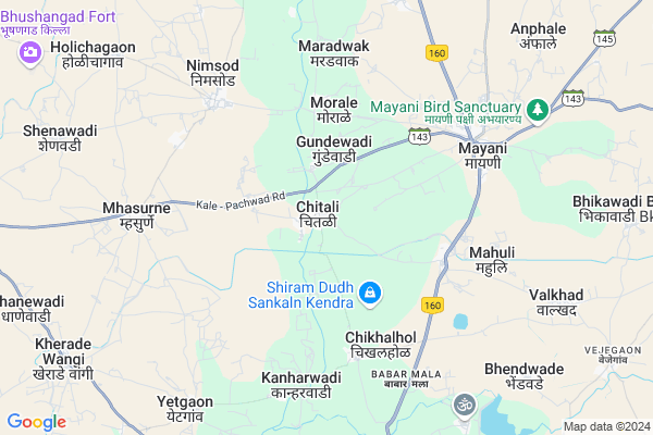
Chitali
Chitali Map
EDIT Map
Add Your House
 ..
..
Current Corona Virus Infected Patients Count in Satara District
| City Name | District Name | Total Covid cases |
|---|---|---|
| Satara District | Satara | 16 |
| Khandala | Satara | 1 |
Locality Name :
Chitali
( चैताली )
Taluka Name : Khatav
District : Satara
State : Maharashtra
Region : Desh or Paschim Maharashtra
Division : Pune
Language : Marathi and Satara
Current Time 02:16 PM
Date: Monday , Apr 28,2025 (IST)
Time zone: IST (UTC+5:30)
Elevation / Altitude: 626 meters. Above Seal level
Telephone Code / Std Code: 02375
Assembly constituency : Man assembly constituency
Assembly MLA : Jaykumar Bhagwanrao Gore
Lok Sabha constituency : Madha parliamentary constituency
Parliament MP : Ranjeetsinha Hindurao Naik- Nimbalkar
Serpanch Name :
Pin Code : 415102
Post Office Name : Mayani
Commodities Prices : Vita Market / Mandi
Chitali Live Weather
Temperature: 36.1 °C
clear sky
Humidity: 13%
Wind : 3.94 mt/sec towards NE
StationName : "Vite"
observed on 2 Hours Back
Temperature: 36.1 °C
clear sky
Humidity: 13%
Wind : 3.94 mt/sec towards NE
StationName : "Vite"
observed on 2 Hours Back
Chitali Weather Forecast for Next 5 days
29-04-2025
28.3°C to 37.9°C
clear sky, scattered clouds, few clouds
28.3°C to 37.9°C
clear sky, scattered clouds, few clouds
30-04-2025
25.2°C to 38.7°C
clear sky, scattered clouds, few clouds
25.2°C to 38.7°C
clear sky, scattered clouds, few clouds
01-05-2025
23.1°C to 38.7°C
clear sky, few clouds, scattered clouds, broken clouds
23.1°C to 38.7°C
clear sky, few clouds, scattered clouds, broken clouds
02-05-2025
24.4°C to 39.1°C
broken clouds, clear sky, scattered clouds, few clouds
24.4°C to 39.1°C
broken clouds, clear sky, scattered clouds, few clouds
03-05-2025
27.3°C to 39.0°C
few clouds, scattered clouds, broken clouds, clear sky
27.3°C to 39.0°C
few clouds, scattered clouds, broken clouds, clear sky
Edit below overview about Chitali
Edit below overview about Chitali
OverView of Chitali
Two rever goes around this village , name of rever is one is yerla, and second is chand, the name is chand because rever like moon crove shep. The population of chitali aproximatly 4500. This village none by politically strong. Chitali village also known by sant vitthal mharaj mandir sapta. Which is come jully or augst month. Big tempel, Mumbai to chitali 365 km by road.Edit below overview about Chitali
National Highways Reachable To Chitali
Nationa High Way :NH548C
Nationa High Way :NH160
Nationa High Way :NH548C
Nationa High Way :NH160
Rivers Near Chitali
Krishna :クリシュナ :कृष्णा
Venna River
Krishna :クリシュナ :कृष्णा
Venna River
About Chitali
Chitali is a Village in Khatav Taluka in Satara District of Maharashtra State, India. It belongs to Desh or Paschim Maharashtra region . It belongs to Pune Division . It is located 70 KM towards East from District head quarters Satara. 24 KM from Khatav. 290 KM from State capital Mumbai
Chitali Pin code is 415102 and postal head office is Mayani .
Maradwak ( 6 KM ) , Nimsod ( 6 KM ) , Mhasurne ( 7 KM ) , Mayani ( 7 KM ) , Goregaon (nim) ( 9 KM ) are the nearby Villages to Chitali. Chitali is surrounded by Khatav Taluka towards North , Khanapur-Vita Taluka towards South , Man Taluka towards North , Palus Taluka towards South .
Mahuli , Vita , Mhaswad , Karad are the near by Cities to Chitali.
Chitali 2011 Census Details
Chitali Local Language is Marathi. Chitali Village Total population is 5802 and number of houses are 1309. Female Population is 50.0%. Village literacy rate is 73.5% and the Female Literacy rate is 34.1%.
Population
| Census Parameter | Census Data |
| Total Population | 5802 |
| Total No of Houses | 1309 |
| Female Population % | 50.0 % ( 2901) |
| Total Literacy rate % | 73.5 % ( 4263) |
| Female Literacy rate | 34.1 % ( 1976) |
| Scheduled Tribes Population % | 2.1 % ( 119) |
| Scheduled Caste Population % | 7.1 % ( 413) |
| Working Population % | 47.8 % |
| Child(0 -6) Population by 2011 | 576 |
| Girl Child(0 -6) Population % by 2011 | 46.2 % ( 266) |
Chitali Census More Deatils.
Politics in Chitali
Bharatiya Janata Party , BJP , NCP , SWP , RSP , INC are the major political parties in this area.Polling Stations /Booths near Chitali
1)Z P Primary School West Side Room No 52)Z P Primary School West Side Room No 4
3)Z P Primary School West Side Room No 3
4)Z P Primary School West Side Room No 3
5)Z P Primary School West Side Room No 1
HOW TO REACH Chitali
By Rail
There is no railway station near to Chitali in less than 10 km. Shirravde Rail Way Station (near to Karad) , Satara Rail Way Station (near to Satara) , Rahimatpur Rail Way Station (near to Rahimatpur) , Jarandeshwar Rail Way Station (near to Satara) , Masur Rail Way Station (near to Karad) are the Rail way stations reachable from near by towns.By Road
Rahimatpur , Vita , Karad , Satara , Phaltan are the nearby by towns to Chitali having road connectivity to ChitaliColleges near Chitali
Raja Bhagwantrao Jr. College, Aundh
Address :
Srm Khatav
Address :
M. G.mahavidaly
Address :
Shri Someshwar Junior College Of Arts, Gursale
Address :
Bharatmata Juniour College Mayani
Address :
Schools in Chitali
Navmaharashtra Vidayal Chitle
Address : chitali , khatav , satara , Maharashtra . PIN- 415538 , Post - Mhasurne
Govt Health Centers near Chitali
1) Chitali , , ,2) Nimsode , , ,
3) Mhasurne , , ,
Sub Villages in Chitali
Petrol Bunks in Chitali,Khatav
Bharat Petroleum; Petrol Pump; KatarKhatav; Satara.
Satara; Maharashtra 415507; India
18.4 KM distance Detail
VIJAYRAJ PETROLEUM
KATAR KHATAV ON MAYNI RD; SATARA; Maharashtra 415507; India
19.3 KM distance Detail
more ..
Colleges in Chitali,Khatav
M. B. S. P. M`s. College of Pharmacy
Khatav; Satara; Mayani; Maharashtra 415102; India
15.2 KM distance Detail
more ..
Electronic Shops in Chitali,Khatav
Jay Bhavani Eletricals Privet Limited Nimsod
Nimsod; Maharashtra 415538; India
6.3 KM distance Detail
Someshwar Electrical & Submersible Goregoan
Samrudhi Road; Goregaon; Maharashtra 415102; India
9.3 KM distance Detail
Police Stations near Chitali,Khatav
About Chitali &
History
How to reach Chitali
Tourist Places Near By Chitali
Schools in Chitali
Colleges in Chitali
Temperature & weather of Chitali
places in Chitali
Chitali photos
More Information
How to reach Chitali
Tourist Places Near By Chitali
Schools in Chitali
Colleges in Chitali
Temperature & weather of Chitali
places in Chitali
Chitali photos
More Information
Village Talk
Post News or Events about this Village
Near Cities
Mahuli 5 KM near
Vita 19 KM near
Mhaswad 43 KM near
Karad 46 KM near
Mahuli 5 KM near
Vita 19 KM near
Mhaswad 43 KM near
Karad 46 KM near
Near By Taluks
Kadegaon 22 KM near
Khatav 23 KM near
Khanapur-Vita 24 KM near
Man 39 KM near
Kadegaon 22 KM near
Khatav 23 KM near
Khanapur-Vita 24 KM near
Man 39 KM near
Near By Air Ports
Kolhapur Airport 95 KM near
Lohegaon Airport 160 KM near
Sholapur Airport 172 KM near
Sambre Airport 194 KM near
Kolhapur Airport 95 KM near
Lohegaon Airport 160 KM near
Sholapur Airport 172 KM near
Sambre Airport 194 KM near
Near By Tourist Places
Mandwa 63 KM near
Satara 65 KM near
Panhala 87 KM near
Kolhapur 95 KM near
Pandharpur 103 KM near
Mandwa 63 KM near
Satara 65 KM near
Panhala 87 KM near
Kolhapur 95 KM near
Pandharpur 103 KM near
Near By Districts
Satara 68 KM near
Sangli 70 KM near
Kolhapur 94 KM near
Ratnagiri 153 KM near
Satara 68 KM near
Sangli 70 KM near
Kolhapur 94 KM near
Ratnagiri 153 KM near
Near By RailWay Station
Karad Rail Way Station 36 KM near
Takari Rail Way Station 39 KM near
Karad Rail Way Station 36 KM near
Takari Rail Way Station 39 KM near