| Home | City Bus | Maps | Villages | Cities | Rail | Tourist Places | School | College | Pin Codes | Corona Cases Count |
| Distance Calculator Bus Services IFSC Codes Trace Mobile Number Weather Search Place Trace IP Available Cash ATM/Banks Locate Polling Booth Report an Error contact People |
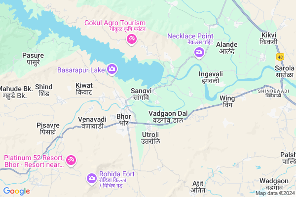
Bhatghar
Bhatghar Map
EDIT Map
Add Your House
 ..
..
Current Corona Virus Infected Patients Count in Satara District
| City Name | District Name | Total Covid cases |
|---|---|---|
| Satara District | Satara | 16 |
| Khandala | Satara | 1 |
Locality Name :
Bhatghar
( भाटघर )
Taluka Name : Khandala
District : Satara
State : Maharashtra
Region : Desh or Paschim Maharashtra
Division : Pune
Language : Marathi and Satara
Current Time 04:29 AM
Date: Saturday , Apr 26,2025 (IST)
Time zone: IST (UTC+5:30)
Elevation / Altitude: 615 meters. Above Seal level
Telephone Code / Std Code: 02169
Assembly constituency : Wai assembly constituency
Assembly MLA : Makrand Laxmanrao Jadhav (Patil)
Lok Sabha constituency : Satara parliamentary constituency
Parliament MP : SHRIMANT CHH. UDAYANRAJE PRATAPSINHMAHARAJ BHONSLE
Serpanch Name :
Pin Code : 412206
Post Office Name : Bhor
Commodities Prices : Vai Market / Mandi
Bhatghar Live Weather
Temperature: 24.5 °C
scattered clouds
Humidity: 54%
Wind : 2.39 mt/sec towards W
StationName : "Bhor"
observed on 2 Hours Back
Temperature: 24.5 °C
scattered clouds
Humidity: 54%
Wind : 2.39 mt/sec towards W
StationName : "Bhor"
observed on 2 Hours Back
Bhatghar Weather Forecast for Next 5 days
26-04-2025
24.7°C to 24.7°C
scattered clouds
24.7°C to 24.7°C
scattered clouds
27-04-2025
24.9°C to 39.4°C
scattered clouds, few clouds, broken clouds
24.9°C to 39.4°C
scattered clouds, few clouds, broken clouds
28-04-2025
24.3°C to 38.5°C
scattered clouds, few clouds, clear sky
24.3°C to 38.5°C
scattered clouds, few clouds, clear sky
29-04-2025
21.7°C to 39.0°C
clear sky, few clouds
21.7°C to 39.0°C
clear sky, few clouds
30-04-2025
23.7°C to 39.4°C
clear sky, few clouds
23.7°C to 39.4°C
clear sky, few clouds
National Highways Reachable To Bhatghar
Nationa High Way :NH965
Nationa High Way :NH548C
Nationa High Way :NH965
Nationa High Way :NH548C
Rivers Near Bhatghar
Krishna :クリシュナ :कृष्णा
Shivaganga :शिवगंगा
Krishna :クリシュナ :कृष्णा
Shivaganga :शिवगंगा
About Bhatghar
Correct below Info and add more info about BhatgharBhatghar is a Village in Khandala Taluka in Satara District of Maharashtra State, India. It belongs to Desh or Paschim Maharashtra region . It belongs to Pune Division . It is located 64 KM towards North from District head quarters Satara. 23 KM from Khandala. 165 KM from State capital Mumbai
Bhatghar Pin code is 412206 and postal head office is Bhor .
Wing ( 6 KM ) , Kanhavadi ( 7 KM ) , Karnvadi ( 8 KM ) , Atit ( 9 KM ) , Shindewadi ( 11 KM ) are the nearby Villages to Bhatghar. Bhatghar is surrounded by Khandala Taluka towards East , Wai Taluka towards South , Velhe Taluka towards west , Purandar Taluka towards East .
Wai , Sasvad , Mahabaleswar , Pune are the near by Cities to Bhatghar.
Bhatghar 2011 Census Details
Bhatghar Local Language is Marathi. Bhatghar Village Total population is 886 and number of houses are 204. Female Population is 48.5%. Village literacy rate is 81.3% and the Female Literacy rate is 36.1%.
Population
| Census Parameter | Census Data |
| Total Population | 886 |
| Total No of Houses | 204 |
| Female Population % | 48.5 % ( 430) |
| Total Literacy rate % | 81.3 % ( 720) |
| Female Literacy rate | 36.1 % ( 320) |
| Scheduled Tribes Population % | 9.8 % ( 87) |
| Scheduled Caste Population % | 19.0 % ( 168) |
| Working Population % | 41.1 % |
| Child(0 -6) Population by 2011 | 64 |
| Girl Child(0 -6) Population % by 2011 | 48.4 % ( 31) |
Bhatghar Census More Deatils.
Politics in Bhatghar
Nationalist Congress Party , NCP , INC , SHS are the major political parties in this area.Polling Stations /Booths near Bhatghar
1)Z.p. Primary School Bhade Near Post Office Room No 22)Z.p. Primary School Wadgaon East Side Room No 1
3)Z.p. Primary School Zagalwadi Room No 1
4)Z.p. Primary School Wathar Colony Room No. 1
5)Z.p. Primary School Wing East Side Room No 2
HOW TO REACH Bhatghar
By Rail
There is no railway station near to Bhatghar in less than 10 km. are the Rail way stations reachable from near by towns.By Road
Wai , Bhor , Phaltan are the nearby by towns to Bhatghar having road connectivity to BhatgharColleges near Bhatghar
Chhatrapati Shahu Polytechnic, Atit
Address :
Schools in Bhatghar
Z.p.ps Bhatghar
Address : bhatghar , khandala , satara , Maharashtra . PIN- 412206 , Post - Bhor
Govt Health Centers near Bhatghar
1) Uttroli , Uttroli , Uttroli , raj poltri farm2) SDH Bhor , Bhor , ,
3) Velwand , Velwand , Velwand , Left Bank of bhataghar Dam
Hospitals in Bhatghar,Khandala
Shree Swami Samartha Hospital
542; Amarai Lane; Pune; Bhor; Maharashtra 412206; India
1.5 KM distance Detail
Anant Medical
Shop No. 4453 Near ST Stand Bhor; Pune; Maharashtra 412206; India
2.0 KM distance Detail
Suresh Medical & General Store
Shop No. 4448 Near ST Stand Bhor; Pune; Maharashtra 412206; India
2.0 KM distance Detail
more ..
Petrol Bunks in Bhatghar,Khandala
HP PETROL PUMP - PRITHVIRAJ PETROLEUM
GUT NO 291; Bholawade TAL Bhor; Pune; Maharashtra 412206; India
1.9 KM distance Detail
Shree Ram Samarth Petroleum
Gat No. 45 Vadagaon Dal Bhor; Pune; Maharashtra 412206; India
2.2 KM distance Detail
AMIT SERVICE CENTRE
MAHAD PANDHARPUR ROAD BH; PUNE; Maharashtra 412206; India
2.3 KM distance Detail
more ..
Colleges in Bhatghar,Khandala
Shri Chatrapati Shivaji Junior College Of Vocational Training
Bhor; Maharashtra 412206; India
2.8 KM distance Detail
more ..
Schools in Bhatghar,Khandala
Vidya Pratishthan's Bhor English Medium School
Near By RiceMill; Bhor-Shirur Rd; Bholawade; Maharashtra 412206; India
1.3 KM distance Detail
Shree Datta Pushpalay
90; Mangalwar Peth; Bhor; Pune; Maharashtra 412206; India
2.1 KM distance Detail
Electronic Shops in Bhatghar,Khandala
Ovi Mobile Shopee Kapurhol
Bhor-Kapurhol Rd; Sangvi; Maharashtra 412206; India
0.7 KM distance Detail
Super Markets in Bhatghar,Khandala
ASHISH TRADERS
138; Mangalwar Peth; BHOR DIST; Pune; Maharashtra 412206; India
2.1 KM distance Detail
शा. सुरचंद धनजी अॅन्ड सन्स
Mangalwar Peth; Bajrang Ali; Bajrang Ali; Bhor; Maharashtra 412206; India
2.2 KM distance Detail
Local Parks in Bhatghar,Khandala
Municiple Garden
412206; Hassan Ali Building; Bora Bazar St; Borabazar Precinct; Navy Nagar; Fort; Mumbai; Maharashtra 400001; India
2.3 KM distance Detail
MFD Maharashtra Forest Department Garden
Bhor-Pasure-Warandha-Mahad Rd; Pasure; Maharashtra 412206; India
3.3 KM distance Detail
Governement Offices near Bhatghar,Khandala
Saraswati Lawns Mangal Karyaley
Bhor-Khandala Rd; Boravale; Maharashtra 412206; India
2.2 KM distance Detail
About Bhatghar &
History
How to reach Bhatghar
Tourist Places Near By Bhatghar
Schools in Bhatghar
Colleges in Bhatghar
Temperature & weather of Bhatghar
places in Bhatghar
Bhatghar photos
More Information
How to reach Bhatghar
Tourist Places Near By Bhatghar
Schools in Bhatghar
Colleges in Bhatghar
Temperature & weather of Bhatghar
places in Bhatghar
Bhatghar photos
More Information
Village Talk
Post News or Events about this Village
Near Cities
Wai 25 KM near
Sasvad 29 KM near
Mahabaleswar 38 KM near
Pune 45 KM near
Wai 25 KM near
Sasvad 29 KM near
Mahabaleswar 38 KM near
Pune 45 KM near
Near By Taluks
Bhor 5 KM near
Khandala 22 KM near
Wai 26 KM near
Velhe 31 KM near
Bhor 5 KM near
Khandala 22 KM near
Wai 26 KM near
Velhe 31 KM near
Near By Air Ports
Lohegaon Airport 52 KM near
Chhatrapati Shivaji International Airport 164 KM near
Kolhapur Airport 194 KM near
Gandhinagar Airport 225 KM near
Lohegaon Airport 52 KM near
Chhatrapati Shivaji International Airport 164 KM near
Kolhapur Airport 194 KM near
Gandhinagar Airport 225 KM near
Near By Tourist Places
Panchgani 30 KM near
Mahabaleshwar 38 KM near
Pune 44 KM near
Lavasa 51 KM near
Pimpri-Chinchwad 57 KM near
Panchgani 30 KM near
Mahabaleshwar 38 KM near
Pune 44 KM near
Lavasa 51 KM near
Pimpri-Chinchwad 57 KM near
Near By Districts
Pune 45 KM near
Satara 61 KM near
Raigad 132 KM near
Ahmednagar 157 KM near
Pune 45 KM near
Satara 61 KM near
Raigad 132 KM near
Ahmednagar 157 KM near
Near By RailWay Station
Pune Junction Rail Way Station 45 KM near
Shivajinagar Rail Way Station 46 KM near
Pune Junction Rail Way Station 45 KM near
Shivajinagar Rail Way Station 46 KM near