| Home | City Bus | Maps | Villages | Cities | Rail | Tourist Places | School | College | Pin Codes | Corona Cases Count |
| Distance Calculator Bus Services IFSC Codes Trace Mobile Number Weather Search Place Trace IP Available Cash ATM/Banks Locate Polling Booth Report an Error contact People |
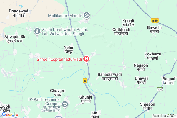
Tandulwadi
Tandulwadi Map
EDIT Map
Add Your House
 ..
..
Current Corona Virus Infected Patients Count in Sangli District
| City Name | District Name | Total Covid cases |
|---|---|---|
| Sangli District | Sangli | 20 |
| Sangli | Sangli | 9 |
Locality Name :
Tandulwadi
( तांदुळवाडी )
Taluka Name : Valva-islampur
District : Sangli
State : Maharashtra
Region : Desh or Paschim Maharashtra
Division : Pune
Language : Marathi and Kannada
Current Time 07:00 AM
Date: Saturday , Apr 26,2025 (IST)
Time zone: IST (UTC+5:30)
Elevation / Altitude: 558 meters. Above Seal level
Telephone Code / Std Code: 02342
Assembly constituency : Shirala assembly constituency
Assembly MLA : Mansing Fattesingrao Naik
Lok Sabha constituency : Hatkanangle parliamentary constituency
Parliament MP : Dhairyasheel Sambhajirao Mane
Serpanch Name :
Pin Code : 415411
Post Office Name : Yelur
Commodities Prices : Vadgaonpeth Market / Mandi
Tandulwadi Live Weather
Temperature: 27.4 °C
few clouds
Humidity: 40%
Wind : 1.29 mt/sec towards NW
StationName : "Kodoli"
observed on Now
Temperature: 27.4 °C
few clouds
Humidity: 40%
Wind : 1.29 mt/sec towards NW
StationName : "Kodoli"
observed on Now
Tandulwadi Weather Forecast for Next 5 days
27-04-2025
27.0°C to 37.8°C
few clouds, scattered clouds, broken clouds, overcast clouds
27.0°C to 37.8°C
few clouds, scattered clouds, broken clouds, overcast clouds
28-04-2025
22.9°C to 39.6°C
overcast clouds, few clouds, scattered clouds, clear sky
22.9°C to 39.6°C
overcast clouds, few clouds, scattered clouds, clear sky
29-04-2025
22.1°C to 40.3°C
clear sky, few clouds
22.1°C to 40.3°C
clear sky, few clouds
30-04-2025
21.7°C to 39.8°C
clear sky, few clouds
21.7°C to 39.8°C
clear sky, few clouds
01-05-2025
21.0°C to 39.7°C
clear sky
21.0°C to 39.7°C
clear sky
National Highways Reachable To Tandulwadi
Nationa High Way :NH266
Nationa High Way :NH166H
Nationa High Way :NH266
Nationa High Way :NH166H
Rivers Near Tandulwadi
Warna River
Krishna :クリシュナ :ಕೃಷ್ಣಾ :कृष्णा
Warna River
Krishna :クリシュナ :ಕೃಷ್ಣಾ :कृष्णा
About Tandulwadi
Correct below Info and add more info about TandulwadiTandulwadi is a Village in Valva-islampur Taluka in Sangli District of Maharashtra State, India. It belongs to Desh or Paschim Maharashtra region . It belongs to Pune Division . It is located 37 KM towards west from District head quarters Sangli. 10 KM from Valva-Islampur. 324 KM from State capital Mumbai
Tandulwadi Pin code is 415411 and postal head office is Yelur .
Bharatwadi ( 3 KM ) , Bahadurwadi ( 3 KM ) , Kanegaon ( 4 KM ) , Kundalwadi ( 4 KM ) , Bhadkimbe ( 5 KM ) are the nearby Villages to Tandulwadi. Tandulwadi is surrounded by Hatkanangale Taluka towards South , Palus Taluka towards East , Kolhapur Taluka towards South , Shirala Taluka towards west .
Vadgaon Kasba , Uran Islampur , Uchgaon , Kolhapur are the near by Cities to Tandulwadi.
Tandulwadi 2011 Census Details
Tandulwadi Local Language is Marathi. Tandulwadi Village Total population is 3493 and number of houses are 721. Female Population is 48.6%. Village literacy rate is 78.0% and the Female Literacy rate is 35.7%.
Population
| Census Parameter | Census Data |
| Total Population | 3493 |
| Total No of Houses | 721 |
| Female Population % | 48.6 % ( 1697) |
| Total Literacy rate % | 78.0 % ( 2723) |
| Female Literacy rate | 35.7 % ( 1248) |
| Scheduled Tribes Population % | 2.2 % ( 76) |
| Scheduled Caste Population % | 15.2 % ( 532) |
| Working Population % | 37.6 % |
| Child(0 -6) Population by 2011 | 348 |
| Girl Child(0 -6) Population % by 2011 | 42.5 % ( 148) |
Tandulwadi Census More Deatils.
Politics in Tandulwadi
BJP , NCP , Shivsena , SWP , INC are the major political parties in this area.Polling Stations /Booths near Tandulwadi
1)Anganwadi No.118 Malwadi Rcc Building Facing West2)Shivchatrapati Vidyalay Facing North Building From East Room No.3
3)Office Of Kendra Pramukh Yelur Market In The Premises Of Zilha Parishad School Outside
4)Zilha Parishad Primary Girls School No.3 Room No 2 Facing East From North
5)Zilha Parishad Primary Kendra School Facing East Room No.3 From North.
HOW TO REACH Tandulwadi
By Rail
There is no railway station near to Tandulwadi in less than 10 km. are the Rail way stations reachable from near by towns.By Road
Uran Islampur are the nearby by towns to Tandulwadi having road connectivity to TandulwadiColleges near Tandulwadi
Krantisinh Nana Patil College, Walwa
Address :
Jijabai Wamnrao Kate Arts College Bagani
Address :
Schools in Tandulwadi
Pandit Neharu High School
Address : tandulwadi , walwa , sangli , Maharashtra . PIN- 415411 , Post - Yelur
Govt Health Centers near Tandulwadi
1) Kundalwadi , sc kudalwadi , 208 , bajar peth2) Tandulwadi , Tandulwadi , 970 , kolhapur road
3) Bahadurwadi , SC BAHADURWADI , 575 , ST STAND NEAR
Sub Villages in Tandulwadi
Petrol Bunks in Tandulwadi,Valva-islampur
Hindustan Petroleum
Itkar; Sangli; NH-4; Madras Bombay Trunk Road; Walwa; Walwa; Maharashtra 415411; India
2.6 KM distance Detail
HP Petrol Pump
GAT NO 1463 NH NO 4 Yellur TL Walwa Dist; Vasco; Maharashtra 415411; India
2.7 KM distance Detail
more ..
Schools in Tandulwadi,Valva-islampur
Pandit Nehru High School
Thandulvadi; Sangli; NH-4; Pune Banglore Highway; Walwa; Walwa; Maharashtra 415411; India
0.5 KM distance Detail
Local Parks in Tandulwadi,Valva-islampur
Hutatma Smarak
Padwalwadi; Tal- walwa; Dist-Sangli; Pin code-416313; Maharashtra; India
11.6 KM distance Detail
Police Stations near Tandulwadi,Valva-islampur
Vadgaon Police Station
Shivaji Chowk; Peth Vadgaon; Vadgaon Kasba; Maharashtra 416112; India
13.3 KM distance Detail
Governement Offices near Tandulwadi,Valva-islampur
Talathi Karyalaya
Thandulvadi; Sangli; NH-4; Madras Bombay Trunk Road; Walwa; Walwa; Maharashtra 415411; India
0.6 KM distance Detail
Aarogya Upkendra(P.H.C.subcentre)
Ganesh Chowk Rd; Itkare; Maharashtra 415403; India
5.4 KM distance Detail
About Tandulwadi &
History
How to reach Tandulwadi
Tourist Places Near By Tandulwadi
Schools in Tandulwadi
Colleges in Tandulwadi
Temperature & weather of Tandulwadi
places in Tandulwadi
Tandulwadi photos
More Information
How to reach Tandulwadi
Tourist Places Near By Tandulwadi
Schools in Tandulwadi
Colleges in Tandulwadi
Temperature & weather of Tandulwadi
places in Tandulwadi
Tandulwadi photos
More Information
Village Talk
Post News or Events about this Village
Near Cities
Vadgaon Kasba 11 KM near
Uran Islampur 15 KM near
Uchgaon 28 KM near
Kolhapur 29 KM near
Vadgaon Kasba 11 KM near
Uran Islampur 15 KM near
Uchgaon 28 KM near
Kolhapur 29 KM near
Near By Taluks
Valva-Islampur 9 KM near
Hatkanangale 22 KM near
Palus 25 KM near
Kolhapur 29 KM near
Valva-Islampur 9 KM near
Hatkanangale 22 KM near
Palus 25 KM near
Kolhapur 29 KM near
Near By Air Ports
Kolhapur Airport 33 KM near
Sambre Airport 139 KM near
Dabolim Airport 199 KM near
Lohegaon Airport 210 KM near
Kolhapur Airport 33 KM near
Sambre Airport 139 KM near
Dabolim Airport 199 KM near
Lohegaon Airport 210 KM near
Near By Tourist Places
Panhala 24 KM near
Kolhapur 30 KM near
Dajipur Wildlife Sanctuary 82 KM near
Mandwa 85 KM near
Satara 100 KM near
Panhala 24 KM near
Kolhapur 30 KM near
Dajipur Wildlife Sanctuary 82 KM near
Mandwa 85 KM near
Satara 100 KM near
Near By Districts
Kolhapur 28 KM near
Sangli 35 KM near
Satara 100 KM near
Ratnagiri 118 KM near
Kolhapur 28 KM near
Sangli 35 KM near
Satara 100 KM near
Ratnagiri 118 KM near
Near By RailWay Station
Kirloskarvadi Rail Way Station 24 KM near
Takari Rail Way Station 26 KM near
Kirloskarvadi Rail Way Station 24 KM near
Takari Rail Way Station 26 KM near