| Home | City Bus | Maps | Villages | Cities | Rail | Tourist Places | School | College | Pin Codes | Corona Cases Count |
| Distance Calculator Bus Services IFSC Codes Trace Mobile Number Weather Search Place Trace IP Available Cash ATM/Banks Locate Polling Booth Report an Error contact People |
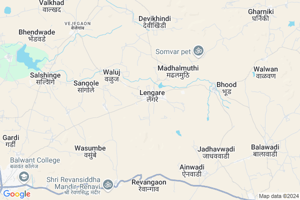
Lengre
Lengre Map
EDIT Map
Add Your House
 ..
..
Current Corona Virus Infected Patients Count in Sangli District
| City Name | District Name | Total Covid cases |
|---|---|---|
| Sangli District | Sangli | 20 |
| Sangli | Sangli | 9 |
Locality Name :
Lengre
( लेंगरे )
Taluka Name : Khanapur-vita
District : Sangli
State : Maharashtra
Region : Desh or Paschim Maharashtra
Division : Pune
Language : Marathi and Kannada
Current Time 11:49 AM
Date: Sunday , Apr 27,2025 (IST)
Time zone: IST (UTC+5:30)
Elevation / Altitude: 669 meters. Above Seal level
Telephone Code / Std Code: 02346
Assembly constituency : Khanapur assembly constituency
Assembly MLA : Sumanvahini R.R. (Aba) Patil
Lok Sabha constituency : Sangli parliamentary constituency
Parliament MP : Sanjaykaka Patil
Serpanch Name :
Pin Code : 415309
Post Office Name : Lengare
Commodities Prices : Vita Market / Mandi
Lengre Live Weather
Temperature: 35.4 °C
few clouds
Humidity: 22%
Wind : 2.06 mt/sec towards NE
StationName : "Vite"
observed on 49 Mins Back
Temperature: 35.4 °C
few clouds
Humidity: 22%
Wind : 2.06 mt/sec towards NE
StationName : "Vite"
observed on 49 Mins Back
Lengre Weather Forecast for Next 5 days
28-04-2025
25.3°C to 36.9°C
few clouds, scattered clouds, broken clouds, clear sky
25.3°C to 36.9°C
few clouds, scattered clouds, broken clouds, clear sky
29-04-2025
23.8°C to 37.3°C
clear sky, broken clouds, scattered clouds, few clouds
23.8°C to 37.3°C
clear sky, broken clouds, scattered clouds, few clouds
30-04-2025
23.2°C to 37.9°C
broken clouds, few clouds, clear sky
23.2°C to 37.9°C
broken clouds, few clouds, clear sky
01-05-2025
21.3°C to 37.8°C
few clouds, clear sky, scattered clouds
21.3°C to 37.8°C
few clouds, clear sky, scattered clouds
02-05-2025
24.1°C to 38.1°C
few clouds, scattered clouds, clear sky
24.1°C to 38.1°C
few clouds, scattered clouds, clear sky
Edit below overview about Lengre
Edit below overview about Lengre
OverView of Lengre
Lengare is place of various farming i.e. Sugar Kane, Greps etc. Popullation is mostly of Hidnu - Muslim. Great unity among Hindu-Muslim lives in lengare. Pir Kalandar Baba Darga is the important and famous place. Every year after 7 days of Gudhipadava , there is Yatra with various famous activity viz. Bullack Race, kusthi/Dangal.Edit below overview about Lengre
National Highways Reachable To Lengre
Nationa High Way :NH266
Nationa High Way :NH166E
Nationa High Way :NH266
Nationa High Way :NH166E
Rivers Near Lengre
Nandani
Agrani
Nandani
Agrani
About Lengre
Lengre is a Village in Khanapur-vita Taluka in Sangli District of Maharashtra State, India. It belongs to Desh or Paschim Maharashtra region . It belongs to Pune Division . It is located 62 KM towards North from District head quarters Sangli. 6 KM from Khanapur. 311 KM from State capital Mumbai
Lengre Pin code is 415309 and postal head office is Lengare .
Jondhalkhindi ( 4 KM ) , Sangole ( 5 KM ) , Devikhindi ( 6 KM ) , Bhood ( 6 KM ) , Ainwadi ( 7 KM ) are the nearby Villages to Lengre. Lengre is surrounded by Atpadi Taluka towards East , Tasgaon Taluka towards South , Kadegaon Taluka towards west , Palus Taluka towards South .
Vita , Mahuli , Tasgaon , Mhaswad are the near by Cities to Lengre.
Lengre 2011 Census Details
Lengre Local Language is Marathi. Lengre Village Total population is 6174 and number of houses are 1357. Female Population is 51.3%. Village literacy rate is 71.4% and the Female Literacy rate is 33.8%.
Population
| Census Parameter | Census Data |
| Total Population | 6174 |
| Total No of Houses | 1357 |
| Female Population % | 51.3 % ( 3166) |
| Total Literacy rate % | 71.4 % ( 4411) |
| Female Literacy rate | 33.8 % ( 2086) |
| Scheduled Tribes Population % | 0.1 % ( 5) |
| Scheduled Caste Population % | 14.2 % ( 878) |
| Working Population % | 48.7 % |
| Child(0 -6) Population by 2011 | 629 |
| Girl Child(0 -6) Population % by 2011 | 47.2 % ( 297) |
Lengre Census More Deatils.
Politics in Lengre
Bharatiya Janata Party , BJP , INC , SHS are the major political parties in this area.Polling Stations /Booths near Lengre
1)Z.p School Room No. 1 Form South Side Facing Towards East2)Anganwadi Building Infront Of Grampachayat Office Balawadi (bha)
3)Z.p.school Hatnoli R C C Buliding Facing Towards West Room No.1 From South
4)Z.p Primary School Girls And Boys School New Rcc Building West Doored Room No 2
5)Z.p Primary School Lengre New Rcc Building North Doored East Side Room No 2
HOW TO REACH Lengre
By Rail
There is no railway station near to Lengre in less than 10 km. Shirravde Rail Way Station (near to Karad) , Sangli Rail Way Station (near to Sangli) , Madhavnagar Rail Way Station (near to Sangli) , Masur Rail Way Station (near to Karad) are the Rail way stations reachable from near by towns.By Road
Vita , Sangli , Karad are the nearby by towns to Lengre having road connectivity to LengreColleges near Lengre
Vithalrao Deshmukh Adhyapak Vidhyalay. Mahuli.
Address :
Schools near Lengre
Aadrsh Madhyamik Vita
Address : vita , khanapur , sangli , Maharashtra . PIN- 415311 , Post - Vite
Navin Marathi Madh.
Address : vita , khanapur , sangli , Maharashtra . PIN- 114315
M.v.c.kanya Vidya
Address : khanapur , khanapur , sangli , Maharashtra . PIN- 415307 , Post - Khanapur (Sangli)
D. P. Vidyalaya
Address : vejegaon , khanapur , sangli , Maharashtra . PIN- 415310 , Post - Mahuli (Sangli)
Govt Health Centers near Lengre
1) Lengare , SubCentre Lengare , Near Primary Health Unit Lengare , Vita bhud Road2) Renavi , SubCentre Renavi , Grampancyat West , Vita Khanapur Road
3) Vejegaon , Primary Health Center Vejegaon , Near Dajiram Patloji Highschool ,
Sub Villages in Lengre
Hospitals in Lengre,Khanapur-vita
S.T. Stand
Ghoti Khurd - Tamkhadi Rd; Ghoti Khurd; Maharashtra 415311; India
10.0 KM distance Detail
more ..
Petrol Bunks in Lengre,Khanapur-vita
HP PETROL PUMP - PARTH PETROLEUM
Hpcl Dealers; S./gat NO. 733; A/P.- Lengre; Tehsil Khanapur;; Vasco; Maharashtra 415309; India
0.5 KM distance Detail
more ..
Colleges in Lengre,Khanapur-vita
College of Education
Sulkai rd; Hanuman Nagar; Vita; Khanapur; Sangli; Maharashtra 415311; India
8.3 KM distance Detail
Madhav Tukaram Yadav Junior College
Sangli; SH-78; Vijapur Guhagar Road; Khanapur; Khanapur; Maharashtra 415307; India
12.2 KM distance Detail
more ..
Super Markets in Lengre,Khanapur-vita
Anat Traders & Anat Arts Lengare
Ap-lenagare tal -khanapur dost-; Sangli; Maharashtra; India
0.4 KM distance Detail
Governement Offices near Lengre,Khanapur-vita
Matrimony
''Janai''; at post Bhood; tal khanapur; sangli; Maharashtra 415309; India
5.6 KM distance Detail
About Lengre &
History
How to reach Lengre
Tourist Places Near By Lengre
Schools in Lengre
Colleges in Lengre
Temperature & weather of Lengre
places in Lengre
Lengre photos
More Information
How to reach Lengre
Tourist Places Near By Lengre
Schools in Lengre
Colleges in Lengre
Temperature & weather of Lengre
places in Lengre
Lengre photos
More Information
Village Talk
Post News or Events about this Village
Near Cities
Vita 14 KM near
Mahuli 15 KM near
Tasgaon 36 KM near
Mhaswad 41 KM near
Vita 14 KM near
Mahuli 15 KM near
Tasgaon 36 KM near
Mhaswad 41 KM near
Near By Taluks
Khanapur-Vita 6 KM near
Tasgaon 30 KM near
Atpadi 30 KM near
Kadegaon 33 KM near
Khanapur-Vita 6 KM near
Tasgaon 30 KM near
Atpadi 30 KM near
Kadegaon 33 KM near
Near By Air Ports
Kolhapur Airport 90 KM near
Sholapur Airport 158 KM near
Lohegaon Airport 177 KM near
Sambre Airport 183 KM near
Kolhapur Airport 90 KM near
Sholapur Airport 158 KM near
Lohegaon Airport 177 KM near
Sambre Airport 183 KM near
Near By Tourist Places
Mandwa 82 KM near
Satara 85 KM near
Panhala 88 KM near
Pandharpur 92 KM near
Kolhapur 92 KM near
Mandwa 82 KM near
Satara 85 KM near
Panhala 88 KM near
Pandharpur 92 KM near
Kolhapur 92 KM near
Near By Districts
Sangli 59 KM near
Satara 88 KM near
Kolhapur 91 KM near
Bijapur District 143 KM near
Sangli 59 KM near
Satara 88 KM near
Kolhapur 91 KM near
Bijapur District 143 KM near
Near By RailWay Station
Kirloskarvadi Rail Way Station 40 KM near
Takari Rail Way Station 42 KM near
Kirloskarvadi Rail Way Station 40 KM near
Takari Rail Way Station 42 KM near