| Home | City Bus | Maps | Villages | Cities | Rail | Tourist Places | School | College | Pin Codes | Corona Cases Count |
| Distance Calculator Bus Services IFSC Codes Trace Mobile Number Weather Search Place Trace IP Available Cash ATM/Banks Locate Polling Booth Report an Error contact People |
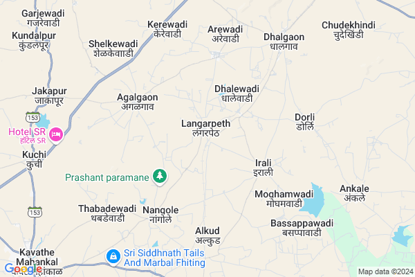
Langarpeth
Langarpeth Map
EDIT Map
Add Your House
 ..
..
Current Corona Virus Infected Patients Count in Sangli District
| City Name | District Name | Total Covid cases |
|---|---|---|
| Sangli District | Sangli | 20 |
| Sangli | Sangli | 9 |
Locality Name :
Langarpeth
( लँगरपेठ )
Taluka Name : Kavathemahankal
District : Sangli
State : Maharashtra
Region : Desh or Paschim Maharashtra
Division : Pune
Language : Marathi and Kannada
Current Time 03:58 PM
Date: Tuesday , Apr 29,2025 (IST)
Time zone: IST (UTC+5:30)
Elevation / Altitude: 611 meters. Above Seal level
Telephone Code / Std Code: 02341
Assembly constituency : Tasgaon - Kavathe Mahankal assembly constituency
Assembly MLA : Sumanvahini R.R. (Aba) Patil
Lok Sabha constituency : Sangli parliamentary constituency
Parliament MP : Sanjaykaka Patil
Serpanch Name :
Pin Code : 416405
Post Office Name : Kavathe Mahankal
Commodities Prices : Tasgaon Market / Mandi
Langarpeth Live Weather
Temperature: 37.5 °C
clear sky
Humidity: 14%
Wind : 3.3 mt/sec towards NE
StationName : "TÄ\u0081sgaon"
observed on 1 Hours Back
Temperature: 37.5 °C
clear sky
Humidity: 14%
Wind : 3.3 mt/sec towards NE
StationName : "TÄ\u0081sgaon"
observed on 1 Hours Back
Langarpeth Weather Forecast for Next 5 days
30-04-2025
26.6°C to 37.9°C
clear sky, few clouds
26.6°C to 37.9°C
clear sky, few clouds
01-05-2025
25.7°C to 38.7°C
few clouds, clear sky, broken clouds, scattered clouds
25.7°C to 38.7°C
few clouds, clear sky, broken clouds, scattered clouds
02-05-2025
23.2°C to 38.7°C
few clouds, clear sky, scattered clouds
23.2°C to 38.7°C
few clouds, clear sky, scattered clouds
03-05-2025
25.3°C to 38.1°C
few clouds, scattered clouds, clear sky
25.3°C to 38.1°C
few clouds, scattered clouds, clear sky
04-05-2025
25.5°C to 38.1°C
few clouds, broken clouds, scattered clouds, clear sky
25.5°C to 38.1°C
few clouds, broken clouds, scattered clouds, clear sky
National Highways Reachable To Langarpeth
Nationa High Way :NH266
Nationa High Way :NH166H
Nationa High Way :NH266
Nationa High Way :NH166H
Rivers Near Langarpeth
Agrani
Yerla River
Agrani
Yerla River
About Langarpeth
Correct below Info and add more info about LangarpethLangarpeth is a Village in Kavathemahankal Taluka in Sangli District of Maharashtra State, India. It belongs to Desh or Paschim Maharashtra region . It belongs to Pune Division . It is located 54 KM towards East from District head quarters Sangli. 8 KM from Kavathe Mahankal. 361 KM from State capital Mumbai
Langarpeth Pin code is 416405 and postal head office is Kavathe Mahankal .
Dholewadi ( 2 KM ) , Irali ( 4 KM ) , Agalgaon ( 4 KM ) , Arewadi ( 5 KM ) , Nangole ( 6 KM ) are the nearby Villages to Langarpeth. Langarpeth is surrounded by Tasgaon Taluka towards west , Jath Taluka towards East , Sangola Taluka towards North , Atpadi Taluka towards North .
Sangole , Tasgaon , Miraj , Sangli are the near by Cities to Langarpeth.
Langarpeth 2011 Census Details
Langarpeth Local Language is Marathi. Langarpeth Village Total population is 2124 and number of houses are 489. Female Population is 48.8%. Village literacy rate is 64.4% and the Female Literacy rate is 27.4%.
Population
| Census Parameter | Census Data |
| Total Population | 2124 |
| Total No of Houses | 489 |
| Female Population % | 48.8 % ( 1036) |
| Total Literacy rate % | 64.4 % ( 1368) |
| Female Literacy rate | 27.4 % ( 583) |
| Scheduled Tribes Population % | 0.0 % ( 0) |
| Scheduled Caste Population % | 5.0 % ( 107) |
| Working Population % | 47.3 % |
| Child(0 -6) Population by 2011 | 203 |
| Girl Child(0 -6) Population % by 2011 | 37.4 % ( 76) |
Langarpeth Census More Deatils.
Politics in Langarpeth
Bharatiya Janata Party , BJP , INC are the major political parties in this area.Polling Stations /Booths near Langarpeth
1)Zilla Parishad School Eastern Room No.3 Door To North Side Building2)Zilla Parishad Primary School Hingangaon East West Building Door To North Side East Side Room No
3)Zilla Parishad School New Rcc Building Eastern Room No.1 Door To North Side
4)Zilla Parishad Primary School New Building Eastern Facing Room No. 2 From North
5)Z.p.primary Boyu0027s School From East Side Room No. 4
HOW TO REACH Langarpeth
By Rail
Kavathe Mahankal Rail Way Station , Langarpeth Rail Way Station are the very nearby railway stations to Langarpeth. Miraj Junction Rail Way Station (near to Miraj) , Arag Rail Way Station (near to Miraj) are the Rail way stations reachable from near by towns.By Road
Miraj are the nearby by towns to Langarpeth having road connectivity to LangarpethColleges near Langarpeth
Yashwant Jr. Collage Ranjani
Address :
P.v.p. Mahavidhalaya,kavathemahankal
Address :
Schools in Langarpeth
Langarpeth Hischool Langarpeth
Address : langarpeth , kavathe mahankal , sangli , Maharashtra . PIN- 416405 , Post - Kavathe Mahankal
Z. P. School
Address : langarpeth , kavathe mahankal , sangli , Maharashtra . PIN- 416405 , Post - Kavathe Mahankal
Govt Health Centers near Langarpeth
1) Dhalewadi , A/P Dhalewadi, Subcentre Dhalewadi , Dhalgaon Road , Near ZP Primary School2) Agalgaon , A/P Agalgaon, Subcentre Agalgaon , , PHC Agalgaon
3) Agalgaon , A/P Agalgaon, Primary Health Centre Agalgaon , Arewadi Road , Near Nikamwasti
Sub Villages in Langarpeth
Petrol Bunks in Langarpeth,Kavathemahankal
Shri Ganesh Automobiles Center
Miraj - Sangola - Pandharpur Rd; Nagaj; Maharashtra 416403; India
8.5 KM distance Detail
Indian Oil Petrol Pump
Nimaj; Sangli; NH-204; Jath Road; Nagaj; Nagaj; Maharashtra 413314; India
8.7 KM distance Detail
Bharat Petroleum
NH-204; Pandharpur Road; Nagaj; Nagaj; Maharashtra 413314; India
10.5 KM distance Detail
more ..
Colleges in Langarpeth,Kavathemahankal
Dnyankiran Computer & prajwal online computer
Front of sm highchool ; main road vidyanagar; Kavathe Mahankal; Maharashtra 416405; India
13.7 KM distance Detail
Vasant Dada Patil MahaVidyalaya
Shindewadi; Kavthe Mahakal; Sangli; SH-155; Jath Sangli; Sangli; Sangli; Maharashtra 416405; India
13.9 KM distance Detail
more ..
Governement Offices near Langarpeth,Kavathemahankal
Panchyat Samiti Karyalya
Nagaj; Sangli; SH-78; Sangola Vita Road; Sangli; Sangli; Maharashtra 416403; India
9.7 KM distance Detail
Gram Sachivalaya
Kavathe mahankal; Sangli; SH-155; Jath Chadchan Road; Sangli; Sangli; Maharashtra 416405; India
13.4 KM distance Detail
About Langarpeth &
History
How to reach Langarpeth
Tourist Places Near By Langarpeth
Schools in Langarpeth
Colleges in Langarpeth
Temperature & weather of Langarpeth
places in Langarpeth
Langarpeth photos
More Information
How to reach Langarpeth
Tourist Places Near By Langarpeth
Schools in Langarpeth
Colleges in Langarpeth
Temperature & weather of Langarpeth
places in Langarpeth
Langarpeth photos
More Information
Village Talk
Post News or Events about this Village
Near Cities
Sangole 30 KM near
Tasgaon 41 KM near
Miraj 46 KM near
Sangli 52 KM near
Sangole 30 KM near
Tasgaon 41 KM near
Miraj 46 KM near
Sangli 52 KM near
Near By Taluks
Kavathemahankal 7 KM near
Jath 35 KM near
Tasgaon 35 KM near
Athni 43 KM near
Kavathemahankal 7 KM near
Jath 35 KM near
Tasgaon 35 KM near
Athni 43 KM near
Near By Air Ports
Kolhapur Airport 89 KM near
Sholapur Airport 136 KM near
Sambre Airport 155 KM near
Hubli Airport 213 KM near
Kolhapur Airport 89 KM near
Sholapur Airport 136 KM near
Sambre Airport 155 KM near
Hubli Airport 213 KM near
Near By Tourist Places
Pandharpur 87 KM near
Bijapur 96 KM near
Kolhapur 96 KM near
Panhala 103 KM near
Mandwa 129 KM near
Pandharpur 87 KM near
Bijapur 96 KM near
Kolhapur 96 KM near
Panhala 103 KM near
Mandwa 129 KM near
Near By Districts
Sangli 51 KM near
Kolhapur 95 KM near
Bijapur District 97 KM near
Solapur 136 KM near
Sangli 51 KM near
Kolhapur 95 KM near
Bijapur District 97 KM near
Solapur 136 KM near
Near By RailWay Station
Kavathe Mahankal Rail Way Station 0.9 KM near
Langarpeth Rail Way Station 2.5 KM near
Dhalgaon Rail Way Station 8.1 KM near
Miraj Junction Rail Way Station 48 KM near
Sangli Rail Way Station 50 KM near
Kavathe Mahankal Rail Way Station 0.9 KM near
Langarpeth Rail Way Station 2.5 KM near
Dhalgaon Rail Way Station 8.1 KM near
Miraj Junction Rail Way Station 48 KM near
Sangli Rail Way Station 50 KM near