| Home | City Bus | Maps | Villages | Cities | Rail | Tourist Places | School | College | Pin Codes | Corona Cases Count |
| Distance Calculator Bus Services IFSC Codes Trace Mobile Number Weather Search Place Trace IP Available Cash ATM/Banks Locate Polling Booth Report an Error contact People |
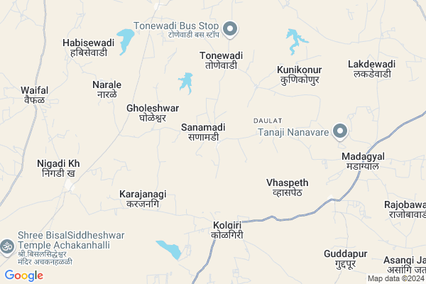
Sanamadi
Sanamadi Map
EDIT Map
Add Your House
 ..
..
Current Corona Virus Infected Patients Count in Sangli District
| City Name | District Name | Total Covid cases |
|---|---|---|
| Sangli District | Sangli | 20 |
| Sangli | Sangli | 9 |
Locality Name :
Sanamadi
( सणांमदीं )
Taluka Name : Jath
District : Sangli
State : Maharashtra
Region : Desh or Paschim Maharashtra
Division : Pune
Language : Marathi and Kannada
Current Time 09:31 AM
Date: Thursday , Apr 24,2025 (IST)
Time zone: IST (UTC+5:30)
Elevation / Altitude: 567 meters. Above Seal level
Telephone Code / Std Code: 02344
Assembly constituency : Jat assembly constituency
Assembly MLA : Jagtap Vilasrao Narayan
Lok Sabha constituency : Sangli parliamentary constituency
Parliament MP : Sanjaykaka Patil
Serpanch Name :
Pin Code : 416404
Post Office Name : Jath
Alternate Village Name : Sanamdi
Commodities Prices : Sangola Market / Mandi
Rivers Near Sanamadi
Agrani
Agrani
About Sanamadi
Correct below Info and add more info about SanamadiSanamadi is a Village in Jath Taluka in Sangli District of Maharashtra State, India. It belongs to Desh or Paschim Maharashtra region . It belongs to Pune Division . It is located 101 KM towards East from District head quarters Sangli. 14 KM from Jath. 391 KM from State capital Mumbai
Sanamadi Pin code is 416404 and postal head office is Jath .
Tonewadi ( 5 KM ) , Karajanagi ( 5 KM ) , Vhaspeth ( 6 KM ) , Karajangi ( 6 KM ) , Kunikonur ( 6 KM ) are the nearby Villages to Sanamadi. Sanamadi is surrounded by Sangola Taluka towards North , Mangalvedhe Taluka towards North , Kavathemahankal Taluka towards west , Bijapur Taluka towards East .
Sangole , Mangalvedhe , Bijapur , Pandharpur are the near by Cities to Sanamadi.
Sanamadi 2011 Census Details
Sanamadi Local Language is Marathi. Sanamadi Village Total population is 2170 and number of houses are 429. Female Population is 49.6%. Village literacy rate is 58.7% and the Female Literacy rate is 24.9%.
Population
| Census Parameter | Census Data |
| Total Population | 2170 |
| Total No of Houses | 429 |
| Female Population % | 49.6 % ( 1076) |
| Total Literacy rate % | 58.7 % ( 1273) |
| Female Literacy rate | 24.9 % ( 541) |
| Scheduled Tribes Population % | 0.2 % ( 5) |
| Scheduled Caste Population % | 20.6 % ( 447) |
| Working Population % | 56.5 % |
| Child(0 -6) Population by 2011 | 264 |
| Girl Child(0 -6) Population % by 2011 | 45.5 % ( 120) |
Sanamadi Census More Deatils.
Politics in Sanamadi
Bharatiya Janata Party , BJP , NCP , INC are the major political parties in this area.Polling Stations /Booths near Sanamadi
1)Zilha Parishad Primary Urdu School Hexagonal Slab Building2)Ekatmik Balvikas Seva Scheme Project West Side Facing East South Side Slab Building No.2
3)Zilla Parishad.primary Marathi Boys & Girls School. Hexegon R C C Bilding East Ward West Facing Ro
4)Zila Parishad Primary Marathi Boys And Girls School South Side Facing East Room No. 1 Slab Buildin
5)Z.p.primary Marathi Boys School Awandhi Room No 1 From South Facing East.
HOW TO REACH Sanamadi
By Rail
There is no railway station near to Sanamadi in less than 10 km. Solapur Rail Way Station (near to Solapur) , Miraj Junction Rail Way Station (near to Miraj) , Bale Rail Way Station (near to Solapur) , Vijayapura Rail Way Station (near to Bijapur) , Arag Rail Way Station (near to Miraj) , Ibrahimpur Rail Way Station (near to Bijapur) are the Rail way stations reachable from near by towns.By Road
Athani (Karnataka) , Bijapur , Miraj , Solapur are the nearby by towns to Sanamadi having road connectivity to SanamadiColleges near Sanamadi
Sri Guru Basav Vidya Mandir & Jr. College Sankh
Address :
Shri R.k Patil Arts,commerce & Science Mahavidyalay ,sankh
Address : Sankh -badachi Road
Raje Ramaro Mahavidyalay Jath
Address :
Rajaram Bapu Junior College
Address :
Arts, Commerce & Science College, Umadi, Tq- Jath,
Address :
Schools in Sanamadi
Sanmadi Hischool Sanmadi
Address : sanamadi , jath , sangli , Maharashtra . PIN- 416404 , Post - Jath
M.j. P Ashram Shala Sanmadi
Address : sanamadi , jath , sangli , Maharashtra . PIN- 416404 , Post - Jath
Z.p. School
Address : sanamadi , jath , sangli , Maharashtra . PIN- 416404 , Post - Jath
Govt Health Centers near Sanamadi
1) Sanmadi , SubCenter Sanmadi , Madhgyal Road , Near the Grampanchyat2) Konikonur , SubCenter Konikour , Govbhag , Near Zp School
3) Nigadi , SubNigadi , Govbhag , Near Zp School
Sub Villages in Sanamadi
Hospitals in Sanamadi,Jath
Hitti Multispeciality Hospital
Madagyal; Sangli; SH-155; Jath Chadchan Road; Sangli; Sangli; Maharashtra 416413; India
9.0 KM distance Detail
Primary Health Centre
Sangli; SH-155; Jath Chadchan Road; Madgyal; Madagyal; Maharashtra 416413; India
9.0 KM distance Detail
more ..
Petrol Bunks in Sanamadi,Jath
Bharat Petroleum
Sangli; SH-155; Jath Chadchan Road; Madgyal; Madagyal; Maharashtra 416413; India
8.7 KM distance Detail
Petrol Pump
Muchandi- Guddapur Rd; Soradi; Guddapur; Maharashtra 416412; India
11.8 KM distance Detail
HP PETROL PUMP - SANGRAM FUEL STATION
Hpcl Dealers A/P. Jath; Jath Visapur Road; Taluka Jath; Vasco; Maharashtra 416404; India
18.4 KM distance Detail
more ..
Colleges in Sanamadi,Jath
Siddharth Polytechnic College
672/1; Shegaon Road; Jath; PIN - 416404; Shegaon Road; Jath-Sangola Rd; Maharashtra 416404; India
18.0 KM distance Detail
more ..
Schools in Sanamadi,Jath
Zila Parishad Prathamik Marathi Shala
Vaspeth; Sangli; SH-155; Jath Chadchan Road; Madgyal; Madagyal; Maharashtra 416413; India
7.9 KM distance Detail
Shri Sanarth Shivprabhu Highschool and Jr. College; Yelvi.
Mangalwedha - Jath Rd; Yelavi; Maharashtra 416404; India
7.9 KM distance Detail
Electronic Shops in Sanamadi,Jath
SANSKRUTl ELECTRICALS machinery
Mangalwedha - Jath Rd; Gholeshwar; Maharashtra 416404; India
8.7 KM distance Detail
Super Markets in Sanamadi,Jath
Muktai Photo Jath 9683650056
Mangalwar Peth; Jath; Maharashtra 416404; India
19.2 KM distance Detail
Governement Offices near Sanamadi,Jath
Talathi Office
Vaspeth; Sangli; SH-155; Jath Chadchan Road; Madgyal; Madagyal; Maharashtra 416413; India
8.0 KM distance Detail
About Sanamadi &
History
How to reach Sanamadi
Tourist Places Near By Sanamadi
Schools in Sanamadi
Colleges in Sanamadi
Temperature & weather of Sanamadi
places in Sanamadi
Sanamadi photos
More Information
How to reach Sanamadi
Tourist Places Near By Sanamadi
Schools in Sanamadi
Colleges in Sanamadi
Temperature & weather of Sanamadi
places in Sanamadi
Sanamadi photos
More Information
Village Talk
Post News or Events about this Village
Near Cities
Sangole 29 KM near
Mangalvedhe 47 KM near
Bijapur 60 KM near
Pandharpur 67 KM near
Sangole 29 KM near
Mangalvedhe 47 KM near
Bijapur 60 KM near
Pandharpur 67 KM near
Near By Taluks
Jath 13 KM near
Sangola 37 KM near
Mangalvedhe 37 KM near
Kavathemahankal 54 KM near
Jath 13 KM near
Sangola 37 KM near
Mangalvedhe 37 KM near
Kavathemahankal 54 KM near
Near By Air Ports
Sholapur Airport 93 KM near
Kolhapur Airport 133 KM near
Sambre Airport 181 KM near
Latur Airport 206 KM near
Sholapur Airport 93 KM near
Kolhapur Airport 133 KM near
Sambre Airport 181 KM near
Latur Airport 206 KM near
Near By Tourist Places
Bijapur 59 KM near
Pandharpur 66 KM near
Solapur 96 KM near
Tuljapur 138 KM near
Kolhapur 141 KM near
Bijapur 59 KM near
Pandharpur 66 KM near
Solapur 96 KM near
Tuljapur 138 KM near
Kolhapur 141 KM near
Near By Districts
Bijapur District 60 KM near
Solapur 93 KM near
Sangli 97 KM near
Bagalkot 126 KM near
Bijapur District 60 KM near
Solapur 93 KM near
Sangli 97 KM near
Bagalkot 126 KM near
Near By RailWay Station
Sangola Rail Way Station 41 KM near
Vijayapura Rail Way Station 61 KM near
Sangola Rail Way Station 41 KM near
Vijayapura Rail Way Station 61 KM near