| Home | City Bus | Maps | Villages | Cities | Rail | Tourist Places | School | College | Pin Codes | Corona Cases Count |
| Distance Calculator Bus Services IFSC Codes Trace Mobile Number Weather Search Place Trace IP Available Cash ATM/Banks Locate Polling Booth Report an Error contact People |
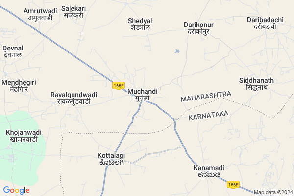
Muchandi
Muchandi Map
EDIT Map
Add Your House
 ..
..
Current Corona Virus Infected Patients Count in Sangli District
| City Name | District Name | Total Covid cases |
|---|---|---|
| Sangli District | Sangli | 20 |
| Sangli | Sangli | 9 |
Locality Name :
Muchandi
( मुचंडी )
Taluka Name : Jath
District : Sangli
State : Maharashtra
Region : Desh or Paschim Maharashtra
Division : Pune
Language : Marathi and Kannada
Current Time 08:20 AM
Date: Wednesday , Apr 30,2025 (IST)
Time zone: IST (UTC+5:30)
Elevation / Altitude: 567 meters. Above Seal level
Telephone Code / Std Code: 02344
Assembly constituency : Jat assembly constituency
Assembly MLA : Jagtap Vilasrao Narayan
Lok Sabha constituency : Sangli parliamentary constituency
Parliament MP : Sanjaykaka Patil
Serpanch Name :
Pin Code : 416404
Post Office Name : Jath
Commodities Prices : Athani Market / Mandi
Muchandi Live Weather
Temperature: 27.4 °C
clear sky
Humidity: 48%
Wind : 3.2 mt/sec towards W
StationName : "Athani"
observed on 2 Hours Back
Temperature: 27.4 °C
clear sky
Humidity: 48%
Wind : 3.2 mt/sec towards W
StationName : "Athani"
observed on 2 Hours Back
Muchandi Weather Forecast for Next 5 days
01-05-2025
29.2°C to 38.4°C
clear sky, scattered clouds
29.2°C to 38.4°C
clear sky, scattered clouds
02-05-2025
27.1°C to 39.4°C
few clouds, clear sky, scattered clouds
27.1°C to 39.4°C
few clouds, clear sky, scattered clouds
03-05-2025
26.7°C to 39.1°C
few clouds, scattered clouds, clear sky, broken clouds
26.7°C to 39.1°C
few clouds, scattered clouds, clear sky, broken clouds
04-05-2025
27.9°C to 38.8°C
scattered clouds, broken clouds, clear sky, few clouds
27.9°C to 38.8°C
scattered clouds, broken clouds, clear sky, few clouds
05-05-2025
26.9°C to 37.7°C
broken clouds, clear sky, few clouds
26.9°C to 37.7°C
broken clouds, clear sky, few clouds
Edit below overview about Muchandi
Edit below overview about Muchandi
OverView of Muchandi
Mucchandi Daryappa Temple is one of the best temple, I met there it's wonderful nature, it is good memorable movement in my life. i'll never forget this place. shankar ling temple is one the best temple, I met there it's wonder fullnature ,it is good memorable movement in my life. i wil never forget this place...Edit below overview about Muchandi
Rivers Near Muchandi
Agrani
Agrani
About Muchandi
Muchandi is a Village in Jath Taluka in Sangli District of Maharashtra State, India. It belongs to Desh or Paschim Maharashtra region . It belongs to Pune Division . It is located 95 KM towards East from District head quarters Sangli. 16 KM from Jath. 405 KM from State capital Mumbai
Muchandi Pin code is 416404 and postal head office is Jath .
Darikonur ( 7 KM ) , Untwadi ( 8 KM ) , Shidhanath ( 9 KM ) , Sordi ( 10 KM ) , Amrutwadi ( 11 KM ) are the nearby Villages to Muchandi. Muchandi is surrounded by Athni Taluka towards west , Bijapur Taluka towards East , Kavathemahankal Taluka towards west , Sangola Taluka towards North .
Sangole , Bijapur , Mangalvedhe , Rabkavi Banhatti are the near by Cities to Muchandi.
Muchandi 2011 Census Details
Muchandi Local Language is Marathi. Muchandi Village Total population is 4295 and number of houses are 861. Female Population is 49.7%. Village literacy rate is 61.0% and the Female Literacy rate is 26.4%.
Population
| Census Parameter | Census Data |
| Total Population | 4295 |
| Total No of Houses | 861 |
| Female Population % | 49.7 % ( 2133) |
| Total Literacy rate % | 61.0 % ( 2619) |
| Female Literacy rate | 26.4 % ( 1133) |
| Scheduled Tribes Population % | 0.6 % ( 27) |
| Scheduled Caste Population % | 8.6 % ( 370) |
| Working Population % | 47.6 % |
| Child(0 -6) Population by 2011 | 563 |
| Girl Child(0 -6) Population % by 2011 | 47.2 % ( 266) |
Muchandi Census More Deatils.
Politics in Muchandi
Bharatiya Janata Party , BJP , NCP , INC are the major political parties in this area.Polling Stations /Booths near Muchandi
1)Grampanchayat Karyalay R C C Building Pratapur2)Z.p.primary Kannada School Room No.1 From West Facing South.
3)Zilla Parishad Primary Kannad School Borgi Hexagonal Near Samuh Sadhangat South Side Facing West
4)Primary Marathi Boys School Room No.2 Facing North.
5)Z.p.primary Marathi Boys School.room No.1 From East Facing West
HOW TO REACH Muchandi
By Rail
There is no railway station near to Muchandi in less than 10 km. Solapur Rail Way Station (near to Solapur) , Miraj Junction Rail Way Station (near to Miraj) , Bale Rail Way Station (near to Solapur) , Vijayapura Rail Way Station (near to Bijapur) , Arag Rail Way Station (near to Miraj) , Ibrahimpur Rail Way Station (near to Bijapur) are the Rail way stations reachable from near by towns.By Road
Athani (Karnataka) , Bijapur , Miraj , Solapur are the nearby by towns to Muchandi having road connectivity to MuchandiColleges near Muchandi
Sri Guru Basav Vidya Mandir & Jr. College Sankh
Address :
Shri R.k Patil Arts,commerce & Science Mahavidyalay ,sankh
Address : Sankh -badachi Road
Raje Ramaro Mahavidyalay Jath
Address :
Rajaram Bapu Junior College
Address :
Arts, Commerce & Science College, Umadi, Tq- Jath,
Address :
Schools in Muchandi
New English School
Address : muchandi , jath , sangli , Maharashtra . PIN- 416404 , Post - Jath
Govt Health Centers near Muchandi
1) Muchandi , SubCenter Muchandi , Jath Vijapur Road , Near the Grampanchyat2) Walsang , PHC Walsang , Govbhag , Near High School
3) Walsang , SubCentre Walsang , Govbhag , Near Maruti Mandir
Sub Villages in Muchandi
Hospitals in Muchandi,Jath
Primary Health Centre
Muchundi; Sangli; SH-78; Jath Road; Jath; Jath; Maharashtra 416404; India
1.0 KM distance Detail
more ..
Petrol Bunks in Muchandi,Jath
Petrol Pump
Muchandi- Guddapur Rd; Soradi; Guddapur; Maharashtra 416412; India
13.1 KM distance Detail
HP PETROL PUMP - SANGRAM FUEL STATION
Hpcl Dealers A/P. Jath; Jath Visapur Road; Taluka Jath; Vasco; Maharashtra 416404; India
15.5 KM distance Detail
more ..
Super Markets in Muchandi,Jath
Vitthal-Rakhumai Mandir; Umarani
Village & Post-Umarani; Tehsil- Dist-; Jath; Maharashtra; India
15.0 KM distance Detail
M.M Color Shortex Machine;Kakamari
mujawar; Kakamari; Karnataka 591265; India
17.3 KM distance Detail
Governement Offices near Muchandi,Jath
Gram Sachivalaya
Muchundi; Sangli; SH-78; Jath Road; Jath; Jath; Maharashtra 416404; India
1.0 KM distance Detail
About Muchandi &
History
How to reach Muchandi
Tourist Places Near By Muchandi
Schools in Muchandi
Colleges in Muchandi
Temperature & weather of Muchandi
places in Muchandi
Muchandi photos
More Information
How to reach Muchandi
Tourist Places Near By Muchandi
Schools in Muchandi
Colleges in Muchandi
Temperature & weather of Muchandi
places in Muchandi
Muchandi photos
More Information
Village Talk
Post News or Events about this Village
Near Cities
Sangole 42 KM near
Bijapur 48 KM near
Mangalvedhe 67 KM near
Rabkavi Banhatti 68 KM near
Sangole 42 KM near
Bijapur 48 KM near
Mangalvedhe 67 KM near
Rabkavi Banhatti 68 KM near
Near By Taluks
Jath 16 KM near
Athni 46 KM near
Bijapur 47 KM near
Kavathemahankal 53 KM near
Jath 16 KM near
Athni 46 KM near
Bijapur 47 KM near
Kavathemahankal 53 KM near
Near By Air Ports
Sholapur Airport 107 KM near
Kolhapur Airport 126 KM near
Sambre Airport 164 KM near
Hubli Airport 204 KM near
Sholapur Airport 107 KM near
Kolhapur Airport 126 KM near
Sambre Airport 164 KM near
Hubli Airport 204 KM near
Near By Tourist Places
Bijapur 48 KM near
Pandharpur 86 KM near
Solapur 111 KM near
Kolhapur 135 KM near
Aihole 135 KM near
Bijapur 48 KM near
Pandharpur 86 KM near
Solapur 111 KM near
Kolhapur 135 KM near
Aihole 135 KM near
Near By Districts
Bijapur District 49 KM near
Sangli 92 KM near
Bagalkot 107 KM near
Solapur 108 KM near
Bijapur District 49 KM near
Sangli 92 KM near
Bagalkot 107 KM near
Solapur 108 KM near
Near By RailWay Station
Vijayapura Rail Way Station 51 KM near
Sangola Rail Way Station 59 KM near
Vijayapura Rail Way Station 51 KM near
Sangola Rail Way Station 59 KM near