| Home | City Bus | Maps | Villages | Cities | Rail | Tourist Places | School | College | Pin Codes | Corona Cases Count |
| Distance Calculator Bus Services IFSC Codes Trace Mobile Number Weather Search Place Trace IP Available Cash ATM/Banks Locate Polling Booth Report an Error contact People |
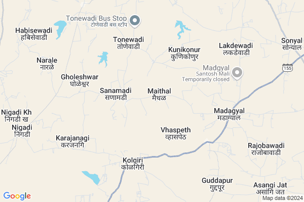
Maithal
Maithal Map
EDIT Map
Add Your House
 ..
..
Current Corona Virus Infected Patients Count in Sangli District
| City Name | District Name | Total Covid cases |
|---|---|---|
| Sangli District | Sangli | 20 |
| Sangli | Sangli | 9 |
Locality Name :
Maithal
( मैथिल )
Taluka Name : Jath
District : Sangli
State : Maharashtra
Region : Desh or Paschim Maharashtra
Division : Pune
Language : Marathi and Kannada
Current Time 08:42 AM
Date: Friday , Apr 25,2025 (IST)
Time zone: IST (UTC+5:30)
Elevation / Altitude: 567 meters. Above Seal level
Telephone Code / Std Code: 02344
Assembly constituency : Jat assembly constituency
Assembly MLA : Jagtap Vilasrao Narayan
Lok Sabha constituency : Sangli parliamentary constituency
Parliament MP : Sanjaykaka Patil
Serpanch Name :
Pin Code : 416404
Post Office Name : Jath
Commodities Prices : Sangola Market / Mandi
Maithal Live Weather
Temperature: 33.3 °C
clear sky
Humidity: 27%
Wind : 4.92 mt/sec towards N
StationName : "SÄ\u0081ngola"
observed on Now
Temperature: 33.3 °C
clear sky
Humidity: 27%
Wind : 4.92 mt/sec towards N
StationName : "SÄ\u0081ngola"
observed on Now
Maithal Weather Forecast for Next 5 days
26-04-2025
30.6°C to 39.5°C
clear sky, scattered clouds, broken clouds
30.6°C to 39.5°C
clear sky, scattered clouds, broken clouds
27-04-2025
30.6°C to 38.5°C
broken clouds, light rain, overcast clouds
30.6°C to 38.5°C
broken clouds, light rain, overcast clouds
28-04-2025
27.8°C to 38.4°C
broken clouds, scattered clouds
27.8°C to 38.4°C
broken clouds, scattered clouds
29-04-2025
26.2°C to 38.7°C
broken clouds, few clouds, clear sky, scattered clouds
26.2°C to 38.7°C
broken clouds, few clouds, clear sky, scattered clouds
30-04-2025
26.9°C to 39.5°C
few clouds, clear sky, scattered clouds, broken clouds
26.9°C to 39.5°C
few clouds, clear sky, scattered clouds, broken clouds
Rivers Near Maithal
Agrani
Agrani
About Maithal
Correct below Info and add more info about MaithalMaithal is a Village in Jath Taluka in Sangli District of Maharashtra State, India. It belongs to Desh or Paschim Maharashtra region . It belongs to Pune Division . It is located 104 KM towards East from District head quarters Sangli. 17 KM from Jath. 394 KM from State capital Mumbai
Maithal Pin code is 416404 and postal head office is Jath .
Sanamadi ( 3 KM ) , Kunikonur ( 4 KM ) , Tonewadi ( 5 KM ) , Madgyal ( 6 KM ) , Karajanagi ( 8 KM ) are the nearby Villages to Maithal. Maithal is surrounded by Mangalvedhe Taluka towards North , Sangola Taluka towards North , Bijapur Taluka towards East , Kavathemahankal Taluka towards west .
Sangole , Mangalvedhe , Bijapur , Pandharpur are the near by Cities to Maithal.
Maithal 2011 Census Details
Maithal Local Language is Marathi. Maithal Village Total population is 638 and number of houses are 127. Female Population is 49.2%. Village literacy rate is 61.3% and the Female Literacy rate is 26.0%.
Population
| Census Parameter | Census Data |
| Total Population | 638 |
| Total No of Houses | 127 |
| Female Population % | 49.2 % ( 314) |
| Total Literacy rate % | 61.3 % ( 391) |
| Female Literacy rate | 26.0 % ( 166) |
| Scheduled Tribes Population % | 0.6 % ( 4) |
| Scheduled Caste Population % | 26.2 % ( 167) |
| Working Population % | 48.1 % |
| Child(0 -6) Population by 2011 | 99 |
| Girl Child(0 -6) Population % by 2011 | 46.5 % ( 46) |
Maithal Census More Deatils.
Politics in Maithal
Bharatiya Janata Party , BJP , NCP , INC are the major political parties in this area.Polling Stations /Booths near Maithal
1)Zila Parishad Primary Marathi Boys And Girls School South Side Facing East Room No. 1 Slab Buildin2)Zilha Parishad Primary Urdu School Hexagonal Slab Building
3)Ekatmik Balvikas Seva Scheme Project West Side Facing East South Side Slab Building No.2
4)Z.p.primary Marathi Boys School Awandhi Room No 1 From South Facing East.
5)Zilla Parishad.primary Marathi Boys & Girls School Room No.1 From East Facing North.
HOW TO REACH Maithal
By Rail
There is no railway station near to Maithal in less than 10 km. Solapur Rail Way Station (near to Solapur) , Miraj Junction Rail Way Station (near to Miraj) , Bale Rail Way Station (near to Solapur) , Vijayapura Rail Way Station (near to Bijapur) , Arag Rail Way Station (near to Miraj) , Ibrahimpur Rail Way Station (near to Bijapur) are the Rail way stations reachable from near by towns.By Road
Athani (Karnataka) , Bijapur , Miraj , Solapur are the nearby by towns to Maithal having road connectivity to MaithalColleges near Maithal
Sri Guru Basav Vidya Mandir & Jr. College Sankh
Address :
Shri R.k Patil Arts,commerce & Science Mahavidyalay ,sankh
Address : Sankh -badachi Road
Raje Ramaro Mahavidyalay Jath
Address :
Rajaram Bapu Junior College
Address :
Arts, Commerce & Science College, Umadi, Tq- Jath,
Address :
Schools in Maithal
Z.p.school
Address : maithal , jath , sangli , Maharashtra . PIN- 416404 , Post - Jath
Govt Health Centers near Maithal
1) Sanmadi , SubCenter Sanmadi , Madhgyal Road , Near the Grampanchyat2) Konikonur , SubCenter Konikour , Govbhag , Near Zp School
3) Yelvi , SubCenter Yelvi , Govbhag , Near the Grampanchyat
Hospitals in Maithal,Jath
Hitti Multispeciality Hospital
Madagyal; Sangli; SH-155; Jath Chadchan Road; Sangli; Sangli; Maharashtra 416413; India
6.6 KM distance Detail
Primary Health Centre
Sangli; SH-155; Jath Chadchan Road; Madgyal; Madagyal; Maharashtra 416413; India
6.6 KM distance Detail
more ..
Petrol Bunks in Maithal,Jath
Bharat Petroleum
Sangli; SH-155; Jath Chadchan Road; Madgyal; Madagyal; Maharashtra 416413; India
6.4 KM distance Detail
Petrol Pump
Muchandi- Guddapur Rd; Soradi; Guddapur; Maharashtra 416412; India
10.5 KM distance Detail
more ..
Schools in Maithal,Jath
Zila Parishad Prathamik Marathi Shala
Vaspeth; Sangli; SH-155; Jath Chadchan Road; Madgyal; Madagyal; Maharashtra 416413; India
5.7 KM distance Detail
Primary School
Sangli; SH-155; Jath Chadchan Road; Madgyal; Madagyal; Maharashtra 416413; India
6.5 KM distance Detail
Electronic Shops in Maithal,Jath
SANSKRUTl ELECTRICALS machinery
Mangalwedha - Jath Rd; Gholeshwar; Maharashtra 416404; India
10.0 KM distance Detail
Super Markets in Maithal,Jath
Muktai Photo Jath 9683650056
Mangalwar Peth; Jath; Maharashtra 416404; India
21.2 KM distance Detail
Governement Offices near Maithal,Jath
Talathi Office
Vaspeth; Sangli; SH-155; Jath Chadchan Road; Madgyal; Madagyal; Maharashtra 416413; India
5.8 KM distance Detail
About Maithal &
History
How to reach Maithal
Tourist Places Near By Maithal
Schools in Maithal
Colleges in Maithal
Temperature & weather of Maithal
places in Maithal
Maithal photos
More Information
How to reach Maithal
Tourist Places Near By Maithal
Schools in Maithal
Colleges in Maithal
Temperature & weather of Maithal
places in Maithal
Maithal photos
More Information
Village Talk
Post News or Events about this Village
Near Cities
Sangole 31 KM near
Mangalvedhe 47 KM near
Bijapur 58 KM near
Pandharpur 67 KM near
Sangole 31 KM near
Mangalvedhe 47 KM near
Bijapur 58 KM near
Pandharpur 67 KM near
Near By Taluks
Jath 15 KM near
Mangalvedhe 36 KM near
Sangola 38 KM near
Kavathemahankal 56 KM near
Jath 15 KM near
Mangalvedhe 36 KM near
Sangola 38 KM near
Kavathemahankal 56 KM near
Near By Air Ports
Sholapur Airport 91 KM near
Kolhapur Airport 135 KM near
Sambre Airport 182 KM near
Latur Airport 205 KM near
Sholapur Airport 91 KM near
Kolhapur Airport 135 KM near
Sambre Airport 182 KM near
Latur Airport 205 KM near
Near By Tourist Places
Bijapur 57 KM near
Pandharpur 66 KM near
Solapur 94 KM near
Tuljapur 136 KM near
Kolhapur 144 KM near
Bijapur 57 KM near
Pandharpur 66 KM near
Solapur 94 KM near
Tuljapur 136 KM near
Kolhapur 144 KM near
Near By Districts
Bijapur District 58 KM near
Solapur 92 KM near
Sangli 99 KM near
Bagalkot 125 KM near
Bijapur District 58 KM near
Solapur 92 KM near
Sangli 99 KM near
Bagalkot 125 KM near
Near By RailWay Station
Sangola Rail Way Station 42 KM near
Vijayapura Rail Way Station 59 KM near
Sangola Rail Way Station 42 KM near
Vijayapura Rail Way Station 59 KM near