| Home | City Bus | Maps | Villages | Cities | Rail | Tourist Places | School | College | Pin Codes | Corona Cases Count |
| Distance Calculator Bus Services IFSC Codes Trace Mobile Number Weather Search Place Trace IP Available Cash ATM/Banks Locate Polling Booth Report an Error contact People |
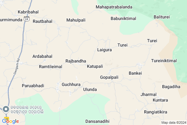
Katupali Map
EDIT Map
Add Your House
 ..
..
Current Corona Virus Infected Patients Count in Sambalpur District
| City Name | District Name | Total Covid cases |
|---|
Locality Name :
Katupali
( କତ୍ତୃପଲି )
Tehsil Name : Kuchinda
District : Sambalpur
State : Odisha
Language : Oriya and Hindi
Current Time 01:09 PM
Date: Tuesday , Apr 29,2025 (IST)
Time zone: IST (UTC+5:30)
Elevation / Altitude: 254 meters. Above Seal level
Telephone Code / Std Code: 06642
Assembly constituency : Kuchinda assembly constituency
Assembly MLA : rabinarayan naik
Lok Sabha constituency : Sambalpur parliamentary constituency
Parliament MP : NITESH GANGA DEB
Serpanch Name :
Pin Code : 768227
Post Office Name : Kusumi
Alternate Village Name : Katupalli
Commodities Prices : Kuchinda Market / Mandi
Katupali Live Weather
Temperature: 39.7 °C
clear sky
Humidity: 15%
Wind : 4.69 mt/sec towards W
StationName : "Kuchinda"
observed on Now
Temperature: 39.7 °C
clear sky
Humidity: 15%
Wind : 4.69 mt/sec towards W
StationName : "Kuchinda"
observed on Now
Katupali Weather Forecast for Next 5 days
30-04-2025
21.4°C to 39.6°C
clear sky, light rain, broken clouds
21.4°C to 39.6°C
clear sky, light rain, broken clouds
01-05-2025
20.9°C to 40.5°C
clear sky, light rain, scattered clouds
20.9°C to 40.5°C
clear sky, light rain, scattered clouds
02-05-2025
21.2°C to 40.5°C
clear sky, light rain, scattered clouds
21.2°C to 40.5°C
clear sky, light rain, scattered clouds
03-05-2025
20.9°C to 39.9°C
few clouds, clear sky, light rain, moderate rain, broken clouds
20.9°C to 39.9°C
few clouds, clear sky, light rain, moderate rain, broken clouds
04-05-2025
21.7°C to 40.1°C
scattered clouds, clear sky, light rain
21.7°C to 40.1°C
scattered clouds, clear sky, light rain
National Highways Reachable To Katupali
Nationa High Way :NH49
Nationa High Way :NH49
Rivers Near Katupali
Matwali
Ib River
Matwali
Ib River
About Katupali
Correct below Info and add more info about KatupaliKatupali is a small Village/hamlet in Kuchinda Tehsil in Sambalpur District of Odisha State, India. It is located 71 KM towards East from District head quarters Sambalpur. 8 KM from Kuchinda. 263 KM from State capital Bhubaneswar
Katupali Pin code is 768227 and postal head office is Kusumi .
Ardabahal ( 7 KM ) , Babuniktimal ( 7 KM ) , Paruabhadi ( 8 KM ) , Kuntara ( 9 KM ) , Tainsar ( 10 KM ) are the nearby Villages to Katupali. Katupali is surrounded by Bamra Tehsil towards North , Laikera Tehsil towards west , Kolabira Tehsil towards west , Jamankira Tehsil towards South .
Kuchinda , Bamra , Rajagangapur , Debagarh are the near by Cities to Katupali.
Katupali 2011 Census Details
Katupali Local Language is Oriya. Katupali Village Total population is 414 and number of houses are 113. Female Population is 49.8%. Village literacy rate is 57.7% and the Female Literacy rate is 24.9%.
Population
| Census Parameter | Census Data |
| Total Population | 414 |
| Total No of Houses | 113 |
| Female Population % | 49.8 % ( 206) |
| Total Literacy rate % | 57.7 % ( 239) |
| Female Literacy rate | 24.9 % ( 103) |
| Scheduled Tribes Population % | 48.1 % ( 199) |
| Scheduled Caste Population % | 35.7 % ( 148) |
| Working Population % | 66.7 % |
| Child(0 -6) Population by 2011 | 50 |
| Girl Child(0 -6) Population % by 2011 | 50.0 % ( 25) |
Katupali Census More Deatils.
Politics in Katupali
BJP , INC are the major political parties in this area.Polling Stations /Booths near Katupali
1)Bandhapali2)Laidaguna-2
3)Laigura-1
4)Goelmundi
5)Dhudipali
HOW TO REACH Katupali
By Rail
There is no railway station near to Katupali in less than 10 km.Colleges near Katupali
Kuchinda College
Address : Kuchinda
Schools in Katupali
Katupali Ps
Address : katupali , kuchinda , sambalpur , Sikkim . PIN- 768227 , Post - Kusumi
Govt Health Centers near Katupali
1) UFWC, AITHAPALI , URBAN FAMILY WELFARE CENTER AINTHAPALI , Aithapali , Near Trafic2) DR.JANARDAN PUJARI MATERNITY HOME SAMBALPUR , JPM SAMBALPUR , GOLEBAZAR , Golebazar
3) Hatibari , , ,
Petrol Bunks in Katupali,Kuchinda
HP PETROL PUMP - GANPATRAI SRIKISHEN
HP Dealer Kuchinda Bamra Post Dist; Kuchinda; Odisha 768222; India
15.8 KM distance Detail
more ..
About Katupali &
History
How to reach Katupali
Tourist Places Near By Katupali
Schools in Katupali
Colleges in Katupali
Temperature & weather of Katupali
places in Katupali
Katupali photos
More Information
How to reach Katupali
Tourist Places Near By Katupali
Schools in Katupali
Colleges in Katupali
Temperature & weather of Katupali
places in Katupali
Katupali photos
More Information
Village Talk
Post News or Events about this Village
Near Cities
Kuchinda 15 KM near
Bamra 32 KM near
Rajagangapur 48 KM near
Debagarh 49 KM near
Kuchinda 15 KM near
Bamra 32 KM near
Rajagangapur 48 KM near
Debagarh 49 KM near
Near By Taluks
Kuchinda 8 KM near
Bamra 25 KM near
Laikera 25 KM near
Kolabira 30 KM near
Kuchinda 8 KM near
Bamra 25 KM near
Laikera 25 KM near
Kolabira 30 KM near
Near By Air Ports
Ranchi Airport 210 KM near
Bhubaneswar Airport 252 KM near
Raipur Airport 324 KM near
Gaya Airport 367 KM near
Ranchi Airport 210 KM near
Bhubaneswar Airport 252 KM near
Raipur Airport 324 KM near
Gaya Airport 367 KM near
Near By Tourist Places
Sambalpur 71 KM near
Rourkela 72 KM near
Hirakud 73 KM near
Simdega 97 KM near
Raigarh 121 KM near
Sambalpur 71 KM near
Rourkela 72 KM near
Hirakud 73 KM near
Simdega 97 KM near
Raigarh 121 KM near
Near By Districts
Deogarh 47 KM near
Jharsuguda 49 KM near
Sundargarh 59 KM near
Sambalpur 68 KM near
Deogarh 47 KM near
Jharsuguda 49 KM near
Sundargarh 59 KM near
Sambalpur 68 KM near
Near By RailWay Station
Bamra Rail Way Station 33 KM near
Rajgangpur Rail Way Station 46 KM near
Bamra Rail Way Station 33 KM near
Rajgangpur Rail Way Station 46 KM near