| Home | City Bus | Maps | Villages | Cities | Rail | Tourist Places | School | College | Pin Codes | Corona Cases Count |
| Distance Calculator Bus Services IFSC Codes Trace Mobile Number Weather Search Place Trace IP Available Cash ATM/Banks Locate Polling Booth Report an Error contact People |
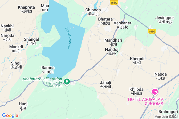
Nandoj
Nandoj Map
EDIT Map
Add Your House
 ..
..
Current Corona Virus Infected Patients Count in Sabar Kantha District
| City Name | District Name | Total Covid cases |
|---|
Locality Name :
Nandoj
( નંદોજ )
Taluka Name : Bhiloda
District : Sabar Kantha
State : Gujarat
Language : Gujarati and Hindi
Current Time 05:31 PM
Date: Monday , Apr 28,2025 (IST)
Time zone: IST (UTC+5:30)
Elevation / Altitude: 190 meters. Above Seal level
Telephone Code / Std Code: 02771
Assembly constituency : Bhiloda assembly constituency
Assembly MLA : P.C.Baranda
Lok Sabha constituency : Sabarkantha parliamentary constituency
Parliament MP : RATHOD DIPSINH SHANKARSINH
Serpanch Name :
Pin Code : 383245
Post Office Name : Bhiloda
Alternate Village Name : Nandoj Dungari
Commodities Prices : Bhiloda Market / Mandi
Nandoj Live Weather
Temperature: 43.3 °C
clear sky
Humidity: 8%
Wind : 6.05 mt/sec towards W
StationName : "Kheradi"
observed on 2 Hours Back
Temperature: 43.3 °C
clear sky
Humidity: 8%
Wind : 6.05 mt/sec towards W
StationName : "Kheradi"
observed on 2 Hours Back
Nandoj Weather Forecast for Next 5 days
29-04-2025
28.6°C to 43.1°C
clear sky
28.6°C to 43.1°C
clear sky
30-04-2025
26.7°C to 44.0°C
clear sky, scattered clouds, few clouds
26.7°C to 44.0°C
clear sky, scattered clouds, few clouds
01-05-2025
27.4°C to 44.0°C
few clouds, clear sky
27.4°C to 44.0°C
few clouds, clear sky
02-05-2025
25.6°C to 43.1°C
clear sky
25.6°C to 43.1°C
clear sky
03-05-2025
25.5°C to 42.7°C
clear sky
25.5°C to 42.7°C
clear sky
National Highways Reachable To Nandoj
Nationa High Way :NH 76A
Nationa High Way :NH48
Nationa High Way :NH 76A
Nationa High Way :NH48
Rivers Near Nandoj
Moran
Meshwa
Moran
Meshwa
About Nandoj
Correct below Info and add more info about NandojNandoj is a Village in Bhiloda Taluka in Sabar Kantha District of Gujarat State, India. It is located 36 KM towards East from District head quarters Himmatnagar. 10 KM from Bhiloda. 92 KM from State capital Gandhinagar
Nandoj Pin code is 383245 and postal head office is Bhiloda .
Vanzar ( 4 KM ) , Khumapur ( 4 KM ) , Bhatera ( 5 KM ) , Kheradi ( 6 KM ) , Bamna ( 6 KM ) are the nearby Villages to Nandoj. Nandoj is surrounded by Modasa Taluka towards South , Himatnagar Taluka towards west , Sabar Kantha Taluka towards west , Idar Taluka towards west .
Modasa , Idar , Himatnagar , Khedbrahma are the near by Cities to Nandoj.
Nandoj 2011 Census Details
Nandoj Local Language is Gujarati. Nandoj Village Total population is 2831 and number of houses are 569. Female Population is 49.2%. Village literacy rate is 67.2% and the Female Literacy rate is 27.3%.
Population
| Census Parameter | Census Data |
| Total Population | 2831 |
| Total No of Houses | 569 |
| Female Population % | 49.2 % ( 1392) |
| Total Literacy rate % | 67.2 % ( 1903) |
| Female Literacy rate | 27.3 % ( 772) |
| Scheduled Tribes Population % | 14.5 % ( 411) |
| Scheduled Caste Population % | 18.1 % ( 513) |
| Working Population % | 47.2 % |
| Child(0 -6) Population by 2011 | 341 |
| Girl Child(0 -6) Population % by 2011 | 46.6 % ( 159) |
Nandoj Census More Deatils.
Politics in Nandoj
Bharatiya Janata Party , BJP , INC are the major political parties in this area.Polling Stations /Booths near Nandoj
1)Bhiloda-9 (gambhirpura)2)Nanasamera
3)Mandepan
4)Ghanti-1
5)Laxmanpura
HOW TO REACH Nandoj
By Rail
There is no railway station near to Nandoj in less than 10 km.Colleges near Nandoj
Aryajyoti Comrs College
Address : Samlaji
Adivasi Arts & Commerce College,bhiloda
Address : Sabarkantha District, Gujarat - 383240
Schools in Nandoj
Kamarba Ashram Sch
Address : nandoj , bhiloda , sabar kantha , Gujarat . PIN- 383245 , Post - Bhiloda
Shankarpura Sch
Address : nandoj , bhiloda , sabar kantha , Gujarat . PIN- 383245 , Post - Bhiloda
Nandoj Sch
Address : nandoj , bhiloda , sabar kantha , Gujarat . PIN- 383245 , Post - Bhiloda
Govt Health Centers near Nandoj
1) Bamna , Primary health centre , BAMNA PHC , Near Bus Stand2) Sadatpura , Sub Centre Sadatpura , ,
3) Vijapur , CHC Vijapur , Opp. Taluka Panchayat , Khatri Kuva
Sub Villages in Nandoj
Hospitals in Nandoj,Bhiloda
Primary Health Centre
Nandoj; Aravalli; SH-143; Vankaner Gambhoi Road; Bhiloda; Bhiloda; Gujarat 383245; India
3.2 KM distance Detail
Primary Health Centre
Adahathrol; Aravalli; SH-143; Vankaner Gambhoi Road; Bhiloda; Bhiloda; Gujarat 383240; India
3.8 KM distance Detail
Primary Health Centre
Vankaner; Aravalli; SH-143; Sabarkadha Road; Bhiloda; Bhiloda; Gujarat 383245; India
6.5 KM distance Detail
more ..
Petrol Bunks in Nandoj,Bhiloda
Essar Petroleum
Gujarat State Highway 145; Bavaliya Torda; Bhiloda; Gujarat 383245; India
8.5 KM distance Detail
HP PETROL PUMP - SHAHID PETROLEUM
Vill. Bhiloda TAL. Bhiloda Dist Sabarkntha; Ahmedabad; Gujarat 383245; India
9.4 KM distance Detail
more ..
Colleges in Nandoj,Bhiloda
Ratanba College of Education Rajendranagar
National Highway No. 8; Rajendranagar Char Rasta; Raigadh; Gujarat 383276; India
12.0 KM distance Detail
more ..
Schools in Nandoj,Bhiloda
Government High School
Nandoj; Aravalli; SH-143; Vankaner Gambhoi Road; Bhiloda; Bhiloda; Gujarat 383245; India
3.5 KM distance Detail
Government Primary School
Nandoj; Aravalli; SH-143; Vankaner Gambhoi Road; Bhiloda; Bhiloda; Gujarat 383245; India
3.5 KM distance Detail
Government Primary School
Adahathrol; Aravalli; SH-143; Vankaner Gambhoi Road; Bhiloda; Bhiloda; Gujarat 383240; India
3.8 KM distance Detail
Electronic Shops in Nandoj,Bhiloda
Chirag Welding works
opp Akar complex;; Idar - Bhiloda Rd; Bhiloda; Gujarat 383245; India
9.7 KM distance Detail
Governement Offices near Nandoj,Bhiloda
Gram Panchyat Office Vankaner
Vankaner; Aravalli; SH-143; Sabarkadha Road; Bhiloda; Bhiloda; Gujarat 383245; India
6.5 KM distance Detail
Gram Panchyat Office Bhailoda Patel Society
Patel Society; Aravalli; SH-10; Sabarkadha Road; Bhiloda; Bhiloda; Gujarat 383245; India
9.9 KM distance Detail
Nayab Karyapalak
Aravalli; SH-10; Sabarkadha Road; Bhiloda; Bhiloda; Gujarat 383245; India
10.1 KM distance Detail
About Nandoj &
History
How to reach Nandoj
Tourist Places Near By Nandoj
Schools in Nandoj
Colleges in Nandoj
Temperature & weather of Nandoj
places in Nandoj
Nandoj photos
More Information
How to reach Nandoj
Tourist Places Near By Nandoj
Schools in Nandoj
Colleges in Nandoj
Temperature & weather of Nandoj
places in Nandoj
Nandoj photos
More Information
Village Talk
Post News or Events about this Village
Near Cities
Modasa 28 KM near
Idar 33 KM near
Himatnagar 33 KM near
Khedbrahma 48 KM near
Modasa 28 KM near
Idar 33 KM near
Himatnagar 33 KM near
Khedbrahma 48 KM near
Near By Taluks
Bhiloda 10 KM near
Modasa 25 KM near
Himatnagar 27 KM near
Sabar Kantha 33 KM near
Bhiloda 10 KM near
Modasa 25 KM near
Himatnagar 27 KM near
Sabar Kantha 33 KM near
Near By Air Ports
Ahmedabad Airport 104 KM near
Dabok Airport 137 KM near
Vadodara Airport 169 KM near
Bhavnagar Airport 269 KM near
Ahmedabad Airport 104 KM near
Dabok Airport 137 KM near
Vadodara Airport 169 KM near
Bhavnagar Airport 269 KM near
Near By Tourist Places
Sabarkantha 34 KM near
Dungarpur 57 KM near
Danta Ambaji 83 KM near
Gandhinagar 88 KM near
Ambaji 91 KM near
Sabarkantha 34 KM near
Dungarpur 57 KM near
Danta Ambaji 83 KM near
Gandhinagar 88 KM near
Ambaji 91 KM near
Near By Districts
Sabar Kantha 34 KM near
Dungarpur 57 KM near
Gandhinagar 88 KM near
Mahesana 95 KM near
Sabar Kantha 34 KM near
Dungarpur 57 KM near
Gandhinagar 88 KM near
Mahesana 95 KM near
Near By RailWay Station
Mahesana Junction Rail Way Station 97 KM near
Unjha Rail Way Station 98 KM near
Mahesana Junction Rail Way Station 97 KM near
Unjha Rail Way Station 98 KM near