| Home | City Bus | Maps | Villages | Cities | Rail | Tourist Places | School | College | Pin Codes | Corona Cases Count |
| Distance Calculator Bus Services IFSC Codes Trace Mobile Number Weather Search Place Trace IP Available Cash ATM/Banks Locate Polling Booth Report an Error contact People |
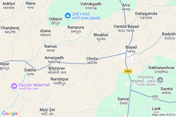
Choila
Choila Map
EDIT Map
Add Your House
 ..
..
Current Corona Virus Infected Patients Count in Sabar Kantha District
| City Name | District Name | Total Covid cases |
|---|
Locality Name :
Choila
( ચોઈલા )
Taluka Name : Bayad
District : Sabar Kantha
State : Gujarat
Language : Gujarati and Hindi
Current Time 11:37 AM
Date: Friday , Mar 14,2025 (IST)
Time zone: IST (UTC+5:30)
Elevation / Altitude: 106 meters. Above Seal level
Telephone Code / Std Code: 02779
Assembly constituency : Bayad assembly constituency
Assembly MLA : Dhavalsinh Narendrasinh Zala
Lok Sabha constituency : Sabarkantha parliamentary constituency
Parliament MP : RATHOD DIPSINH SHANKARSINH
Serpanch Name :
Pin Code : 383327
Post Office Name : Choila
Commodities Prices : Dhansura Market / Mandi
Choila Live Weather
Temperature: 35.4 °C
clear sky
Humidity: 16%
Wind : 4.63 mt/sec towards W
StationName : "Kapadvanj"
observed on now
Temperature: 35.4 °C
clear sky
Humidity: 16%
Wind : 4.63 mt/sec towards W
StationName : "Kapadvanj"
observed on now
Choila Weather Forecast for Next 5 days
15-03-2025
25.1°C to 38.5°C
clear sky
25.1°C to 38.5°C
clear sky
16-03-2025
23.7°C to 38.1°C
clear sky, few clouds
23.7°C to 38.1°C
clear sky, few clouds
17-03-2025
23.1°C to 37.4°C
clear sky
23.1°C to 37.4°C
clear sky
18-03-2025
21.5°C to 35.8°C
clear sky
21.5°C to 35.8°C
clear sky
19-03-2025
21.7°C to 35.8°C
clear sky, few clouds
21.7°C to 35.8°C
clear sky, few clouds
National Highways Reachable To Choila
Nationa High Way :NH147
Nationa High Way :NH48
Nationa High Way :NH147
Nationa High Way :NH48
Rivers Near Choila
Mahi
Meshwa
Mahi
Meshwa
About Choila
Correct below Info and add more info about ChoilaChoila is a Village in Bayad Taluka in Sabar Kantha District of Gujarat State, India. It is located 54 KM towards South from District head quarters Himmatnagar. 7 KM from . 62 KM from State capital Gandhinagar
Choila Pin code is 383327 and postal head office is Choila.
Vasnirel ( 3 KM ) , Amargadh ( 5 KM ) , Vasna Mota ( 5 KM ) , Ramas ( 6 KM ) , Vatrakgadh ( 6 KM ) are the nearby Villages to Choila. Choila is surrounded by Dhansura Taluka towards North , Kapadvanj Taluka towards South , Talod Taluka towards west , Balasinor Taluka towards South .
Kapadvanj , Modasa , Dehgam , Prantij are the near by Cities to Choila.
Choila 2011 Census Details
Choila Local Language is Gujarati. Choila Village Total population is 8648 and number of houses are 1806. Female Population is 48.4%. Village literacy rate is 72.2% and the Female Literacy rate is 31.1%.
Population
| Census Parameter | Census Data |
| Total Population | 8648 |
| Total No of Houses | 1806 |
| Female Population % | 48.4 % ( 4182) |
| Total Literacy rate % | 72.2 % ( 6246) |
| Female Literacy rate | 31.1 % ( 2687) |
| Scheduled Tribes Population % | 0.1 % ( 9) |
| Scheduled Caste Population % | 10.2 % ( 882) |
| Working Population % | 40.8 % |
| Child(0 -6) Population by 2011 | 980 |
| Girl Child(0 -6) Population % by 2011 | 47.1 % ( 462) |
Choila Census More Deatils.
Politics in Choila
Bharatiya Janata Party , BJP , INC are the major political parties in this area.Polling Stations /Booths near Choila
1)Choila-12)Choila-2
3)Choila-3
4)Choila-4
5)Chhapariya
HOW TO REACH Choila
By Rail
Beyad Rail Way Station , Kashipura Rail Way Station are the very nearby railway stations to Choila.Colleges near Choila
Gitanjali Pharmacy College
Address : Gitanjali Pharmacy College, Talod, At. & Po. Talod
Sheth H P Arts & T S M Commerce College, Talod
Address : Talod
Schools in Choila
Choila - 2 Sch
Address : choila , bayad , sabar kantha , Gujarat . PIN- 383327
Choila High & Pra Sch
Address : choila , bayad , sabar kantha , Gujarat . PIN- 383327
Chhapariya Sch
Address : choila , bayad , sabar kantha , Gujarat . PIN- 383327
Choila - 1 Sch
Address : choila , bayad , sabar kantha , Gujarat . PIN- 383327
Govt Health Centers near Choila
1) Lalmandva , Sub Centre Lalmandva , ,2) Sunda , Sub Centre Sunda , ,
3) Kapadvanj , Urban Health Centre Kapadvanj , ,
Sub Villages in Choila
Hospitals in Choila,Bayad
JAY SHIVALIK HOSPITAL AND ICU
GJ SH 69; Giriraj Society; Bayad; Gujarat 383325; India
5.1 KM distance Detail
more ..
Colleges in Choila,Bayad
Giriraj Primary School
State Highway 59; Giriraj Society; Bayad; Gujarat 383325; India
5.1 KM distance Detail
more ..
Schools in Choila,Bayad
Sheth Shree U.G. High School Choila
2; Dahegam-Bayad Road; Bayad; Gujarat 383325; India
1.8 KM distance Detail
Super Markets in Choila,Bayad
Vishwash Super Market
Vallabh Complex; Giriraj Society; Nagrik Bank Society; Bayad; Gujarat 383325; India
5.3 KM distance Detail
Local Parks in Choila,Bayad
BAPA SITARAM FARM
Rakeshbhai panchal NEAR ADALPURA KAMPA ADALPURA KAMPA;Dhansura Aniyod Road Dhansura; District. Arvalli; Gujarat 383315; India
17.5 KM distance Detail
Police Stations near Choila,Bayad
Bayad Police Station
Kapadwanj Road;Bayad; State Highway 59; Bayad; Gujarat 383325; India
5.3 KM distance Detail
Governement Offices near Choila,Bayad
Gram Panchayat - Vasni Rel
vasnirel; Dahegam-Bayad Rd; Bayad; Gujarat 383325; India
3.5 KM distance Detail
About Choila &
History
How to reach Choila
Tourist Places Near By Choila
Schools in Choila
Colleges in Choila
Temperature & weather of Choila
places in Choila
Choila photos
More Information
How to reach Choila
Tourist Places Near By Choila
Schools in Choila
Colleges in Choila
Temperature & weather of Choila
places in Choila
Choila photos
More Information
Village Talk
Post News or Events about this Village
Near Cities
Kapadvanj 26 KM near
Modasa 33 KM near
Dehgam 40 KM near
Prantij 44 KM near
Kapadvanj 26 KM near
Modasa 33 KM near
Dehgam 40 KM near
Prantij 44 KM near
Near By Taluks
Bayad 8 KM near
Dhansura 13 KM near
Kapadvanj 20 KM near
Talod 24 KM near
Bayad 8 KM near
Dhansura 13 KM near
Kapadvanj 20 KM near
Talod 24 KM near
Near By Air Ports
Ahmedabad Airport 65 KM near
Vadodara Airport 111 KM near
Dabok Airport 192 KM near
Bhavnagar Airport 214 KM near
Ahmedabad Airport 65 KM near
Vadodara Airport 111 KM near
Dabok Airport 192 KM near
Bhavnagar Airport 214 KM near
Near By Tourist Places
Sabarkantha 53 KM near
Gandhinagar 58 KM near
Ahmedabad 72 KM near
Kheda 81 KM near
Anand 85 KM near
Sabarkantha 53 KM near
Gandhinagar 58 KM near
Ahmedabad 72 KM near
Kheda 81 KM near
Anand 85 KM near
Near By Districts
Sabar Kantha 51 KM near
Gandhinagar 58 KM near
Ahmadabad 68 KM near
Panch Mahals 76 KM near
Sabar Kantha 51 KM near
Gandhinagar 58 KM near
Ahmadabad 68 KM near
Panch Mahals 76 KM near
Near By RailWay Station
Beyad Rail Way Station 4.5 KM near
Kashipura Rail Way Station 9.3 KM near
Sabarmati Junction Rail Way Station 68 KM near
Mahemdavad Kheda Road Rail Way Station 69 KM near
Beyad Rail Way Station 4.5 KM near
Kashipura Rail Way Station 9.3 KM near
Sabarmati Junction Rail Way Station 68 KM near
Mahemdavad Kheda Road Rail Way Station 69 KM near