| Home | City Bus | Maps | Villages | Cities | Rail | Tourist Places | School | College | Pin Codes | Corona Cases Count |
| Distance Calculator Bus Services IFSC Codes Trace Mobile Number Weather Search Place Trace IP Available Cash ATM/Banks Locate Polling Booth Report an Error contact People |
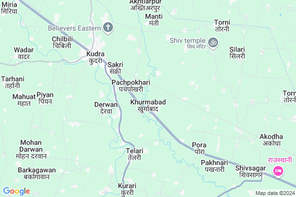
Khurmabad Map
EDIT Map
Add Your House
 ..
..
Current Corona Virus Infected Patients Count in Rohtas District
| City Name | District Name | Total Covid cases |
|---|---|---|
| Rohtas District | Rohtas | 10 |
| Sasaram | Rohtas | 5 |
Locality Name :
Khurmabad
( खुर्माबाद )
Block Name : Chenari
District : Rohtas
State : Bihar
Division : Patna
Language : Maithili and Bhojpuri, Hindi, Urdu
Current Time 06:53 AM
Date: Saturday , Apr 26,2025 (IST)
Time zone: IST (UTC+5:30)
Elevation / Altitude: 140 meters. Above Seal level
Telephone Code / Std Code: 06189
Assembly constituency : Chenari assembly constituency
Assembly MLA : Murari Prasad Gautam
Lok Sabha constituency : Sasaram parliamentary constituency
Parliament MP : CHHEDI PASWAN
Serpanch Name :
Pin Code : 821111
Post Office Name : Sheosagar
Commodities Prices : Jamanian Market / Mandi
Khurmabad Live Weather
Temperature: 29.7 °C
clear sky
Humidity: 9%
Wind : 0.89 mt/sec towards S
StationName : "Bhabhua"
observed on Now
Temperature: 29.7 °C
clear sky
Humidity: 9%
Wind : 0.89 mt/sec towards S
StationName : "Bhabhua"
observed on Now
Khurmabad Weather Forecast for Next 5 days
27-04-2025
30.7°C to 44.5°C
clear sky, broken clouds, scattered clouds, overcast clouds
30.7°C to 44.5°C
clear sky, broken clouds, scattered clouds, overcast clouds
28-04-2025
28.5°C to 42.9°C
overcast clouds, light rain, broken clouds
28.5°C to 42.9°C
overcast clouds, light rain, broken clouds
29-04-2025
26.5°C to 42.1°C
broken clouds, scattered clouds, few clouds, overcast clouds
26.5°C to 42.1°C
broken clouds, scattered clouds, few clouds, overcast clouds
30-04-2025
25.7°C to 39.7°C
overcast clouds, broken clouds, clear sky, scattered clouds
25.7°C to 39.7°C
overcast clouds, broken clouds, clear sky, scattered clouds
01-05-2025
23.7°C to 40.3°C
broken clouds, scattered clouds, few clouds, clear sky
23.7°C to 40.3°C
broken clouds, scattered clouds, few clouds, clear sky
Edit below overview about Khurmabad
Edit below overview about Khurmabad
OverView of Khurmabad
Khurmabad is a historical village. Here a mosque had been built by Khuram Badshah.The remains of the mosque are still here. This is a highly populated village, where Hindus and Muslims live peacefully and harmonical atmosphere. Kudra river passes by the village. This river is very clean. This village is situated on grand trunk road built by Sher Shah Suri, once who ruled on India. This village is on the border of Rohtas and Kaimur district. Late Haricharan Guruji promoted the youth and students of this village into social, cultural, music and drama activities. He was professionally a noted teacher of this village.
khurmabad panchayat office and best of chouhaddi in khurmabad north side railway line soth side of kaimur river west side of brahmanipada border of kaimur east side ebrahimpur village
Edit below overview about Khurmabad
Rivers Near Khurmabad
Punpun
Adri
Punpun
Adri
About Khurmabad
Khurmabad is a Village in Chenari Block in Rohtas District of Bihar State, India. It belongs to Patna Division . It is located 23 KM towards west from District head quarters Sasaram. 14 KM from Chenari. 171 KM from State capital Patna
Khurmabad Pin code is 821111 and postal head office is Sheosagar .
Silari ( 8 KM ) , Dumari ( 11 KM ) , Hata ( 12 KM ) , Bhokhari ( 13 KM ) , Banauli ( 13 KM ) are the nearby Villages to Khurmabad. Khurmabad is surrounded by Sheosagar Block towards East , Chenari Block towards South , Rampur Block towards west , Kargahar Block towards East .
Sasaram , Bhabua , Mohania , Nokha are the near by Cities to Khurmabad.
This Place is in the border of the Rohtas District and Palamu District. Palamu District Haidernagar is South towards this place . Also it is in the Border of other district Garhwa . It is near to the Jharkhand State Border.
Khurmabad 2011 Census Details
Khurmabad Local Language is Maithili. Khurmabad Village Total population is 6555 and number of houses are 1088. Female Population is 50.2%. Village literacy rate is 53.9% and the Female Literacy rate is 24.9%.
Population
| Census Parameter | Census Data |
| Total Population | 6555 |
| Total No of Houses | 1088 |
| Female Population % | 50.2 % ( 3293) |
| Total Literacy rate % | 53.9 % ( 3530) |
| Female Literacy rate | 24.9 % ( 1634) |
| Scheduled Tribes Population % | 0.6 % ( 39) |
| Scheduled Caste Population % | 17.3 % ( 1136) |
| Working Population % | 31.4 % |
| Child(0 -6) Population by 2011 | 1359 |
| Girl Child(0 -6) Population % by 2011 | 47.7 % ( 648) |
Khurmabad Census More Deatils.
Politics in Khurmabad
JD(U) , RLSP , Bharatiya Janata Party , BJP , RJD , INC are the major political parties in this area.Polling Stations /Booths near Khurmabad
1)Kanya Hindi Madhya Vidyalay Khurmabad (pashchimi Bhag)2)Harizan Prathamik Vidyalay Daranagar
3)Madhya Vidyalay Kenarkala
4)Madhya Vidyalay Khurmabad (dakshini Bhag)
5)Uchcha Vidyalay Sadokhar
HOW TO REACH Khurmabad
By Rail
Khurmabad Road Rail Way Station , Kudra Rail Way Station are the very nearby railway stations to Khurmabad. Karwandia Rail Way Station (near to Sasaram) , Sasaram Junction Rail Way Station (near to Sasaram) are the Rail way stations reachable from near by towns.By Road
Sasaram are the nearby by towns to Khurmabad having road connectivity to KhurmabadColleges near Khurmabad
Ram Dulari Ganga High School Chenari
Address :
B.s. College, Chenari
Address : B.s. College, Chenari
Schools in Khurmabad
M.s.,khurmabad
Address : khurmabad , chenari , rohtas , Bihar . PIN- 821104 , Post - Chenari
U.g.p.s.,khurmabad
Address : khurmabad , chenari , rohtas , Bihar . PIN- 821104 , Post - Chenari
Govt Health Centers near Khurmabad
1) Akorha , Akorha , Akorha ,2) Pachpokhri , Pachpokhri , Pachpokhri , Pachpokhri
3) Kudra Hq , Kudra Hq , Kudra Hq , Kudra Hq
Petrol Bunks in Khurmabad,Chenari
HP PETROL PUMP - CHENARI AGRO SERVICES CHENARI HP
HP Petrol Pump Virnagar Chenari; Patna; Bihar 821104; India
12.4 KM distance Detail
Hindustan Petroleum
Chenari; Rohtas; SH-67; Rohtas; Rohtas; Bihar 821104; India
12.7 KM distance Detail
more ..
Colleges in Khurmabad,Chenari
Shakuntalam Institute Of Teacher's Education
Kumhau Station Road; Kirihiri; Bihar 821111; India
13.9 KM distance Detail
more ..
Schools in Khurmabad,Chenari
Government Middle School
Shahapur; Telari; Rohtas; SH-67; Chenari Shivsagar Road; Rohtas; Rohtas; Bihar 821108; India
6.9 KM distance Detail
Electronic Shops in Khurmabad,Chenari
ARPITA MOBILE CENTER
Shivsagar-Bhadrashila Rd; Shivsagar; Bihar 821111; India
11.2 KM distance Detail
Arzoo Mobile Center
Shivsagar-Bhadrashila Rd; Shivsagar; Bihar 821111; India
11.2 KM distance Detail
Governement Offices near Khurmabad,Chenari
JEEViKA;DPCU;Rohtas
2nd Floor; Mehta Tower; Balthua; Beda; Sasaram; Bihar 821115; India
20.4 KM distance Detail
About Khurmabad &
History
How to reach Khurmabad
Tourist Places Near By Khurmabad
Schools in Khurmabad
Colleges in Khurmabad
Temperature & weather of Khurmabad
places in Khurmabad
Khurmabad photos
More Information
How to reach Khurmabad
Tourist Places Near By Khurmabad
Schools in Khurmabad
Colleges in Khurmabad
Temperature & weather of Khurmabad
places in Khurmabad
Khurmabad photos
More Information
Village Talk
Post News or Events about this Village
Near Cities
Sasaram 22 KM near
Bhabua 24 KM near
Mohania 29 KM near
Nokha 33 KM near
Sasaram 22 KM near
Bhabua 24 KM near
Mohania 29 KM near
Nokha 33 KM near
Near By Taluks
Kudra 6 KM near
Sheosagar 12 KM near
Rampur 14 KM near
Chenari 14 KM near
Kudra 6 KM near
Sheosagar 12 KM near
Rampur 14 KM near
Chenari 14 KM near
Near By Air Ports
Varanasi Airport 122 KM near
Gaya Airport 130 KM near
Patna Airport 158 KM near
Gorakhpur Airport 219 KM near
Varanasi Airport 122 KM near
Gaya Airport 130 KM near
Patna Airport 158 KM near
Gorakhpur Airport 219 KM near
Near By Tourist Places
Sasaram 22 KM near
Rohtasgarh Fort 51 KM near
Sarnath 101 KM near
Varanasi 103 KM near
Bodh Gaya 136 KM near
Sasaram 22 KM near
Rohtasgarh Fort 51 KM near
Sarnath 101 KM near
Varanasi 103 KM near
Bodh Gaya 136 KM near
Near By Districts
Rohtas 22 KM near
Kaimur (Bhabua) 25 KM near
Aurangabad 69 KM near
Buxar 70 KM near
Rohtas 22 KM near
Kaimur (Bhabua) 25 KM near
Aurangabad 69 KM near
Buxar 70 KM near
Near By RailWay Station
Khurmabad Road Rail Way Station 2.8 KM near
Kudra Rail Way Station 5.8 KM near
Shiu Sagar Road Rail Way Station 8.2 KM near
Sasaram Junction Rail Way Station 22 KM near
Khurmabad Road Rail Way Station 2.8 KM near
Kudra Rail Way Station 5.8 KM near
Shiu Sagar Road Rail Way Station 8.2 KM near
Sasaram Junction Rail Way Station 22 KM near