| Home | City Bus | Maps | Villages | Cities | Rail | Tourist Places | School | College | Pin Codes | Corona Cases Count |
| Distance Calculator Bus Services IFSC Codes Trace Mobile Number Weather Search Place Trace IP Available Cash ATM/Banks Locate Polling Booth Report an Error contact People |
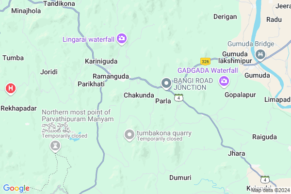
Chakunda
Chakunda Map
EDIT Map
Add Your House
 ..
..
Current Corona Virus Infected Patients Count in Rayagada District
| City Name | District Name | Total Covid cases |
|---|
Locality Name :
Chakunda
( ଛକୁଣ୍ଡ )
Tehsil Name : Ramanaguda
District : Rayagada
State : Odisha
Language : Oriya and Hindi, Telugu
Current Time 05:25 PM
Date: Tuesday , Apr 29,2025 (IST)
Time zone: IST (UTC+5:30)
Elevation / Altitude: 91 meters. Above Seal level
Telephone Code / Std Code: 06862
Assembly constituency : Gunupur assembly constituency
Assembly MLA : trinath gomango
Lok Sabha constituency : Koraput parliamentary constituency
Parliament MP : SAPTAGIRI SANKAR ULAKA
Serpanch Name :
Commodities Prices : Gunpur Market / Mandi
Chakunda Live Weather
Temperature: 33.1 °C
scattered clouds
Humidity: 46%
Wind : 5.92 mt/sec towards S
StationName : "Gunupur"
observed on 13 Mins Back
Temperature: 33.1 °C
scattered clouds
Humidity: 46%
Wind : 5.92 mt/sec towards S
StationName : "Gunupur"
observed on 13 Mins Back
Chakunda Weather Forecast for Next 5 days
30-04-2025
26.3°C to 33.0°C
scattered clouds, light rain, few clouds
26.3°C to 33.0°C
scattered clouds, light rain, few clouds
01-05-2025
23.9°C to 37.0°C
clear sky, few clouds, heavy intensity rain, moderate rain, light rain, broken clouds, scattered clouds
23.9°C to 37.0°C
clear sky, few clouds, heavy intensity rain, moderate rain, light rain, broken clouds, scattered clouds
02-05-2025
22.9°C to 35.1°C
scattered clouds, clear sky, moderate rain, broken clouds
22.9°C to 35.1°C
scattered clouds, clear sky, moderate rain, broken clouds
03-05-2025
23.7°C to 38.1°C
few clouds, clear sky, light rain, scattered clouds
23.7°C to 38.1°C
few clouds, clear sky, light rain, scattered clouds
04-05-2025
23.1°C to 35.7°C
clear sky, light rain, moderate rain, overcast clouds, broken clouds
23.1°C to 35.7°C
clear sky, light rain, moderate rain, overcast clouds, broken clouds
Rivers Near Chakunda
Vamsadhara
Gumma Gedda
Vamsadhara
Gumma Gedda
About Chakunda
Correct below Info and add more info about ChakundaChakunda is a small Village/hamlet in Ramanaguda Tehsil in Rayagada District of Odisha State, India. It is located 34 KM towards East from District head quarters Rayagada. 2 KM from Ramanaguda. 298 KM from State capital Bhubaneswar
Gogupadu ( 5 KM ) , Rekhapadar ( 10 KM ) , Kujendri ( 13 KM ) , Nilamguda ( 13 KM ) , Bhoimada ( 13 KM ) are the nearby Villages to Chakunda. Chakunda is surrounded by Padmapur Tehsil towards East , Gudari Tehsil towards North , Gummalakshmipuram Tehsil towards South , Kolnara Tehsil towards west .
Gunupur , Rayagada , Parvathipuram , Parlakhemundi are the near by Cities to Chakunda.
Chakunda 2011 Census Details
Chakunda Local Language is Oriya. Chakunda Village Total population is 736 and number of houses are 177. Female Population is 52.0%. Village literacy rate is 50.8% and the Female Literacy rate is 24.6%.
Population
| Census Parameter | Census Data |
| Total Population | 736 |
| Total No of Houses | 177 |
| Female Population % | 52.0 % ( 383) |
| Total Literacy rate % | 50.8 % ( 374) |
| Female Literacy rate | 24.6 % ( 181) |
| Scheduled Tribes Population % | 67.4 % ( 496) |
| Scheduled Caste Population % | 1.2 % ( 9) |
| Working Population % | 51.5 % |
| Child(0 -6) Population by 2011 | 112 |
| Girl Child(0 -6) Population % by 2011 | 42.0 % ( 47) |
Chakunda Census More Deatils.
Politics in Chakunda
BJP , BJD , INC are the major political parties in this area.Polling Stations /Booths near Chakunda
1)Primary School Burlendi2)Primary School Goibandh
3)Primary School Tabalaguda
4)Project Upper Pry.school Sargiguda
5)P.u.p. School Sanogorotha
HOW TO REACH Chakunda
By Rail
There is no railway station near to Chakunda in less than 10 km.Pincodes near Chakunda
765024 ( Ukkamba ) , 765029 ( Ramanaguda ) , 765023 ( Kujendri )Colleges near Chakunda
Draupadi Junior College
Address : Gumuda
Schools near Chakunda
Primary School , Dumburiguda
Address : via- Kujendri
po- Omidingi
Govt Health Centers near Chakunda
1) SC-Judo , Judo, Sub-Center , Sahada Sector , Judo2) SC-Akhusingi , , ,
3) Asana , Sub centre building , Kotpad ,
Hospitals in Chakunda,Ramanaguda
Community Health Center
Ramanaguda; Rayagada; SH-4; Rayagada Koraput Road; Gunupur; Gunupur; Odisha 765029; India
2.4 KM distance Detail
Ramanagouda Hospital
Rayagada; SH-4; Ramanaguda; Ramanaguda; Odisha 765001; India
2.4 KM distance Detail
more ..
About Chakunda &
History
How to reach Chakunda
Tourist Places Near By Chakunda
Schools in Chakunda
Colleges in Chakunda
Temperature & weather of Chakunda
places in Chakunda
Chakunda photos
More Information
How to reach Chakunda
Tourist Places Near By Chakunda
Schools in Chakunda
Colleges in Chakunda
Temperature & weather of Chakunda
places in Chakunda
Chakunda photos
More Information
Village Talk
Post News or Events about this Village
Near Cities
Gunupur 20 KM near
Rayagada 33 KM near
Parvathipuram 60 KM near
Parlakhemundi 78 KM near
Gunupur 20 KM near
Rayagada 33 KM near
Parvathipuram 60 KM near
Parlakhemundi 78 KM near
Near By Taluks
Ramanaguda 1 KM near
Padmapur 19 KM near
Gudari 24 KM near
Gummalakshmipuram 24 KM near
Ramanaguda 1 KM near
Padmapur 19 KM near
Gudari 24 KM near
Gummalakshmipuram 24 KM near
Near By Air Ports
Vishakhapatnam Airport 191 KM near
Bhubaneswar Airport 281 KM near
Raipur Airport 336 KM near
Rajahmundry Airport 341 KM near
Vishakhapatnam Airport 191 KM near
Bhubaneswar Airport 281 KM near
Raipur Airport 336 KM near
Rajahmundry Airport 341 KM near
Near By Tourist Places
Kalahandi 102 KM near
Berhampur 130 KM near
Jeypore 138 KM near
Vizayanagaram 140 KM near
Gopalpur 143 KM near
Kalahandi 102 KM near
Berhampur 130 KM near
Jeypore 138 KM near
Vizayanagaram 140 KM near
Gopalpur 143 KM near
Near By Districts
Rayagada 33 KM near
Gajapati 50 KM near
Kalahandi 108 KM near
Srikakulam 115 KM near
Rayagada 33 KM near
Gajapati 50 KM near
Kalahandi 108 KM near
Srikakulam 115 KM near
Near By RailWay Station
Rayagada Rail Way Station 33 KM near
Singapur Road Rail Way Station 34 KM near
Rayagada Rail Way Station 33 KM near
Singapur Road Rail Way Station 34 KM near