| Home | City Bus | Maps | Villages | Cities | Rail | Tourist Places | School | College | Pin Codes | Corona Cases Count |
| Distance Calculator Bus Services IFSC Codes Trace Mobile Number Weather Search Place Trace IP Available Cash ATM/Banks Locate Polling Booth Report an Error contact People |
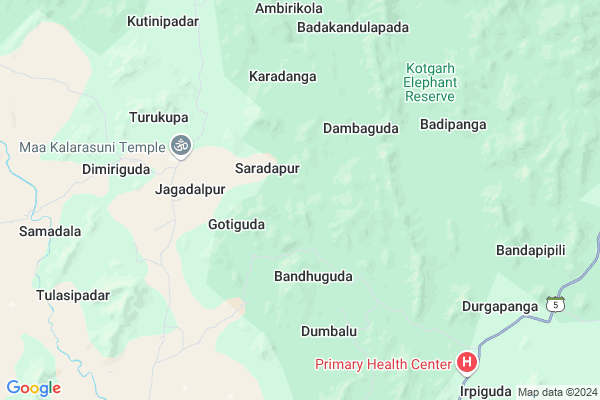
Bamuni Map
EDIT Map
Add Your House
 ..
..
Current Corona Virus Infected Patients Count in Rayagada District
| City Name | District Name | Total Covid cases |
|---|
Locality Name :
Bamuni
( ବାମୁଣୀ )
Tehsil Name : Muniguda
District : Rayagada
State : Odisha
Language : Oriya and Hindi, Telugu
Current Time 05:42 PM
Date: Saturday , Apr 26,2025 (IST)
Time zone: IST (UTC+5:30)
Elevation / Altitude: 335 meters. Above Seal level
Telephone Code / Std Code: 06848
Assembly constituency : Bissam Cuttack assembly constituency
Assembly MLA : jagannath saraka
Lok Sabha constituency : Koraput parliamentary constituency
Parliament MP : SAPTAGIRI SANKAR ULAKA
Serpanch Name :
Pin Code : 765020
Post Office Name : Muniguda
Commodities Prices : Rayagada(Muniguda) Market / Mandi
Bamuni Live Weather
Temperature: 27.1 °C
heavy intensity rain
Humidity: 53%
Wind : 2.63 mt/sec towards E
Rain : null
StationName : "BhawÄ\u0081nipatna"
observed on Now
Temperature: 27.1 °C
heavy intensity rain
Humidity: 53%
Wind : 2.63 mt/sec towards E
Rain : null
StationName : "BhawÄ\u0081nipatna"
observed on Now
Bamuni Weather Forecast for Next 5 days
27-04-2025
24.6°C to 26.3°C
broken clouds, overcast clouds
24.6°C to 26.3°C
broken clouds, overcast clouds
28-04-2025
24.5°C to 36.5°C
overcast clouds, broken clouds
24.5°C to 36.5°C
overcast clouds, broken clouds
29-04-2025
23.4°C to 39.1°C
scattered clouds, clear sky, broken clouds, few clouds
23.4°C to 39.1°C
scattered clouds, clear sky, broken clouds, few clouds
30-04-2025
22.2°C to 38.3°C
clear sky, light rain, broken clouds
22.2°C to 38.3°C
clear sky, light rain, broken clouds
01-05-2025
20.9°C to 39.7°C
scattered clouds, few clouds, light rain, overcast clouds, broken clouds, clear sky
20.9°C to 39.7°C
scattered clouds, few clouds, light rain, overcast clouds, broken clouds, clear sky
National Highways Reachable To Bamuni
Nationa High Way :NH130C
Nationa High Way :NH130C
Rivers Near Bamuni
Indravati
Vamsadhara
Indravati
Vamsadhara
About Bamuni
Correct below Info and add more info about BamuniBamuni is a small Village/hamlet in Muniguda Tehsil in Rayagada District of Odisha State, India. It is located 79 KM towards North from District head quarters Rayagada. 13 KM from Muniguda. 283 KM from State capital Bhubaneswar
Bamuni Pin code is 765020 and postal head office is Muniguda .
Sibapadar ( 13 KM ) , Telengapadar ( 14 KM ) , Paikaranipinda ( 16 KM ) , Munikhol ( 16 KM ) are the nearby Villages to Bamuni. Bamuni is surrounded by Kotagarh Tehsil towards East , Chandrapur Tehsil towards South , Tumudibandh Tehsil towards North , Lanjigarh Tehsil towards west .
Bhawanipatna , Rayagada , Titlagarh , Gunupur are the near by Cities to Bamuni.
This Place is in the border of the Rayagada District and Kalahandi District. Kalahandi District Lanjigarh is west towards this place .
Bamuni 2011 Census Details
Bamuni Local Language is Oriya. Bamuni Village Total population is 59 and number of houses are 15. Female Population is 52.5%. Village literacy rate is 16.9% and the Female Literacy rate is 3.4%.
Population
| Census Parameter | Census Data |
| Total Population | 59 |
| Total No of Houses | 15 |
| Female Population % | 52.5 % ( 31) |
| Total Literacy rate % | 16.9 % ( 10) |
| Female Literacy rate | 3.4 % ( 2) |
| Scheduled Tribes Population % | 100.0 % ( 59) |
| Scheduled Caste Population % | 0.0 % ( 0) |
| Working Population % | 55.9 % |
| Child(0 -6) Population by 2011 | 11 |
| Girl Child(0 -6) Population % by 2011 | 36.4 % ( 4) |
Bamuni Census More Deatils.
Politics in Bamuni
BJD , INC are the major political parties in this area.Polling Stations /Booths near Bamuni
1)Primary School Gopikankubadi2)Project Upper Primary School Gobordhan
3)Up Graded High School Paikaranipinda
4)Primary School Bandhakaranja
5)Up-graded Upper Primary School Patraguda
HOW TO REACH Bamuni
By Rail
There is no railway station near to Bamuni in less than 10 km.Colleges near Bamuni
Muniguda College
Address : Muniguda, Berhampur-760007.
Schools near Bamuni
Govt Health Centers near Bamuni
1) Lanjigarh Road SC , LANJIGARH ROAD , LANJIGARH ROAD , Near PHC (N) Lanjigarh road2) SC-Kuruli , Kurli , Sub-Center , Chatikona Sector , PHC (N) Khambesi
3) Rutungia , Subcenter Rutungia , , Near Rutungia Seva Ashrama School
Petrol Bunks in Bamuni,Muniguda
K Bhima Raju and Sons Filling Station Indian Oil Petrol Pump
Muniguda; Rayagada; SH-5; Jaykaypur Tumudibandha Road; Raigarh; Raigarh; Odisha 765020; India
19.6 KM distance Detail
more ..
Super Markets in Bamuni,Muniguda
Shidi Ganesh General Store
Rayagada-Bhawanipatna Rd; Ambodala; Odisha 765021; India
19.6 KM distance Detail
Local Parks in Bamuni,Muniguda
About Bamuni &
History
How to reach Bamuni
Tourist Places Near By Bamuni
Schools in Bamuni
Colleges in Bamuni
Temperature & weather of Bamuni
places in Bamuni
Bamuni photos
More Information
How to reach Bamuni
Tourist Places Near By Bamuni
Schools in Bamuni
Colleges in Bamuni
Temperature & weather of Bamuni
places in Bamuni
Bamuni photos
More Information
Village Talk
Post News or Events about this Village
Near Cities
Bhawanipatna 54 KM near
Rayagada 74 KM near
Titlagarh 85 KM near
Gunupur 86 KM near
Bhawanipatna 54 KM near
Rayagada 74 KM near
Titlagarh 85 KM near
Gunupur 86 KM near
Near By Taluks
Muniguda 12 KM near
Kotagarh 27 KM near
Chandrapur 28 KM near
Lanjigarh 29 KM near
Muniguda 12 KM near
Kotagarh 27 KM near
Chandrapur 28 KM near
Lanjigarh 29 KM near
Near By Air Ports
Vishakhapatnam Airport 255 KM near
Bhubaneswar Airport 268 KM near
Raipur Airport 280 KM near
Rajahmundry Airport 389 KM near
Vishakhapatnam Airport 255 KM near
Bhubaneswar Airport 268 KM near
Raipur Airport 280 KM near
Rajahmundry Airport 389 KM near
Near By Tourist Places
Kalahandi 51 KM near
Phulbani 117 KM near
Berhampur 151 KM near
Jeypore 163 KM near
Gopalpur 166 KM near
Kalahandi 51 KM near
Phulbani 117 KM near
Berhampur 151 KM near
Jeypore 163 KM near
Gopalpur 166 KM near
Near By Districts
Kalahandi 54 KM near
Rayagada 75 KM near
Gajapati 92 KM near
Kandhamal 118 KM near
Kalahandi 54 KM near
Rayagada 75 KM near
Gajapati 92 KM near
Kandhamal 118 KM near
Near By RailWay Station
Ambodala Rail Way Station 18 KM near
Muniguda Rail Way Station 19 KM near
Ambodala Rail Way Station 18 KM near
Muniguda Rail Way Station 19 KM near