| Home | City Bus | Maps | Villages | Cities | Rail | Tourist Places | School | College | Pin Codes | Corona Cases Count |
| Distance Calculator Bus Services IFSC Codes Trace Mobile Number Weather Search Place Trace IP Available Cash ATM/Banks Locate Polling Booth Report an Error contact People |
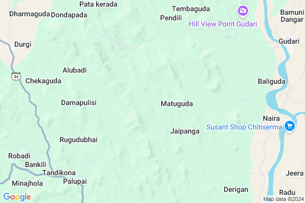
Gunjuguda Map
EDIT Map
Add Your House
 ..
..
Current Corona Virus Infected Patients Count in Rayagada District
| City Name | District Name | Total Covid cases |
|---|
Locality Name :
Gunjuguda
( ଗୁଞ୍ଜୁଗୁଡା )
Tehsil Name : Gudari
District : Rayagada
State : Odisha
Language : Oriya and Hindi, Telugu
Current Time 09:29 AM
Date: Thursday , Apr 24,2025 (IST)
Time zone: IST (UTC+5:30)
Elevation / Altitude: 91 meters. Above Seal level
Telephone Code / Std Code: 06862
Assembly constituency : Gunupur assembly constituency
Assembly MLA : trinath gomango
Lok Sabha constituency : Koraput parliamentary constituency
Parliament MP : SAPTAGIRI SANKAR ULAKA
Serpanch Name :
Pin Code : 765024
Post Office Name : Ukkamba
Commodities Prices : Gunpur Market / Mandi
Gunjuguda Live Weather
Temperature: 35.7 °C
clear sky
Humidity: 34%
Wind : 2.24 mt/sec towards S
StationName : "GudÄ\u0081ri"
observed on Now
Temperature: 35.7 °C
clear sky
Humidity: 34%
Wind : 2.24 mt/sec towards S
StationName : "GudÄ\u0081ri"
observed on Now
Gunjuguda Weather Forecast for Next 5 days
25-04-2025
26.1°C to 40.4°C
few clouds, scattered clouds, broken clouds, clear sky
26.1°C to 40.4°C
few clouds, scattered clouds, broken clouds, clear sky
26-04-2025
24.7°C to 42.7°C
clear sky, few clouds
24.7°C to 42.7°C
clear sky, few clouds
27-04-2025
24.6°C to 38.7°C
clear sky, light rain, broken clouds
24.6°C to 38.7°C
clear sky, light rain, broken clouds
28-04-2025
24.3°C to 39.0°C
broken clouds, scattered clouds, light rain
24.3°C to 39.0°C
broken clouds, scattered clouds, light rain
29-04-2025
23.6°C to 36.7°C
broken clouds, few clouds, clear sky, light rain, overcast clouds, scattered clouds
23.6°C to 36.7°C
broken clouds, few clouds, clear sky, light rain, overcast clouds, scattered clouds
Rivers Near Gunjuguda
Vamsadhara
Nagarvali
Vamsadhara
Nagarvali
About Gunjuguda
Correct below Info and add more info about GunjugudaGunjuguda is a small Village/hamlet in Gudari Tehsil in Rayagada District of Odisha State, India. It is located 38 KM towards East from District head quarters Rayagada. 14 KM from Gudari. 291 KM from State capital Bhubaneswar
Gunjuguda Pin code is 765024 and postal head office is Ukkamba .
Ramanaguda ( 10 KM ) , Sanahuma ( 11 KM ) , Durgi ( 12 KM ) , Gudari ( 12 KM ) , Gudiabandha ( 14 KM ) are the nearby Villages to Gunjuguda. Gunjuguda is surrounded by Ramanaguda Tehsil towards South , Padmapur Tehsil towards East , Kolnara Tehsil towards west , Bissamcuttack Tehsil towards North .
Gunupur , Rayagada , Parvathipuram , Parlakhemundi are the near by Cities to Gunjuguda.
Gunjuguda 2011 Census Details
Gunjuguda Local Language is Oriya. Gunjuguda Village Total population is 132 and number of houses are 24. Female Population is 53.8%. Village literacy rate is 1.5% and the Female Literacy rate is 0.0%.
Population
| Census Parameter | Census Data |
| Total Population | 132 |
| Total No of Houses | 24 |
| Female Population % | 53.8 % ( 71) |
| Total Literacy rate % | 1.5 % ( 2) |
| Female Literacy rate | 0.0 % ( 0) |
| Scheduled Tribes Population % | 100.0 % ( 132) |
| Scheduled Caste Population % | 0.0 % ( 0) |
| Working Population % | 79.5 % |
| Child(0 -6) Population by 2011 | 20 |
| Girl Child(0 -6) Population % by 2011 | 35.0 % ( 7) |
Gunjuguda Census More Deatils.
Politics in Gunjuguda
BJP , BJD , INC are the major political parties in this area.Polling Stations /Booths near Gunjuguda
1)Primary School Hemburu2)Primary School Chandrapur
3)Primary School .i.o.b. Colony Padmapur
4)Project Upper Pry.school Birisa
5)Up-graded Upper Primary School Meringi
HOW TO REACH Gunjuguda
By Rail
There is no railway station near to Gunjuguda in less than 10 km.Colleges near Gunjuguda
Ma College Arts Kashipur
Address :
Centre For World Education Service
Address : Centre For World Education Service , Raniguda Far
Draupadi Junior College
Address : Gumuda
Institute Of Advanced Computer & Research
Address : Prajukti Vihar, Aurobindo Marg, Rayagada - 765 00
Majhighariani Institute Of Technology & Science
Address : Rayagada - 765017
Schools near Gunjuguda
Govt Health Centers near Gunjuguda
1) SC-Akhusingi , , ,2) SC-Judo , Judo, Sub-Center , Sahada Sector , Judo
3) SC-Seriguma , Seriguma SC , , Near GPO Office
Hospitals in Gunjuguda,Gudari
Ramanagouda Hospital
Rayagada; SH-4; Ramanaguda; Ramanaguda; Odisha 765001; India
12.8 KM distance Detail
more ..
About Gunjuguda &
History
How to reach Gunjuguda
Tourist Places Near By Gunjuguda
Schools in Gunjuguda
Colleges in Gunjuguda
Temperature & weather of Gunjuguda
places in Gunjuguda
Gunjuguda photos
More Information
How to reach Gunjuguda
Tourist Places Near By Gunjuguda
Schools in Gunjuguda
Colleges in Gunjuguda
Temperature & weather of Gunjuguda
places in Gunjuguda
Gunjuguda photos
More Information
Village Talk
Post News or Events about this Village
Near Cities
Gunupur 31 KM near
Rayagada 37 KM near
Parvathipuram 72 KM near
Parlakhemundi 87 KM near
Gunupur 31 KM near
Rayagada 37 KM near
Parvathipuram 72 KM near
Parlakhemundi 87 KM near
Near By Taluks
Gudari 14 KM near
Ramanaguda 15 KM near
Padmapur 19 KM near
Kolnara 25 KM near
Gudari 14 KM near
Ramanaguda 15 KM near
Padmapur 19 KM near
Kolnara 25 KM near
Near By Air Ports
Vishakhapatnam Airport 204 KM near
Bhubaneswar Airport 275 KM near
Raipur Airport 326 KM near
Rajahmundry Airport 352 KM near
Vishakhapatnam Airport 204 KM near
Bhubaneswar Airport 275 KM near
Raipur Airport 326 KM near
Rajahmundry Airport 352 KM near
Near By Tourist Places
Kalahandi 91 KM near
Berhampur 129 KM near
Gopalpur 142 KM near
Jeypore 143 KM near
Vizayanagaram 153 KM near
Kalahandi 91 KM near
Berhampur 129 KM near
Gopalpur 142 KM near
Jeypore 143 KM near
Vizayanagaram 153 KM near
Near By Districts
Rayagada 37 KM near
Gajapati 52 KM near
Kalahandi 97 KM near
Srikakulam 128 KM near
Rayagada 37 KM near
Gajapati 52 KM near
Kalahandi 97 KM near
Srikakulam 128 KM near
Near By RailWay Station
Therubali Rail Way Station 32 KM near
Singapur Road Rail Way Station 34 KM near
Therubali Rail Way Station 32 KM near
Singapur Road Rail Way Station 34 KM near