| Home | City Bus | Maps | Villages | Cities | Rail | Tourist Places | School | College | Pin Codes | Corona Cases Count |
| Distance Calculator Bus Services IFSC Codes Trace Mobile Number Weather Search Place Trace IP Available Cash ATM/Banks Locate Polling Booth Report an Error contact People |
Kutama
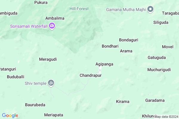
Kutama Map
EDIT Map
Add Your House
 ..
..
Current Corona Virus Infected Patients Count in Rayagada District
| City Name | District Name | Total Covid cases |
|---|
Locality Name :
Kutama
( କୁଟମ )
Tehsil Name : Chandrapur
District : Rayagada
State : Odisha
Language : Oriya and Hindi, Telugu
Current Time 05:33 PM
Date: Saturday , Apr 26,2025 (IST)
Time zone: IST (UTC+5:30)
Elevation / Altitude: 335 meters. Above Seal level
Telephone Code / Std Code: 06862
Assembly constituency : Gunupur assembly constituency
Assembly MLA : trinath gomango
Lok Sabha constituency : Koraput parliamentary constituency
Parliament MP : SAPTAGIRI SANKAR ULAKA
Serpanch Name :
Pin Code : 765020
Post Office Name : Muniguda
Commodities Prices : Bampada Market / Mandi
Rivers Near Kutama
Nagavali
Vamsadhara
Nagavali
Vamsadhara
About Kutama
Correct below Info and add more info about KutamaKutama is a small Village/hamlet in Chandrapur Tehsil in Rayagada District of Odisha State, India. It is located 80 KM towards North from District head quarters Rayagada. 15 KM from Chandrapur. 255 KM from State capital Bhubaneswar
Kutama Pin code is 765020 and postal head office is Muniguda .
Kutama is surrounded by Kotagarh Tehsil towards North , Gudari Tehsil towards South , Daringibadi Tehsil towards North , Bissamcuttack Tehsil towards west .
Gunupur , Rayagada , Bhawanipatna , Asika are the near by Cities to Kutama.
Kutama 2011 Census Details
Kutama Local Language is Oriya. Kutama Village Total population is 388 and number of houses are 78. Female Population is 57.5%. Village literacy rate is 39.2% and the Female Literacy rate is 18.6%.
Population
| Census Parameter | Census Data |
| Total Population | 388 |
| Total No of Houses | 78 |
| Female Population % | 57.5 % ( 223) |
| Total Literacy rate % | 39.2 % ( 152) |
| Female Literacy rate | 18.6 % ( 72) |
| Scheduled Tribes Population % | 75.8 % ( 294) |
| Scheduled Caste Population % | 23.7 % ( 92) |
| Working Population % | 40.7 % |
| Child(0 -6) Population by 2011 | 76 |
| Girl Child(0 -6) Population % by 2011 | 65.8 % ( 50) |
Kutama Census More Deatils.
Politics in Kutama
BJP , BJD , INC are the major political parties in this area.Polling Stations /Booths near Kutama
1)D.p.e.p. Primary School Buthingi2)Primary School Chakunda
3)Upper Primary School Marichaguda
4)Project Upper Pry. School Pandarakhal
5)Residential Sevashram Landasin Laxmipur
HOW TO REACH Kutama
By Rail
There is no railway station near to Kutama in less than 10 km.Colleges near Kutama
Ma College Arts Kashipur
Address :
Centre For World Education Service
Address : Centre For World Education Service , Raniguda Far
Draupadi Junior College
Address : Gumuda
Institute Of Advanced Computer & Research
Address : Prajukti Vihar, Aurobindo Marg, Rayagada - 765 00
Majhighariani Institute Of Technology & Science
Address : Rayagada - 765017
Schools near Kutama
Govt Health Centers near Kutama
1) SC-Akhusingi , , ,2) Rutungia , Subcenter Rutungia , , Near Rutungia Seva Ashrama School
3) SC-Judo , Judo, Sub-Center , Sahada Sector , Judo
Super Markets in Kutama,Chandrapur
Local Parks in Kutama,Chandrapur
Police Stations near Kutama,Chandrapur
Governement Offices near Kutama,Chandrapur
About Kutama &
History
How to reach Kutama
Tourist Places Near By Kutama
Schools in Kutama
Colleges in Kutama
Temperature & weather of Kutama
places in Kutama
Kutama photos
More Information
How to reach Kutama
Tourist Places Near By Kutama
Schools in Kutama
Colleges in Kutama
Temperature & weather of Kutama
places in Kutama
Kutama photos
More Information
Village Talk
Post News or Events about this Village
Near Cities
Gunupur 65 KM near
Rayagada 76 KM near
Bhawanipatna 91 KM near
Asika 91 KM near
Gunupur 65 KM near
Rayagada 76 KM near
Bhawanipatna 91 KM near
Asika 91 KM near
Near By Taluks
Chandrapur 14 KM near
Kotagarh 24 KM near
Gudari 31 KM near
Daringibadi 39 KM near
Chandrapur 14 KM near
Kotagarh 24 KM near
Gudari 31 KM near
Daringibadi 39 KM near
Near By Air Ports
Bhubaneswar Airport 241 KM near
Vishakhapatnam Airport 246 KM near
Raipur Airport 316 KM near
Rajahmundry Airport 394 KM near
Bhubaneswar Airport 241 KM near
Vishakhapatnam Airport 246 KM near
Raipur Airport 316 KM near
Rajahmundry Airport 394 KM near
Near By Tourist Places
Kalahandi 88 KM near
Berhampur 114 KM near
Phulbani 115 KM near
Gopalpur 129 KM near
Chilika 163 KM near
Kalahandi 88 KM near
Berhampur 114 KM near
Phulbani 115 KM near
Gopalpur 129 KM near
Chilika 163 KM near
Near By Districts
Gajapati 58 KM near
Rayagada 77 KM near
Kalahandi 91 KM near
Kandhamal 116 KM near
Gajapati 58 KM near
Rayagada 77 KM near
Kalahandi 91 KM near
Kandhamal 116 KM near
Near By RailWay Station
Muniguda Rail Way Station 44 KM near
Ambodala Rail Way Station 55 KM near
Muniguda Rail Way Station 44 KM near
Ambodala Rail Way Station 55 KM near