| Home | City Bus | Maps | Villages | Cities | Rail | Tourist Places | School | College | Pin Codes | Corona Cases Count |
| Distance Calculator Bus Services IFSC Codes Trace Mobile Number Weather Search Place Trace IP Available Cash ATM/Banks Locate Polling Booth Report an Error contact People |
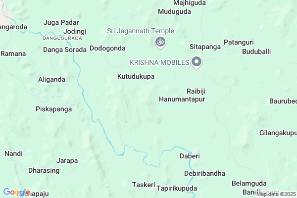
Jambakhal
Jambakhal Map
EDIT Map
Add Your House
 ..
..
Current Corona Virus Infected Patients Count in Rayagada District
| City Name | District Name | Total Covid cases |
|---|
Locality Name :
Jambakhal
( ଜାମ୍ବଖାଲ )
Tehsil Name : Chandrapur
District : Rayagada
State : Odisha
Language : Oriya and Hindi, Telugu
Current Time 05:38 PM
Date: Saturday , Apr 26,2025 (IST)
Time zone: IST (UTC+5:30)
Elevation / Altitude: 335 meters. Above Seal level
Telephone Code / Std Code: 06862
Assembly constituency : Gunupur assembly constituency
Assembly MLA : trinath gomango
Lok Sabha constituency : Koraput parliamentary constituency
Parliament MP : SAPTAGIRI SANKAR ULAKA
Serpanch Name :
Pin Code : 765020
Post Office Name : Muniguda
Commodities Prices : Rayagada(Muniguda) Market / Mandi
Rivers Near Jambakhal
Nagavali
Vamsadhara
Nagavali
Vamsadhara
About Jambakhal
Correct below Info and add more info about JambakhalJambakhal is a small Village/hamlet in Chandrapur Tehsil in Rayagada District of Odisha State, India. It is located 63 KM towards North from District head quarters Rayagada. 4 KM from Chandrapur. 276 KM from State capital Bhubaneswar
Jambakhal Pin code is 765020 and postal head office is Muniguda .
Buduballi ( 9 KM ) , Karlaghati ( 12 KM ) , Telengapadar ( 15 KM ) , Dukum ( 16 KM ) are the nearby Villages to Jambakhal. Jambakhal is surrounded by Bissamcuttack Tehsil towards west , Gudari Tehsil towards South , Muniguda Tehsil towards west , Kotagarh Tehsil towards North .
Rayagada , Gunupur , Bhawanipatna , Parvathipuram are the near by Cities to Jambakhal.
Demographics of Jambakhal
Oriya is the Local Language here.Politics in Jambakhal
BJP , BJD , INC are the major political parties in this area.Polling Stations /Booths near Jambakhal
1)Up-graded M.e. School Turiguda2)Sevashram Bharsing
3)Upper Primary School Tapirikupuda
4)Upper Primary School Pradhaniguda
5)Project Upper Pry. School Bandiri
HOW TO REACH Jambakhal
By Rail
There is no railway station near to Jambakhal in less than 10 km.Colleges near Jambakhal
Ma College Arts Kashipur
Address :
Centre For World Education Service
Address : Centre For World Education Service , Raniguda Far
Draupadi Junior College
Address : Gumuda
Institute Of Advanced Computer & Research
Address : Prajukti Vihar, Aurobindo Marg, Rayagada - 765 00
Majhighariani Institute Of Technology & Science
Address : Rayagada - 765017
Schools near Jambakhal
Govt Health Centers near Jambakhal
1) SC-Akhusingi , , ,2) SC-Judo , Judo, Sub-Center , Sahada Sector , Judo
3) SC-Kuruli , Kurli , Sub-Center , Chatikona Sector , PHC (N) Khambesi
Super Markets in Jambakhal,Chandrapur
Local Parks in Jambakhal,Chandrapur
Police Stations near Jambakhal,Chandrapur
Governement Offices near Jambakhal,Chandrapur
About Jambakhal &
History
How to reach Jambakhal
Tourist Places Near By Jambakhal
Schools in Jambakhal
Colleges in Jambakhal
Temperature & weather of Jambakhal
places in Jambakhal
Jambakhal photos
More Information
How to reach Jambakhal
Tourist Places Near By Jambakhal
Schools in Jambakhal
Colleges in Jambakhal
Temperature & weather of Jambakhal
places in Jambakhal
Jambakhal photos
More Information
Village Talk
Post News or Events about this Village
Near Cities
Rayagada 59 KM near
Gunupur 60 KM near
Bhawanipatna 77 KM near
Parvathipuram 102 KM near
Rayagada 59 KM near
Gunupur 60 KM near
Bhawanipatna 77 KM near
Parvathipuram 102 KM near
Near By Taluks
Chandrapur 4 KM near
Bissamcuttack 21 KM near
Gudari 26 KM near
Muniguda 28 KM near
Chandrapur 4 KM near
Bissamcuttack 21 KM near
Gudari 26 KM near
Muniguda 28 KM near
Near By Air Ports
Vishakhapatnam Airport 235 KM near
Bhubaneswar Airport 261 KM near
Raipur Airport 306 KM near
Rajahmundry Airport 378 KM near
Vishakhapatnam Airport 235 KM near
Bhubaneswar Airport 261 KM near
Raipur Airport 306 KM near
Rajahmundry Airport 378 KM near
Near By Tourist Places
Kalahandi 73 KM near
Phulbani 129 KM near
Berhampur 130 KM near
Gopalpur 145 KM near
Jeypore 160 KM near
Kalahandi 73 KM near
Phulbani 129 KM near
Berhampur 130 KM near
Gopalpur 145 KM near
Jeypore 160 KM near
Near By Districts
Rayagada 60 KM near
Gajapati 65 KM near
Kalahandi 78 KM near
Kandhamal 130 KM near
Rayagada 60 KM near
Gajapati 65 KM near
Kalahandi 78 KM near
Kandhamal 130 KM near
Near By RailWay Station
Muniguda Rail Way Station 27 KM near
Ambodala Rail Way Station 44 KM near
Muniguda Rail Way Station 27 KM near
Ambodala Rail Way Station 44 KM near