| Home | City Bus | Maps | Villages | Cities | Rail | Tourist Places | School | College | Pin Codes | Corona Cases Count |
| Distance Calculator Bus Services IFSC Codes Trace Mobile Number Weather Search Place Trace IP Available Cash ATM/Banks Locate Polling Booth Report an Error contact People |
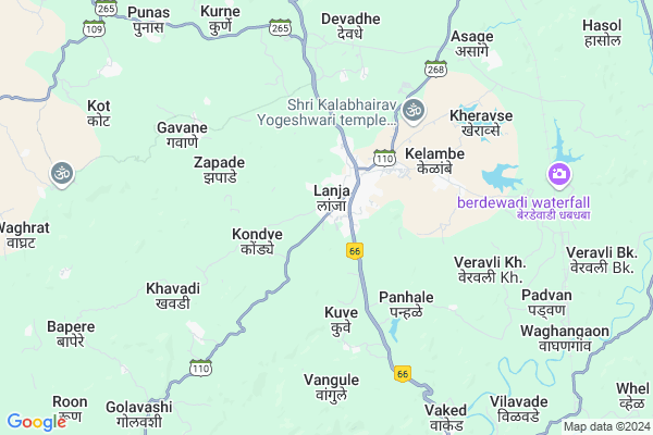
Patharwadi
Patharwadi Map
EDIT Map
Add Your House
 ..
..
Current Corona Virus Infected Patients Count in Ratnagiri District
| City Name | District Name | Total Covid cases |
|---|---|---|
| Ratnagiri District | Ratnagiri | 7 |
| Shrungartali | Ratnagiri | 1 |
Locality Name :
Patharwadi
( पठारवाडी )
Taluka Name : Lanja
District : Ratnagiri
State : Maharashtra
Region : Konkan
Division : Konkan
Language : Marathi and Daldi
Current Time 06:45 PM
Date: Tuesday , Apr 29,2025 (IST)
Time zone: IST (UTC+5:30)
Elevation / Altitude: 72 meters. Above Seal level
Telephone Code / Std Code: 02351
Assembly constituency : Rajapur assembly constituency
Assembly MLA : Avinash Shantaram Lad
Lok Sabha constituency : Ratnagiri-Sindhudurg parliamentary constituency
Parliament MP : Vinayak Raut
Serpanch Name :
Pin Code : 415643
Post Office Name : Watul
Main Village Name : Isawali
Commodities Prices : Ratnagiri (Nachane) Market / Mandi
Patharwadi Live Weather
Temperature: 31.1 °C
clear sky
Humidity: 46%
Wind : 4.59 mt/sec towards NW
StationName : "LÄ\u0081nja"
observed on 1 Hours Back
Temperature: 31.1 °C
clear sky
Humidity: 46%
Wind : 4.59 mt/sec towards NW
StationName : "LÄ\u0081nja"
observed on 1 Hours Back
Patharwadi Weather Forecast for Next 5 days
30-04-2025
23.5°C to 32.4°C
clear sky
23.5°C to 32.4°C
clear sky
01-05-2025
22.6°C to 36.7°C
clear sky
22.6°C to 36.7°C
clear sky
02-05-2025
23.2°C to 37.1°C
clear sky
23.2°C to 37.1°C
clear sky
03-05-2025
23.0°C to 37.5°C
clear sky
23.0°C to 37.5°C
clear sky
04-05-2025
23.1°C to 37.0°C
clear sky, scattered clouds, broken clouds
23.1°C to 37.0°C
clear sky, scattered clouds, broken clouds
National Highways Reachable To Patharwadi
Nationa High Way :NH66
Nationa High Way :NH66;NH166
Nationa High Way :NH66
Nationa High Way :NH66;NH166
Rivers Near Patharwadi
Warna River
Kumbhi
Warna River
Kumbhi
About Patharwadi
Correct below Info and add more info about PatharwadiPatharwadi is a small Village/hamlet in Lanja Taluka in Ratnagiri District of Maharashtra State, India. It comes under Isawali Panchayath. It belongs to Konkan region . It belongs to Konkan Division . It is located 36 KM towards East from District head quarters Ratnagiri. 295 KM from State capital Mumbai
Patharwadi Pin code is 415643 and postal head office is Watul .
Patharwadi is surrounded by Rajapur Taluka towards South , Ratnagiri Taluka towards west , Sangmeshwar Taluka towards North , Shahuwadi Taluka towards East .
Ratnagiri , Devgarh , Kolhapur , Chiplun are the near by Cities to Patharwadi.
It is near to arabian sea. There is a chance of humidity in the weather.
Demographics of Patharwadi
Marathi is the Local Language here.Politics in Patharwadi
INC , SHS are the major political parties in this area.Polling Stations /Booths near Patharwadi
1)Lanja2)Kuveshi
3)Agargaon (kot )
4)Lanja
5)Kodavali
HOW TO REACH Patharwadi
By Rail
Adavali Rail Way Station is the very nearby railway stations to Patharwadi. Ratnagiri Rail Way Station (near to Ratnagiri) are the Rail way stations reachable from near by towns.By Road
Rajapur , Ratnagiri are the nearby by towns to Patharwadi having road connectivity to PatharwadiColleges near Patharwadi
Saraswati Madhamic & Uchha Madhamic Vidya Mandir Ringane
Address :
Br. Nath Pai Jr. College Of Science
Address :
Schools near Patharwadi
La.r.s. Berde Vidya. Sapu.tal
Address : wadilimbu , lanja , ratnagiri , Maharashtra . PIN- 416712 , Post - Devadhe
Harche High School
Address : harche , lanja , ratnagiri , Maharashtra . PIN- 416712 , Post - Devadhe
R.s. Berde High. Sch. Satawa
Address : satawali , lanja , ratnagiri , Maharashtra . PIN- 416701 , Post - Lanja
Ringane High School
Address : ringane , lanja , ratnagiri , Maharashtra . PIN- 415643 , Post - Watul
Govt Health Centers near Patharwadi
1) RH Lanja , , ,2) Lanja , At Lanja , Post Lanja , Near RH
3) Gawane , At Gawane , Karmbele Wadi , Near Grampanchayat
Electronic Shops in Patharwadi,Lanja
Super Markets in Patharwadi,Lanja
Local Parks in Patharwadi,Lanja
Police Stations near Patharwadi,Lanja
About Patharwadi &
History
How to reach Patharwadi
Tourist Places Near By Patharwadi
Schools in Patharwadi
Colleges in Patharwadi
Temperature & weather of Patharwadi
places in Patharwadi
Patharwadi photos
More Information
How to reach Patharwadi
Tourist Places Near By Patharwadi
Schools in Patharwadi
Colleges in Patharwadi
Temperature & weather of Patharwadi
places in Patharwadi
Patharwadi photos
More Information
Village Talk
Post News or Events about this Village
Near Cities
Ratnagiri 34 KM near
Devgarh 62 KM near
Kolhapur 83 KM near
Chiplun 84 KM near
Ratnagiri 34 KM near
Devgarh 62 KM near
Kolhapur 83 KM near
Chiplun 84 KM near
Near By Taluks
Lanja 0 KM near
Rajapur 23 KM near
Ratnagiri 29 KM near
Sangmeshwar 38 KM near
Lanja 0 KM near
Rajapur 23 KM near
Ratnagiri 29 KM near
Sangmeshwar 38 KM near
Near By Air Ports
Kolhapur Airport 97 KM near
Sambre Airport 178 KM near
Dabolim Airport 185 KM near
Lohegaon Airport 220 KM near
Kolhapur Airport 97 KM near
Sambre Airport 178 KM near
Dabolim Airport 185 KM near
Lohegaon Airport 220 KM near
Near By Tourist Places
Ratnagiri 34 KM near
Vijaydurg 44 KM near
Kunkeshwar 66 KM near
Dajipur Wildlife Sanctuary 66 KM near
Panhala 69 KM near
Ratnagiri 34 KM near
Vijaydurg 44 KM near
Kunkeshwar 66 KM near
Dajipur Wildlife Sanctuary 66 KM near
Panhala 69 KM near
Near By Districts
Ratnagiri 34 KM near
Kolhapur 86 KM near
Sindhudurg 93 KM near
Satara 117 KM near
Ratnagiri 34 KM near
Kolhapur 86 KM near
Sindhudurg 93 KM near
Satara 117 KM near
Near By RailWay Station
Adavali Rail Way Station 10 KM near
Vilavade Rail Way Station 12 KM near
Adavali Rail Way Station 10 KM near
Vilavade Rail Way Station 12 KM near