| Home | City Bus | Maps | Villages | Cities | Rail | Tourist Places | School | College | Pin Codes | Corona Cases Count |
| Distance Calculator Bus Services IFSC Codes Trace Mobile Number Weather Search Place Trace IP Available Cash ATM/Banks Locate Polling Booth Report an Error contact People |
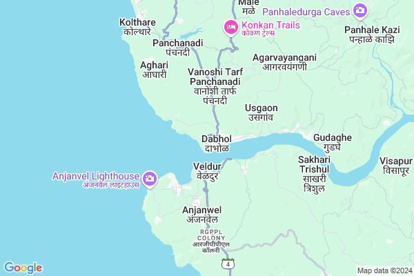
Dabhol
Dabhol Map
EDIT Map
Add Your House
 ..
..
Current Corona Virus Infected Patients Count in Ratnagiri District
| City Name | District Name | Total Covid cases |
|---|---|---|
| Ratnagiri District | Ratnagiri | 7 |
| Shrungartali | Ratnagiri | 1 |
Locality Name :
Dabhol
( दाभोळ )
Taluka Name : Dapoli
District : Ratnagiri
State : Maharashtra
Region : Konkan
Division : Konkan
Language : Marathi and Daldi
Current Time 10:16 AM
Date: Sunday , Apr 27,2025 (IST)
Time zone: IST (UTC+5:30)
Elevation / Altitude: 27 meters. Above Seal level
Telephone Code / Std Code: 02358
Assembly constituency : Dapoli assembly constituency
Assembly MLA : Kadam Sanjayrao Vasant
Lok Sabha constituency : Raigad parliamentary constituency
Parliament MP : Tatkare Sunil Dattatray
Serpanch Name :
Pin Code : 415706
Post Office Name : Dabhol
Commodities Prices : Mahad Market / Mandi
Dabhol Live Weather
Temperature: 33.9 °C
clear sky
Humidity: 34%
Wind : 3.49 mt/sec towards NW
StationName : "DÄ\u0081bhol"
observed on Now
Temperature: 33.9 °C
clear sky
Humidity: 34%
Wind : 3.49 mt/sec towards NW
StationName : "DÄ\u0081bhol"
observed on Now
Dabhol Weather Forecast for Next 5 days
28-04-2025
26.2°C to 33.8°C
clear sky
26.2°C to 33.8°C
clear sky
29-04-2025
25.1°C to 33.2°C
scattered clouds, overcast clouds, broken clouds, few clouds, clear sky
25.1°C to 33.2°C
scattered clouds, overcast clouds, broken clouds, few clouds, clear sky
30-04-2025
25.3°C to 31.8°C
clear sky, few clouds
25.3°C to 31.8°C
clear sky, few clouds
01-05-2025
25.2°C to 31.5°C
few clouds, clear sky
25.2°C to 31.5°C
few clouds, clear sky
02-05-2025
25.1°C to 31.9°C
clear sky
25.1°C to 31.9°C
clear sky
National Highways Reachable To Dabhol
Nationa High Way :NH66
Nationa High Way :NH66
Rivers Near Dabhol
Jog river
Jog river
Jog river
Jog river
About Dabhol
Correct below Info and add more info about DabholDabhol is a Village in Dapoli Taluka in Ratnagiri District of Maharashtra State, India. It belongs to Konkan region . It belongs to Konkan Division . It is located 78 KM towards North from District head quarters Ratnagiri. 25 KM from Dapoli. 190 KM from State capital Mumbai
Dabhol Pin code is 415706 and postal head office is Dabhol .
Veldur ( 1 KM ) , Navanagar ( 2 KM ) , Navse ( 3 KM ) , Vanoshi T. Panchanadi ( 3 KM ) , Anjanvel ( 4 KM ) are the nearby Villages to Dabhol. Dabhol is surrounded by Dapoli Taluka towards North , Khed Taluka towards East , Chipalun Taluka towards East , Mandangad Taluka towards North .
Chiplun , Mahad , Mahabaleswar , Ratnagiri are the near by Cities to Dabhol.
It is near to arabian sea. There is a chance of humidity in the weather.
Demographics of Dabhol
Marathi is the Local Language here.Politics in Dabhol
Nationalist Congress Party , NCP , SHS , INC are the major political parties in this area.Polling Stations /Booths near Dabhol
1)Purna Prathamik Urdu Shala Burondi New Building Room No. 42)Z.p.kanya Shala Dabhol Dakshinekadil Room No. 1
3)Z.p.kanya Shala Dabhol Dakshinekadil Room No. 2
4)Z.p.marathi Shala Burondi Kalamwadi No.2
5)Z.p.marathi Shala Udaynagar Dapoli
HOW TO REACH Dabhol
By Rail
There is no railway station near to Dabhol in less than 10 km. Khed Rail Way Station (near to Khed) are the Rail way stations reachable from near by towns.By Road
Khed are the nearby by towns to Dabhol having road connectivity to DabholColleges near Dabhol
A.g Highschool Umbarle
Address :
Schools in Dabhol
A.k.i.high School
Address : dabhol , dapoli , ratnagiri , Maharashtra . PIN- 415706 , Post - Dabhol
Lokmannya Tilak Vid.
Address : dabhol , dapoli , ratnagiri , Maharashtra . PIN- 415706 , Post - Dabhol
Sanjeev English Med.sch.
Address : dabhol , dapoli , ratnagiri , Maharashtra . PIN- 415706 , Post - Dabhol
Govt Health Centers near Dabhol
1) Veldur , , , at po veldur2) Vanoshi , Vanoshi , Vanoshi , Vanoshi
3) Anjanwel , , , at po anjanwel
Colleges in Dabhol,Dapoli
Industrial Training Institute
Bhiv Bandar Road; Village - Dabhol; Taluka - Dapoli; Maharashtra 415706; India
0.8 KM distance Detail
Industrial Training Institute; Guhagar
RGPPL Colony; Anjanwel; Maharashtra 415634; India
5.6 KM distance Detail
more ..
Local Parks in Dabhol,Dapoli
Ajagolkar Family home
Gav Devi Mandir Rd; Palpene; Maharashtra 415724; India
11.8 KM distance Detail
About Dabhol &
History
How to reach Dabhol
Tourist Places Near By Dabhol
Schools in Dabhol
Colleges in Dabhol
Temperature & weather of Dabhol
places in Dabhol
Dabhol photos
More Information
How to reach Dabhol
Tourist Places Near By Dabhol
Schools in Dabhol
Colleges in Dabhol
Temperature & weather of Dabhol
places in Dabhol
Dabhol photos
More Information
Village Talk
Post News or Events about this Village
Near Cities
Chiplun 42 KM near
Mahad 66 KM near
Mahabaleswar 70 KM near
Ratnagiri 75 KM near
Chiplun 42 KM near
Mahad 66 KM near
Mahabaleswar 70 KM near
Ratnagiri 75 KM near
Near By Taluks
Guhagar 21 KM near
Dapoli 23 KM near
Khed 33 KM near
Chipalun 42 KM near
Guhagar 21 KM near
Dapoli 23 KM near
Khed 33 KM near
Chipalun 42 KM near
Near By Air Ports
Lohegaon Airport 152 KM near
Kolhapur Airport 179 KM near
Chhatrapati Shivaji International Airport 190 KM near
Sambre Airport 276 KM near
Lohegaon Airport 152 KM near
Kolhapur Airport 179 KM near
Chhatrapati Shivaji International Airport 190 KM near
Sambre Airport 276 KM near
Near By Tourist Places
Anjanvel 2 KM near
Guhagar 13 KM near
Murud-Karde 21 KM near
Harnai 23 KM near
Velneshwar 26 KM near
Anjanvel 2 KM near
Guhagar 13 KM near
Murud-Karde 21 KM near
Harnai 23 KM near
Velneshwar 26 KM near
Near By Districts
Ratnagiri 75 KM near
Satara 99 KM near
Raigad 137 KM near
Pune 142 KM near
Ratnagiri 75 KM near
Satara 99 KM near
Raigad 137 KM near
Pune 142 KM near
Near By RailWay Station
Khed Rail Way Station 32 KM near
Chiplun Rail Way Station 42 KM near
Khed Rail Way Station 32 KM near
Chiplun Rail Way Station 42 KM near