| Home | City Bus | Maps | Villages | Cities | Rail | Tourist Places | School | College | Pin Codes | Corona Cases Count |
| Distance Calculator Bus Services IFSC Codes Trace Mobile Number Weather Search Place Trace IP Available Cash ATM/Banks Locate Polling Booth Report an Error contact People |
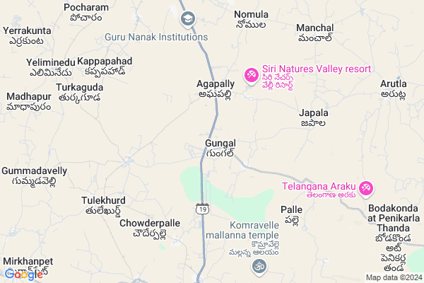
Gungal
Gungal Map
EDIT Map
Add Your House
 ..
..
Current Corona Virus Infected Patients Count in Rangareddi District
| City Name | District Name | Total Covid cases |
|---|---|---|
| Vikarabad District | Vikarabad | 37 |
| Ranga Reddy District | Ranga Reddy | 25 |
| Medchal Malkajgiri District | Medchal Malkajgiri | 8 |
| Nagarkurnool District | Nagarkurnool | 2 |
| Qutbullapur | Medchal Malkajgiri | 1 |
| Kokapet | Ranga Reddy | 1 |
| Chandanagar | Ranga Reddy | 1 |
Locality Name :
Gungal
( గుంగల్ )
Mandal Name : Yacharam
District : Rangareddi
State : Telangana
Region : Telangana
Language : Telugu and Urdu
Current Time 11:54 AM
Date: Wednesday , Apr 30,2025 (IST)
Time zone: IST (UTC+5:30)
Elevation / Altitude: 523 meters. Above Seal level
Telephone Code / Std Code: 08414
Assembly constituency : Ibrahimpatnam assembly constituency
Assembly MLA : Malreddy Ranga Reddy
Lok Sabha constituency : Bhongir parliamentary constituency
Parliament MP : Komati Reddy Venkat Reddy
Serpanch Name :
Pin Code : 501506
Post Office Name : Ibrahimpatnam (K.V.Rangareddy)
Commodities Prices : Ibrahimputnam Market / Mandi
Gungal Live Weather
Temperature: 34.9 °C
scattered clouds
Humidity: 28%
Wind : 3.95 mt/sec towards S
StationName : "Hyderabad"
observed on 1 Hours Back
Temperature: 34.9 °C
scattered clouds
Humidity: 28%
Wind : 3.95 mt/sec towards S
StationName : "Hyderabad"
observed on 1 Hours Back
Gungal Weather Forecast for Next 5 days
01-05-2025
25.8°C to 38.6°C
scattered clouds, broken clouds, few clouds
25.8°C to 38.6°C
scattered clouds, broken clouds, few clouds
02-05-2025
25.0°C to 39.6°C
clear sky, scattered clouds, few clouds, broken clouds
25.0°C to 39.6°C
clear sky, scattered clouds, few clouds, broken clouds
03-05-2025
24.9°C to 39.0°C
scattered clouds, clear sky, broken clouds
24.9°C to 39.0°C
scattered clouds, clear sky, broken clouds
04-05-2025
24.4°C to 39.3°C
scattered clouds, clear sky, few clouds, overcast clouds
24.4°C to 39.3°C
scattered clouds, clear sky, few clouds, overcast clouds
05-05-2025
26.7°C to 37.8°C
broken clouds, light rain, clear sky, few clouds
26.7°C to 37.8°C
broken clouds, light rain, clear sky, few clouds
National Highways Reachable To Gungal
Nationa High Way :Old NH7
Nationa High Way :Old NH7
About Gungal
Correct below Info and add more info about GungalGungal is a Village in Yacharam Mandal in Rangareddi District of Telangana State, India. It belongs to Telangana region . As part Telangana Districts re-organisation , Gungal Village Yacharam Mandal re organised from Rangareddi District to Ranga Reddy district. It is located 73 KM towards East from District head quarters Hyderabad. 9 KM from Yacharam.
Gungal Pin code is 501506 and postal head office is Ibrahimpatnam (K.V.Rangareddy).
Japal ( 4 KM ) , Agapally ( 4 KM ) , Tulekalan ( 5 KM ) , Rangapur ( 5 KM ) , Cheeded ( 7 KM ) are the nearby Villages to Gungal. Gungal is surrounded by Yacharam Mandal towards South , Ibrahimpatnam Mandal towards North , Kandukur Mandal towards west , Hayathnagar Mandal towards North .
Hyderabad , Farooqnagar , Bhongir , Devarakonda are the near by Cities to Gungal.
Gungal 2011 Census Details
Gungal Local Language is Telugu. Gungal Village Total population is 4254 and number of houses are 1056. Female Population is 48.2%. Village literacy rate is 55.7% and the Female Literacy rate is 20.9%.
Population
| Census Parameter | Census Data |
| Total Population | 4254 |
| Total No of Houses | 1056 |
| Female Population % | 48.2 % ( 2049) |
| Total Literacy rate % | 55.7 % ( 2371) |
| Female Literacy rate | 20.9 % ( 888) |
| Scheduled Tribes Population % | 1.0 % ( 42) |
| Scheduled Caste Population % | 25.0 % ( 1064) |
| Working Population % | 51.5 % |
| Child(0 -6) Population by 2011 | 470 |
| Girl Child(0 -6) Population % by 2011 | 43.6 % ( 205) |
Gungal Census More Deatils.
Politics in Gungal
TDP , CPM , TRS , INC are the major political parties in this area.Polling Stations /Booths near Gungal
1)Gowrelly2)Gun Gal
3)Eliminedu
4)Aagapalli
5)Zphs Building Arutla
HOW TO REACH Gungal
By Road
L B Nagar is the Nearest Town to Gungal. L B Nagar is 49 km from Gungal. Road connectivity is there from L B Nagar to Gungal.By Rail
There is no railway station near to Gungal in less than 10 km. How ever there are railway Stations from Near By town L B Nagar. are the railway Stations near to L B Nagar. You can reach from L B Nagar to Gungal by road after .Colleges near Gungal
Ponugoti Madhavarao Jr Clg,mall-v,yacharam
Address : Mall-v,yacharam
Schools in Gungal
Zphs Gungal
Address : gungal , yacharam , rangareddi , Andhra Pradesh . PIN- 501506 , Post - Ibrahimpatnam (K.V.Rangareddy)
Yashodha Concept School
Address : gungal , yacharam , rangareddi , Andhra Pradesh . PIN- 501509 , Post - Yacharam
Mpups Gaddamallaiahguda
Address : gungal , yacharam , rangareddi , Andhra Pradesh . PIN- 501506 , Post - Ibrahimpatnam (K.V.Rangareddy)
Govt Health Centers near Gungal
1) SubCentre Gongal , , Gandhi nager , Near Surpunch home2) SubCentre Chowdarpally , GOVT , MAINROAD , Opp to PRIMARY SCHOOL
3) SubCentre Rangapur , GOVT , RANGAPUR , BE SIDE ZPHS SCHOOL
Sub Villages in Gungal
Hospitals in Gungal,Yacharam
Laxmi Medical
Opp:Bus Station; Ibrhimpatnam; Hyderabad; 501506; Hyderabad; Telangana 501506; India
5.4 KM distance Detail
Sri Divya Hospital
#7-166; Manchala Road; Ibrahimpaatnam.; hyderabad; Telangana 501506; India
5.4 KM distance Detail
more ..
Petrol Bunks in Gungal,Yacharam
Sri Durga Filling Station Indian Oil Petrol Pump
Nagarjuna Sagar Rd; Yacharam; Telangana 501509; India
0.3 KM distance Detail
Anjamma Oil Filling Station Indian Oil Petrol Pump
Gungal; Rangareddy; SH-19; Hyderabad Nagarjuna Sagar Road; Ibrahimpatnam; Ibrahimpatnam; Telangana 501506; India
6.7 KM distance Detail
more ..
Colleges in Gungal,Yacharam
GNIT main Block
Shop No 1; Brindavan Colony; Hyderabad; Telangana 501506; India
6.7 KM distance Detail
more ..
Electronic Shops in Gungal,Yacharam
Lakshmi Electronics & Solutions
H- no : 1-97; Near Ramalayam Temple; Nomula; Telangana 501508; India
7.7 KM distance Detail
Mani Digital Studio
Near Bus Stop; Manchal Main Road; Manchal.; Ibrahimpatnam; Telangana 501508; India
8.5 KM distance Detail
Police Stations near Gungal,Yacharam
Yacharam Police Station
Nagarjuna Sagar Rd; Yacharam; Telangana 501509; India
9.2 KM distance Detail
Police Station Ibrahimpatnam
Beside APSRTC Bus Depot; Ibrahimpatnam; Telangana 501506; India
10.5 KM distance Detail
Governement Offices near Gungal,Yacharam
Yacharam Grama Panchayath
Chowdariguda Gram Panchayat Road; Nacharam; Hyderabad; Telangana 500088; India
8.4 KM distance Detail
MeeSeva Center
H.NO. 2-100; Seetharampet; Ibrahimpatnam; Telangana 501506; India
8.4 KM distance Detail
About Gungal &
History
How to reach Gungal
Tourist Places Near By Gungal
Schools in Gungal
Colleges in Gungal
Temperature & weather of Gungal
places in Gungal
Gungal photos
More Information
How to reach Gungal
Tourist Places Near By Gungal
Schools in Gungal
Colleges in Gungal
Temperature & weather of Gungal
places in Gungal
Gungal photos
More Information
Village Talk
Post News or Events about this Village
Near Cities
Hyderabad 42 KM near
Farooqnagar 55 KM near
Bhongir 56 KM near
Devarakonda 60 KM near
Hyderabad 42 KM near
Farooqnagar 55 KM near
Bhongir 56 KM near
Devarakonda 60 KM near
Near By Taluks
Manchal 6 KM near
Yacharam 9 KM near
Ibrahimpatnam 12 KM near
Kandukur 22 KM near
Manchal 6 KM near
Yacharam 9 KM near
Ibrahimpatnam 12 KM near
Kandukur 22 KM near
Near By Air Ports
Rajiv Gandhi International Airport 33 KM near
Vijayawada Airport 263 KM near
Nanded Airport 303 KM near
Latur Airport 307 KM near
Rajiv Gandhi International Airport 33 KM near
Vijayawada Airport 263 KM near
Nanded Airport 303 KM near
Latur Airport 307 KM near
Near By Tourist Places
Hyderabad 40 KM near
Nagarjunsagar 102 KM near
Medak 126 KM near
Srisailam 131 KM near
Nagarjunakonda 150 KM near
Hyderabad 40 KM near
Nagarjunsagar 102 KM near
Medak 126 KM near
Srisailam 131 KM near
Nagarjunakonda 150 KM near
Near By Districts
Hyderabad 47 KM near
Nalgonda 70 KM near
Rangareddi 70 KM near
Mahbubnagar 92 KM near
Hyderabad 47 KM near
Nalgonda 70 KM near
Rangareddi 70 KM near
Mahbubnagar 92 KM near
Near By RailWay Station
Kacheguda Rail Way Station 40 KM near
Hyderabad Deccan Nampally Rail Way Station 42 KM near
Kacheguda Rail Way Station 40 KM near
Hyderabad Deccan Nampally Rail Way Station 42 KM near