| Home | City Bus | Maps | Villages | Cities | Rail | Tourist Places | School | College | Pin Codes | Corona Cases Count |
| Distance Calculator Bus Services IFSC Codes Trace Mobile Number Weather Search Place Trace IP Available Cash ATM/Banks Locate Polling Booth Report an Error contact People |
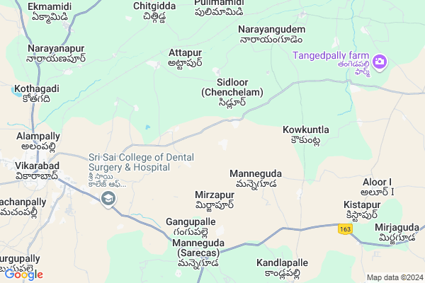
Lalsingh Tanda
Lalsingh Tanda Map
EDIT Map
Add Your House
 ..
..
Current Corona Virus Infected Patients Count in Rangareddi District
| City Name | District Name | Total Covid cases |
|---|---|---|
| Vikarabad District | Vikarabad | 37 |
| Ranga Reddy District | Ranga Reddy | 25 |
| Medchal Malkajgiri District | Medchal Malkajgiri | 8 |
| Nagarkurnool District | Nagarkurnool | 2 |
| Qutbullapur | Medchal Malkajgiri | 1 |
| Kokapet | Ranga Reddy | 1 |
| Chandanagar | Ranga Reddy | 1 |
Locality Name :
Lalsingh Tanda
( లలీసింగ్ తండా )
Mandal Name : Vikarabad
District : Rangareddi
State : Telangana
Region : Telangana
Language : Telugu and Urdu
Current Time 04:53 AM
Date: Monday , Apr 28,2025 (IST)
Time zone: IST (UTC+5:30)
Elevation / Altitude: 633 meters. Above Seal level
Telephone Code / Std Code: 08416
Assembly constituency : Vikarabad assembly constituency
Assembly MLA : Gaddam Prasad Kumar
Lok Sabha constituency : Chelvella parliamentary constituency
Parliament MP : Dr. G. Ranjith Reddy
Serpanch Name :
Main Village Name : Kottalguda
Commodities Prices : Vikarabad Market / Mandi
Lalsingh Tanda Live Weather
Temperature: 26.6 °C
broken clouds
Humidity: 57%
Wind : 3.67 mt/sec towards SE
StationName : "VikÄ\u0081rÄ\u0081bÄ\u0081d"
observed on 1 Hours Back
Temperature: 26.6 °C
broken clouds
Humidity: 57%
Wind : 3.67 mt/sec towards SE
StationName : "VikÄ\u0081rÄ\u0081bÄ\u0081d"
observed on 1 Hours Back
Lalsingh Tanda Weather Forecast for Next 5 days
29-04-2025
25.8°C to 36.2°C
scattered clouds, few clouds, clear sky, broken clouds
25.8°C to 36.2°C
scattered clouds, few clouds, clear sky, broken clouds
30-04-2025
28.0°C to 37.7°C
broken clouds, few clouds, clear sky, light rain
28.0°C to 37.7°C
broken clouds, few clouds, clear sky, light rain
01-05-2025
27.6°C to 40.1°C
clear sky, few clouds, scattered clouds, broken clouds
27.6°C to 40.1°C
clear sky, few clouds, scattered clouds, broken clouds
02-05-2025
27.8°C to 41.5°C
broken clouds, few clouds, clear sky, overcast clouds
27.8°C to 41.5°C
broken clouds, few clouds, clear sky, overcast clouds
National Highways Reachable To Lalsingh Tanda
Nationa High Way :Old NH7
Nationa High Way :NH765
Nationa High Way :Old NH7
Nationa High Way :NH765
Rivers Near Lalsingh Tanda
Musi River :మూసి
Musi River :మూసి
About Lalsingh Tanda
Correct below Info and add more info about Lalsingh TandaLalsingh Tanda is a small Village/hamlet in Vikarabad Mandal in Rangareddi District of Telangana State, India. It comes under Kottalguda Panchayath. It belongs to Telangana region . As part Telangana Districts re-organisation , Lalsingh Tanda Village Vikarabad Mandal re organised from Rangareddi District to Vikarabad district. It is located 16 KM towards west from District head quarters Hyderabad. 10 KM from Vikarabad.
Lalsingh Tanda is surrounded by Nawabpet Mandal towards North , Pudur Mandal towards South , Chevella Mandal towards East , Shankarpally Mandal towards East .
Vicarabad , Singapur , Sadasivpet , Sangareddy are the near by Cities to Lalsingh Tanda.
Demographics of Lalsingh Tanda
Telugu is the Local Language here.Politics in Lalsingh Tanda
INC , TDP , TRS , TDP , INC are the major political parties in this area.Polling Stations /Booths near Lalsingh Tanda
1)Kot Marpalli2)Shivareddypet
3)Siddulur
4)Pilligundla Gundlamarpally
5)Buchan Palli
HOW TO REACH Lalsingh Tanda
By Rail
Chitgidda Rail Way Station , Gullaguda Rail Way Station are the very nearby railway stations to Lalsingh Tanda. Godamgura Rail Way Station (near to Vikarabad) , Vikarabad Junction Rail Way Station (near to Vikarabad) are the Rail way stations reachable from near by towns.By Road
Vikarabad are the nearby by towns to Lalsingh Tanda having road connectivity to Lalsingh TandaPincodes near Lalsingh Tanda
501101 ( Vikarabad ) , 501111 ( Nawabpet (K.V.Rangareddy) ) , 501203 ( Shankarpalli )Colleges near Lalsingh Tanda
Takshashila Degree College
Address :
Sri Saraswathi Vidyalaya Jr Coll, Vikarabad
Address : Vikarabad
Vikas Jr Coll Vikarabad
Address : Vikas Jr Coll Vikarabad
Mary A Knotts Jr Coll(co-edu), Vikarabad
Address : Vikarabad
Siddhartha Jr College Vikarabad
Address : Siddhartha Jr College Vikarabad
Schools near Lalsingh Tanda
Apswr School(g)
Address : vikarabad , vikarabad , rangareddi , Andhra Pradesh . PIN- 501101 , Post - Vikarabad
Kgbv E M
Address : vikarabad , vikarabad , rangareddi , Andhra Pradesh . PIN- 501101 , Post - Vikarabad
Mphs Gottimukla
Address : gottimukla , vikarabad , rangareddi , Andhra Pradesh . PIN- 501101 , Post - Vikarabad
Sri Krishnaveni Talent Sc
Address : vikarabad , vikarabad , rangareddi , Andhra Pradesh . PIN- 501101 , Post - Vikarabad
Govt Health Centers near Lalsingh Tanda
1) SubCentre, Siddaloor , 4-100 , BC Colony , Opp. Gram Panchayath2) Primary Health Centre, Siddaloor , , Beside ZPHS School , Beside ZPHS School
3) SubCentre, Kowkuntla , GOVT , BESIDE GRAMAPANCHAYATHI , NEAR HIGH SCHOOL
Petrol Bunks in Lalsingh Tanda,Vikarabad
Syed Intiyazuddin G Patel Bharat Petroleum
Manneguda; Rangareddy; SH-4; Hyderabad Vikarabad Road; Pudur; Pudur; Telangana 501101; India
6.9 KM distance Detail
IOCL SREE KANAKA DURGA FILLING STATION
Vikarabad Rd; Chevella; Telangana 501503; India
7.0 KM distance Detail
more ..
Colleges in Lalsingh Tanda,Vikarabad
Grahambell Institute of Technology & Science
Sy.No. 129 & 130; Thumkuntha; Shamirpet Road; Hyderabad; Telangana 501101; India
5.7 KM distance Detail
Pallavi College of Education
Nacherla Gate; Gandeed Mandal; R.R. District; Hyderabad; Telangana 501101; India
5.7 KM distance Detail
more ..
Super Markets in Lalsingh Tanda,Vikarabad
Dhatani Cotton Mill .Chittampally
Chittampally; Angadi Chitampally; Telangana; India
7.0 KM distance Detail
Local Parks in Lalsingh Tanda,Vikarabad
ms bradars garden
Vikarabad Rd; Alampally; Vikarabad; Telangana 501101; India
6.6 KM distance Detail
M A Khan garden
Pargi - Manneguda Road; Syedmalkapur; Telangana 501101; India
7.5 KM distance Detail
Police Stations near Lalsingh Tanda,Vikarabad
Superintendent of Police Vikarabad dist office
Vikarabad Road; Vikarabad; Telangana 501101; India
9.5 KM distance Detail
Governement Offices near Lalsingh Tanda,Vikarabad
MeeSeva Center
Main Road;Manneguda Chowrasta; Manneguda; Telangana 501101; India
7.0 KM distance Detail
About Lalsingh Tanda &
History
How to reach Lalsingh Tanda
Tourist Places Near By Lalsingh Tanda
Schools in Lalsingh Tanda
Colleges in Lalsingh Tanda
Temperature & weather of Lalsingh Tanda
places in Lalsingh Tanda
Lalsingh Tanda photos
More Information
How to reach Lalsingh Tanda
Tourist Places Near By Lalsingh Tanda
Schools in Lalsingh Tanda
Colleges in Lalsingh Tanda
Temperature & weather of Lalsingh Tanda
places in Lalsingh Tanda
Lalsingh Tanda photos
More Information
Village Talk
Post News or Events about this Village
Near Cities
Vicarabad 10 KM near
Singapur 22 KM near
Sadasivpet 33 KM near
Sangareddy 37 KM near
Vicarabad 10 KM near
Singapur 22 KM near
Sadasivpet 33 KM near
Sangareddy 37 KM near
Near By Taluks
Vikarabad 9 KM near
Nawabpet 11 KM near
Pudur 12 KM near
Chevella 15 KM near
Vikarabad 9 KM near
Nawabpet 11 KM near
Pudur 12 KM near
Chevella 15 KM near
Near By Air Ports
Rajiv Gandhi International Airport 53 KM near
Latur Airport 223 KM near
Nanded Airport 241 KM near
Sholapur Airport 246 KM near
Rajiv Gandhi International Airport 53 KM near
Latur Airport 223 KM near
Nanded Airport 241 KM near
Sholapur Airport 246 KM near
Near By Tourist Places
Hyderabad 59 KM near
Bidar 86 KM near
Medak 93 KM near
Gulbarga 137 KM near
Nagarjunsagar 185 KM near
Hyderabad 59 KM near
Bidar 86 KM near
Medak 93 KM near
Gulbarga 137 KM near
Nagarjunsagar 185 KM near
Near By Districts
Rangareddi 16 KM near
Medak 35 KM near
Hyderabad 58 KM near
Mahbubnagar 75 KM near
Rangareddi 16 KM near
Medak 35 KM near
Hyderabad 58 KM near
Mahbubnagar 75 KM near
Near By RailWay Station
Chitgidda Rail Way Station 6.1 KM near
Vikarabad Junction Rail Way Station 9 KM near
Shankarpalli Rail Way Station 20 KM near
Chitgidda Rail Way Station 6.1 KM near
Vikarabad Junction Rail Way Station 9 KM near
Shankarpalli Rail Way Station 20 KM near