| Home | City Bus | Maps | Villages | Cities | Rail | Tourist Places | School | College | Pin Codes | Corona Cases Count |
| Distance Calculator Bus Services IFSC Codes Trace Mobile Number Weather Search Place Trace IP Available Cash ATM/Banks Locate Polling Booth Report an Error contact People |
Tumalapally
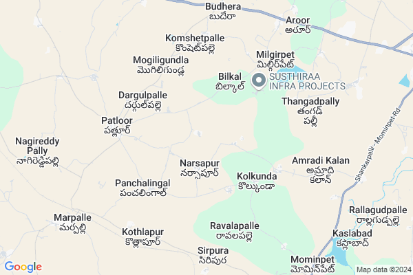
Tumalapally Map
EDIT Map
Add Your House
 ..
..
Current Corona Virus Infected Patients Count in Rangareddi District
| City Name | District Name | Total Covid cases |
|---|---|---|
| Vikarabad District | Vikarabad | 37 |
| Ranga Reddy District | Ranga Reddy | 25 |
| Medchal Malkajgiri District | Medchal Malkajgiri | 8 |
| Nagarkurnool District | Nagarkurnool | 2 |
| Kokapet | Ranga Reddy | 1 |
| Chandanagar | Ranga Reddy | 1 |
| Qutbullapur | Medchal Malkajgiri | 1 |
Locality Name :
Tumalapally
( తుమ్మలపల్లి )
Mandal Name : Marpally
District : Rangareddi
State : Telangana
Region : Telangana
Language : Telugu and Urdu
Current Time 05:21 AM
Date: Saturday , Apr 26,2025 (IST)
Time zone: IST (UTC+5:30)
Elevation / Altitude: 628 meters. Above Seal level
Telephone Code / Std Code: 08451
Assembly constituency : Vikarabad assembly constituency
Assembly MLA : Gaddam Prasad Kumar
Lok Sabha constituency : Chelvella parliamentary constituency
Parliament MP : Dr. G. Ranjith Reddy
Serpanch Name :
Pin Code : 501202
Post Office Name : Mominpet
Alternate Village Name : Thummalapally
Commodities Prices : Marapally Market / Mandi
Tumalapally Live Weather
Temperature: 29.4 °C
broken clouds
Humidity: 37%
Wind : 3.15 mt/sec towards SW
StationName : "SadÄ\u0081seopet"
observed on Now
Temperature: 29.4 °C
broken clouds
Humidity: 37%
Wind : 3.15 mt/sec towards SW
StationName : "SadÄ\u0081seopet"
observed on Now
Tumalapally Weather Forecast for Next 5 days
27-04-2025
29.5°C to 38.4°C
broken clouds, light rain, overcast clouds
29.5°C to 38.4°C
broken clouds, light rain, overcast clouds
28-04-2025
27.3°C to 35.8°C
broken clouds, overcast clouds, scattered clouds, clear sky
27.3°C to 35.8°C
broken clouds, overcast clouds, scattered clouds, clear sky
29-04-2025
26.4°C to 38.8°C
clear sky, scattered clouds, broken clouds
26.4°C to 38.8°C
clear sky, scattered clouds, broken clouds
30-04-2025
28.3°C to 39.3°C
clear sky, broken clouds, scattered clouds
28.3°C to 39.3°C
clear sky, broken clouds, scattered clouds
National Highways Reachable To Tumalapally
Nationa High Way :NH65
Nationa High Way :NH65
About Tumalapally
Correct below Info and add more info about TumalapallyTumalapally is a Village in Marpally Mandal in Rangareddi District of Telangana State, India. It belongs to Telangana region . It is located 51 KM towards North from District head quarters Hyderabad. 7 KM from Marpally(Kalan).
Tumalapally Pin code is 501202 and postal head office is Mominpet .
Bilkal ( 3 KM ) , Kolkonda ( 3 KM ) , Panchalingal ( 4 KM ) , Amradikhurd ( 5 KM ) , Patloor ( 5 KM ) are the nearby Villages to Tumalapally. Tumalapally is surrounded by Mominpet Mandal towards South , Sadasivpet Mandal towards East , Kohir Mandal towards west , Munpalle Mandal towards North .
Sadasivpet , Zahirabad , Vicarabad , Sangareddy are the near by Cities to Tumalapally.
This Place is in the border of the Rangareddi District and Medak District. Medak District Kohir is west towards this place .
Thummalapalle 2011 Census Details
Tumalapally Local Language is Telugu. Thummalapalle Village Total population is 1426 and number of houses are 331. Female Population is 49.4%. Village literacy rate is 43.3% and the Female Literacy rate is 17.9%.
Population
| Census Parameter | Census Data |
| Total Population | 1426 |
| Total No of Houses | 331 |
| Female Population % | 49.4 % ( 704) |
| Total Literacy rate % | 43.3 % ( 617) |
| Female Literacy rate | 17.9 % ( 255) |
| Scheduled Tribes Population % | 0.0 % ( 0) |
| Scheduled Caste Population % | 35.8 % ( 511) |
| Working Population % | 61.4 % |
| Child(0 -6) Population by 2011 | 147 |
| Girl Child(0 -6) Population % by 2011 | 46.3 % ( 68) |
Thummalapalle Census More Deatils.
Politics in Tumalapally
INC , TDP , TRS , TDP , INC are the major political parties in this area.Polling Stations /Booths near Tumalapally
1)Thimmapur2)Dannaram
3)Naraayana Pur Pendlimaadugu
4)Pilaram
5)Gudpally
HOW TO REACH Tumalapally
By Road
Sadasivpet is the Nearest Town to Tumalapally. Sadasivpet is 11 km from Tumalapally. Road connectivity is there from Sadasivpet to Tumalapally.By Rail
Marpalli Rail Way Station is the very nearby railway stations to Tumalapally.Colleges near Tumalapally
Maharshi Degree College
Address :
Scient Institute Of Engineering Technology
Address :
Infant Jesus Junior College
Address : Velankanni,shamshabad,ranga Reddy District
Sree Nidhi Institute Of Science & Technology (autonomous)
Address :
Drk College Of Engineering And Technology
Address :
Schools in Tumalapally
Mpups Tumalapally
Address : tumalapally , marpalle , rangareddi , Andhra Pradesh . PIN- 501202 , Post - Mominpet
Govt Health Centers near Tumalapally
1) SubCentre,Thummalapally , , BC COLONY , OPP.AIRTEL TOWER2) SubCentre, Patloor , 1--122/2 , BC COLONY , NEAR HANUMAN MANDIR
3) Primary Health Centre, Patloor , , PATLOOR , HANUMAN TEMPLE OPP
Sub Villages in Tumalapally
Hospitals in Tumalapally,Marpally
Mallanna Patel Clinic And General Stores
Thumallapally; Telangana 501202; India
0.5 KM distance Detail
Shivashree Hospital And Diagnostics
Mumbai Hwy; Budera; Telangana 501202; India
8.2 KM distance Detail
more ..
Petrol Bunks in Tumalapally,Marpally
Sri Siddi Vinayaka Filling Station-Bharat Petrol P
Budhera; Medak; NH-9; Mumbai Highway; Munipally; Munipally; Telangana 502345; India
8.2 KM distance Detail
Sri Siddi Vinayaka Filling station ALLADI
NH65; Budera; Telangana 501202; India
8.2 KM distance Detail
more ..
Colleges in Tumalapally,Marpally
Govt. Junior College Budhera
Budhera Marpally Road;; Komshetpalle; Telangana; India
8.2 KM distance Detail
more ..
Electronic Shops in Tumalapally,Marpally
Pooja Mobiles & Electronics
Budhera - Marpally Rd; Komshetpalle; Telangana 501202; India
7.9 KM distance Detail
Police Stations near Tumalapally,Marpally
Mominpet Police Station
Vikarabad - Sadasivapet State Hwy; Telangana 501202; India
10.7 KM distance Detail
Police Station Sadashivpet
Mumbai Hwy; Siddapu Colony; Sadashivpet; Telangana 502291; India
14.5 KM distance Detail
Governement Offices near Tumalapally,Marpally
MeeSeva Center
2; Glory Computer Network; Budera Road; Marpalle; Patlur; Telangana 501202; India
5.3 KM distance Detail
MeeSeva Center
Pitla Rajyalaxmi;1-52/1; Sriram Communication; Akbarpet; Bhompalli X-Road; Boompally X Road;Akbarpet(V);Mirdoddi(M);; Budera; Telangana 501202; India
8.3 KM distance Detail
MeeSeva Center
Shanthi Communications; Near Govt School; Aroor; Sadasivpet; 3-59; Aroor; Telangana 502291; India
8.4 KM distance Detail
About Tumalapally &
History
How to reach Tumalapally
Tourist Places Near By Tumalapally
Schools in Tumalapally
Colleges in Tumalapally
Temperature & weather of Tumalapally
places in Tumalapally
Tumalapally photos
More Information
How to reach Tumalapally
Tourist Places Near By Tumalapally
Schools in Tumalapally
Colleges in Tumalapally
Temperature & weather of Tumalapally
places in Tumalapally
Tumalapally photos
More Information
Village Talk
Post News or Events about this Village
Near Cities
Sadasivpet 14 KM near
Zahirabad 29 KM near
Vicarabad 31 KM near
Sangareddy 33 KM near
Sadasivpet 14 KM near
Zahirabad 29 KM near
Vicarabad 31 KM near
Sangareddy 33 KM near
Near By Taluks
Marpally 7 KM near
Mominpet 13 KM near
Sadasivpet 13 KM near
Kohir 16 KM near
Marpally 7 KM near
Mominpet 13 KM near
Sadasivpet 13 KM near
Kohir 16 KM near
Near By Air Ports
Rajiv Gandhi International Airport 81 KM near
Latur Airport 192 KM near
Nanded Airport 209 KM near
Sholapur Airport 226 KM near
Rajiv Gandhi International Airport 81 KM near
Latur Airport 192 KM near
Nanded Airport 209 KM near
Sholapur Airport 226 KM near
Near By Tourist Places
Bidar 52 KM near
Medak 77 KM near
Hyderabad 80 KM near
Gulbarga 123 KM near
Mantralayam 209 KM near
Bidar 52 KM near
Medak 77 KM near
Hyderabad 80 KM near
Gulbarga 123 KM near
Mantralayam 209 KM near
Near By Districts
Medak 29 KM near
Rangareddi 48 KM near
Bidar 55 KM near
Hyderabad 76 KM near
Medak 29 KM near
Rangareddi 48 KM near
Bidar 55 KM near
Hyderabad 76 KM near
Near By RailWay Station
Zahirabad Rail Way Station 29 KM near
Vikarabad Junction Rail Way Station 31 KM near
Zahirabad Rail Way Station 29 KM near
Vikarabad Junction Rail Way Station 31 KM near