| Home | City Bus | Maps | Villages | Cities | Rail | Tourist Places | School | College | Pin Codes | Corona Cases Count |
| Distance Calculator Bus Services IFSC Codes Trace Mobile Number Weather Search Place Trace IP Available Cash ATM/Banks Locate Polling Booth Report an Error contact People |
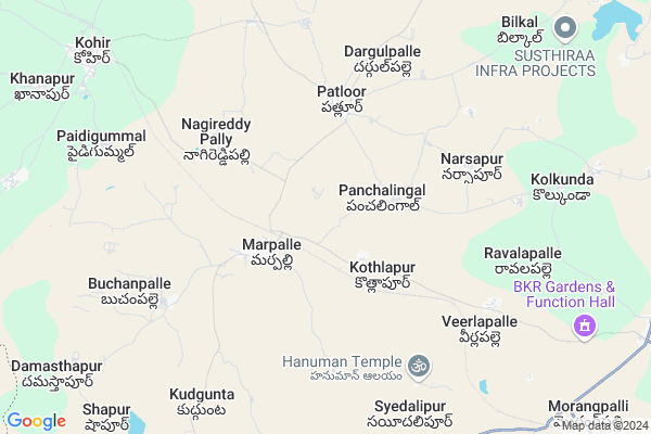
Ravulapally
Ravulapally Map
EDIT Map
Add Your House
 ..
..
Current Corona Virus Infected Patients Count in Rangareddi District
| City Name | District Name | Total Covid cases |
|---|---|---|
| Vikarabad District | Vikarabad | 37 |
| Ranga Reddy District | Ranga Reddy | 25 |
| Medchal Malkajgiri District | Medchal Malkajgiri | 8 |
| Nagarkurnool District | Nagarkurnool | 2 |
| Qutbullapur | Medchal Malkajgiri | 1 |
| Kokapet | Ranga Reddy | 1 |
| Chandanagar | Ranga Reddy | 1 |
Locality Name :
Ravulapally
( రావులపల్లి )
Mandal Name : Marpally
District : Rangareddi
State : Telangana
Region : Telangana
Language : Telugu and Urdu
Current Time 12:03 PM
Date: Tuesday , Apr 29,2025 (IST)
Time zone: IST (UTC+5:30)
Elevation / Altitude: 628 meters. Above Seal level
Telephone Code / Std Code: 08451
Assembly constituency : Vikarabad assembly constituency
Assembly MLA : Gaddam Prasad Kumar
Lok Sabha constituency : Chelvella parliamentary constituency
Parliament MP : Dr. G. Ranjith Reddy
Serpanch Name :
Pin Code : 501106
Post Office Name : Kotpalli
Commodities Prices : Marapally Market / Mandi
Ravulapally Live Weather
Temperature: 31.4 °C
clear sky
Humidity: 34%
Wind : 4.3 mt/sec towards SW
StationName : "SadÄ\u0081seopet"
observed on 2 Hours Back
Temperature: 31.4 °C
clear sky
Humidity: 34%
Wind : 4.3 mt/sec towards SW
StationName : "SadÄ\u0081seopet"
observed on 2 Hours Back
Ravulapally Weather Forecast for Next 5 days
30-04-2025
30.3°C to 36.8°C
clear sky, scattered clouds, broken clouds
30.3°C to 36.8°C
clear sky, scattered clouds, broken clouds
01-05-2025
28.8°C to 38.8°C
scattered clouds, few clouds, clear sky, broken clouds, overcast clouds
28.8°C to 38.8°C
scattered clouds, few clouds, clear sky, broken clouds, overcast clouds
02-05-2025
27.4°C to 40.6°C
scattered clouds, clear sky, few clouds
27.4°C to 40.6°C
scattered clouds, clear sky, few clouds
03-05-2025
27.9°C to 40.4°C
broken clouds, clear sky, scattered clouds, few clouds
27.9°C to 40.4°C
broken clouds, clear sky, scattered clouds, few clouds
04-05-2025
29.1°C to 41.0°C
scattered clouds, clear sky, broken clouds, overcast clouds
29.1°C to 41.0°C
scattered clouds, clear sky, broken clouds, overcast clouds
Edit below overview about Ravulapally
Edit below overview about Ravulapally
OverView of Ravulapally
Ravulapally[Village] Marpally[Mandal]Ranga Reddy[District] Telangana[State]Pin Code[501106]Head Quarters[Vikarabad]Ranga Reddy[District].
Edit below overview about Ravulapally
National Highways Reachable To Ravulapally
Nationa High Way :NH65
Nationa High Way :NH65
About Ravulapally
Ravulapally is a Village in Marpally Mandal in Rangareddi District of Telangana State, India. It belongs to Telangana region . It is located 51 KM towards west from District head quarters Hyderabad.
Ravulapally Pin code is 501106 and postal head office is Kotpalli .
Ravulapally is surrounded by Kohir Mandal towards west , Mominpet Mandal towards East , Bantwaram Mandal towards South , Sadasivpet Mandal towards East .
Sadasivpet , Zahirabad , Vicarabad , Sangareddy are the near by Cities to Ravulapally.
This Place is in the border of the Rangareddi District and Medak District. Medak District Kohir is west towards this place .
Ravalapalle 2011 Census Details
Ravulapally Local Language is Telugu. Ravalapalle Village Total population is 1963 and number of houses are 430. Female Population is 50.2%. Village literacy rate is 54.8% and the Female Literacy rate is 22.7%.
Population
| Census Parameter | Census Data |
| Total Population | 1963 |
| Total No of Houses | 430 |
| Female Population % | 50.2 % ( 986) |
| Total Literacy rate % | 54.8 % ( 1076) |
| Female Literacy rate | 22.7 % ( 445) |
| Scheduled Tribes Population % | 0.0 % ( 0) |
| Scheduled Caste Population % | 36.8 % ( 723) |
| Working Population % | 56.1 % |
| Child(0 -6) Population by 2011 | 211 |
| Girl Child(0 -6) Population % by 2011 | 53.1 % ( 112) |
Ravalapalle Census More Deatils.
Politics in Ravulapally
INC , TDP , TRS , TDP , INC are the major political parties in this area.Polling Stations /Booths near Ravulapally
1)Kothapally2)Kothrepally
3)Narsapur
4)Panchalingaala
5)Mala Somaram
HOW TO REACH Ravulapally
By Road
Vicarabad is the Nearest Town to Ravulapally. Vicarabad is 30 km from Ravulapally. Road connectivity is there from Vicarabad to Ravulapally.By Rail
Marpalli Rail Way Station is the very nearby railway stations to Ravulapally. Also you can consider railway Stations from Near By town Vicarabad. Vikarabad Junction Rail Way Station , Godamgura Rail Way Station are the railway Stations near to Vicarabad. You can reach from Vicarabad to Ravulapally by road after .Colleges near Ravulapally
Maharshi Degree College
Address :
Scient Institute Of Engineering Technology
Address :
Infant Jesus Junior College
Address : Velankanni,shamshabad,ranga Reddy District
Sree Nidhi Institute Of Science & Technology (autonomous)
Address :
Drk College Of Engineering And Technology
Address :
Schools in Ravulapally
Zphs Ravulapally
Address : ravulapally , marpalle , rangareddi , Andhra Pradesh . PIN- 501106 , Post - Kotpalli
Govt Health Centers near Ravulapally
1) SubCentre Kothlapur , 1--46 , BC COLONY , BESIDE GP2) SubCentre, Patloor , 1--122/2 , BC COLONY , NEAR HANUMAN MANDIR
3) Primary Health Centre, Patloor , , PATLOOR , HANUMAN TEMPLE OPP
Sub Villages in Ravulapally
Super Markets in Ravulapally,Marpally
SEVEN STARS BAKERY (Ambaa Foods)
Behind government hospital; Marpally; Telangana 501202; India
3.3 KM distance Detail
Police Stations near Ravulapally,Marpally
Mominpet Police Station
Vikarabad - Sadasivapet State Hwy; Telangana 501202; India
13.4 KM distance Detail
Governement Offices near Ravulapally,Marpally
MeeSeva Center
Nagadapally Neelamma;1-1; ; ; Opposite Mro Office; Marpally (V; Marpally; 501202; India
3.5 KM distance Detail
About Ravulapally &
History
How to reach Ravulapally
Tourist Places Near By Ravulapally
Schools in Ravulapally
Colleges in Ravulapally
Temperature & weather of Ravulapally
places in Ravulapally
Ravulapally photos
More Information
How to reach Ravulapally
Tourist Places Near By Ravulapally
Schools in Ravulapally
Colleges in Ravulapally
Temperature & weather of Ravulapally
places in Ravulapally
Ravulapally photos
More Information
Village Talk
Post News or Events about this Village
Near Cities
Sadasivpet 21 KM near
Zahirabad 26 KM near
Vicarabad 30 KM near
Sangareddy 39 KM near
Sadasivpet 21 KM near
Zahirabad 26 KM near
Vicarabad 30 KM near
Sangareddy 39 KM near
Near By Taluks
Marpally 0 KM near
Kohir 13 KM near
Mominpet 15 KM near
Bantwaram 16 KM near
Marpally 0 KM near
Kohir 13 KM near
Mominpet 15 KM near
Bantwaram 16 KM near
Near By Air Ports
Rajiv Gandhi International Airport 85 KM near
Latur Airport 189 KM near
Nanded Airport 210 KM near
Sholapur Airport 220 KM near
Rajiv Gandhi International Airport 85 KM near
Latur Airport 189 KM near
Nanded Airport 210 KM near
Sholapur Airport 220 KM near
Near By Tourist Places
Bidar 52 KM near
Medak 83 KM near
Hyderabad 85 KM near
Gulbarga 116 KM near
Mantralayam 204 KM near
Bidar 52 KM near
Medak 83 KM near
Hyderabad 85 KM near
Gulbarga 116 KM near
Mantralayam 204 KM near
Near By Districts
Medak 36 KM near
Rangareddi 50 KM near
Bidar 54 KM near
Hyderabad 82 KM near
Medak 36 KM near
Rangareddi 50 KM near
Bidar 54 KM near
Hyderabad 82 KM near
Near By RailWay Station
Marpalli Rail Way Station 2.3 KM near
Zahirabad Rail Way Station 26 KM near
Vikarabad Junction Rail Way Station 30 KM near
Marpalli Rail Way Station 2.3 KM near
Zahirabad Rail Way Station 26 KM near
Vikarabad Junction Rail Way Station 30 KM near