| Home | City Bus | Maps | Villages | Cities | Rail | Tourist Places | School | College | Pin Codes | Corona Cases Count |
| Distance Calculator Bus Services IFSC Codes Trace Mobile Number Weather Search Place Trace IP Available Cash ATM/Banks Locate Polling Booth Report an Error contact People |
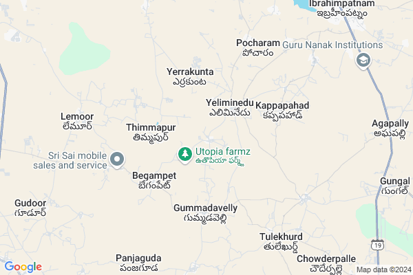
Madhapur
Madhapur Map
EDIT Map
Add Your House
 ..
..
Current Corona Virus Infected Patients Count in Rangareddi District
| City Name | District Name | Total Covid cases |
|---|---|---|
| Vikarabad District | Vikarabad | 37 |
| Ranga Reddy District | Ranga Reddy | 25 |
| Medchal Malkajgiri District | Medchal Malkajgiri | 8 |
| Nagarkurnool District | Nagarkurnool | 2 |
| Chandanagar | Ranga Reddy | 1 |
| Qutbullapur | Medchal Malkajgiri | 1 |
| Kokapet | Ranga Reddy | 1 |
Locality Name :
Madhapur
( మాదాపూర్ )
Mandal Name : Kandukur
District : Rangareddi
State : Telangana
Region : Telangana
Language : Telugu and Urdu
Current Time 08:48 AM
Date: Saturday , Apr 12,2025 (IST)
Time zone: IST (UTC+5:30)
Elevation / Altitude: 581 meters. Above Seal level
Telephone Code / Std Code: 08414
Assembly constituency : Ibrahimpatnam assembly constituency
Assembly MLA : Malreddy Ranga Reddy
Lok Sabha constituency : Bhongir parliamentary constituency
Parliament MP : Komati Reddy Venkat Reddy
Serpanch Name :
Pin Code : 501506
Post Office Name : Ibrahimpatnam (K.V.Rangareddy)
Commodities Prices : Ibrahimputnam Market / Mandi
Madhapur Live Weather
Temperature: 27.2 °C
few clouds
Humidity: 31%
Wind : 7.36 mt/sec towards W
StationName : "Hyderabad"
observed on Now
Temperature: 27.2 °C
few clouds
Humidity: 31%
Wind : 7.36 mt/sec towards W
StationName : "Hyderabad"
observed on Now
Madhapur Weather Forecast for Next 5 days
13-04-2025
29.4°C to 37.2°C
scattered clouds, light rain
29.4°C to 37.2°C
scattered clouds, light rain
14-04-2025
25.5°C to 36.7°C
overcast clouds, broken clouds, scattered clouds, few clouds
25.5°C to 36.7°C
overcast clouds, broken clouds, scattered clouds, few clouds
15-04-2025
24.3°C to 36.4°C
scattered clouds, overcast clouds, broken clouds, few clouds, clear sky
24.3°C to 36.4°C
scattered clouds, overcast clouds, broken clouds, few clouds, clear sky
16-04-2025
23.3°C to 37.0°C
clear sky, broken clouds, scattered clouds, light rain, overcast clouds
23.3°C to 37.0°C
clear sky, broken clouds, scattered clouds, light rain, overcast clouds
17-04-2025
23.5°C to 37.0°C
scattered clouds, few clouds, clear sky, light rain, broken clouds
23.5°C to 37.0°C
scattered clouds, few clouds, clear sky, light rain, broken clouds
National Highways Reachable To Madhapur
Nationa High Way :Old NH7
Nationa High Way :Old NH7
Rivers Near Madhapur
Musa River
Musa River
About Madhapur
Correct below Info and add more info about MadhapurMadhapur is a Village in Kandukur Mandal in Rangareddi District of Telangana State, India. It belongs to Telangana region . As part Telangana Districts re-organisation , Madhapur Village Kandukur Mandal re organised from Rangareddi District to Ranga Reddy district. It is located 61 KM towards East from District head quarters Hyderabad. 13 KM from Kandukur.
Madhapur Pin code is 501506 and postal head office is Ibrahimpatnam (K.V.Rangareddy).
Gummadavelly ( 5 KM ) , Kappapahad ( 5 KM ) , Thurkaguda ( 5 KM ) , Yeliminedu ( 5 KM ) , Agarmiyaguda ( 6 KM ) are the nearby Villages to Madhapur. Madhapur is surrounded by Kandukur Mandal towards west , Yacharam Mandal towards South , Manchal Mandal towards East , Saroornagar Mandal towards North .
Hyderabad , Farooqnagar , Bhongir , Devarakonda are the near by Cities to Madhapur.
This Place is in the border of the Rangareddi District and Mahbubnagar District. Mahbubnagar District Talakondapalle is South towards this place .
Madhapur 2011 Census Details
Madhapur Local Language is Telugu. Madhapur Village Total population is 1277 and number of houses are 276. Female Population is 47.3%. Village literacy rate is 54.1% and the Female Literacy rate is 21.5%.
Population
| Census Parameter | Census Data |
| Total Population | 1277 |
| Total No of Houses | 276 |
| Female Population % | 47.3 % ( 604) |
| Total Literacy rate % | 54.1 % ( 691) |
| Female Literacy rate | 21.5 % ( 274) |
| Scheduled Tribes Population % | 0.0 % ( 0) |
| Scheduled Caste Population % | 45.5 % ( 581) |
| Working Population % | 50.5 % |
| Child(0 -6) Population by 2011 | 154 |
| Girl Child(0 -6) Population % by 2011 | 44.2 % ( 68) |
Madhapur Census More Deatils.
Politics in Madhapur
TDP , CPM , TRS , INC are the major political parties in this area.Polling Stations /Booths near Madhapur
1)Dandumailaram2)Eliminedu
3)Kammaguda
4)Kappapahad
5)Turka Yamjal
HOW TO REACH Madhapur
By Road
L B Nagar is the Nearest Town to Madhapur. L B Nagar is 40 km from Madhapur. Road connectivity is there from L B Nagar to Madhapur.By Rail
There is no railway station near to Madhapur in less than 10 km. How ever there are railway Stations from Near By town L B Nagar. are the railway Stations near to L B Nagar. You can reach from L B Nagar to Madhapur by road after .Colleges near Madhapur
Aryans Junior College, Madhapur
Address : Madhapur
Schools in Madhapur
Mpups Madhapur
Address : madhapur , kandukur , rangareddi , Andhra Pradesh . PIN- 501506 , Post - Ibrahimpatnam (K.V.Rangareddy)
Govt Health Centers near Madhapur
1) SubCentre Eliminedu , Feb-96 , REDDY COLONY , BUS STOP2) SubCentre, Rachaloor , , SC quarters , School back side
3) SubCentre, Pocharam , , ,
Hospitals in Madhapur,Kandukur
JABEEN CLINIC
501506; Pocharam Village Main Road; Pocharam; Secunderabad; Telangana 500088; India
6.5 KM distance Detail
more ..
Petrol Bunks in Madhapur,Kandukur
HP PETROL PUMP - SAI SWAPNA FILL STA GUMMADAVELLY
S.Y NO 4 Gummadavelly Village Kandukur Mandal; Secunderabad; 501506; India
4.6 KM distance Detail
Shirdi Sai Filling Station
IDA; Bala Nagar; Hyderabad; Telangana 500037; India
9.8 KM distance Detail
more ..
Colleges in Madhapur,Kandukur
Global Institue of Management
Mangalpally 'X' Road; Near CVR Engineering College; Uppariguda (V); Ibrahimpatnam (M); R.R.Dist; Hyderabad; Telangana 501510; India
7.6 KM distance Detail
more ..
Super Markets in Madhapur,Kandukur
Saidul Kirana And General Store
Pocharam; Secunderabad; Telangana 501506; India
6.8 KM distance Detail
Police Stations near Madhapur,Kandukur
Police Station Ibrahimpatnam
Beside APSRTC Bus Depot; Ibrahimpatnam; Telangana 501506; India
11.3 KM distance Detail
Adibata Police Station; Rachakonda Police commissionerate
Bongloor; Telangana 501510; India
13.3 KM distance Detail
About Madhapur &
History
How to reach Madhapur
Tourist Places Near By Madhapur
Schools in Madhapur
Colleges in Madhapur
Temperature & weather of Madhapur
places in Madhapur
Madhapur photos
More Information
How to reach Madhapur
Tourist Places Near By Madhapur
Schools in Madhapur
Colleges in Madhapur
Temperature & weather of Madhapur
places in Madhapur
Madhapur photos
More Information
Village Talk
Post News or Events about this Village
Near Cities
Hyderabad 35 KM near
Farooqnagar 45 KM near
Bhongir 60 KM near
Devarakonda 67 KM near
Hyderabad 35 KM near
Farooqnagar 45 KM near
Bhongir 60 KM near
Devarakonda 67 KM near
Near By Taluks
Ibrahimpatnam 10 KM near
Kandukur 13 KM near
Yacharam 16 KM near
Manchal 16 KM near
Ibrahimpatnam 10 KM near
Kandukur 13 KM near
Yacharam 16 KM near
Manchal 16 KM near
Near By Air Ports
Rajiv Gandhi International Airport 22 KM near
Vijayawada Airport 274 KM near
Nanded Airport 296 KM near
Latur Airport 297 KM near
Rajiv Gandhi International Airport 22 KM near
Vijayawada Airport 274 KM near
Nanded Airport 296 KM near
Latur Airport 297 KM near
Near By Tourist Places
Hyderabad 33 KM near
Nagarjunsagar 112 KM near
Medak 120 KM near
Srisailam 136 KM near
Bidar 155 KM near
Hyderabad 33 KM near
Nagarjunsagar 112 KM near
Medak 120 KM near
Srisailam 136 KM near
Bidar 155 KM near
Near By Districts
Hyderabad 40 KM near
Rangareddi 59 KM near
Nalgonda 81 KM near
Medak 85 KM near
Hyderabad 40 KM near
Rangareddi 59 KM near
Nalgonda 81 KM near
Medak 85 KM near
Near By RailWay Station
Kacheguda Rail Way Station 33 KM near
Hyderabad Deccan Nampally Rail Way Station 35 KM near
Kacheguda Rail Way Station 33 KM near
Hyderabad Deccan Nampally Rail Way Station 35 KM near