| Home | City Bus | Maps | Villages | Cities | Rail | Tourist Places | School | College | Pin Codes | Corona Cases Count |
| Distance Calculator Bus Services IFSC Codes Trace Mobile Number Weather Search Place Trace IP Available Cash ATM/Banks Locate Polling Booth Report an Error contact People |
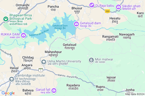
Getalsud Map
EDIT Map
Add Your House
 ..
..
Current Corona Virus Infected Patients Count in Ranchi District
| City Name | District Name | Total Covid cases |
|---|---|---|
| Ranchi District | Ranchi | 32 |
| Hindpiri | Ranchi | 12 |
| Hindipiri | Ranchi | 5 |
| Hindpidi | Ranchi | 2 |
| Lowadih | Ranchi | 2 |
| Azad Basti | Ranchi | 2 |
Locality Name :
Getalsud
( गेतलसूद )
Block Name : Angara
District : Ranchi
State : Jharkhand
Language : Hindi and Urdu, Bengali, Asuri, Munda
Current Time 02:39 PM
Date: Tuesday , Apr 29,2025 (IST)
Time zone: IST (UTC+5:30)
Elevation / Altitude: 544 meters. Above Seal level
Telephone Code / Std Code: 0651
Assembly constituency : Khijri assembly constituency
Assembly MLA : Rajesh Kachhap
Lok Sabha constituency : Ranchi parliamentary constituency
Parliament MP : SANJAY SETH
Serpanch Name :
Pin Code : 835103
Post Office Name : Tatisilway
Alternate Village Name : Getalsub
Commodities Prices : Khunti Market / Mandi
Getalsud Live Weather
Temperature: 29.2 °C
overcast clouds
Humidity: 19%
Wind : 0.45 mt/sec towards NW
StationName : "Ranchi"
observed on 1 Hours Back
Temperature: 29.2 °C
overcast clouds
Humidity: 19%
Wind : 0.45 mt/sec towards NW
StationName : "Ranchi"
observed on 1 Hours Back
Getalsud Weather Forecast for Next 5 days
30-04-2025
22.4°C to 34.2°C
scattered clouds, light rain, broken clouds, overcast clouds
22.4°C to 34.2°C
scattered clouds, light rain, broken clouds, overcast clouds
01-05-2025
21.3°C to 35.8°C
broken clouds, clear sky, scattered clouds, light rain
21.3°C to 35.8°C
broken clouds, clear sky, scattered clouds, light rain
02-05-2025
21.9°C to 35.8°C
clear sky, scattered clouds, moderate rain, overcast clouds, broken clouds
21.9°C to 35.8°C
clear sky, scattered clouds, moderate rain, overcast clouds, broken clouds
03-05-2025
21.5°C to 35.6°C
broken clouds, scattered clouds, few clouds, clear sky, overcast clouds
21.5°C to 35.6°C
broken clouds, scattered clouds, few clouds, clear sky, overcast clouds
04-05-2025
23.7°C to 36.6°C
overcast clouds, few clouds, clear sky, light rain, moderate rain, scattered clouds
23.7°C to 36.6°C
overcast clouds, few clouds, clear sky, light rain, moderate rain, scattered clouds
National Highways Reachable To Getalsud
Nationa High Way :NH43
Nationa High Way :NH39
Nationa High Way :NH43
Nationa High Way :NH39
Rivers Near Getalsud
Subarnarekha river
Bambhani
Subarnarekha river
Bambhani
About Getalsud
Correct below Info and add more info about GetalsudGetalsud is a Village in Angara Block in Ranchi District of Jharkhand State, India. It is located 29 KM towards East from District head quarters Ranchi. 5 KM from Angara. 30 KM from State capital Ranchi
Getalsud Pin code is 835103 and postal head office is Tatisilway .
Bisa ( 4 KM ) , Rajadera ( 6 KM ) , Paancha ( 7 KM ) , Childag ( 7 KM ) , Hesatu ( 7 KM ) are the nearby Villages to Getalsud. Getalsud is surrounded by Ormanjhi Block towards west , Ramgarh Block towards North , Kanke Block towards west , Gola Block towards East .
Ramngarh , Ranchi , Saunda , Patratu are the near by Cities to Getalsud.
Getalsud 2011 Census Details
Getalsud Local Language is Hindi. Getalsud Village Total population is 3263 and number of houses are 649. Female Population is 48.7%. Village literacy rate is 60.0% and the Female Literacy rate is 24.6%.
Population
| Census Parameter | Census Data |
| Total Population | 3263 |
| Total No of Houses | 649 |
| Female Population % | 48.7 % ( 1589) |
| Total Literacy rate % | 60.0 % ( 1957) |
| Female Literacy rate | 24.6 % ( 802) |
| Scheduled Tribes Population % | 45.9 % ( 1497) |
| Scheduled Caste Population % | 7.9 % ( 259) |
| Working Population % | 36.4 % |
| Child(0 -6) Population by 2011 | 435 |
| Girl Child(0 -6) Population % by 2011 | 48.7 % ( 212) |
Getalsud Census More Deatils.
Politics in Getalsud
Bharatiya Janata Party , BJP , INC are the major political parties in this area.Polling Stations /Booths near Getalsud
1)Panchayat Bhawan Chatra2)Govt Ms Tumbagutu West Part
3)Govt Upg Ms Pailada Nagrabera
4)Govt. Ups Lalkhatanga Naya Bhusur
5)Ums Tundahuli
HOW TO REACH Getalsud
By Rail
Gangaghat Rail Way Station , Jonha Rail Way Station are the very nearby railway stations to Getalsud.Colleges near Getalsud
Ranchi College Ranchi
Address :
Ramsobha College Of Education
Address :
Amanat Ali Inter College
Address :
Sbs College Ranchi
Address :
L.m.n.s.m Memorial College Itki
Address : Near
Schools near Getalsud
Global Wisdom Public School Nawagarh Chatti
Address : at+po nawagarh chatti
Marigold Public School
Address : Sikidiri
Govt Health Centers near Getalsud
1) PHC GETALSUD , PHC GETALSUD , GETALSUD ,2) HSC GETALSUDH , HSC GETALSUDH , GETALSUDH ,
3) HSC MAHESPUR , HSC MAHESPUR , MAHESPUR ,
Colleges in Getalsud,Angara
J.D. National B.Ed College
Ranchi - Purulia Rd; Angara; Janum; Jharkhand 835103; India
6.3 KM distance Detail
Jaspuria B. Ed. College
Bisa;P.O Getalsud; Angara; Ranchi; Jharkhand 835103; India
8.4 KM distance Detail
more ..
Schools in Getalsud,Angara
GOVERNMENT MIDDILE SCHOOL RESHAM GETALSUD ANGARA RANCHI
Resham; Jharkhand 835103; India
2.3 KM distance Detail
Electronic Shops in Getalsud,Angara
Pawan Digital Studio
Jharkhand State Highway 1; Rajadera; Jharkhand 835103; India
4.9 KM distance Detail
Police Stations near Getalsud,Angara
Ranchi-Purulia state Highway
Jharkhand State Highway 1; Jharkhand 835103; India
5.0 KM distance Detail
Governement Offices near Getalsud,Angara
Pragya Kendra
Purilia Road; Gondali Pokhar; Angara; Ranchi; Jharkhand 835103; India
7.9 KM distance Detail
Kanchenjunga Karyalay Saha
Gondli Pokhar; Angara; Ranchi; Jharkhand 835103; India
8.4 KM distance Detail
About Getalsud &
History
How to reach Getalsud
Tourist Places Near By Getalsud
Schools in Getalsud
Colleges in Getalsud
Temperature & weather of Getalsud
places in Getalsud
Getalsud photos
More Information
How to reach Getalsud
Tourist Places Near By Getalsud
Schools in Getalsud
Colleges in Getalsud
Temperature & weather of Getalsud
places in Getalsud
Getalsud photos
More Information
Village Talk
Post News or Events about this Village
Near Cities
Ramngarh 24 KM near
Ranchi 28 KM near
Saunda 36 KM near
Patratu 41 KM near
Ramngarh 24 KM near
Ranchi 28 KM near
Saunda 36 KM near
Patratu 41 KM near
Near By Taluks
Angara 5 KM near
Ormanjhi 12 KM near
Ramgarh 20 KM near
Gola 25 KM near
Angara 5 KM near
Ormanjhi 12 KM near
Ramgarh 20 KM near
Gola 25 KM near
Near By Air Ports
Ranchi Airport 29 KM near
Gaya Airport 177 KM near
Patna Airport 274 KM near
Netaji Subhas Chandra Bose Airport 345 KM near
Ranchi Airport 29 KM near
Gaya Airport 177 KM near
Patna Airport 274 KM near
Netaji Subhas Chandra Bose Airport 345 KM near
Near By Tourist Places
Ranchi 29 KM near
Dassam Falls 30 KM near
Bokaro Steel City 67 KM near
Chotanagpur 81 KM near
Purulia 82 KM near
Ranchi 29 KM near
Dassam Falls 30 KM near
Bokaro Steel City 67 KM near
Chotanagpur 81 KM near
Purulia 82 KM near
Near By Districts
Ramgarh 24 KM near
Ranchi 28 KM near
Khunti 53 KM near
Hazaribagh 72 KM near
Ramgarh 24 KM near
Ranchi 28 KM near
Khunti 53 KM near
Hazaribagh 72 KM near
Near By RailWay Station
Namkom Rail Way Station 22 KM near
Ramgarh Cantt. Rail Way Station 23 KM near
Namkom Rail Way Station 22 KM near
Ramgarh Cantt. Rail Way Station 23 KM near