| Home | City Bus | Maps | Villages | Cities | Rail | Tourist Places | School | College | Pin Codes | Corona Cases Count |
| Distance Calculator Bus Services IFSC Codes Trace Mobile Number Weather Search Place Trace IP Available Cash ATM/Banks Locate Polling Booth Report an Error contact People |
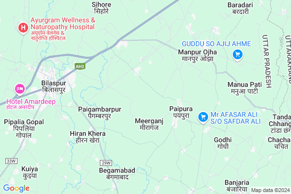
Rafatpur
Rafatpur Map
EDIT Map
Add Your House
 ..
..
Current Corona Virus Infected Patients Count in Rampur District
| City Name | District Name | Total Covid cases |
|---|---|---|
| Rampur District | Rampur | 20 |
Locality Name :
Rafatpur
( रफतपुर )
Block Name : Bilaspur
District : Rampur
State : Uttar Pradesh
Division : Moradabad
Language : Hindi and Urdu
Current Time 06:09 AM
Date: Saturday , Apr 26,2025 (IST)
Time zone: IST (UTC+5:30)
Elevation / Altitude: 196 meters. Above Seal level
Telephone Code / Std Code: 0595
Assembly constituency : Bilaspur assembly constituency
Assembly MLA : Baldev Singh Aulakh
Lok Sabha constituency : Rampur parliamentary constituency
Parliament MP : Mohammad Azam Khan
Serpanch Name :
Pin Code : 244923
Post Office Name : Bilaspur Chini Mill
Main Village Name : Pipalia Mehto
Commodities Prices : Vilaspur Market / Mandi
Rafatpur Live Weather
Temperature: 25.4 °C
clear sky
Humidity: 10%
Wind : 1.59 mt/sec towards NE
StationName : "BÄ«lÄ\u0081spur"
observed on 1 Hours Back
Temperature: 25.4 °C
clear sky
Humidity: 10%
Wind : 1.59 mt/sec towards NE
StationName : "BÄ«lÄ\u0081spur"
observed on 1 Hours Back
Rafatpur Weather Forecast for Next 5 days
27-04-2025
24.8°C to 42.7°C
clear sky, scattered clouds, overcast clouds
24.8°C to 42.7°C
clear sky, scattered clouds, overcast clouds
28-04-2025
27.7°C to 40.7°C
overcast clouds, broken clouds
27.7°C to 40.7°C
overcast clouds, broken clouds
29-04-2025
25.9°C to 41.8°C
overcast clouds, broken clouds, clear sky
25.9°C to 41.8°C
overcast clouds, broken clouds, clear sky
30-04-2025
26.5°C to 41.2°C
clear sky, scattered clouds, broken clouds, few clouds, overcast clouds
26.5°C to 41.2°C
clear sky, scattered clouds, broken clouds, few clouds, overcast clouds
National Highways Reachable To Rafatpur
Nationa High Way :NH9
Nationa High Way :NH734
Nationa High Way :NH9
Nationa High Way :NH734
Rivers Near Rafatpur
Baur
Ramganga
Baur
Ramganga
About Rafatpur
Correct below Info and add more info about RafatpurRafatpur is a small Village/hamlet in Bilaspur Block in Rampur District of Uttar Pradesh State, India. It comes under Pipalia Mehto Panchayath. It belongs to Moradabad Division . It is located 36 KM towards East from District head quarters Rampur. 6 KM from Bilaspur. 323 KM from State capital Lucknow
Rafatpur Pin code is 244923 and postal head office is Bilaspur Chini Mill .
Paipura ( 3 KM ) , Rawana Lala Urf Bishanpuri ( 3 KM ) , Paigambarpur ( 4 KM ) , Arsal Parsal ( 4 KM ) , Manpur Ojha ( 4 KM ) are the nearby Villages to Rafatpur. Rafatpur is surrounded by Rudrapur Block towards East , Baheri Block towards East , Gadarpur Block towards North , Shergarh Block towards South .
Rudrapur , Shishgarh , kichha , Nagla are the near by Cities to Rafatpur.
This Place is in the border of the Rampur District and Udam Singh Nagar District. Udam Singh Nagar District Rudrapur is East towards this place . It is near to the Uttarakhand State Border.
Rafatpur 2011 Census Details
Rafatpur Local Language is Hindi. Rafatpur Village Total population is 67 and number of houses are 14. Female Population is 56.7%. Village literacy rate is 64.2% and the Female Literacy rate is 34.3%.
Population
| Census Parameter | Census Data |
| Total Population | 67 |
| Total No of Houses | 14 |
| Female Population % | 56.7 % ( 38) |
| Total Literacy rate % | 64.2 % ( 43) |
| Female Literacy rate | 34.3 % ( 23) |
| Scheduled Tribes Population % | 0.0 % ( 0) |
| Scheduled Caste Population % | 0.0 % ( 0) |
| Working Population % | 28.4 % |
| Child(0 -6) Population by 2011 | 4 |
| Girl Child(0 -6) Population % by 2011 | 100.0 % ( 4) |
Rafatpur Census More Deatils.
Politics in Rafatpur
BJP , SP , INC are the major political parties in this area.Polling Stations /Booths near Rafatpur
1)Junior High School Bda Bosena2)Junior High School Bhensiya Jualapur Room No-1
3)Primary School Bhanwarki
4)Primary School Devri Khurd
5)Primary School Saeedabad
HOW TO REACH Rafatpur
By Rail
Bilaspur Road Rail Way Station is the very nearby railway stations to Rafatpur.Colleges near Rafatpur
Government Degree College
Address :
Dav Inter College
Address :
Dav Inter College
Address :
Dav Inter Callege
Address :
Schools near Rafatpur
Ups Mahesh Pura
Address : akilpur , bilaspur , rampur , Uttar Pradesh . PIN- 454545
Ups Noor Pur
Address : akilpur , bilaspur , rampur , Uttar Pradesh . PIN- 145641
Ups Pipliya Gopal
Address : akilpur , bilaspur , rampur , Uttar Pradesh . PIN- 454544
Ups 333333333333333mudiya
Address : akilpur , bilaspur , rampur , Uttar Pradesh . PIN- 641515
Govt Health Centers near Rafatpur
1) Darudhpur , DHARUDPUR , DHARUDPUR , DHARUDPUR2) SUKATIYA , , ,
3) Gulariyapur , gulriyapur , gulriyapur , gulriyapur
Petrol Bunks in Rafatpur,Bilaspur
PURI FILLING STATION
BILASPUR ; NH87; RAMPUR; RAMPUR; Uttar Pradesh 244921; India
6.1 KM distance Detail
more ..
Colleges in Rafatpur,Bilaspur
Apex Institute of Technology
National Highway No. 87; Kaushalganj; Bilaspur; Rampur; Uttar Pradesh 244923; India
3.2 KM distance Detail
DAV Inter College
National Highway 87; Isa Nagar; Uttar Pradesh 244921; India
5.7 KM distance Detail
more ..
Schools in Rafatpur,Bilaspur
आदर्श पब्लिक स्कूल
पईपुरा तहसील जनपद pin244923; Bilaspur; Uttar Pradesh 244923; India
2.8 KM distance Detail
Azaad Public School Rampura Bujurg
Bilaspur Tehsil; Rampur District; Rampura Bujurg; Uttar Pradesh 244923; India
3.0 KM distance Detail
आज़ाद पब्लिक स्कूल
ग्राम व पोस्ट रम्पुरा बुज़ुर्ग तहसील जनपद पिन 244923; Bilaspur; Uttar Pradesh 244923; India
3.0 KM distance Detail
Local Parks in Rafatpur,Bilaspur
अम्बेडकर पार्क; बिलासपुर
निकट भाखड़ा डाम; NH-87; बिलासपुर; Uttar Pradesh 244921; India
7.0 KM distance Detail
Police Stations near Rafatpur,Bilaspur
Police Chowki Isanagar
Arsal Parsal; Rampur; NH-87; Rampur Rudrapur Road; Bilaspur; Bilaspur; Uttar Pradesh 244921; India
5.1 KM distance Detail
पुलिस चाैकी; कस्बा बिलासपुर
पुराना तहसील रोड; बिलासपुर; रामपुर; उ.प्र.; पिन; Bilaspur; Uttar Pradesh 244921; India
7.1 KM distance Detail
Kotwali Thana Bilaspur
Ram Nagaria; Rampur; NH-87; Rampur Rudrapur Road; Bilaspur; Bilaspur; Uttar Pradesh 244921; India
8.3 KM distance Detail
Governement Offices near Rafatpur,Bilaspur
FLIGHT ABROAD SERVICE ( IELTS & VISA FILING )
NEAR DAM; Rudrapur Bypass Rd; Bilaspur; Uttar Pradesh 244921; India
6.7 KM distance Detail
Bilaspur Sehkari Sangh Limited
Rampur-Bilaspur Rd; Bialspur; Uttar Pradesh 244921; India
7.8 KM distance Detail
Neelkanth tripshit & behti centre
Bilaspur-Rudrapur-Haldwani Rd; Temra; Uttarakhand 244923; India
8.5 KM distance Detail
About Rafatpur &
History
How to reach Rafatpur
Tourist Places Near By Rafatpur
Schools in Rafatpur
Colleges in Rafatpur
Temperature & weather of Rafatpur
places in Rafatpur
Rafatpur photos
More Information
How to reach Rafatpur
Tourist Places Near By Rafatpur
Schools in Rafatpur
Colleges in Rafatpur
Temperature & weather of Rafatpur
places in Rafatpur
Rafatpur photos
More Information
Village Talk
Post News or Events about this Village
Near Cities
Rudrapur 13 KM near
Shishgarh 19 KM near
kichha 20 KM near
Nagla 25 KM near
Rudrapur 13 KM near
Shishgarh 19 KM near
kichha 20 KM near
Nagla 25 KM near
Near By Taluks
Bilaspur 5 KM near
Rudrapur 16 KM near
Baheri 19 KM near
Gadarpur 22 KM near
Bilaspur 5 KM near
Rudrapur 16 KM near
Baheri 19 KM near
Gadarpur 22 KM near
Near By Air Ports
Pantnagar Airport 24 KM near
Muzaffarnagar Airport 193 KM near
Dehra Dun Airport 227 KM near
Indira Gandhi International Airport 246 KM near
Pantnagar Airport 24 KM near
Muzaffarnagar Airport 193 KM near
Dehra Dun Airport 227 KM near
Indira Gandhi International Airport 246 KM near
Near By Tourist Places
Kathgodam 53 KM near
Kashipur 59 KM near
Moradabad 60 KM near
Sattal 62 KM near
Bhimtal 62 KM near
Kathgodam 53 KM near
Kashipur 59 KM near
Moradabad 60 KM near
Sattal 62 KM near
Bhimtal 62 KM near
Near By Districts
Udam Singh Nagar 14 KM near
Rampur 34 KM near
Pilibhit 59 KM near
Moradabad 60 KM near
Udam Singh Nagar 14 KM near
Rampur 34 KM near
Pilibhit 59 KM near
Moradabad 60 KM near
Near By RailWay Station
Bilaspur Road Rail Way Station 8.9 KM near
Rudrapur City Rail Way Station 12 KM near
Bilaspur Road Rail Way Station 8.9 KM near
Rudrapur City Rail Way Station 12 KM near