| Home | City Bus | Maps | Villages | Cities | Rail | Tourist Places | School | College | Pin Codes | Corona Cases Count |
| Distance Calculator Bus Services IFSC Codes Trace Mobile Number Weather Search Place Trace IP Available Cash ATM/Banks Locate Polling Booth Report an Error contact People |
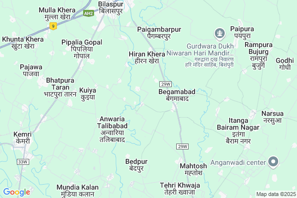
Choukoni
Choukoni Map
EDIT Map
Add Your House
 ..
..
Current Corona Virus Infected Patients Count in Rampur District
| City Name | District Name | Total Covid cases |
|---|---|---|
| Rampur District | Rampur | 20 |
Locality Name :
Choukoni
( चौकोनी )
Block Name : Bilaspur
District : Rampur
State : Uttar Pradesh
Division : Moradabad
Language : Hindi and Urdu
Current Time 06:33 PM
Date: Sunday , Apr 27,2025 (IST)
Time zone: IST (UTC+5:30)
Elevation / Altitude: 196 meters. Above Seal level
Telephone Code / Std Code: 0595
Assembly constituency : Bilaspur assembly constituency
Assembly MLA : Baldev Singh Aulakh
Lok Sabha constituency : Rampur parliamentary constituency
Parliament MP : Mohammad Azam Khan
Serpanch Name :
Pin Code : 244921
Post Office Name : Bilaspur (Rampur)
Alternate Village Name : Chokoni
Commodities Prices : Vilaspur Market / Mandi
Choukoni Live Weather
Temperature: 34.6 °C
broken clouds
Humidity: 11%
Wind : 0.58 mt/sec towards S
StationName : "Kemrī"
observed on 20 Mins Back
Temperature: 34.6 °C
broken clouds
Humidity: 11%
Wind : 0.58 mt/sec towards S
StationName : "Kemrī"
observed on 20 Mins Back
Choukoni Weather Forecast for Next 5 days
28-04-2025
27.2°C to 36.1°C
overcast clouds, broken clouds, scattered clouds
27.2°C to 36.1°C
overcast clouds, broken clouds, scattered clouds
29-04-2025
25.1°C to 41.3°C
broken clouds, clear sky
25.1°C to 41.3°C
broken clouds, clear sky
30-04-2025
25.6°C to 40.6°C
clear sky, scattered clouds, few clouds, broken clouds
25.6°C to 40.6°C
clear sky, scattered clouds, few clouds, broken clouds
01-05-2025
27.1°C to 40.5°C
overcast clouds, broken clouds, scattered clouds, clear sky
27.1°C to 40.5°C
overcast clouds, broken clouds, scattered clouds, clear sky
02-05-2025
27.1°C to 40.9°C
overcast clouds, broken clouds, scattered clouds, clear sky, few clouds, light rain
27.1°C to 40.9°C
overcast clouds, broken clouds, scattered clouds, clear sky, few clouds, light rain
National Highways Reachable To Choukoni
Nationa High Way :NH9
Nationa High Way :NH734
Nationa High Way :NH9
Nationa High Way :NH734
Rivers Near Choukoni
Baur
Ramganga
Baur
Ramganga
About Choukoni
Correct below Info and add more info about ChoukoniChoukoni is a Village in Bilaspur Block in Rampur District of Uttar Pradesh State, India. It belongs to Moradabad Division . It is located 31 KM towards East from District head quarters Rampur. 5 KM from Bilaspur. 320 KM from State capital Lucknow
Choukoni Pin code is 244921 and postal head office is Bilaspur (Rampur) .
Siras Khera ( 2 KM ) , Bahapur Gangapur ( 3 KM ) , Kurthia ( 4 KM ) , Bedpur ( 5 KM ) , Kuiya ( 5 KM ) are the nearby Villages to Choukoni. Choukoni is surrounded by Baheri Block towards East , Shergarh Block towards South , Milak Block towards South , Rudrapur Block towards East .
Shishgarh , Rudrapur , kichha , Rampur are the near by Cities to Choukoni.
This Place is in the border of the Rampur District and Udam Singh Nagar District. Udam Singh Nagar District Rudrapur is East towards this place . It is near to the Uttarakhand State Border.
Choukoni 2011 Census Details
Choukoni Local Language is Hindi. Choukoni Village Total population is 814 and number of houses are 164. Female Population is 46.6%. Village literacy rate is 44.0% and the Female Literacy rate is 14.1%.
Population
| Census Parameter | Census Data |
| Total Population | 814 |
| Total No of Houses | 164 |
| Female Population % | 46.6 % ( 379) |
| Total Literacy rate % | 44.0 % ( 358) |
| Female Literacy rate | 14.1 % ( 115) |
| Scheduled Tribes Population % | 0.0 % ( 0) |
| Scheduled Caste Population % | 4.2 % ( 34) |
| Working Population % | 28.6 % |
| Child(0 -6) Population by 2011 | 144 |
| Girl Child(0 -6) Population % by 2011 | 49.3 % ( 71) |
Choukoni Census More Deatils.
Politics in Choukoni
BJP , SP , INC are the major political parties in this area.Polling Stations /Booths near Choukoni
1)Junior High School Room No-2 Pipaliya Gopal2)Junior High School Prithvipur & Chidiyakheda
3)Primary School Bhojipura
4)Primary School Chanpura Jadid
5)Primary School Kamua Nagla
HOW TO REACH Choukoni
By Rail
Bilaspur Road Rail Way Station , Kemri Rail Way Station are the very nearby railway stations to Choukoni.Colleges near Choukoni
Government Degree College
Address :
Dav Inter College
Address :
Dav Inter College
Address :
Dav Inter Callege
Address :
Schools in Choukoni
P.s. Chokoni
Address : chokoni , bilaspur , rampur , Uttar Pradesh . PIN- 244901 , Post - Rampur
Govt Health Centers near Choukoni
1) SUKATIYA , , ,2) Darudhpur , DHARUDPUR , DHARUDPUR , DHARUDPUR
3) Gulariyapur , gulriyapur , gulriyapur , gulriyapur
Hospitals in Choukoni,Bilaspur
Zed Family Dental Care Centre
Behind; Tehsil Road; Bilaspur; Uttar Pradesh 244921; India
7.8 KM distance Detail
more ..
Petrol Bunks in Choukoni,Bilaspur
SAWARIYA filling station
bilaspur road near railway station; BILASPUR UTTAR PRADESH; Uttar Pradesh 244921; India
6.6 KM distance Detail
Bharat Petroleum
Bilaspur; Rampur; Khatima Road; Kichha; Kichha; 262308; India
7.0 KM distance Detail
more ..
Colleges in Choukoni,Bilaspur
Dr. Ram Bahadur Singh Memorial Mahavidyalaya
Builaspur Road; Rampur; Uttar Pradesh 244921; India
6.2 KM distance Detail
D.A.V. Kanya Inter College
Mohalla Sahukara; Vard-16; Near Old Ramlila Ground; Bilaspur; Uttar Pradesh 244922; India
7.7 KM distance Detail
more ..
Schools in Choukoni,Bilaspur
Surya Prakash Educational Academy
Gangapur Kalan; 4 km away from dhawani; on dhawani - chainpur road; Bilaspur; Uttar Pradesh 244921; India
5.6 KM distance Detail
Local Parks in Choukoni,Bilaspur
अम्बेडकर पार्क; बिलासपुर
निकट भाखड़ा डाम; NH-87; बिलासपुर; Uttar Pradesh 244921; India
8.5 KM distance Detail
Shiv Mandir Inayatpur
243701; RD Complex; U-3; Unnamed Rd; Sector 3; Avas Vikas Colony; Sikandra; Agra; Uttar Pradesh 282004; India
20.1 KM distance Detail
Police Stations near Choukoni,Bilaspur
पुलिस चाैकी; कस्बा बिलासपुर
पुराना तहसील रोड; बिलासपुर; रामपुर; उ.प्र.; पिन; Bilaspur; Uttar Pradesh 244921; India
7.9 KM distance Detail
Kotwali Thana Bilaspur
Ram Nagaria; Rampur; NH-87; Rampur Rudrapur Road; Bilaspur; Bilaspur; Uttar Pradesh 244921; India
8.0 KM distance Detail
Governement Offices near Choukoni,Bilaspur
Bilaspur Sehkari Sangh Limited
Rampur-Bilaspur Rd; Bialspur; Uttar Pradesh 244921; India
8.0 KM distance Detail
FLIGHT ABROAD SERVICE ( IELTS & VISA FILING )
NEAR DAM; Rudrapur Bypass Rd; Bilaspur; Uttar Pradesh 244921; India
8.4 KM distance Detail
About Choukoni &
History
How to reach Choukoni
Tourist Places Near By Choukoni
Schools in Choukoni
Colleges in Choukoni
Temperature & weather of Choukoni
places in Choukoni
Choukoni photos
More Information
How to reach Choukoni
Tourist Places Near By Choukoni
Schools in Choukoni
Colleges in Choukoni
Temperature & weather of Choukoni
places in Choukoni
Choukoni photos
More Information
Village Talk
Post News or Events about this Village
Near Cities
Shishgarh 14 KM near
Rudrapur 21 KM near
kichha 26 KM near
Rampur 29 KM near
Shishgarh 14 KM near
Rudrapur 21 KM near
kichha 26 KM near
Rampur 29 KM near
Near By Taluks
Bilaspur 4 KM near
Baheri 20 KM near
Milak 22 KM near
Shergarh 22 KM near
Bilaspur 4 KM near
Baheri 20 KM near
Milak 22 KM near
Shergarh 22 KM near
Near By Air Ports
Pantnagar Airport 32 KM near
Muzaffarnagar Airport 191 KM near
Dehra Dun Airport 229 KM near
Indira Gandhi International Airport 241 KM near
Pantnagar Airport 32 KM near
Muzaffarnagar Airport 191 KM near
Dehra Dun Airport 229 KM near
Indira Gandhi International Airport 241 KM near
Near By Tourist Places
Moradabad 55 KM near
Kashipur 61 KM near
Kathgodam 61 KM near
Sattal 70 KM near
Bhimtal 70 KM near
Moradabad 55 KM near
Kashipur 61 KM near
Kathgodam 61 KM near
Sattal 70 KM near
Bhimtal 70 KM near
Near By Districts
Udam Singh Nagar 22 KM near
Rampur 29 KM near
Moradabad 55 KM near
Bareilly 58 KM near
Udam Singh Nagar 22 KM near
Rampur 29 KM near
Moradabad 55 KM near
Bareilly 58 KM near
Near By RailWay Station
Bilaspur Road Rail Way Station 6.2 KM near
Rudrapur City Rail Way Station 19 KM near
Bilaspur Road Rail Way Station 6.2 KM near
Rudrapur City Rail Way Station 19 KM near