| Home | City Bus | Maps | Villages | Cities | Rail | Tourist Places | School | College | Pin Codes | Corona Cases Count |
| Distance Calculator Bus Services IFSC Codes Trace Mobile Number Weather Search Place Trace IP Available Cash ATM/Banks Locate Polling Booth Report an Error contact People |
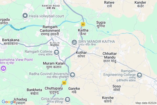
Kothar Map
EDIT Map
Add Your House
 ..
..
Current Corona Virus Infected Patients Count in Ramgarh District
| City Name | District Name | Total Covid cases |
|---|
Locality Name :
Kothar
( कोठार )
Block Name : Ramgarh
District : Ramgarh
State : Jharkhand
Language : Hindi and Santali
Current Time 11:16 AM
Date: Monday , Apr 28,2025 (IST)
Time zone: IST (UTC+5:30)
Elevation / Altitude: 352 meters. Above Seal level
Telephone Code / Std Code: 06553
Assembly constituency : Ramgarh assembly constituency
Assembly MLA : MAMTA DEVI
Lok Sabha constituency : Hazaribagh parliamentary constituency
Parliament MP : JAYANT SINHA
Serpanch Name :
Pin Code : 829122
Post Office Name : Ramgarh Cantt
Commodities Prices : Khunti Market / Mandi
Kothar Live Weather
Temperature: 35.1 °C
scattered clouds
Humidity: 21%
Wind : 1.73 mt/sec towards N
StationName : "RÄ\u0081mgarh"
observed on Now
Temperature: 35.1 °C
scattered clouds
Humidity: 21%
Wind : 1.73 mt/sec towards N
StationName : "RÄ\u0081mgarh"
observed on Now
Kothar Weather Forecast for Next 5 days
29-04-2025
22.8°C to 34.9°C
scattered clouds, light rain, broken clouds, few clouds
22.8°C to 34.9°C
scattered clouds, light rain, broken clouds, few clouds
30-04-2025
22.2°C to 33.3°C
scattered clouds, broken clouds, light rain, few clouds
22.2°C to 33.3°C
scattered clouds, broken clouds, light rain, few clouds
01-05-2025
21.6°C to 36.8°C
scattered clouds, few clouds, moderate rain, light rain, broken clouds
21.6°C to 36.8°C
scattered clouds, few clouds, moderate rain, light rain, broken clouds
02-05-2025
21.9°C to 35.0°C
broken clouds, clear sky, few clouds, light rain, overcast clouds
21.9°C to 35.0°C
broken clouds, clear sky, few clouds, light rain, overcast clouds
03-05-2025
23.3°C to 33.9°C
light rain, broken clouds, overcast clouds, clear sky
23.3°C to 33.9°C
light rain, broken clouds, overcast clouds, clear sky
National Highways Reachable To Kothar
Nationa High Way :NH320
Nationa High Way :NH320
Rivers Near Kothar
Damodar
Nalkari
Damodar
Nalkari
About Kothar
Correct below Info and add more info about KotharKothar is a Village in Ramgarh Block in Ramgarh District of Jharkhand State, India. It is located 6 KM towards East from District head quarters Ramgarh Cantonment. 3 KM from Ramgarh. 44 KM from State capital Ranchi
Kothar Pin code is 829122 and postal head office is Ramgarh Cantt .
Jamira ( 4 KM ) , Ramgarh ( 5 KM ) , Barlong ( 5 KM ) , Usra ( 6 KM ) , Dvc Colony ( 7 KM ) are the nearby Villages to Kothar. Kothar is surrounded by East Singhbum Block towards East , Ormanjhi Block towards South , Mandu Block towards North , Gola Block towards East .
Ramngarh , Saunda , Patratu , Tenu Dam-cum- Kathhara are the near by Cities to Kothar.
This Place is in the border of the Ramgarh District and Ranchi District. Ranchi District Ormanjhi is South towards this place .
Kothar 2011 Census Details
Kothar Local Language is Hindi. Kothar Village Total population is 3910 and number of houses are 720. Female Population is 50.1%. Village literacy rate is 62.3% and the Female Literacy rate is 25.8%.
Population
| Census Parameter | Census Data |
| Total Population | 3910 |
| Total No of Houses | 720 |
| Female Population % | 50.1 % ( 1957) |
| Total Literacy rate % | 62.3 % ( 2435) |
| Female Literacy rate | 25.8 % ( 1008) |
| Scheduled Tribes Population % | 24.0 % ( 939) |
| Scheduled Caste Population % | 16.1 % ( 630) |
| Working Population % | 47.0 % |
| Child(0 -6) Population by 2011 | 614 |
| Girl Child(0 -6) Population % by 2011 | 54.1 % ( 332) |
Kothar Census More Deatils.
Politics in Kothar
AJSU Party , Bharatiya Janata Party , AJSUP , BJP , INC are the major political parties in this area.Polling Stations /Booths near Kothar
1)Utkramit Ucha Vidyalay Korche2)Utkramit Ucha Vidyalay Kothar (east Part)
3)Utkramit Madhay Vidyalay Chaamrom
4)Prathmik Vidyalay Burhakhukhra
5)Prathmik Vidyalay Murramkala (east Part)
HOW TO REACH Kothar
By Rail
Ramgarh Cantt. Rail Way Station , Ranchi Road Rail Way Station are the very nearby railway stations to Kothar.Colleges near Kothar
Redeemer Institute Of Management And Technology (rimt)
Address :
Schools near Kothar
Children Paradise Sukhlal Bagicha Dulmi
Address : At-Dulmi po-harhad lander p.s-rajrappa dust-ramgrarh JHARKHAND 825101
Children Paradise Sukhlal Bagicha Dulmi
Address : At-dulmi po-harhad kander,p.s-rajrappa,dist-ramgarh jharkhand 825101
Indian Public School
Address : Tipu road chitarpur
Macos Public School
Address : Jawahar road chitarpur
Govt Health Centers near Kothar
1) HSC KOTHAR , , ,2) RAMGARH SADAR HOSPITAL , , ,
3) HSC JAMIRA , , ,
Petrol Bunks in Kothar,Ramgarh
HP PETROL PUMP - MAHTO FUELS
HP Retail Outlet NH23 Gola Road Kothar; Ranchi; Jharkhand 825316; India
1.0 KM distance Detail
more ..
Colleges in Kothar,Ramgarh
Maharshi Paramhansh College Of Education
Village Huhua (Kothar); Ramgarh Cantt; NH 23; Jharkhand 829122; India
1.8 KM distance Detail
BIRSA INSTITUTE OF TECHNICAL EDUCATION (B.I.T.E) Ramgarh
NH33; NEAR NEW SHANTI CINEMA; RAMGARH; Ramgarh; Jharkhand 829122; India
3.1 KM distance Detail
more ..
Schools in Kothar,Ramgarh
Sarswati Sanskar Kendr Murram Kala Karmali Tola Ramgarh Cantt
; Ramgarh; Jharkhand 829122; India
2.4 KM distance Detail
Electronic Shops in Kothar,Ramgarh
Riyancy Cyber Cafe & Computer ;printer Repairing Center
Ramgarh; Muram Kalan; Jharkhand 829122; India
2.5 KM distance Detail
Super Markets in Kothar,Ramgarh
Tracker Stand And Vegetables Market
Jharkhand State Highway 2; Ramgarh; Jharkhand 829122; India
4.4 KM distance Detail
Police Stations near Kothar,Ramgarh
Superident Of Police Ramgarh CANTT
Jharkhand State Highway 2; Ramgarh; Jharkhand 829122; India
3.2 KM distance Detail
About Kothar &
History
How to reach Kothar
Tourist Places Near By Kothar
Schools in Kothar
Colleges in Kothar
Temperature & weather of Kothar
places in Kothar
Kothar photos
More Information
How to reach Kothar
Tourist Places Near By Kothar
Schools in Kothar
Colleges in Kothar
Temperature & weather of Kothar
places in Kothar
Kothar photos
More Information
Village Talk
Post News or Events about this Village
Near Cities
Ramngarh 8 KM near
Saunda 23 KM near
Patratu 31 KM near
Tenu Dam-cum- Kathhara 39 KM near
Ramngarh 8 KM near
Saunda 23 KM near
Patratu 31 KM near
Tenu Dam-cum- Kathhara 39 KM near
Near By Taluks
Ramgarh 3 KM near
East Singhbum 10 KM near
Ormanjhi 16 KM near
Mandu 20 KM near
Ramgarh 3 KM near
East Singhbum 10 KM near
Ormanjhi 16 KM near
Mandu 20 KM near
Near By Air Ports
Ranchi Airport 44 KM near
Gaya Airport 157 KM near
Patna Airport 252 KM near
Netaji Subhas Chandra Bose Airport 352 KM near
Ranchi Airport 44 KM near
Gaya Airport 157 KM near
Patna Airport 252 KM near
Netaji Subhas Chandra Bose Airport 352 KM near
Near By Tourist Places
Ranchi 43 KM near
Dassam Falls 52 KM near
Bokaro Steel City 61 KM near
Hazaribagh 78 KM near
Purulia 92 KM near
Ranchi 43 KM near
Dassam Falls 52 KM near
Bokaro Steel City 61 KM near
Hazaribagh 78 KM near
Purulia 92 KM near
Near By Districts
Ramgarh 5 KM near
Ranchi 42 KM near
Hazaribagh 51 KM near
Bokaro 71 KM near
Ramgarh 5 KM near
Ranchi 42 KM near
Hazaribagh 51 KM near
Bokaro 71 KM near
Near By RailWay Station
Ramgarh Cantt. Rail Way Station 3.6 KM near
Ranchi Road Rail Way Station 8.6 KM near
Barkakana Junction Rail Way Station 9 KM near
Ramgarh Cantt. Rail Way Station 3.6 KM near
Ranchi Road Rail Way Station 8.6 KM near
Barkakana Junction Rail Way Station 9 KM near